Total Distance: 60 KMS (but it sorta feels like 120 kms)
Number of days: 7
What to expect: a wildly beautiful but challenging trek
Markha Valley is super popular trek in Ladakh for those who prefer taking their time and exploring the region on foot. The beautiful Himalayan landscape, the authentic small villages, the wildlife you see along the way -what’s not to like.
However, a lot of trekkers don’t realize that it is a challenging trek, and it will test your spirits. Don’t get me wrong, anyone who is reasonably fit can do this trek, even old people, as long as you are prepared for it. I have seen people rocking this trek alpine style, and I have also seen people turn back midway due to AMS.
Know a few things before you start:
- Acclimatization is extremely important: don’t just fly in to Leh and start the trek the next day. Your lungs need a few days to acclimatize to the change in altitude and air.
- Your feet will complain: yes, you will have strenuous days where you’ll walk for maybe 8-10 hours. Of course, it also depends on your speed, but just a heads up.
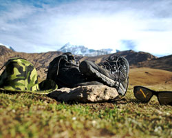
- The terrain is rough, there is a lot of scree, two passes and steep descends. A lot of people twist their ankles on this trek. Make sure you have good shoes with ankle support.
- The weather is unpredictable: yup, you might get everything on this trek, scorching sun, windy evenings or rainy days. But mostly it’s the heat that gets you more than anything else.
It’s also good to know what your 7 days would look like, so you know what to expect and how to prepare for it. Your itinerary would look somewhat like this:
Day 1: Zingchan to Gandala Basecamp (3385m to 4077m)
Time: 4-5 hours
Terrain: dirt patches, moderate ascend, a few river crossings

This is going to be an easy day, so enjoy the walk. You don’t have any steep ascends or descends on this day, so yaay! Take it easy, drink lots of water and enjoy the views.
You will notice the terrain changing every now and then. You will see purple and green hills along the way, but as you reach Yurutse village, you will find lush green fields and yaks and donkeys grazing at a distance. During the last 45 minutes, keep an eye out for mountain goats (also known as blue sheep) on top of the hills. Yurutse is a small village with just one homestay and a gompa. Gandala basecamp is 30 minutes away from Yurutse.
Day 2: Yurutse to Skyu (4077m – 3392m)
Time: 8-10 hours
Terrain: Steep ascend till Ganda-la followed by steep descend and more than 15 river crossings

This is going to be a long tough day, so pack plenty of energy bars for the day. If you are too tired to go till Skyu, you can always stay at Shingo, which is 5-6 hours away from Yurutse. Today you will ascend for the first few hours (3-4hrs) till Ganda-la. The uphill ascend can be exhausting, but the views make it worth it. You might find shepherds with their flock of sheep or Yaks grazing the ground. However, this is also the place where AMS hits you sometimes. You might get a headache, but don’t worry, keep drinking water, the headaches will get better as you descend. Do not stay on the pass for too long, and don’t even think about taking a nap there.
After crossing the pass, you will face a steep descend for an hour or so and then trail gets easier, but it’s still quite a long walk from here. Today you will hop over the Shingri stream at 15 different points along the way. Depending on the water level, you might have to take off your shoes and walk through the stream (this is actually quite fun and refreshing). Your feet will thank you.
After you reach at the tea stall at Shingo, you are just 2-3 hours away from Skyu, but take out your head torch just in case it takes you longer and it gets dark.
Day 3: Skyu to Sara (3392m- 3296 m)
Time: 3-4 hours
Terrain: Mostly straight forward
For the next three days, the trail is pretty straight forward. However, what drains you is the heat. The weather is highly unpredictable in this region, and if you are walking for hours in the scorching heat, it kills you, and you could also get a heat stroke. The trail barely has trees that provide you with shaded patches. However, there are tea stalls every few hours, try and get some rest along the way, in case it’s a super hot day.
If you have the strength, you can head to Markha directly from Skyu instead of staying at Sara. It will take you about 8 hours to reach Markha. However, the homestay at Sara was one of the most charming homestays, we loved our stay there. The terrain is quite straight forward though, since you had a long previous day, take it easy today.
Half an hour before reaching Sara, you will have a very short ascend where you will have to head to the top of a hill, but you will get a view of the entire valley from there.

Day 4: Sara to Markha (3296m – 3815m)
Time: 3-4 hours
Terrain: mostly straight forward with gradual ascend

Markha is one of the biggest villages you will see on the trail. It has quite a few homestays and huge camping sites. Reaching Markha is not very difficult, as even today the trail is quite straight forward. Once you reach Markha though, you have an option to explore the village a little bit. You will find lush green fields there, an old ruined palace and a monastery.
Here is the view from the old palace.

Day 5: Markha to Hankar (3815m – 3897m)
Time: 4-5 hours
Terrain: mostly straight forward with gradual ascend

The best part about today is that you’ll come across multiple lush green mustard fields and a few wildflowers along the way. But again, be mentally prepared to walk on dirt patches and a lot of scree. You will also have to cross a river today without your shoes, so get ready to get wet. We had knee deep water during our batch, but the water levels were higher for the previous batch, at that point the water reached their waist level, in that case you will have to hold on to a rope and cross the river.

Once you reach Hanker, you’ll come across an eco-womens café. These cafes will inspire you, as you’ll get a glimpse of how the local women work together and make a living.
We stayed at upper hanker, which is 30 minutes away from the café.

Day 6: Hankar to Nimaling (3897m – 4730m)
Time: 5-6 hours
Terrain: rough terrain and steep ascend for the first few hours

This is going to be another difficult day, but our motivation was the next campsite, which is extremely beautiful. The first hour is pretty and an easy walk, but then you will have to walk uphill for maybe 2-3 hours till Thachungste. Once you reach Thachungste, keep walking the ridgeline, until you come across two parallel lakes.
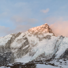
This is where you will get a clear view of the Kang Yatse peak, just behind the lake.

Once you’ve reached the lake, the hard part is over. Nimaling is just an hour away from here, and you’ll see marmots on the way, and Pikas running about and whistling in the area.
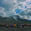
It gets quite cold at Nimaling, so cover up once you get there. But the campsite is extremely beautiful, and the food is even better. It will feel like a great reward after the hard day.

Day 7: Nimaling to Chokdo ( 4730m – 3980m)
Time: 5-6 hours
Terrain: steep ascend till Kongmaru La followed by steep descend and a long walk along the river
This is your final day. From Nimaling you’ll be able to the Kongmaru La (5100 m), this is the pass you need to cross today and it should ideally take you 1.5-2 hours. Ascends always feel much harder, but what you need to be careful of today is the steep descend after the pass. A lot of people feel a strain on their knees right after the pass, just be careful. Once you’ve started your descend, just know the hard part of the entire trek is now behind you. You just need to descend carefully and safely and walk for a few hours till you reach Chokdo, and that’s your finish line. Keep an eye out for mountain goats here as well, you might come across a herd at eye level right after the descend.
Here is the view from Kongmaru La, it gets pretty windy up there, so try not to stay too long.

Trekking at high altitude regions is an achievement in itself. Your biggest challenge is the thin air and the best way to overcome that is to get properly acclimatized before and during the trek.
Markha Valley is not a trek you should take lightly, but who said the journey was going to be easy. You wouldn’t have any stories to tell, if everything went smooth and well planned. You might fall, get stung by plants, twist your ankles, get blisters on your feet, get sun burns, get dehydrated but you will also have a lot of fun, and watch beautiful sunsets, and see the milky way and meet heart-warming locals, and see the ever-changing landscapes.
And just like that, the trek will come to an end. And days after you’ve recovered from the exhaustion, you’ll find yourself planning your next challenging trek.
Happy trekking!
