Mt. Deo Tibba Peak
The Perfect Technical Expedition Meant for Highly Experienced Trekkers Only
Available Batches
Available Batches
Brief Description
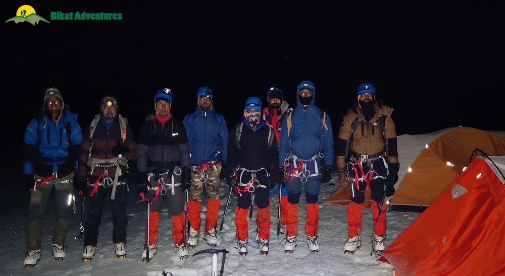
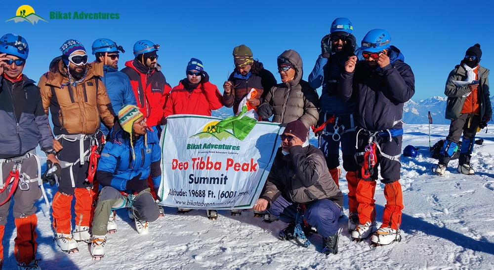
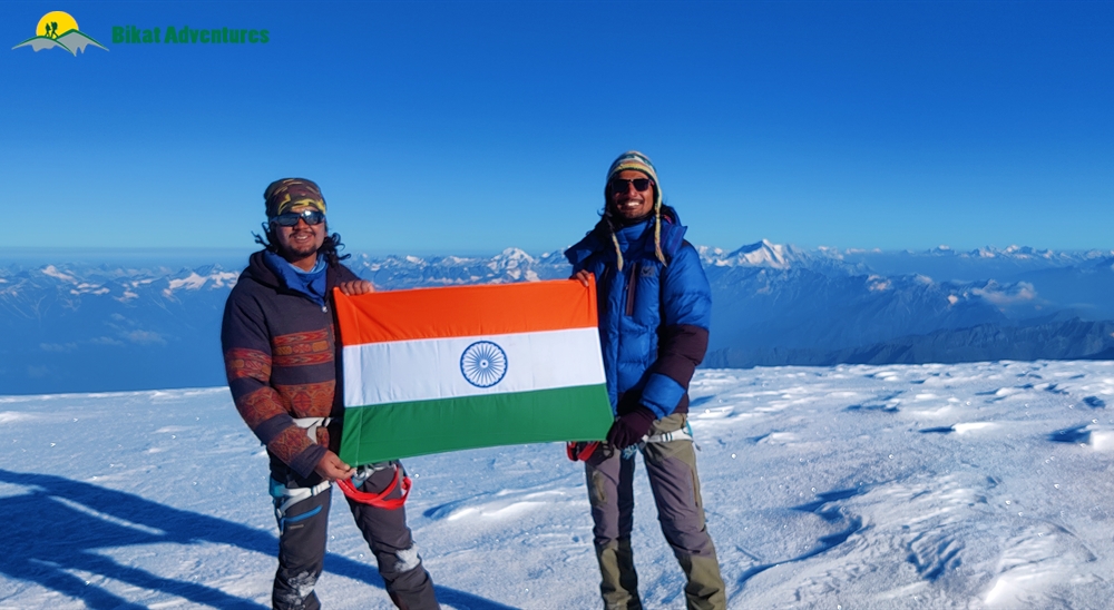
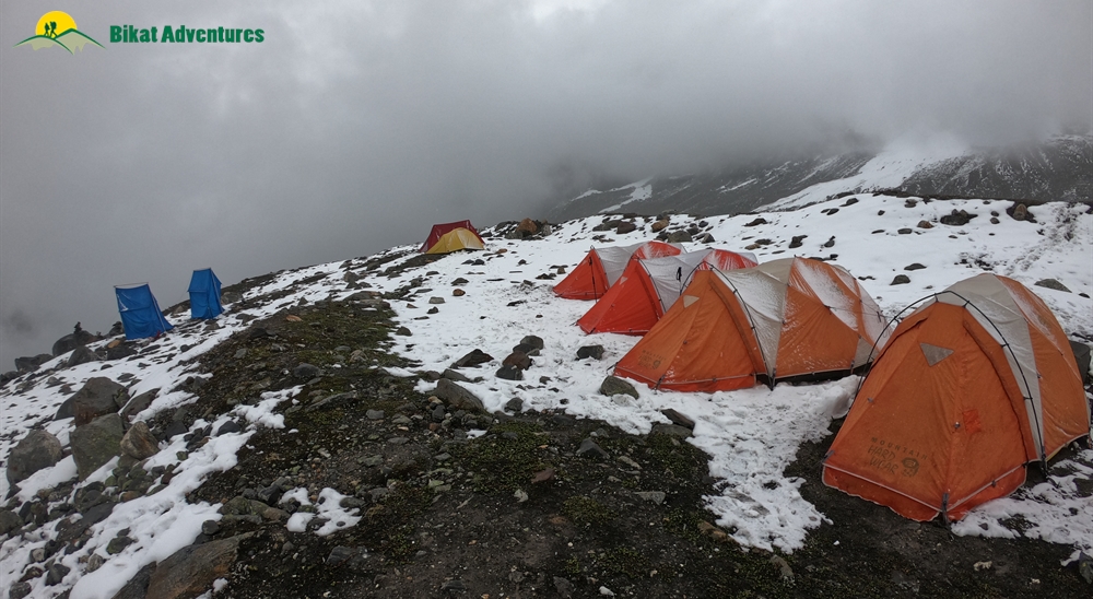
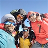
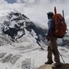
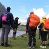
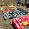
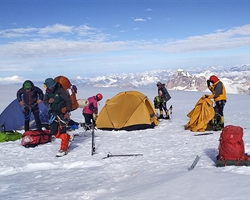
Gallery

Brief Itinerary
Day 1: Make your way to Manali (2,050 M)
Day 2: Rest and Acclimatization in Manali (2,050M)
Day 3: Manali (2,050M) to Chikka (3,175M) (Click to View GPS data)
Day 4: Chikka (3,175M) to Seri (3,700M) (Click to View GPS data)
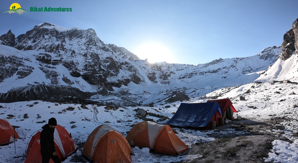
Day 5: Seri (3,700M) to Tainta - Base Camp (4,480M) (Click to View GPS data)
Day 6: Rest and Acclimatization at Base Camp (4,480M)
Day 7 – Day 12: Expedition. Click to View GPS Data: (BC to Duhangan Col) (Duhangan Col to Summit Camp) (Summit Camp to Summit)
Day 13: Base Camp (4,480M) to Manali (2,050M) via Khanol (2,200M)
Day 14 and Day 15: Reserve Days
Detailed Itinerary
Day 1: Make your way to Manali (2,050 M)
The trek starts from the town of Manali which is a very popular tourist destination and hence extremely accessible. If you need guidance on how to get to this high-altitude backpacking center, this article (click here) might come handy.
Day one is reserved for the participants to make their way into Manali and get settled into their accommodation in a Manali hotel. First half of the day is to get comfortable with the mountain air and each other. While the body acclimatizes, we take this time to get together with the group and delve into the happenings of the next few days - schedule, what to expect, basic do's and don'ts in the mountains, how to maintain the sanctity of the environment and such matters of importance.
Day 2: Rest and Acclimatization in Manali (2,050M)
We will spend a day in Manali to acclimatize the body to the altitude before heading on. Use this day to go over your packing list and buy gears and clothing that you might be missing. It is a good idea to move around the town in order to acclimatize your body better – so go out and explore the ins and outs of this small mountain town which has much to offer.
We also use this day to test out personal equipment like trying out snow boots for the right size and getting our crampons ready. This is essential for the right equipment is the deciding factor between success and failure of your expedition.
Day 3: Manali (2,050M) to Chikka (3,175M) (Click to View GPS data)
Distance: 20 kms + 4 kms
Duration: 1 hour drive + 2 hours trek
There’s no rush to leave today since it is a short day. We will be making our way to the large pastures of Chikka. To get there, we will need to drive up to the trail head – Khanol – which houses the Duhangan Hydro Project. The road to get to Khanol is not the best – you might want to eat light before the drive! It takes you in circles up 40 hairpin bends on loopy, kachcha, uneven mountain roads all the way till Khanol where all the expedition essentials will be loaded on mules. When the loopy road turns wavy, know that your drive is about to end. The trek from Khanol to Chikka is a short and pleasant walk along the Jagatsukh Nala through forested land all the way up to the open ground of Chikka.
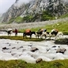
Starting off by crossing a bridge over to the other side of the nala and patches through forested land, the trek to Chikka is mostly on flat terrain with a gradual incline and magnificent views in the background. The roughly marked trail which is easy to lose is a fair indication to the fact that the region does not receive a lot of footfall and is relatively raw as compared to other more popular trekking trails. Rife with fog, an assortment of fauna and random waterfalls that suddenly make an appearance along the trail, this trek is a walk in the park. The campsite is on the open pastoral land of Chikka, next to the noisy Jagatsukh Nala.
Day 4: Chikka (3,175M) to Seri (3,700M) (Click to View GPS data)
Distance: 9 kms
Duration: 5 hours trek
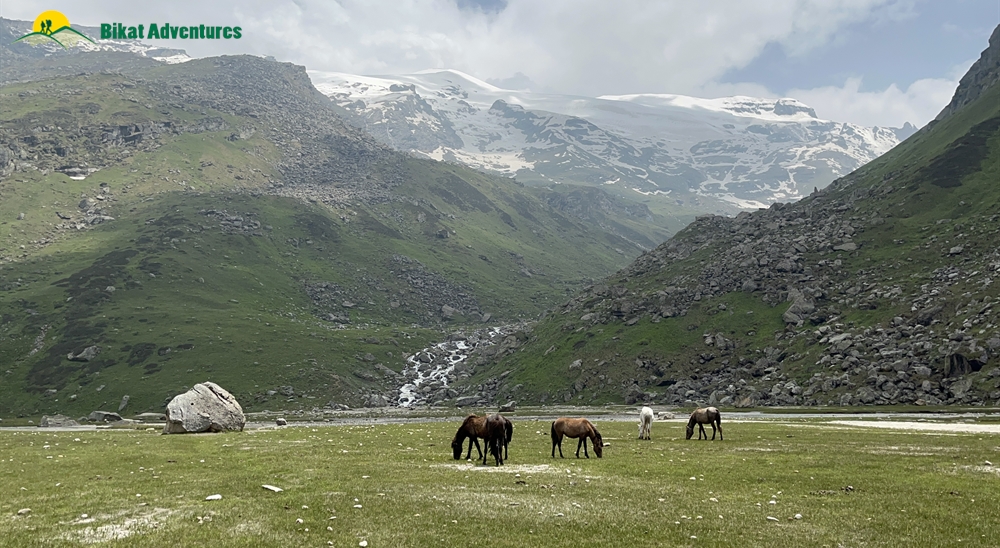
We leave early after an early breakfast today, latest by 9 AM. We continue alongside the Jagatsukh Nala. The day’s trek starts with gradual ascent under the canopy of a thick forested land for the first one hour. After an hour, the forests starts to thin out to give way to Birch trees and finally some bushes and high altitude grasslands. You will be welcomed into the grasslands carpeted with the brightest wildflowers you will see! With a few patches of old snow and a few patches of boulders, the ascent up from 3,175M to 3,700M is gradual – a little steep for the few hours the gradient starts to go down after the 3rd hour going down further at the end of the fourth hour with the land flattening out at the end of the fifth hour. The trail gets easier and the views get better due to a more open landscape. Walking alongside the nala, we pass a freshwater spring at Panduropa and Dudu Patthar until we reach the expansive grasslands at Seri with the Tainta cliffs towering to the left and the waterfalls crashing on the rocks below. We cross the zigzagging river twice to get to our campsite for the day. Remember to not let your shoes get wet while crossing the overzealous nala – remove them and hang them around your neck if that’s what it takes to keep them dry! We camp on the flatlands for the night with a massive waterfall right opposite the campsite.
We go for a one hour acclimatization walk in the early evening to get used to this new height. This is when we will see the dome of Deo Tibba for the first time.
Day 5: Seri (3,700M) to Tainta - Base Camp (4,480M) (Click to View GPS data)
Distance: 4 kms
Duration: 4-5 hours
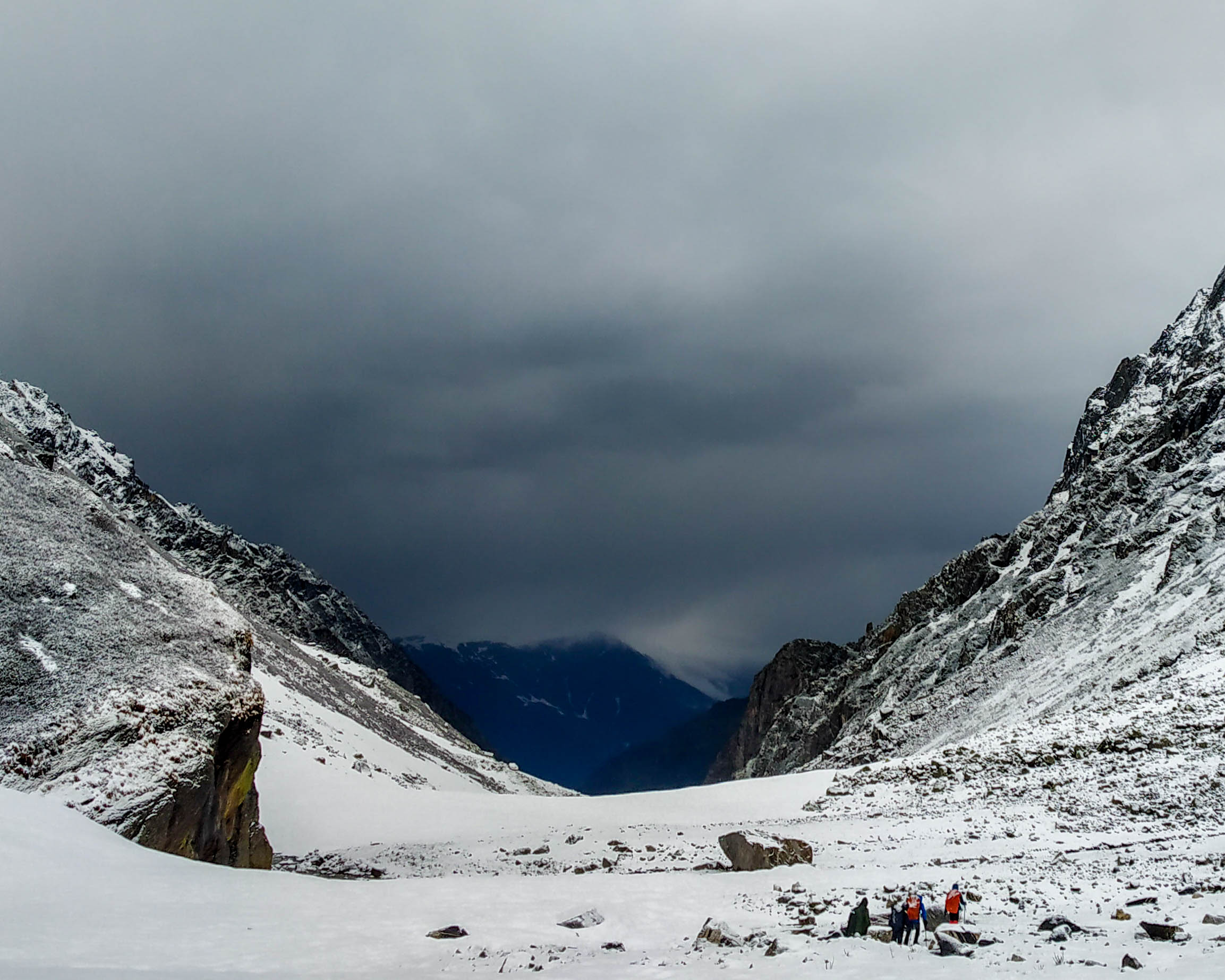
We leave between 9 and 10 AM to continue our walk on the flat meadows of Seri followed by a stream crossing. We then start our climb up a 200M steep serpentine trail which zigzags up through grasslands with patches of big boulders eventually getting to a moraine field. There is one small patch of glacier crossing on the serpentine trail which can get slippery and may require extreme caution. The vegetation starts to thin out and now turns to tufts of brown, dried up grass and we now enter a field alternating between rocks and patches of snow spread across its floor. The last one hour to get to the campsite is on an almost flat land with not much of an incline. The campsite will be chosen based on the amount of snow in the season and availability of a water source nearby. As you explore around the campsite you will realize that the dome of Deo Tibba is right opposite from you and the site also aesthetic views of Jagatsukh Peak as a bonus.
We go for an acclimatization walk in the evening.
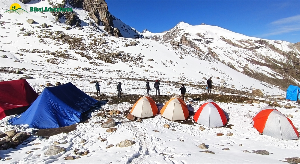
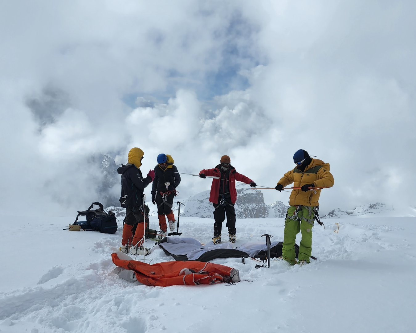
Day 6: Rest and Acclimatization at Base Camp (4,480M)
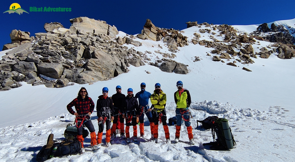
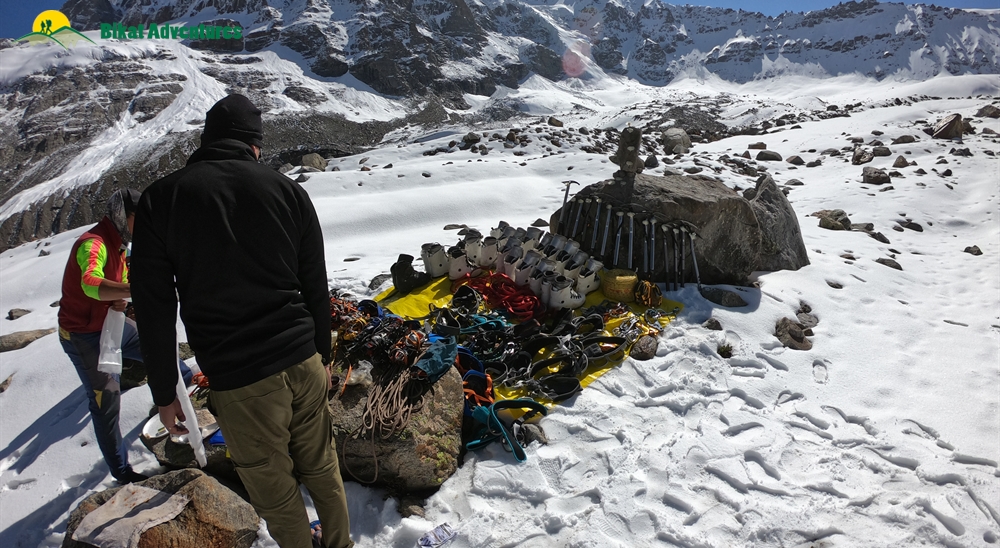
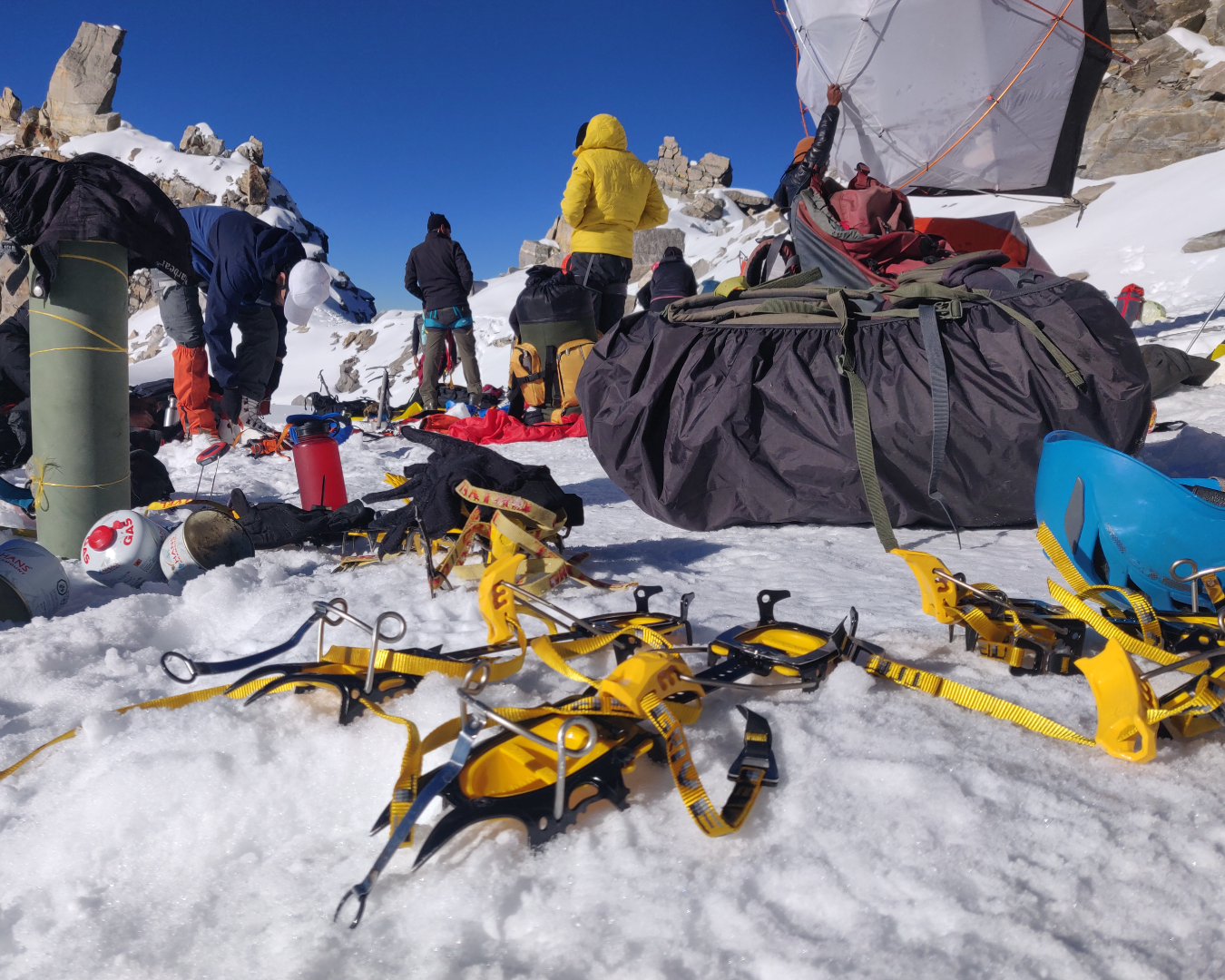
Today is reserved for acclimatization to the altitude since we gained quite a bit of height in the last few days and have also entered a much different terrain. We will also use the day to go to nearby slopes and practice our climbing techniques and get comfortable with our mountaineering equipment in the actual terrain in which we will be using them. So there are two things on the agenda for today – disbursement of personal equipment and ration that each person will be carrying in their sacks and second is to test out and practice with all the gear on actual slopes.
We will also be doing a small prayer at the base camp today praying to the mountain gods for a safe and successful summit.
There is a small high-altitude lake named Chota Chandratal which is an hour’s hike away from the Base Camp. If the weather permits, it is quite a rewarding place to trek to for today’s acclimatization walk.
Day 7 – Day 12: Expedition. Click to View GPS Data: (BC to Duhangan Col) (Duhangan Col to Summit Camp) (Summit Camp to Summit)
Since the conditions on high-altitude are unpredictable, there is a constant readjustment of plans to adapt to the situation at the time. Providing fixed day-wise schedules is thence tricky. Mt. Deo Tibba has 2 camps between base camp and the summit: Camp 1(5,100M), and Summit Camp (5,500M).
After the acclimatization routine suited to the conditions at the time and based on the rope fixing schedule as allowed by the weather, we occupy Summit Camp on Day 10, and will make our first summit attempt on Day 11. By Day 12, we aim to descend back down to Base Camp with an aim to depart from Manali by Day 13.
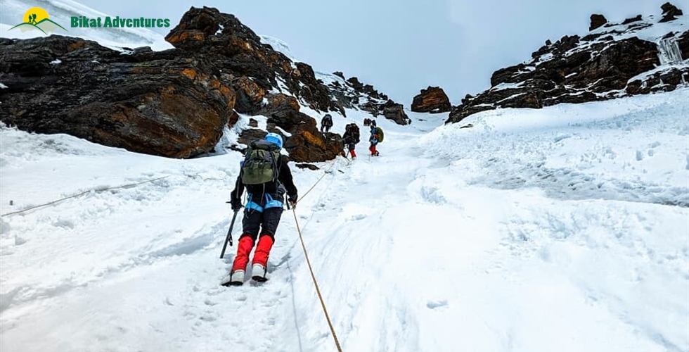
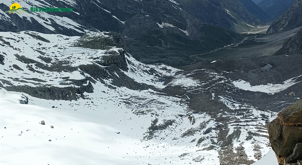
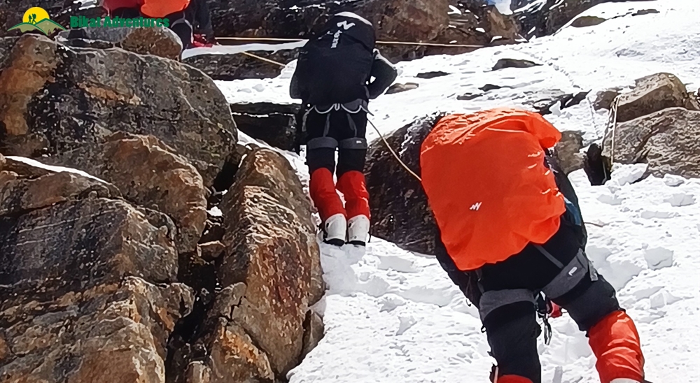
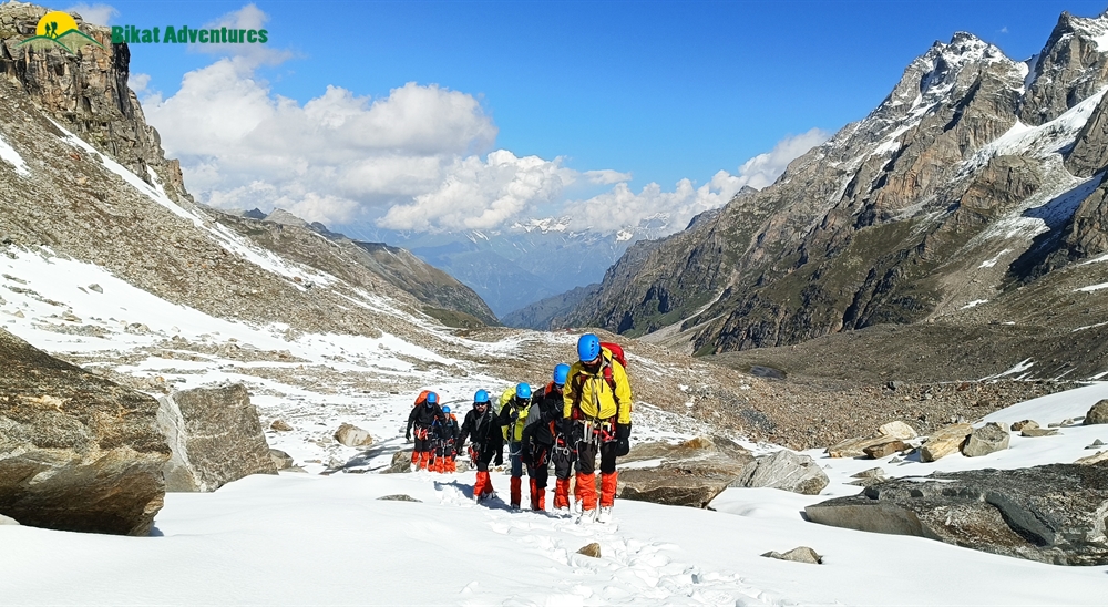
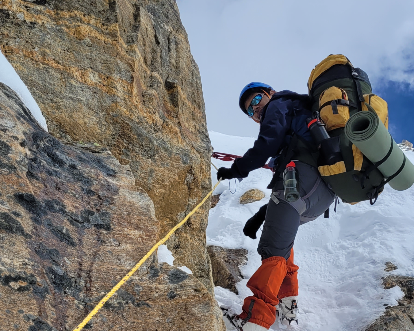
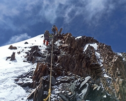
Base Camp (4,480M) to Camp 1 (5,100M): Camp 1 is at Duhangan Col and should take between 6-7 hours to get to. The route from Base Camp to Camp 1 starts on 30 degree slopes with a gradual incline to get to crampon point. Three and a half hours later, we reach the most difficult section of the climb which is a vertical ice gully with a gradient between 60-65 degrees. This section requires the use of fixed ropes and an ascender to climb. Camp 1 lies right on top of this gully which is likely to take between 2.5 to 3 hours to cross. The thrilling bit is that there is no place on the entire gully to take a break and rest yourself, which means that it is a patch of demanding and continuous ascent.
Camp 1 (5,100M) to Summit Camp (5,600M): There is yet another ice gully between Camp 1 and Summit Camp which needs to be navigated. Just as long as the one on the way to Camp 1, just as vertical and just as demanding, if not more. We hit the bottom of the gully two hours into the six hour climb to Summit Camp. We also encounter some very demanding patches of rock and a few knife ridges where the winds make it impossible to ignore your fear of falling on either side of the slippery trail.
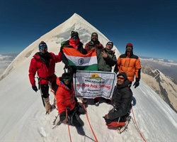
Summit Camp (5,600M) to Summit (6,001M): The 400M to the summit from summit camp seem manageable after the two vertical ice gullies we crossed on our way to get here. The route to the summit is gentle humps, with the real challenge being the increasing altitude and the thinning air. There is one section that requires roping up with the rest of the route being gentle slopes.
Summit Camp (5,600M) Base Camp (4,480M): After returning from the summit push, we spend one night at Summit Camp – which is an open patch of land fully exposed to high speed winds. We head back down to Base Camp the next day which means navigating the knife ridges and the steep gullies one more time. Rappelling down this entire stretch should take us close to 5-6 hours. Expect to reach the sanctuary of your tents at Base Camp before sundown.
Day 13: Base Camp (4,480M) to Manali (2,050M) via Khanol (2,200M)
Distance: 18 kms + 20 kms
Duration: 5-6 hours trek + 1 hour drive
The last day of the trek involves tracing back our steps to where we started - from the Base Camp back to Manali through Seri and Chikka and eventually a drive back from our trailhead, Khanol. We start by 9 AM, so that we can reach a lower altitude as quickly as possible. The trek and drive included should take a couple of hours and reach us to Manali by early evening. Evening of the day is reserved for celebrating the joys and achievements of the last 12 days.
Day 14 and Day 15: Reserve Days
In case of bad weather or other difficulties which might set us off schedule during the course of the entire expedition, Day 14 and Day 15 are set as reserve days. These will only get used if unexpected and unforeseeable conditions present themselves at the last minute preventing us from reaching our destination as planned.
What's Included
- Food as per menu on the trek
- Forest Permits/Camping Charges, if any (upto the amount charged for Indian nationals)
- Tents, Sleeping bags, Sleeping mats
- Safety Equipment includes static rescue rope, seat harness, carabiners, pulleys
- Trek guide, cook, helpers, and porters for carrying common supplies
- Mountaineering course certified Trek Leader with Wilderness Emergency Responder & Rescue. course from NIM Uttarkashi
- Technical Equipment - Ropes, Helmet, Ice Axe, Crampons, Mountaineering Boots
- Accommodation in hotel in Manali on Day 1 and 2
What's Not Included
- Portage of personal bags during the trek
- Cost of any kind of Travel Insurance.
- Any Expense of personal nature.
- Any Expense not specified in the inclusions list.
- Meals during road journeys
- IMF Peak Booking Fee for foreign nationals USD 500 for a team of 2 members and USD 225 for every additional member up to 12 members.
- Mandatory Liaison Officer Fee for foreign expeditions ( ~USD 500 for group of 10)
- IMF deputed liaison officer is mandatory in case of foreign nationals. Expense of liaison officer is distributed amongst foreign nationals equally. Approximate total expense of LO : INR 15000/-
- Summit Bonus fees per participant of INR 5000
Are you Eligible for this Adventure?
Given the technical nature of its climb, its crevasse-ridden terrain and the altitude of the peaks, this expedition is for people with a fair bit of trekking experience in the Himalayas and a fair bit of technical knowledge pertaining to mountaineering equipment. A Basic Mountaineering Course certification is recommended but is not mandatory.
BRS Level Required
This makes it mandatory for you to have high-altitude experience of preferably multiple treks marked at level 6 on the BRS. The altitude, the terrain and the nature of the climb demand a certain level of skill and a need for you to be aware of how your body reacts to the various features of high altitude environment.
If you do not know what level of BRS trek would suit you best, worry not! Fill out this Form:

we will send you a progression chart to help you comfortably get out of your comfort zone in order to level up and ultimately reach your highest potential in the big, bad world of outdoor adventure.
Packing List
This is a list of essential items for individuals doing the trek with Bikat Adventures. This list contains only those items which the participants are required to bring with them. The list excludes those items which are provided by Bikat Adventures on the trek. We have divided the items into five categories. All the items in the list are essential except for those marked as optional.
Trekking Gear
- Ruck sack bag with rain cover. Qty -1
- Day Pack Bag - Recommended for treks with summit day
- Head Torch with spare Batteries. Qty -1
- U V protection sunglasses. Qty -1 Here is how you can choose the best sunglasses for trekking.
- Water Bottles: 2 bottles of 1 liter each
Footwear
- Non-skid, deep treaded, high-ankle trekking shoes Qty -1
- Pair of light weight Slipper/Sandals Qty -1
Clothing
- Quick Dry Warm lower or Track Pants. Qty - 2
- Full sleeves T-shirts/ Sweatshirts. 1 for every 2 days of trekking
- Pair of thick woolen socks. 1 pair for every two days of trekking
- Thermal Body warmer Upper & Lower. Qty-1
- Undergarments. Qty - 1 for every day of trekking
- Warm jacket closed at wrist & neck .Qty-1
- Full sleeves sweater. Qty -1
- Rain wear ( Jacket & Pants ) . Qty-1
- Pair of waterproof, warm gloves. Qty-1
- Woolen cap. Qty-1
- Sun shielding Hat. Qty -1
Toiletries
- Personal toiletries kit (Small Towel, Toilet paper, paper soap, Bar soap, toothbrush, toothpaste, cold cream, etc.)
- Sun screen lotion small pack. Qty -1 Here is your Sun Protection 101 to stay safe in the bright sunny outdoors.
- Lip Balm small pack. Qty-1
Utensils
- Small size, Light weight & Leak proof lunch box. Qty-1
- Plate. Qty- 1
- Spoon.Qty-1
- Tea/Coffee (plastic) Mug.Qty-1
Miscellaneous
- Camera (Optional)
- Carry your medicines in plenty in case you have any specific ailment. Consult your doctor before joining the trek.
- Dry fruits, Nuts, Chocolate bars (Optional)
Frequently Asked Questions
Mt. Deo Tibba is only for experienced trekkers who have done at least one BRS 6 trek or equivalent.
If you can Jog/Run for 5 kms in 25-30 mins, you are ready to take on this trek. Once a week, you can practice running 10 kms in an hour or so to improve your endurance further. In addition to this, you can also add resistance workouts to your schedule like squats, lunges, push ups etc.
If you cannot do the above, there’s no need to worry. It is important to remember that it’s all about practice. Get on a training schedule and we can assure you that you will meet these standards in a matter of a few months.
The climb demands a few basic mountaineering skills; using an ice-axe, pitching a tent in snow, roping up, working together as a team, ascending and descending on steep gradients, gear assisted ascent as well as abseiling, climbing techniques and using technical mountaineering equipment.
The minimum age limit is 16 years. However, minors between 16 to 17 years of age should be accompanied by their parents/ guardians. If you are above the age of 60, kindly carry a medical certificate from your doctor that deems you fit for adventure activities like trekking.
Mt. Deo Tibba is part of the Pir Panjal Range which is the largest range in the Lesser Himalayas. It is stationed in the Kullu district of Himachal Pradesh. The trek starts from the town of Manali.
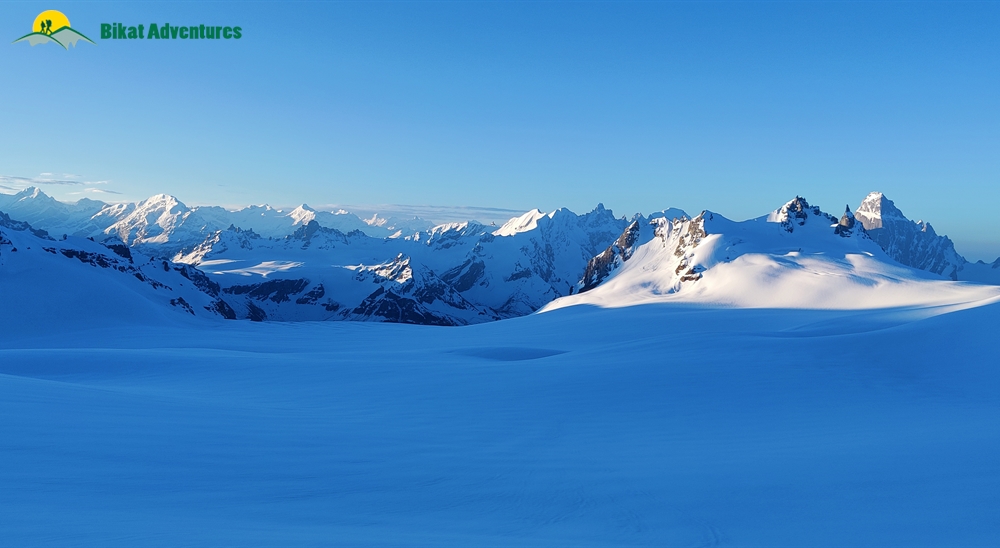
Mt. Deo Tibba, situated in the Kullu valley of Himachal Pradesh, is the second highest peak of the Pir Panjal range, standing tall at an impressive height of 6,001M. According to local beliefs, it is a sacred place where gods come together to discuss important matters. Despite its unpredictable and extreme moods, it is a favorite among climbers due to its eccentric nature. The climb to Duhangan Col, known for its difficulty, is one of the most fascinating parts of the expedition. Additionally, the dome-shaped summit of Mt. Deo Tibba, which is not a sharp, singular point like other mountains, sets it apart from other peaks. For more details on the highlights of this trek, read Highlights of Mt. Deo Tibba Peak
The trek to the summit of Mt. Deo Tibba is a challenging expedition that takes you through a variety of terrain, including forests, meadows, and glaciers. It should only be attempted by experienced trekkers with a know-how of basic mountain skills and prior experience in high altitudes. For more details on the challenges of this climb, read Who is this expedition meant for?
The best months for this trek are June to October.
In Manali, we stay at a hotel. On the trek we have twin-sharing tents. In case you want an individual tent, you can add that to your booking request for an additional cost. On higher camps, due to lack of space to pitch tents, the tents will be on a 4 person sharing basis. The tents used on higher camps are much more spacious and sturdy with ample space.
The temperature at the base of the mountain may range from 10 to 20°C, while at higher altitudes, it can drop to 0 to 5°C or even lower, especially at night. During winters, temperatures can be extremely cold - dropping well below freezing, especially at higher elevations.
There are sections on the climb which require technical know-how for they involve navigating vertical ice gullies. These 60-70 degree gradients require the use of fixed ropes and certain mountaineering equipment to get through. Due to its challenging terrain and expedition style climb, Mt. Deo Tibba expedition is meant for experienced trekkers with prior knowledge of mountaineering techniques such as the use of ice axes, crampons, descender, jumar and roping up procedures.
The trek starts from Manali, which is a very popular tourist destination and hence extremely accessible. If you need guidance on how to get to this high-altitude backpacking centre, read How to reach Manali
Manali has impeccable connectivity of all phone networks. None of the campsites have any cellular range at the moment.
You will find plenty of ATMs in the main market place in Manali. Once we head out of Manali, there are no more ATMs on the way.
Mt. Deo Tibba Peak is a Manali to Manali trip which means that your travel to the trail head, that is, Khanol is already a part of the itinerary and the trek cost.
Expect to reach Manali by early evening.
At an elevation of 2,050M, the scenic landscape and ease of access make Manali a popular tourist destination. In addition to that, Manali is a playground for all levels of adventure enthusiasts. It is rich in sports other than trekking as well, like Paragliding, Ziplining, River Rafting, Biking, Cycling, and much more, in addition to tourist attractions like temples, valleys, and waterfalls. Some of the most popular tourist places are Hidimba Temple, Jogini Falls, Naggar castle etc. In short, Manali is not short on things to keep you busy. While the town itself has much to offer, you can also check out other trekking trails which start from here. Some of the shorter ones are Beas Kund and Bhrigu Lake.
All the common gear like tents, sleeping bags, mattresses etc. are provided. All the technical climbing equipment needed for the trek, like snow boots, crampons, gaiters, ice axe, helmet, harness etc. are also provided to you. Safety equipment used for rescue is carried by our trek leaders.
You can rent trekking shoes, trekking pole, a fleece jacket and a rucksack from us. In case you have any other requirements, you can talk to our representative and we will be happy to assist you in any way that we can.
You will receive your rented equipment during the briefing in Manali, on Day 1.
Our trek leaders will collect the rented equipment from you at the end of the trek on the last day.
For a detailed list, check the Packing List section on this page.
Manali is a popular backpacking destination. It is also a starting point for some of the most popular trekking routes and climbing peaks. You will find shops in the main market of Manali to buy/rent equipment as needed.
Since it is an expedition, each climber carries their own weight. There is no option to offload your bag on multi-camp expeditions such as this.
Yes, you can hand over your extra luggage at our office in Jagatsukh (Near Manali) before we head out for the trek on Day 2. You can collect your luggage from the same place after completion of the trek. The best way to reach Jagatsukh from Manali is by hiring an auto rickshaw or boarding a public bus. It’s 8 kms and takes about half an hour. Please do not leave any valuable items in your luggage such as watch/mobile phone/wallet etc.
On all trek days till you are at base camp, we provide 3 full meals (breakfast, lunch & dinner) in addition to evening snacks and tea. The meals are vegetarian and the menu is pre-decided for all days of the trek. We do provide eggs as well on certain days. If you have any specific food-related allergies or restrictions, you can let our local staff (during the trek) know, and your requests will get accommodated. We try to provide a variety of food across meals so as to avoid repetition as well as cover all nutritional needs. On the higher camps only ready to eat meals are provided.
On campsites, our team will dig dry pits and assemble a toilet tent to provide for safe and secure quarters. A shovel will be provided within the toilet tent as well. Using water in the toilet tent is restricted; you will need to carry your own toilet paper. On the more difficult expeditions, toilet tents are not carried to the higher camps (above base camp) due to restriction of space (to pitch the tent).
In case you get your period on the trail and don’t have sanitary napkins, our trek leaders can provide them to you. If you need any other kind of assistance, you can let our trek leaders know. Irrespective of gender, our leaders are gender sensitised and equipped to assist you in any way you need them to.
Our team carries a first aid kit and all the basic medicines required during the trek. They are equipped to be the first responders in case of any injury or health-related issues. For higher expeditions, we also carry a HAPO Bag and oxygen cylinders to tend to any altitude-related health conditions.
You leave the last charging point behind at your hotel in Manali. From here on, we will be camping in the wilderness with no access to electricity.
A copy of your ID Proof and Medical Certificate are the mandatory documents required for this trek. (Soft copies for all of these are to be sent to us & originals should be on your person while on the trek.)
Yes, insurance for any high-altitude activity is highly recommended to cover for the cost of rescue, evacuation and any other emergency service required as well as to cover for medical cost in case of injury or illness during the trek. You can buy it on your own. Alternatively, if you want us to buy it on your behalf, you can mark it as an add-on during the booking of the trek.
Yes, there are multiple permits required for this. We obtain the permits on every trekkers’ behalf. All the permit costs are included in your trek cost.
Yes, you will receive e-certificates (of completion) after the trek. It will bear your name, the trek, and the maximum altitude you achieved on the trek. In case you were unable to finish the trek, you will get a certificate of participation.
On completion of the trek, the certificate will show up on your dashboard on our website. You can download it directly from there.
Mt. Deo Tibba is in India. If you are coming from outside, you will need a visa to enter the country. You should be able to find the rules for obtaining a Visa based on your home country on the internet. This information is easily available.
This does not apply to you if you are an Indian citizen. In case you don’t hold an Indian passport, you will need to check online for Visa application rules based on your home country.
If you are not an Indian citizen, you will need Travel Medical Insurance to travel to the country. Please make sure that your insurance policy is valid for the altitude you are going to and the activity you are undertaking, to cover risks during the trek. The insurance policy provided by Bikat Adventures does not cover foreign nationals. So, please do not purchase it while making the booking from our website.
Mt. Deo Tibba Peak is the second highest peak of the Pir Panjal range lying in part of the Lesser Himalayas. The Himalayas house the tallest mountains in the world and have long been a treasure trove for all adventure enthusiasts. The variety in terms of beauty, terrain, landscape, geography, culture and opportunity for adventure in the Himalayas, remains undisputedly unmatched.
You can make the booking at any time depending on the availability of slots in our fixed departure batches. You will get this information at the top of this page.
A Basic Mountaineering Course certification from one of the five recognized mountaineering institutes in India is a minimum requirement to join our team. Our field experts are also trained in basic medicine and first-aid response. We also conduct on-ground training for our staff once a year as a refresher for old skills and to learn some new ones. During this training that we call APW (Adventure Professional Workshop), our leaders learn close to 25 topics and techniques of rescue which are not covered in the BMC and AMC courses. For practical training, we simulate on-ground situations to prepare them for quick thinking and quick response during emergencies.
We follow a rigorous regime of hiring and training our experts on the field. Each trek leader is a certified mountaineer with years of experience in the field. The interview process to bring a trek leader on-board is close to 6 months long where we assess various skills as well as personality traits of an individual. They also go through an on-field assignment as part of the hiring process. Trek leaders also progress in time from leading easier treks before advancing to the more difficult ones where the stakes are higher. For detailed information on our selection process, please visit Forerunners - The Making Of A Trek Leader
It absolutely is. We recognize, value and embody the ideology that the world of outdoor adventure can benefit from diversity. We make it our mission to create outdoor spaces as equally accessible and safe for all genders as possible. We also encourage women leaders in the outdoors and all of our staff (irrespective of gender) is gender sensitised. As for accommodation, in case there are no other women on the trek, a solo female trekker is provided with a separate single-occupancy tent.
Our batch sizes for Mt. Deo Tibba Peak are capped at 12 with the trek leader to trekker ratio of 1:4.
In addition to their qualification, our trek leaders are trained to tackle any and all kinds of sudden conditions that may present themselves on ground. During our recce stage, we study the trail in great detail and map out rescue routes before opening it up for our trekkers. We also have local support staff stationed in each area to arrange for emergency services at the place of need as quickly as possible.
We mobilise road rescue efforts where our trek leaders bring the person to be rescued down to the trailhead of the trek from where a car can take them to the nearest healthcare facility. The cost of rescue is not covered in the trek fee that we charge. It must be borne by the participant. However, if you opt for the insurance the cost of rescue operations can be claimed from the Insurance company on production of valid proof e.g. doctor’s prescription & hospital bills etc. Please note that Bikat Adventures is only a facilitator & not a party in the Insurance policy. You need to raise the claim request directly with the Insurance company. Bikat Adventures is not responsible for any rejection of claim. You can call the insurance provider directly for any clarifications related to the Insurance policy. Although not mandatory, we recommend buying the insurance. You don’t necessarily have to get the insurance we provide, you can pick an Insurance company of your choice and get a policy directly from them. If you need more information on the terms and conditions of the insurance policy, get in touch with our customer support team.
All the gear used on our treks and expeditions is tried and tested, maintained for good quality and is overall top notch in quality and condition. We are continually looking to obtain the best of everything there is in the market so as to ensure optimum safety.
That will depend on the nature of your medical condition. Do give us a call, and one of our people will help you understand what is best for you. If not this, we are sure there would be plenty of other options you can choose from our vast portfolio to pick as your next adventure.
We have rolling camps on all our trails. To know why we are strictly against the concept of Fixed Camping, read Reasons to Ban Fixed Camping in Himalayas
This is a complex question and has a compound answer. The simple response is that because it is bad for the environment which we dearly love but if you are interested in a more detailed response to this question, please read Reasons to Ban Fixed Camping in Himalayas
There are a number of measures that we take to prevent overcrowding on some of the most popular trails. Some of them are capping our group size at 15, capping the number of trekkers on a trail to 250 per season, constantly looking for newer trails and routes to spread the crowd around and providing incentives to our trekkers to try unexplored territories with us. We put in place the system of dynamic pricing, which is the first of its kind in the trekking industry, which incentivises trekkers to choose less crowded trails by offering higher discounts. We have noticed, since we started this system, that this has helped in a big way to spread out the crowds between trekking routes. We are also going international so as to relieve some of the stress on the Himalayan landscape as well as explore newer ranges and design newer experiences for our community. If you want a more detailed description of all our measures in this regard, please read Simple solutions to overcrowding on Himalayan Treks
Some basic things to remember are: do not use water, do not dispose of anything non-biodegradable inside the pits, carry your own roll of toilet paper and remember to cover up after yourself to leave a clean toilet for your fellow trekkers. Everything else is much the same like using an Indian style home toilet!
Most wet wipes are not biodegradable which means it could take 100 years or more for them to decompose – not the best thing if you are trying to ‘Leave No Trace’, right?
This is quite a tricky situation but not a hopeless one. Since most of our sanitary waste is not biodegradable, we recommend that you pack your pads/tampons neatly, store it in a zip-lock bag and bring it back down with you where there are better options to dispose of them. In case you do not have zip-lock bags, ask our trek leaders for them and they should be able to provide them to you.
Each trekker is responsible for the use and hygiene of their own eating utensils. And as a measure to maintain proper hygiene, we do not provide plates and spoons. Also, dipping your hands in cold water to wash your own utensils adds something to the overall joy of high-altitude living, wouldn’t you think?
On making the payment, you will receive a booking confirmation along with the packing list and a copy of the undertaking form via email. You will subsequently receive emails detailing documents required, how to prepare physically and mentally for the trek, information on pick-up location on the first day etc. Please add [email protected] in your trusted emails list to make sure our emails don't go to your spam folder.
A Whatsapp group will be formed a few weeks before departure. Members from our team are on those groups as well. Feel free to seek any clarifications you require in regards to the trek, on the group itself. Updates related to transportation/pickup point/pickup timing, accommodation etc. will be shared on the Whatsapp group as well.
Yes, we create a Whatsapp group a few weeks before the departure date so that the flow of information remains smooth and transparent.
Yes, it is one of the mandatory documents you will need to submit before the trek starts. The soft copy is to be sent to us & the original should be on your person while on the trek.
Yes, we will provide you an undertaking form through email which will need to be filled up by you and submitted to us post booking.
Why Bikat?
Small Group Size
Our batch sizes are capped at 15 for smaller treks with the trek leader and trekker ratio of 1:8. This ratio, in our years of experience, has proven to deliver the best trekking experience for individuals as well as groups. Capping the size of the group ensures individual attention to each trekker so that no signs of distress or need during the trek go unnoticed. It also helps to form a more cohesive cohort with better group energy which helps define the rhythm and pace of days on the trek. As you go higher up on the BRS scale, since the stakes are higher, expeditions have an even smaller group size with the ratio of expedition leader to climber set at 1:2.
Qualified Expedition Leaders
We follow a rigorous regime of hiring and training our experts in the field. Each trek leader is a certified mountaineer with years of experience in the field. In addition to their qualification, they also go through practical and situational training to tackle any and all kinds of sudden conditions that may present themselves on the ground. Being unpredictable is the core nature of the mountains but being ready for any circumstance as best as possible is a controllable asset that we try to nurture. Our field experts are also trained in basic medicine and first-aid response. Watch: Forerunners - The Making of A Trek Leader At Bikat Adventures
Guided Progression
Since Bikat Adventures is a learning-based organization, we help you climb up the ladder of difficulty within the sphere of outdoor adventure systematically. Our on-ground training modules are designed to handhold you through the upskilling process so that you are ready to take on bigger challenges.
Equipment Quality and Check
All the gear used on our treks and expeditions is tried and tested, maintained for good quality, and is overall top-notch in quality and condition. We are continually looking to obtain the best of everything there is in the market so as to ensure optimum safety.
Support Systems
Along with the staff you see on-ground, we have a team of superheroes working in the background to give you the best experience possible. Our background team also comprises local staff from each area who know the region best. Having local support helps with studying the area, pre-planning, execution, and in receiving timely support in case of emergencies in these remote locations.
Communication
Our on-field staff is in constant contact with our teams based in primary locations so as to eliminate any avoidable delay in reaching additional help and support when required. We try to use the best tools for communication available, including satellite phones, in regions where they are not restricted.
What our customers Say


Cancellation Policy
Cash refund
Cancellations up to 60 days prior to departure date
Between 60 days to 20 days prior to departure date
Cancellations within 20 days prior to departure date
Voucher refund
Cancellations upto 60 days prior to departure date
Between 60 days upto 20 days prior to departure date
Between 20 days upto 5 days prior to departure date
Less than 5 days prior to departure date
Please Note:
- Cash refund is applicable only in case of bookings made without using any promotional offer code or Cancellation Vouchers or running discounts. "Cash Refund will be processed in 7-14 working days."
- This is only a brief of cancellation terms. For finer details please refer Detailed Cancellation Policy.
Blog Posts
Informative
Even if it didn't bear the title of the second highest peak in Pir Panjal range of Himachal Pradesh, Deo Tibba at 6,001M would still be one fascinating peak. After having experienced the peak a few times, leading expeditions in all seasons when the m...
Read full
Informative
Lying to the southeast of Manali above Jagatsukh village, locals consider Deo Tibba (6,001M) to be the point of assembly for all gods (devtas) who are believed to come together and sit atop this peak to discuss matters of utmost importance! Legends a...
Read full
Experiential
Mt. Deo Tibba is quite the trickster – a Denis the Menace of the mountains, if you will. You never know what its thinking or what it will throw your way next! The schemer that it is, it draws you all in with the irresistible beauty of its first...
Read full
Experiential
On the 11th of June this year, a little after the sun had risen to clear blue skies, mild confusion clouded the snow clad slopes of Mt. Deo Tibba. The source of this confusion lay in a cryptic message Somenath (Expedition leader) had left on Roh...
Read full
Similar Adventures
Mt. Black Peak
The Highest Peak of the Saraswati Range of Mountains - Technical Expedition meant for Experienced Trekkers
Uttarakhand
16 Days
BRS 7
6387 m
Mt. CB 13 and CB 14 Expedition
An Extreme Climb for the Extremely Courageous -Highly Technical Expedition meant for Experienced Climbers
Himachal
16 Days
BRS 7
6264 m
Mt. Nun Peak
The Roof of Ladakh- A Highly Technical Expedition meant for experienced climbers only.
Ladakh
23 Days
BRS 8
7135 m


