Warwan Valley Trek
Hidden Gem of Kashmir
Available Batches
Brief Description
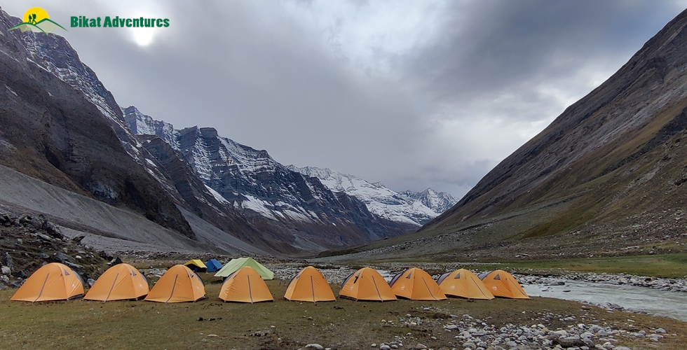
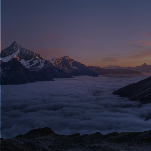
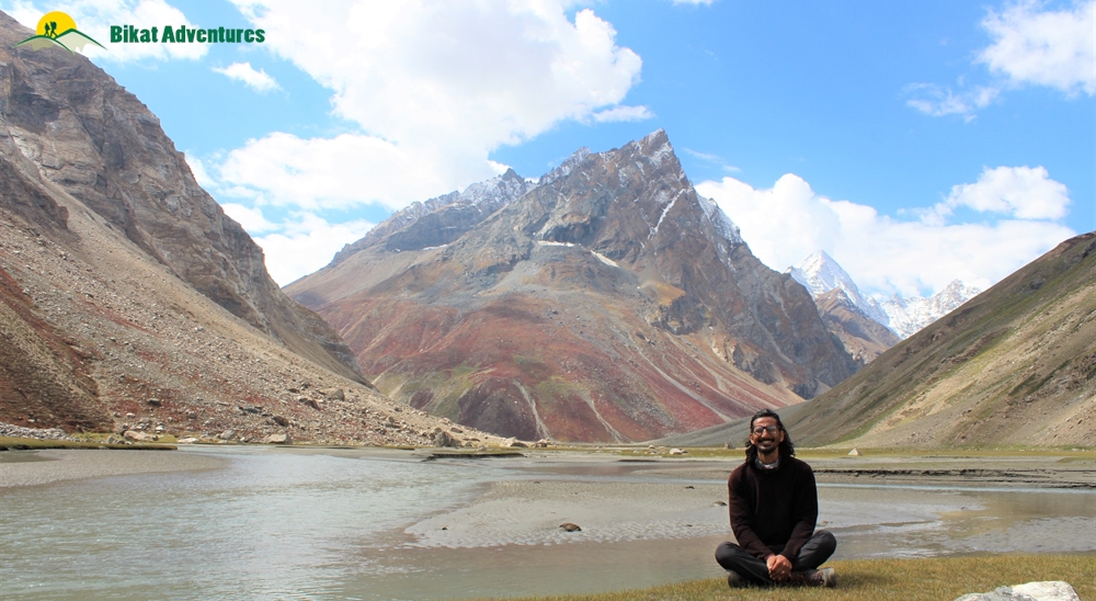
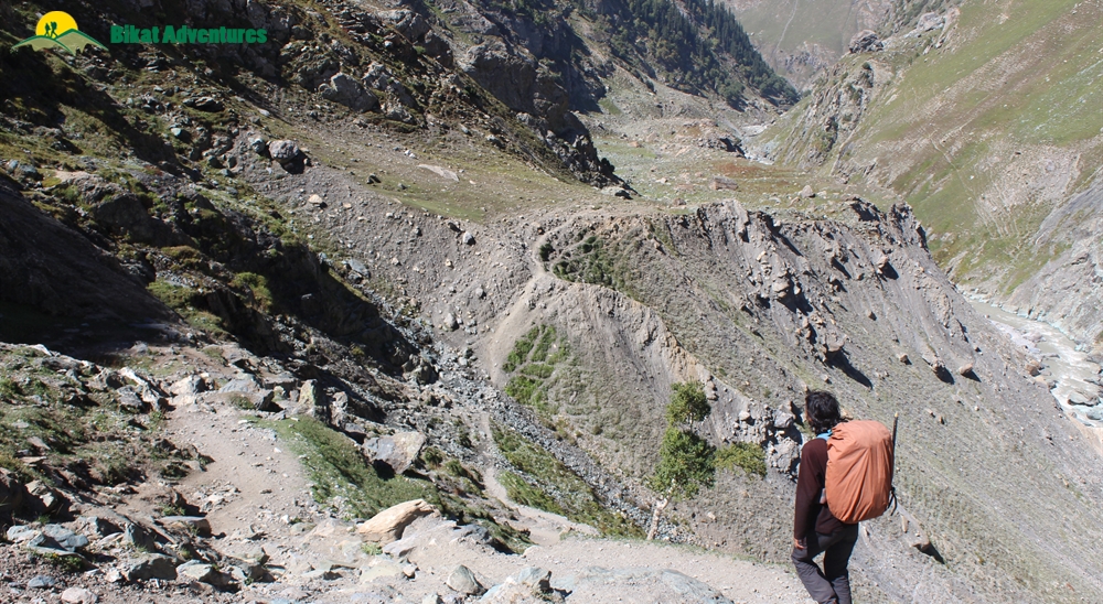
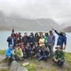
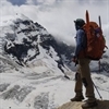
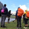
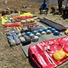
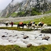
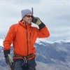
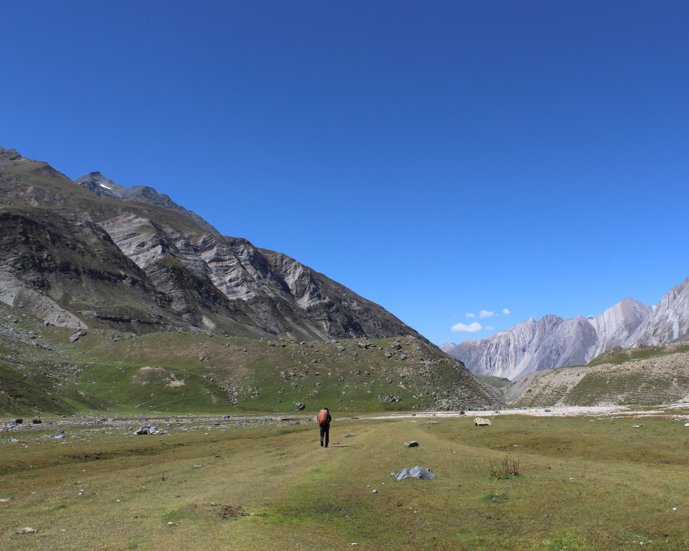
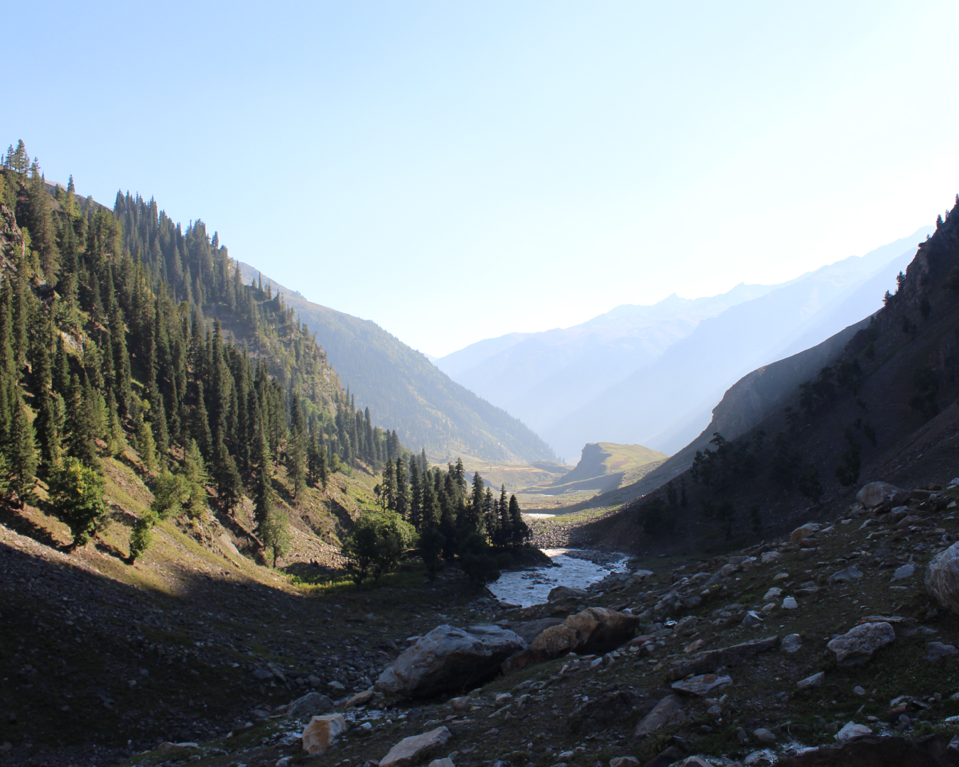
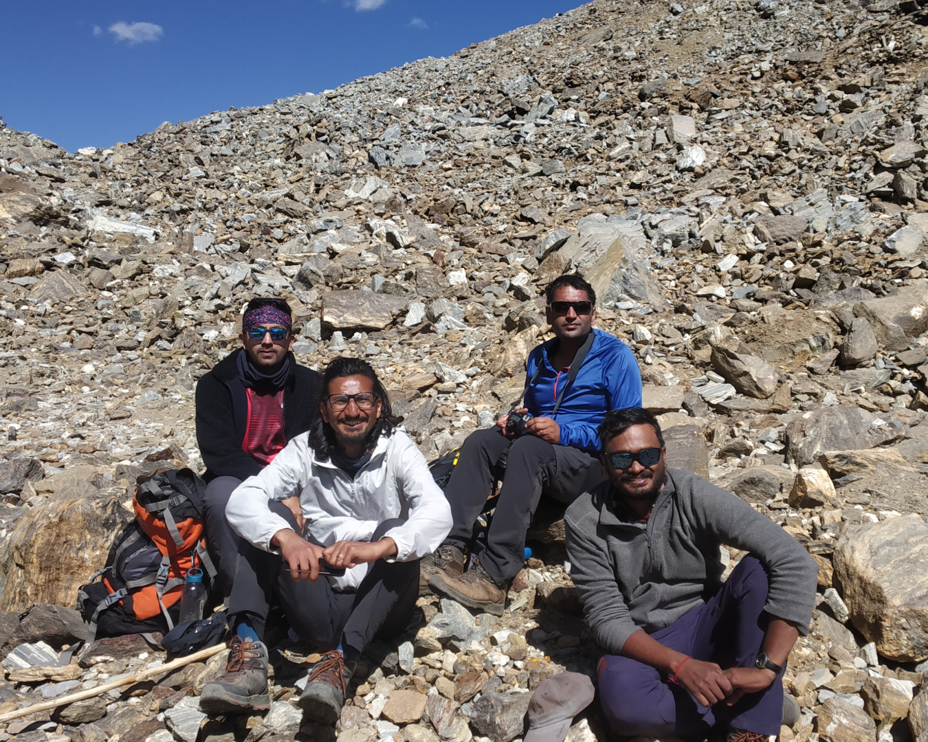
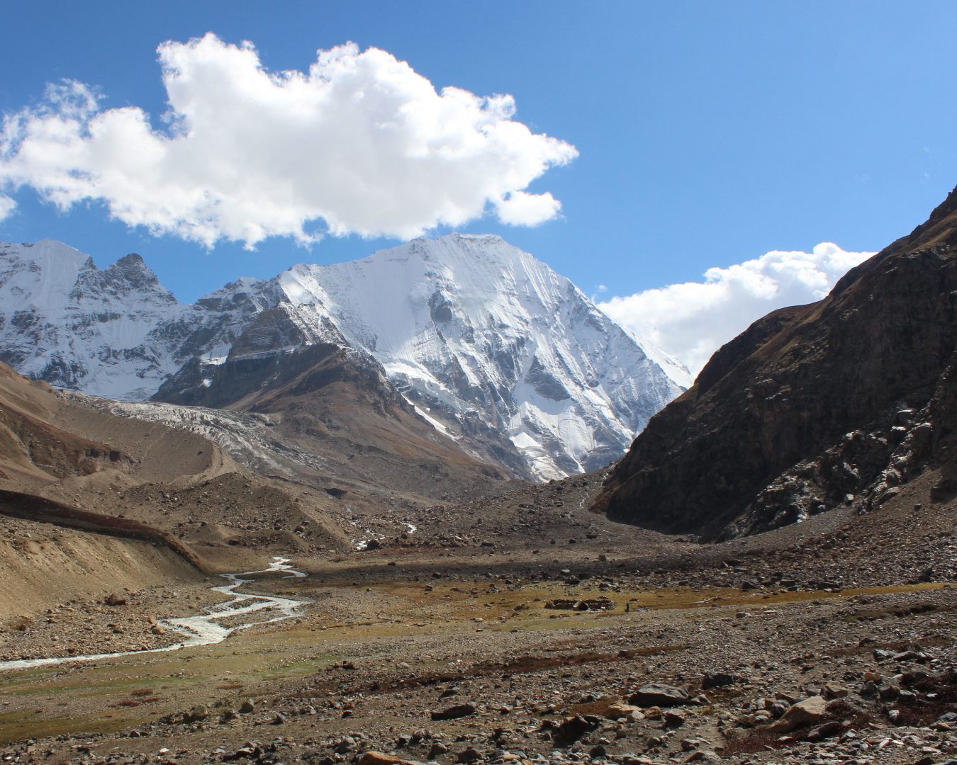
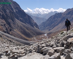
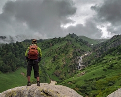
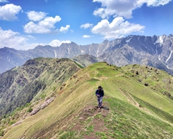
Gallery

Brief Itinerary
Detailed Itinerary
Day 1
Drive from Srinagar (1,585M) to Panikhar (3,300M)
Distance: 265 kms
Duration: 8-9 hours
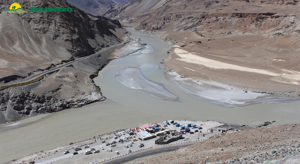
A city of houseboats, Srinagar, at the banks of river Jhelum is a perfect introduction to the beauty and hospitality of Kashmir. We assemble at a pre-decided location to start our drive from here to Panikhar. This 9 hour drive is one highlight after another – we pass through some of the most beautiful places in Kashmir like Sonamarg, Dras, Kargil, Sankoo before finally reaching our destination. On our way we cross 100s of military camps, army men practicing on the fields, and long structures in camouflage colors.
We will stop for snacks at Kargil for a few minutes and then move towards Suru Valley. The silky Suru nallah accompanies us on the right-hand side of the road for an hour and disperses into smaller streams. Two humongous hosts wait for our arrival at the Suru Valley. As we enter the valley side, the magnificent Mt Nun (7,135M) & Mt Kun (7,077M) welcome us with their white caps. Mount Nun is the highest peak in the Zanskar Valley of Ladakh. Mountaineers and climbers from across the globe try to summit the Nun-Kun massif which is counted as an achievement in and of itself plus serves as a worthy training ground for those looking to join the league of the mighty 8000ers. If we are on time and enter Suru before 6 PM, we witness the twin peaks with a vibrant sunset. After driving for another 2 hours, we reach the homestay in Panikhar at around 8 PM.
Day 2
Acclimatization day at Panikhar (3,300M)
We use this day to let our bodies acclimatize in the high altitude. Stay active & participate in the acclimatization walk in the day.
Day 3
Panikhar (3,300M) to Denora (3,764M)
Distance: 7 kms
Duration: 4-5 hours
Early in the morning after a scrumptious breakfast we leave the homestay and assemble at the nearest river point. The trail for the trek begin from the Chalong river point and is extremely easy with a flat gradient. A few minutes into the journey, the view of Panikhar village disappears behind you and a wider section of scenery unfolds in front of you. Throughout the day we walk on the right-hand side of the lustrous Chalong river. Once we cover a distance of 3 km, we see small streams of mountain springs crossing our path. This is our first source of drinking water for the day. The landscape after 3 kilometers gets broader. The barren lands gradually change into lush meadows and the trails take some minimal turns. As we continue walking on the meadow section for another 2 hours, we enter the luxuriant region of Denora, our first campsite.
Day 4
Denora (3,764M) to Kalapari (3,917M)
Distance: 8 kms
Duration: 5-6 hours
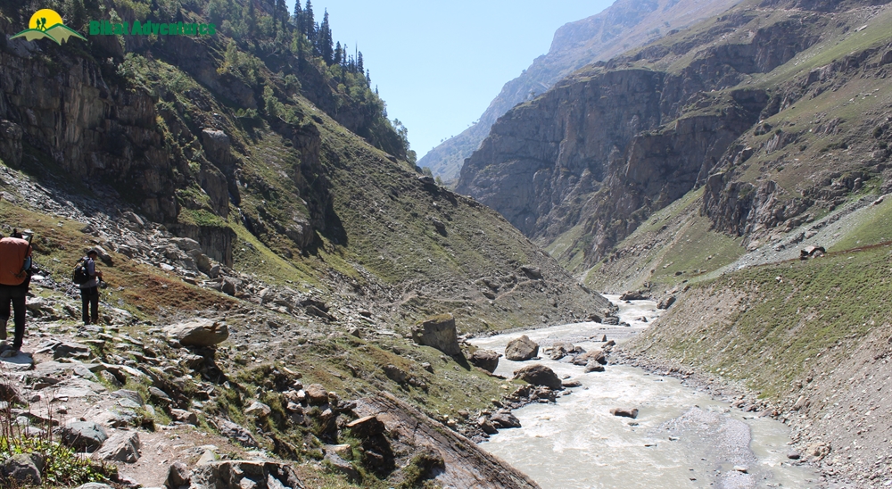
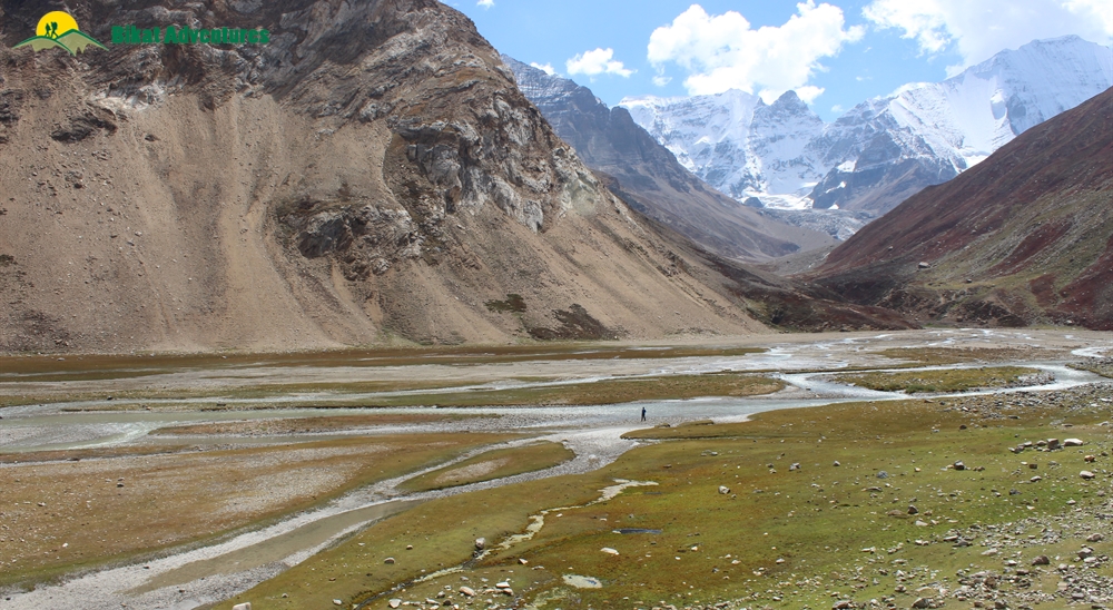
Today, the trails are no less thrilling than a roller coaster ride. The gradient is fairly easy and a bit challenging than the first day with continuous change in topography. We leave the campsite at 9 AM and ascend with minor elevations. The trails extend with a vast sheet of greyish boulders. Hop, jump and walk through the boulders for 3 kilometers, we land on a second elevation point. That’s our cue to be struck by awesomeness! Do not be surprised if you find yourself with an open mind and an open jaw for the next few hours of the journey! A huge river delta basin appears in front of us. In the natural Colosseum, several streams of water compete with each other, trying to flow ahead. This stretch continues for 2 kilometers and ends at the foot of a velvet red mountain covered in bright red shrubs and flowers.
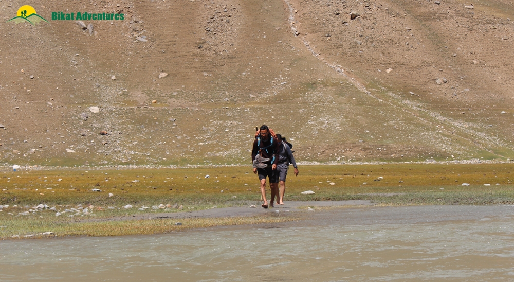
The trails run straight, dip in water and suddenly ascend along the sides of the basin. Remove your shoes, roll up your pants and get ready to cross the bone-chilling river streams. The thrilling river crossing happens twice and leads us to a massive confluence point near the red mountain. We cross the stream for one last time and start ascending towards the left-hand side of the confluence point. Hold on and take a look behind you. As the trails ascend towards the mountain range, you get a sweeping view of the Denora valley behind you. Now, when you turn, remember to look down as you ascend. Notice how the texture of the land changes completely, first from brown to green and then from green to red. It is as if a partial red carpet is placed to greet you at your second campsite.
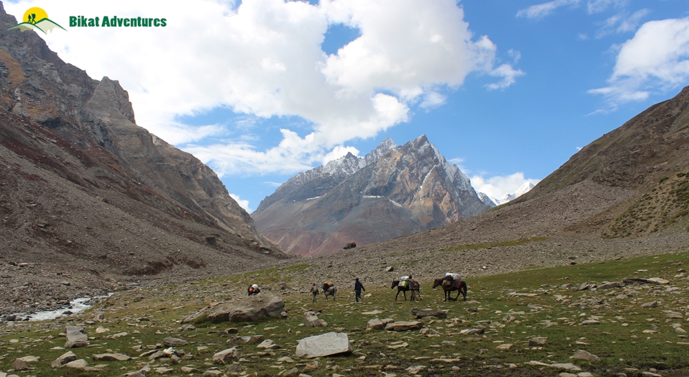
The gradual ascend goes on for 2.5 km and reveals a vast space with glacial ranges on one side, boulder sections in the middle, and barren hills on the other side. We descend for 500 meters and reach our second campsite, Kalapari. Our tents are pitched inside a small shepherd's structure here.
Meaning of Kalapari - Kala -black, Pari - Rock. (Most of the glaciers here are covered with black sand and dust)
Day 5
Kalapari (3,817M) to Kaintal (3,505M) via Ghansla Pass (4,410M)
Distance: 22 kms
Duration: 11 hours
We start early at around 7 AM because today is the longest day of the trek. The gradient of the trails are ‘moderate to difficult’ with narrow ridges, long moraine sections, and steep descents. There is an adequate amount of water source in between every 5 km.
The trails from the beginning of the Kalapari campsite are composed of asymmetrical boulders and moraines. About 10 minutes into the journey, we cross a quaint old cave called Na-Mithung. (Na meaning ‘no’, Mithung meaning ‘sky’)
In the ancient days, there used to be a cave where the shepherds would camp out. It was so deep that even the sky wouldn't be visible. Now, all you can see are the remnants and rubbles inside it. The depth was filled due to landslides and cloud bursts.
We continue to ascend from the cave section for an hour and land near a small water stream. We can witness the entire Kalapari Range from the spot. The trails run flat from the stream and grow narrower as we move ahead. Once we cover a distance of 2 km, the narrow trails are covered with scree making the traverse difficult. Sometimes, the trails even vanish completely. Following the footprint of mules or horses can help you move ahead.
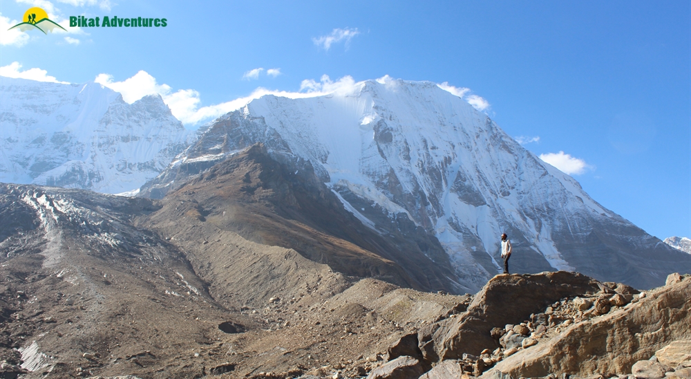
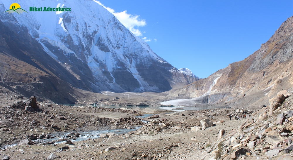
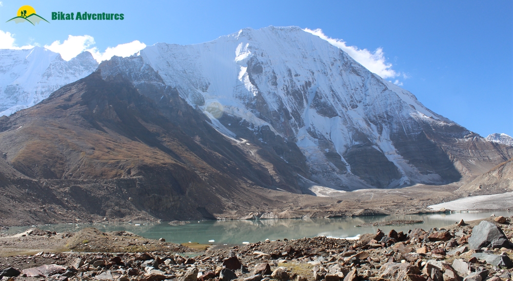
We continue walking on the narrow trails for 2 kilometers and land on a surprising marvel. Amidst the glacier region, huge boulders and mud, lies a phenomenal glacial lake with small ice caps floating on it. The diameter of the olive green lake is bigger and wider than any other Himalayan glacial lake.
We halt for a short break here and resume our journey after 10 minutes. A surprising twist awaits ahead of the lake. The rubble and scree sections end and a flat plain of hard ice emerges, leading us into the glacier section. The thrilling ice walk is extremely easy and it doesn't need any special gear to walk. This icy bliss continues for a 3 km stretch. At the end of the plain, the trail ascends into a moraine section. The gradient from the moraine section runs flat for a few meters and suddenly gains height. This type of changing topography continues for the next 3 km (roughly 2 hours). Finally, after reaching the top, the trail lands on a steep ridge.
The breathtaking ridge spans out for a distance of 500 meters in length and 2-3 meters in width. This sole string ridge is the gateway for Ghansla Pass. Though the pathway is easy, it might give you a tingling sensation in your belly because of the height and slope. Deep breaths and proper footing are the key elements in crossing it.
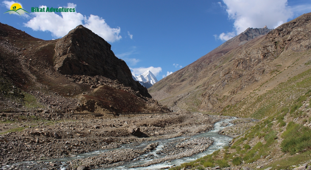
Once we reach the pass, we stumble upon a bigger, better, and more beautiful lake than the previous one. The glacial lake is as enormous as the tropical lakes on sea level. We break for lunch here and move towards the Kaintal glacier after 30 minutes. Locals say that the Bakarwals (shepherds) used to consider Ghansla Pass as the border for Kargil and Kashmir.
About an hour into the journey, the moraine section unveils its big black crevasses. You can find many glacial water streams flowing through the rocks and falling deep inside the crevasses. Once we cover a distance of 2 km, the trail descends and takes us to a special vantage point that holds the front-row view for the colossal Kaintal Glacier. If you carefully listen to the streams, you can hear the water flowing behind the huge bracken surface of the glacier. It is an actual glacier in the making.
The trails from the vantage point get steeper with a 45-degree descent for 3 km. After descending through the glacier surface, we walk on a unique type of surface mixed with moraine, ice, and crevasses. Be careful when you step on the ice floor. They are extremely slippery and dangerous. Following the leader is the best way to be safe. The icy moraine section continues for 5 km and open up to an extensive expanse of the Kashmir valleys. The boulder section transits to a flat grassland and a heavy stream of the Kaintal glacier flows to the left side of the trail. The flat trail runs for another 1 km and ends at Kaintal Campsite.
Day 6
Kaintal (3,505M) to Humpet (3,322M)
Distance: 16 kms
Duration: 7 hours
Today is much easier as compared to yesterday. The gradient runs flat with small ascents and descents. There are plenty of water streams to fill our bottles throughout the journey.
We start from the campsite at around 9 AM to walk along the huge Kaintal stream. The terrain is full of small pebbles, light-colored flowers, and a subtle hint of brown boulders. About 1 hour into the journey, we cross a couple of streams. The adventure and thrill here is amplified by the glacial water. The river crossing from the river basin was just a sample. The icy vibes of the Kaintal stream holds the ability to jolt you back to your senses with a merry dance thrown into the deal as a bonus!
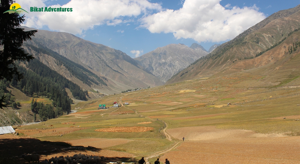
As we cover more distance, the land automatically shuffles between grass, rocks, and slush. A major section of the path runs parallel to the massive river stream. You can find streaks of trail marks paved on the top of the grass mounds. The nature of the grasslands changes when you gain a little height. The grass becomes greener and softer on the top. When you descend a bit downwards, the hues of green reduce and rocks take over. One of the main attractions on this route is the Kota - shepherds' huts. They are perfect structures made by just rocks and mud. If you get a chance, you can enter one and check the form from inside.
Once you cross a distance of 10 km, the snow-capped peaks of the Ladakh range fade into the distance and a small range of the Kashmir valley appears with a punch of vibrancy. The basin and the land next to it get wider and wider with every kilometer. Finally, at the end of an enormous space, when we find the tree line for the first time in the trek, we would have reached the Humpet campsite. Imagine 10 golf courses together in a single space, Humpet holds a massive expanse. After reaching the campsite, you can roam around and enjoy the beautiful sunset with some extra space and privacy.
Day 7
Humpet (3,322M) to Sukhnai (2,840M)
Distance: 18 kms
Duration: 7 hours
Today is the day we finally enter the Warwan Valley. The gradient for the day is moderate with a few steep descents and gradual ascents. We start from the campsite around 9 AM and ascend through a lush meadow section. Compared to the campsite, the meadows are smaller in size with huge boulders. Here, get ready to be surprised by the golden brown rodent, marmot. Not one, not a few, you can spot more than 100 signaling each other from a distance. These adorable beasts playfully run across the rocks and cross your trail. Keep your cameras ready, a few might even pose for you.
The trail gradually ascends for 2 - 3 kilometers and opens up to a ridge. The ridge is the entry point for the Warwan Valley. Once you cross the ridge, you will start descending towards the valley side. The valley is composed of a slim pathway with silver birch trees. The Kaintal stream gushes its way through the narrow spaces creating a roar between the mountains. The soothing shade of the silver birch trees offer a good spot for a quick refreshing break to gather back our energy.
Note - Since the route is less traveled, it doesn't have proper trails or markings. Follow the leader's command and walk with flat-footing.
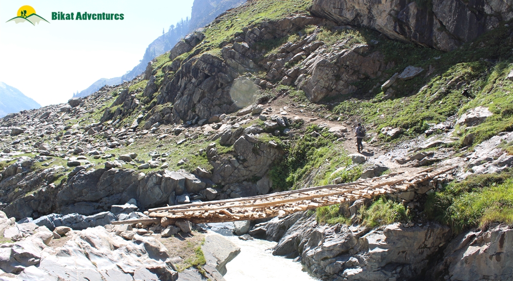
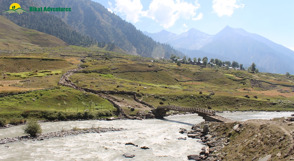
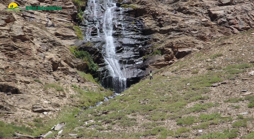
We continue descending for another 3 kilometers until we land on a flat area. The flat expanse takes us through a distinct kind of surprise - a confluence point of two rivers. Crystal blue river stream from the Sheshnag region mixes with Kaintal. Locals call the river Sain nallah. The flat trail gains several twists and turns from the confluence point. Sometimes they run through a waterfall, sometimes they run close to a river stream and many times they might get steep and slippery. Again, following the leader and watching your footing will help you traverse safely. At the end of the narrow trail, we get to an old wooden bridge. By this time, we have covered around 9 km.
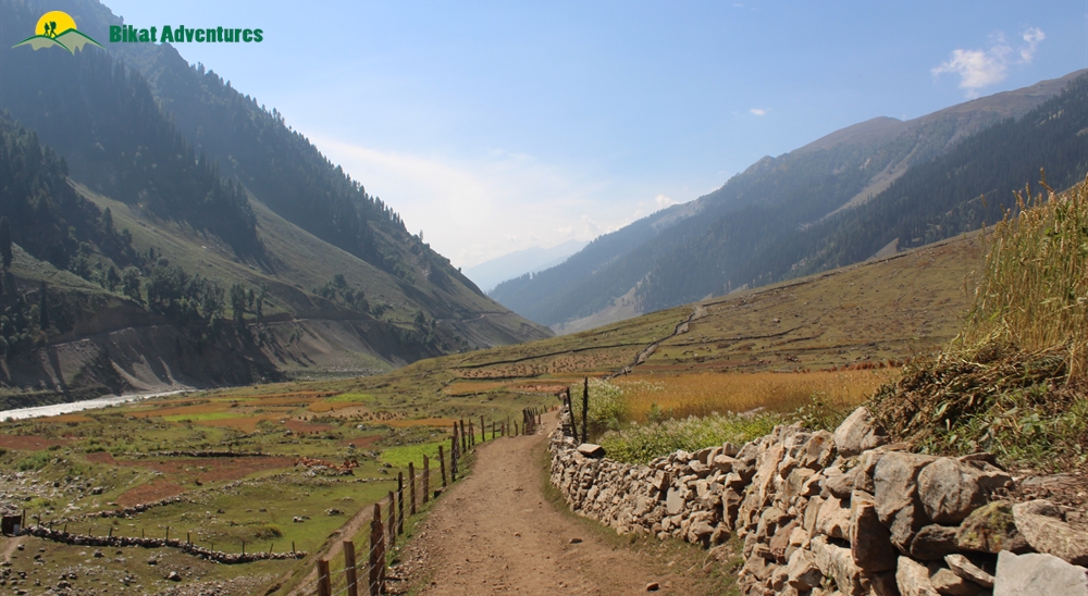
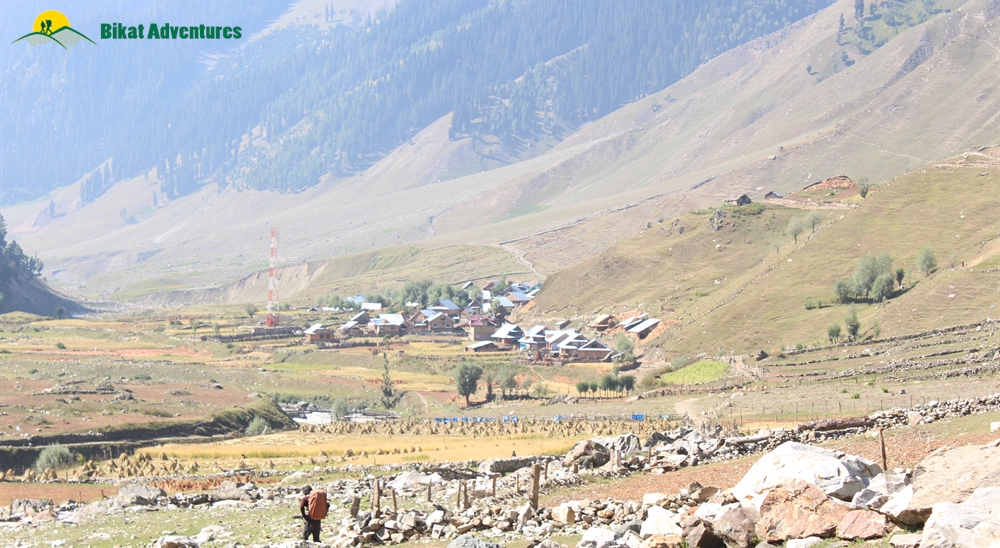
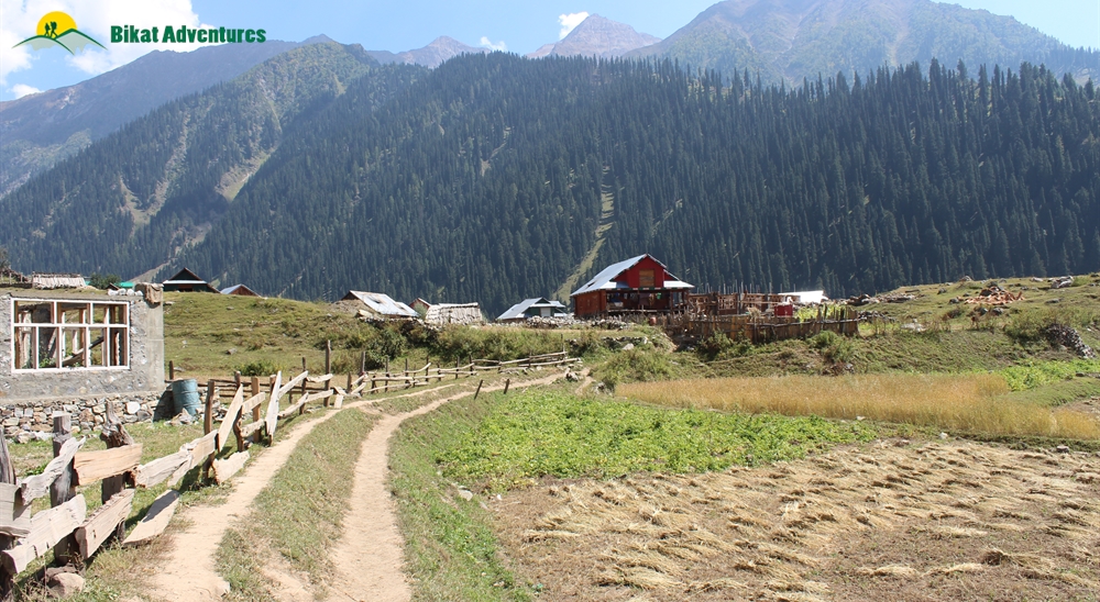
The valley gets wider, denser, and greener from the bridge. The trails are partially paved across several boulders, waterfalls, and tree line. We frequently toggle between forest areas and clearings here. About 2 hours and 5 km from the bridge, the space expands to give us a glimpse of the lush Sukhnai village from a long distance. On our way to Sukhnai, we cross several interesting shepherds of Kashmir. This is where we witness the magic of a single person and a dog managing more than 500-600 sheep at a time. If luck is on our side, they even offer their traditional tea made of goat milk. Finally, when the trails change into a proper paved path and end on a farm, we would have reached the exteriors of Sukhnai. We camp here for the night.
Day 8
Drive from Sukhnai (2,840M)/Basmina/Chaudraiman to Srinagar (1,585M)
Our pre booked vehicle picks us up from Sukhnai to drop us at Srinagar by the late evening. It is around 200 km and should take close to 8 hours to reach Srinagar from Sukhnai. It would be ideal to stay for the night and plan your return journey the next day.
What's Included
- Meals starting dinner on Day 1 till breakfast on Day 8
- Forest Permits/Camping Charges, if any (Upto the amount charged for Indian nationals)
- Dome tents - on twin sharing basis, Sleeping bags, mats
- Micro-spikes, Gaiters, Helmets, if required
- Trek guide, cook, helpers, and porters for carrying common supplies
- Mountaineering course certified Trek Leader with First Aid certification along with special rescue course from NIM, Uttarkashi
- Exhaustive First Aid kit including Oxygen cylinder
What's Not Included
- Portage of personal bags during the trek
- Cost of any kind of Travel Insurance.
- Any Expense of personal nature.
- Meals during road journey
- Any Expense not specified in the inclusions list.
Are you Eligible for this Adventure?
Warwan Valley is one of the lesser-explored utopias of Kashmir's Himalayan region. During the trek, we cover a distance of around 20 kilometers every day through hard moraine sections. The long exhausting walks, traversing through narrow scree sections, narrow ridge walks, and descending on steep surfaces make Warwan Valley a difficult level trek perfect for someone with prior trekking experience looking to level up by a notch! This trek puts you through some really exciting challenges.

BRS Level Required
This makes it mandatory for you to have high-altitude experience of preferably multiple treks marked at level 4 on the BRS. The altitude, the terrain and the nature of the climb demand a certain level of skill and a need for you to be aware of how your body reacts to the various features of a high altitude environment.
If you do not know what level of BRS trek would suit you best, worry not! Fill out this Form:

we will send you a progression chart to help you comfortably get out of your comfort zone in order to level up and ultimately reach your highest potential in the big, bad world of outdoor adventure.
Packing List
This is a list of essential items for individuals doing the trek with Bikat Adventures. This list contains only those items which the participants are required to bring with them. The list excludes those items which are provided by Bikat Adventures on the trek. We have divided the items into five categories. All the items in the list are essential except for those marked as optional.
Trekking Gear
- Ruck sack bag with rain cover. Qty -1
- Day Pack Bag - Recommended for treks with summit day
- Head Torch with spare Batteries. Qty -1
- U V protection sunglasses. Qty -1 Here is how you can choose the best sunglasses for trekking.
- Water Bottles: 2 bottles of 1 liter each
Footwear
- Non-skid, deep treaded, high-ankle trekking shoes Qty -1
- Pair of light weight Slipper/Sandals Qty -1
Clothing
- Quick Dry Warm lower or Track Pants. Qty - 2
- Full sleeves T-shirts/ Sweatshirts. 1 for every 2 days of trekking
- Pair of thick woolen socks. 1 pair for every two days of trekking
- Thermal Body warmer Upper & Lower. Qty-1
- Undergarments. Qty - 1 for every day of trekking
- Warm jacket closed at wrist & neck .Qty-1
- Full sleeves sweater. Qty -1
- Rain wear ( Jacket & Pants ) . Qty-1
- Pair of waterproof, warm gloves. Qty-1
- Woolen cap. Qty-1
- Sun shielding Hat. Qty -1
Toiletries
- Personal toiletries kit (Small Towel, Toilet paper, paper soap, Bar soap, toothbrush, toothpaste, cold cream, etc.)
- Sun screen lotion small pack. Qty -1 Here is your Sun Protection 101 to stay safe in the bright sunny outdoors.
- Lip Balm small pack. Qty-1
Utensils
- Small size, Light weight & Leak proof lunch box. Qty-1
- Plate. Qty- 1
- Spoon.Qty-1
- Tea/Coffee (plastic) Mug.Qty-1
Miscellaneous
- Camera (Optional)
- Carry your medicines in plenty in case you have any specific ailment. Consult your doctor before joining the trek.
- Dry fruits, Nuts, Chocolate bars (Optional)
Frequently Asked Questions
Warwan Valley Trek is suitable for trekkers with prior experience, having completed at least one BRS 4 level trek or equivalent.
If you can Jog/Run for 5 kms in 25-30 mins, you are ready to take on this trek. Once a week, you can practice running 10 kms in an hour or so to improve your endurance further. In addition to this, you can also add resistance workouts to your schedule like squats, lunges, push ups etc.
If you cannot do the above, there’s no need to worry. It is important to remember that it’s all about practice. Get on a training schedule and we can assure you that you will meet these standards in a matter of a few months.
A certain level of fitness and physical endurance are required to take on any high-altitude trail in the Himalayas. Basic knowledge about pitching a tent, ascending and descending on steep gradients, how to use a sleeping bag, toilet tents, sleeping tents, and mountain mannerisms will be helpful.
The minimum age limit is 13 years. However, minors between 13 to 17 years of age should be accompanied by their parents/ guardians. If you are above the age of 60, kindly carry a medical certificate from your doctor that deems you fit for adventure activities like trekking.
The Warwan Valley Trek is located in Jammu and Kashmir. It is situated in the western Himalayas, near the border with Himachal Pradesh.
The quest starts with an exquisite drive from Srinagar to Suru Valley via Kargil. After a night's stay in Panikhar, we come across huge river delta basins, vibrant meadows, massive glacial lakes, moraine sections, and silky streams for the first few days. Then, once we cross the immense pass, we walk through the ginormous Kaintal glacier and enter the Kashmir Valley. On the last day of the trek, we walk through some ancient villages in Kashmir. Some of the alluring highlights here are the larger-than-life spaces, traversing next to massive streams, bone-chilling river crossings, walking through quaint villages, walking on ice, view of glaciers, and walking on steep ridges. Also, be attentive when the golden-brown rodent (marmot) calls out to you, and do not miss the dance of the wagtails. For more details on the highlights of this climb, read Highlights of Warwan Valley Trek
The Warwan Valley trek falls under level 5 on the Bikat Rating Scale, making it a moderate to difficult level trek. During the trek, we cover a distance of around 20 kilometres every day through hard moraine sections. The long exhausting walks, traversing through narrow scree sections, narrow ridge walks, and descending on steep surfaces might be extremely challenging. Proper practice and a standard fitness level are required. For more details on the challenges of this climb, Read Who is this trek meant for?
The best time to do the Warwan Valley trek is during July, August & September.
On the trek we have twin-sharing tents. In case you want an individual tent, you can add that to your booking request for an additional cost.
The trek is most popular between July and September, which is the post-monsoon season in the region. During this time, the weather is mostly clear, and the temperature is pleasant during the day, with it ranging from 15 to 25 degrees Celsius in lower altitudes. As you gain altitude, the temperature can drop significantly, especially at night, with temperatures ranging from 5 to 15 degrees Celsius at higher altitudes.
Warwan Valley Trek is considered to be a challenging trek overall, as it involves long exhausting walks, traversing through narrow scree sections, narrow ridge walks, bone-chilling river crossings and descending on steep surfaces. However, no specialised climbing or mountaineering skills are required.
The base of the Warwan Valley trek is Srinagar which is a very popular tourist destination and hence extremely accessible.
Only postpaid connections work in the Kashmir region. BSNL and Airtel get the best network. You get full network at the base and end point of the trek.
You will find plenty of ATMs in Srinagar.
Pick up point for Warwan Valley Trek is near Dal lake. We will communicate the exact location on the WhatsApp group (formed 2 weeks before departure). Payment for transport will be divided between the number of participants and made on the spot.
Expect to reach Srinagar late in the evening, post 5:00 pm. Make sure your bookings from this point to your respective destinations are for the next day.
Dal Lake: The jewel of Srinagar, the Dal lake is synonymous to a visit to Srinagar and almost a visual definition to the town. Spread over a straggling 26 sq.kms, it is the most photogenic stretch of this paradise on earth and undoubtedly also one of the most sought after of attractions.
Mughal Gardens: Built in the Mughal era, donning its majestic architecture, are the Mughal gardens. The garden is a combination of the Nishat Bagh, Shalimar Gardens & Chashm-e-Shahi. The most prominent feature of the gardens is its long stretches of cascading fountains making this a must see for every traveller.
Nishant Bagh: Laid out in 1633, Nishant Bagh is fondly known as the Garden of Joy. Its beauty is enhanced by the well-manicured landscapes, long avenues of Chinar & cypress trees, rare flowering plants, 12 terraces & several bubbling fountains that cover the whole expanse of the garden.
Shankaracharya Temple: Visit this effulgent, age old temple in Srinagar to feel closer to the gods. Situated at a height of about 1100 feet on the south-east of the city, this sacred temple offers splendid views of the valley and snow-clad mountains of the Pir Panjal range.
Hazratbal: Hazratbal Mosque, situated on the western shore of the pristine Dal Lake, is a sacred Muslim shrine in Hazratbal. Hazratbal's significance is derived from the fact that it houses an heir of the prophet Muhammad, a relic, titled Moi-e-Muqqadas. The relic is only displayed to the public on religious occasions, usually accompanied by colourful fairs afterwards. The shrine commands a grand view of the lake and the mountain beyond, especially when its pristine white marble elegance is reflected in the waters of the lake.
All the common gear like tents, sleeping bags, mattresses etc. are provided. All the technical climbing equipment needed for the trek, like microspikes, Helmets, Gaiters, etc. are also provided to you. Safety equipment used for rescue is carried by our trek leaders.
You can rent trekking shoes, trekking poles, a fleece jacket and a rucksack from us. In case you have any other requirements, you can talk to our representative and we will be happy to assist you in any way that we can.
You will receive your rented equipment at Srinagar, on Day 1.
Our trek leaders will collect the rented equipment from you at the end of the trek on the last day.
For a detailed list, check the Packing List section on this page.
You can buy your essentials in Srinagar. However, do not leave anything for last minute purchase.
Although not recommended, you can off load your bag at an additional cost. Add a request while making your booking for the trek and it can be arranged.
(Note: We don’t recommend offloading because the extra resources on a trail - ponies or porters depending on the trail - means extra load on the environment which can easily be avoided. It also goes against the spirit of trekking by eliminating a level of endurance and discomfort from the experience which are factors at the very heart of an outdoor adventure activity.)
You can leave extra luggage in Srinagar at our storage facility.
On all trek days, we provide 3 full meals (breakfast, lunch & dinner) in addition to evening snacks and tea. The meals are vegetarian and the menu is pre-decided for all days of the trek. We do provide eggs as well on certain days. If you have any specific food-related allergies or restrictions, you can let our local staff (during the trek) know, and your requests will get accommodated. We try to provide a variety of food across meals so as to avoid repetition as well as cover all nutritional needs.
On campsites, our team will dig dry pits and assemble a toilet tent to provide for safe and secure quarters. A shovel will be provided within the toilet tent as well. Using water in the toilet tent is restricted; you will need to carry your own toilet paper. On the more difficult expeditions, toilet tents are not carried to the higher camps (above base camp) due to restriction of space (to pitch the tent).
In case you get your period on the trail and don’t have sanitary napkins, our trek leaders can provide them to you. If you need any other kind of assistance, you can let our trek leaders know. Irrespective of gender, our leaders are gender sensitised and equipped to assist you in any way you need them to.
Our team carries a first aid kit and all the basic medicines required during the trek. They are equipped to be the first responders in case of any injury or health-related issues. For higher expeditions, we also carry a HAPO Bag and oxygen cylinders to tend to any altitude-related health conditions.
No, we will be camping in the wilderness with no access to electricity.
A copy of your ID Proof and Medical Certificate are the mandatory documents required for this trek. (Soft copies for all of these are to be sent to us & originals should be on your person while on the trek.)
Yes, insurance for any high-altitude activity is highly recommended to cover for the cost of rescue, evacuation and any other emergency service required as well as to cover for medical cost in case of injury or illness during the trek. You can buy it on your own. Alternatively, if you want us to buy it on your behalf, you can mark it as an add-on during the booking of the trek.
Yes, there are multiple permits required for this. We obtain the permits on every trekkers’ behalf. All the permit costs are included in your trek cost.
Yes, you will receive e-certificates (of completion) after the trek. It will bear your name, the trek, and the maximum altitude you achieved on the trek. In case you were unable to finish the trek, you will get a certificate of participation.
On completion of the trek, the certificate will show up on your dashboard on our website. You can download it directly from there.
Warwan Valley Trek is in India. If you are coming from outside, you will need a visa to enter the country. You should be able to find the rules for obtaining a Visa based on your home country on the internet. This information is easily available.
This does not apply to you if you are an Indian citizen. In case you don’t hold an Indian passport, you will need to check online for Visa application rules based on your home country.
If you are not an Indian citizen, you will need Travel Medical Insurance to travel to the country. Please make sure that your insurance policy is valid for the altitude you are going to and the activity you are undertaking, to cover risks during the trek. The insurance policy provided by Bikat Adventures does not cover foreign nationals. So, please do not purchase it while making the booking from our website.
Warwan Valley Trek is situated in the western Himalayas. The Himalayas house the tallest mountains in the world and have long been a treasure trove for all adventure enthusiasts. The variety in terms of beauty, terrain, landscape, geography, culture and opportunity for adventure in the Himalayas, remains undisputedly unmatched.
You can make the booking any time depending on availability of slots in our fixed departure batches. You will get this information at the top of this page.
A Basic Mountaineering Course certification from one of the five recognized mountaineering institutes in India is a minimum requirement to join our team. Our field experts are also trained in basic medicine and first-aid response. We also conduct on-ground training for our staff once a year as a refresher for old skills and to learn some new ones. During this training that we call APW (Adventure Professional Workshop), our leaders learn close to 25 topics and techniques of rescue which are not covered in the BMC and AMC courses. For practical training, we simulate on-ground situations to prepare them for quick thinking and quick response during emergencies.
We follow a rigorous regime of hiring and training our experts on the field. Each trek leader is a certified mountaineer with years of experience in the field. The interview process to bring a trek leader on-board is close to 6 months long where we assess various skills as well as personality traits of an individual. They also go through an on-field assignment as part of the hiring process. Trek leaders also progress in time from leading easier treks before advancing to the more difficult ones where the stakes are higher. For detailed information on our selection process, please visit Forerunners - The Making Of A Trek Leader
It absolutely is. We recognize, value and embody the ideology that the world of outdoor adventure can benefit from diversity. We make it our mission to create outdoor spaces as equally accessible and safe for all genders as possible. We also encourage women leaders in the outdoors and all of our staff (irrespective of gender) is gender sensitised. As for accommodation, in case there are no other women on the trek, a solo female trekker is provided with a separate single-occupancy tent.
Our batch sizes for Warwan Valley Trek are capped at 15 with the trek leader to trekker ratio of 1:8.
In addition to their qualification, our trek leaders are trained to tackle any and all kinds of sudden conditions that may present themselves on ground. During our recce stage, we study the trail in great detail and map out rescue routes before opening it up for our trekkers. We also have local support staff stationed in each area to arrange for emergency services at the place of need as quickly as possible.
We mobilise road rescue efforts where our trek leaders bring the person to be rescued down to the trailhead of the trek from where a car can take them to the nearest healthcare facility. The cost of rescue is not covered in the trek fee that we charge. It must be borne by the participant. However, if you opt for the insurance the cost of rescue operations can be claimed from the Insurance company on production of valid proof e.g. doctor’s prescription & hospital bills etc. Please note that Bikat Adventures is only a facilitator & not a party in the Insurance policy. You need to raise the claim request directly with the Insurance company. Bikat Adventures is not responsible for any rejection of claim. You can call the insurance provider directly for any clarifications related to the Insurance policy. Although not mandatory, we recommend buying the insurance. You don’t necessarily have to get the insurance we provide, you can pick an Insurance company of your choice and get a policy directly from them. If you need more information on the terms and conditions of the insurance policy, get in touch with our customer support team.
All the gear used on our treks and expeditions is tried and tested, maintained for good quality and is overall top notch in quality and condition. We are continually looking to obtain the best of everything there is in the market so as to ensure optimum safety.
That will depend on the nature of your medical condition. Do give us a call, and one of our people will help you understand what is best for you. If not this, we are sure there would be plenty of other options you can choose from our vast portfolio to pick as your next adventure.
We have rolling camps on all our trails. To know why we are strictly against the concept of Fixed Camping, read Reasons to Ban Fixed Camping in Himalayas
This is a complex question and has a compound answer. The simple response is that because it is bad for the environment which we dearly love but if you are interested in a more detailed response to this question, please read Reasons to Ban Fixed Camping in Himalayas
There are a number of measures that we take to prevent overcrowding on some of the most popular trails. Some of them are capping our group size at 15, capping the number of trekkers on a trail to 250 per season, constantly looking for newer trails and routes to spread the crowd around and providing incentives to our trekkers to try unexplored territories with us. We put in place the system of dynamic pricing, which is the first of its kind in the trekking industry, which incentivises trekkers to choose less crowded trails by offering higher discounts. We have noticed, since we started this system, that this has helped in a big way to spread out the crowds between trekking routes. We are also going international so as to relieve some of the stress on the Himalayan landscape as well as explore newer ranges and design newer experiences for our community. If you want a more detailed description of all our measures in this regard, please read Simple solutions to overcrowding on Himalayan Treks
Some basic things to remember are: do not use water, do not dispose of anything non-biodegradable inside the pits, carry your own roll of toilet paper and remember to cover up after yourself to leave a clean toilet for your fellow trekkers. Everything else is much the same like using an Indian style home toilet!
Most wet wipes are not biodegradable which means it could take 100 years or more for them to decompose – not the best thing if you are trying to ‘Leave No Trace’, right?
This is quite a tricky situation but not a hopeless one. Since most of our sanitary waste is not biodegradable, we recommend that you pack your pads/tampons neatly, store it in a zip-lock bag and bring it back down with you where there are better options to dispose of them. In case you do not have zip-lock bags, ask our trek leaders for them and they should be able to provide them to you.
Each trekker is responsible for the use and hygiene of their own eating utensils. And as a measure to maintain proper hygiene, we do not provide plates and spoons. Also, dipping your hands in cold water to wash your own utensils adds something to the overall joy of high-altitude living, wouldn’t you think?
On making the payment, you will receive a booking confirmation along with the packing list and a copy of the undertaking form via email. You will subsequently receive emails detailing documents required, how to prepare physically and mentally for the trek, information on pick-up location on the first day etc. Please add [email protected] in your trusted emails list to make sure our emails don't go to your spam folder.
A Whatsapp group will be formed a few weeks before departure. Members from our team are on those groups as well. Feel free to seek any clarifications you require in regards to the trek, on the group itself. Updates related to transportation/pickup point/pickup timing, accommodation etc. will be shared on the Whatsapp group as well.
Yes, we create a Whatsapp group a few weeks before the departure date so that the flow of information remains smooth and transparent.
Yes, it is one of the mandatory documents you will need to submit before the trek starts. The soft copy is to be sent to us & the original should be on your person while on the trek.
Yes, we will provide you an undertaking form through email which will need to be filled up by you and submitted to us post booking.
Why Bikat?
Small Group Size
Our batch sizes are capped at 15 for smaller treks with the trek leader and trekker ratio of 1:8. This ratio, in our years of experience, has proven to deliver the best trekking experience for individuals as well as groups. Capping the size of the group ensures individual attention to each trekker so that no signs of distress or need during the trek go unnoticed. It also helps to form a more cohesive cohort with better group energy which helps define the rhythm and pace of days on the trek. As you go higher up on the BRS scale, since the stakes are higher, expeditions have an even smaller group size with the ratio of expedition leader to climber set at 1:2.
Qualified Trek Leaders
We follow a rigorous regime of hiring and training our experts in the field. Each trek leader is a certified mountaineer with years of experience in the field. In addition to their qualification, they also go through practical and situational training to tackle any and all kinds of sudden conditions that may present themselves on the ground. Being unpredictable is the core nature of the mountains but being ready for any circumstance as best as possible is a controllable asset that we try to nurture. Our field experts are also trained in basic medicine and first-aid response. Watch: Forerunners - The Making of A Trek Leader At Bikat Adventures
Guided Progression
Since Bikat Adventures is a learning-based organization, we help you climb up the ladder of difficulty within the sphere of outdoor adventure systematically. Our on-ground training modules are designed to handhold you through the upskilling process so that you are ready to take on bigger challenges.
Equipment Quality and Check
All the gear used on our treks and expeditions is tried and tested, maintained for good quality, and is overall top-notch in quality and condition. We are continually looking to obtain the best of everything there is in the market so as to ensure optimum safety.
Support Systems
Along with the staff you see on-ground, we have a team of superheroes working in the background to give you the best experience possible. Our background team also comprises local staff from each area who know the region best. Having local support helps with studying the area, pre-planning, execution, and in receiving timely support in case of emergencies in these remote locations.
Communication
Our on-field staff is in constant contact with our teams based in primary locations so as to eliminate any avoidable delay in reaching additional help and support when required. We try to use the best tools for communication available, including satellite phones, in regions where they are not restricted.
What our customers Say


Cancellation Policy
Cash refund
Cancellations up to 60 days prior to departure date
Between 60 days upto 30 days prior to departure date
Between 30 days upto 10 days prior to departure date
Less than 10 days prior to departure date
Voucher refund
Cancellations up to 30 days prior to departure date
Between 30 days upto 15 days prior to departure date
Between 15 days upto 10 days prior to departure date
Less 10 days prior to departure date
Please Note:
- Cash refund is applicable only in case of bookings made without using any promotional offer code or Cancellation Vouchers or Discounts. "Cash Refund will be processed in 7-14 working days."
- This is only a brief of cancellation terms. For finer details please refer Detailed Cancellation Policy.
Blog Posts
Experiential
Let’s say after YOLO, FOMO, and LOL, the millennial short form of wonder is WOW. The Warwan Valley trek is a magical destination that is sure to cast a spell on you with its wonders. Every day in the trek, after witnessing new Himalayan marvels...
Read full
Informative
Warwan Valley trek is one of the ultimate treks of Himalayas for 3 reasons – firstly, it is less traveled and the trails are unexplored. Secondly, it offers all the Himalayan wonders like glaciers, grasslands, ice plains, flower meadows and muc...
Read full
Experiential
The Conversation
Hostel vibes are always cheerful and loud. But, surprisingly, on a Monday evening, a couple of trek leaders and I were immersed in silence and our phone screens. We were waiting for a message. Some wanted to get an update on their n...
Read full
Informative
Warwan Valley, home to versatile landscapes and exotic experiences, is the pinnacle of Himalayan beauty. Imagine all the unique features of the Himalayas from different regions offered to you in a single trek. THAT'S Warwan Valley! This destination c...
Read full
Similar Adventures
Borasu Pass Trek
A Thrilling Cross-Over Trek connecting Har Ki Dun to Baspa Valley
Uttarakhand
9 Days
BRS 5
5360 m
Kalihani Pass Trek
A challenging and off-beat gem of Himachal
Himachal
8 Days
BRS 5
4800 m
Baraadsar Lake Trek
A Challenging Off-beat Trail tucked between the Rupin and Supin Valleys
Uttarakhand
8 Days
BRS 5
4600 m


