Auden's Col Expedition
A Stunning Cross-Over from Gangotri to Kedarnath - Not for the Faint-Hearted
Available Batches
Available Batches
Brief Description
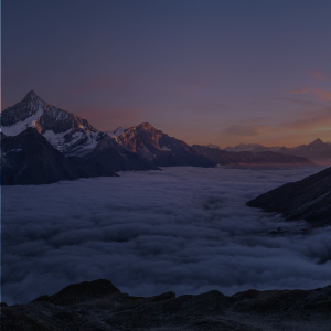
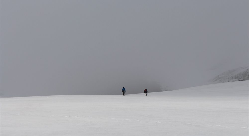
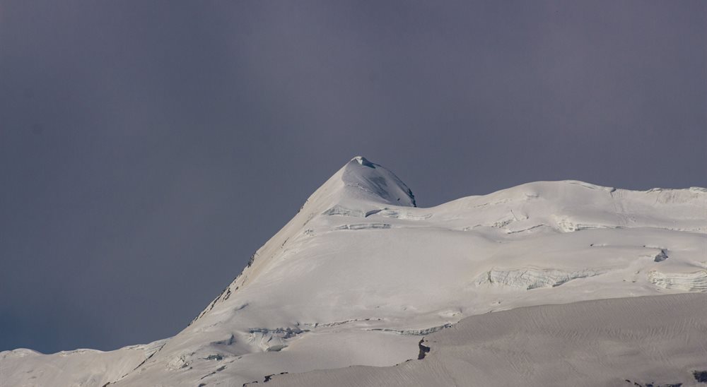
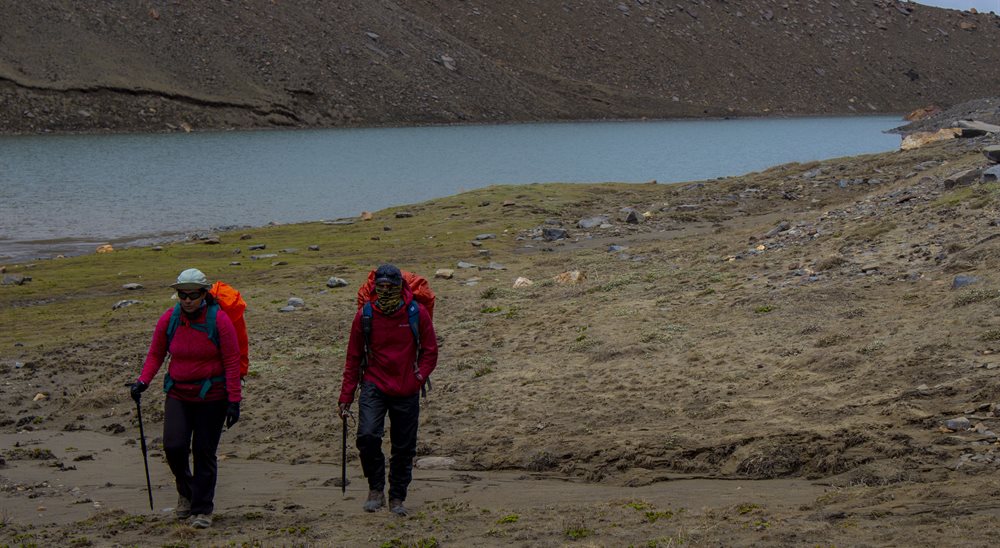
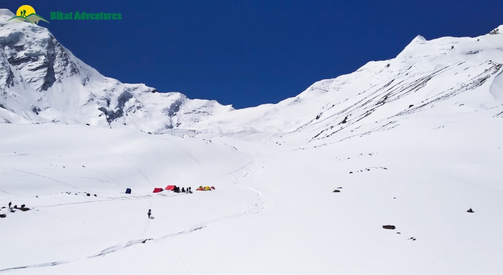
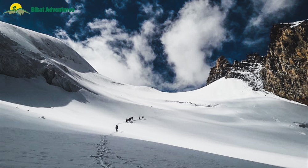
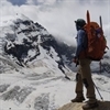
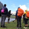
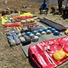
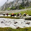
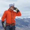
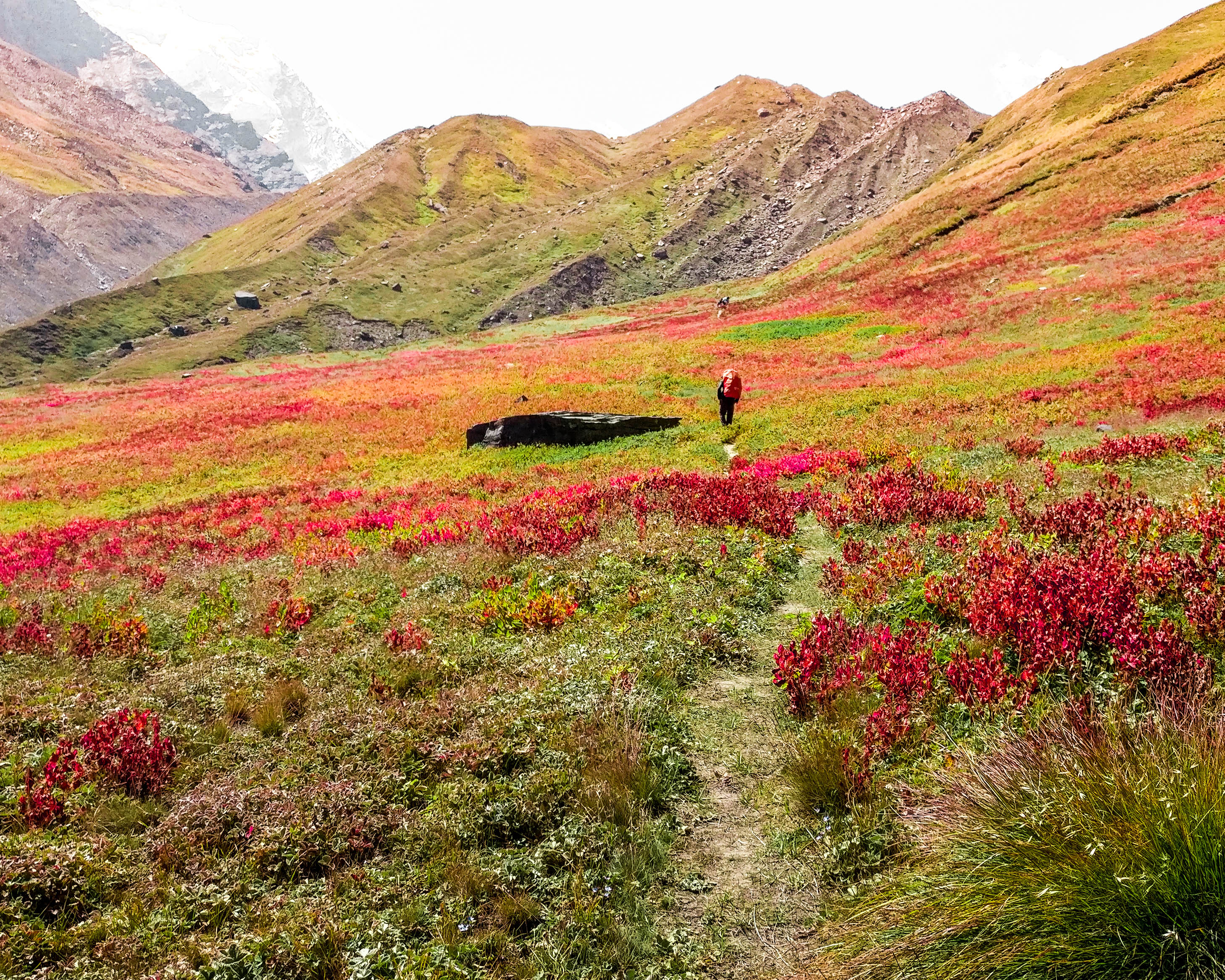
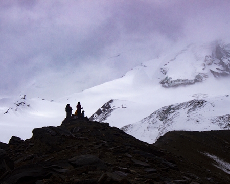
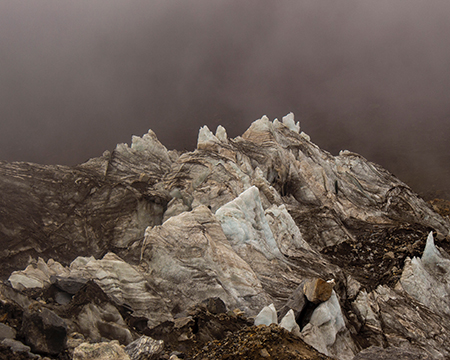
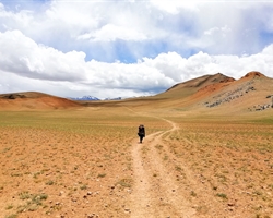
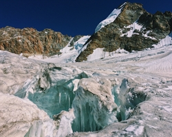
Gallery

Brief Itinerary
Detailed Itinerary
Day 1
Make your way to Gangotri (3,415M)
The trek begins from Gangotri which is a mountain city on the banks of River Bhagirathi and is known to be the origin of the holy River Ganga. Located in the Greater Himalayan Range, legend says that this is where Goddess Ganga descended when Lord Shiva released the river from the locks of his hair. This holy city which lies at an altitude of 3,415M is a 245 km drive away from Dehradun – the closest city with an airport.
If you have signed up with Bikat for a drive from Dehradun to Gangotri, the day starts early. Everyone assembles at the meeting point by 7 in the morning so we can start our long drive up to Gangotri, a holy mountain city in the Uttarkashi district of Uttarakhand. Although there’s nothing more on the agenda for today other than the 8-9 hour drive, it is better to leave as early as possible for two reasons:
One, so we can reach as early as possible and give our bodies enough rest for what’s coming the next day. And, two, roads on the mountains are unpredictable and it is always better to account for delays when we start. It is also better to reach before it gets dark.
Day 2
Rest and acclimatization at Gangotri (3,415M)
Day two is reserved for rest and for acclimatization to the altitude. This is important to allow your body to adapt to its new environment and reduce chances of adverse health conditions. You can go around and explore the market, delve into the colors and culture of this high-mountain town and visit some places nearby. A little movement around the city would be good for acclimatization. Also, use this time to go through your checklist and do some last-minute shopping for what you might be missing for the trek.
While the body acclimatizes, we take this time to get together with the group for a debriefing session where we get to know each other better and delve into the happenings of the next few days - schedule, what to expect, basic do's and don'ts in the mountains, how to maintain the sanctity of the environment and other such matters of importance.
We also go for a short acclimatization walk in the evening to adapt to this new environment better.
Day 3
Gangotri (3,415M) to Nala Camp (3,760M)
Distance: 7 km
Our first day of trekking in this treacherous terrain involves an altitude climb of close to 350M. The trail for most parts runs through dense forests that occasionally open up to miniature grasslands with unclouded views of limpid skies above.
We head southwest from Gangotri, walking down the main valley for around 2 km and then turn east into the Rudugaira valley. The trail from here gradually climbs up through thick oak and birch forests. On crossing the nala, the tree line begins to thin out giving way to wider expanses of landscape in the form of meadows and grazing grounds. Our approach to the campsite for the day offers magnificent views of Gangotri III and Jogin II which looks like a sharks fin when viewed from a certain angle.
On reaching the campsite, we rest our weary selves for a bit, get some fuel in the form of hot food and head out for an acclimatization walk early evening.
Day 4
Nala Camp (3,760M) to Rudugaira Camp (4,350M)
Distance: 4 km
On the agenda today is a 600M altitude gain across a short distance of 4 kms. Needless to say, the ascent up to Rudugaira Base camp will be steep and grueling. Going further ahead from the Nala Camp, the trail climbs to the upper grazing grounds which, if you are lucky, will offer up countless herds of Bharal (Himalayan Mountain Goats) sprinting around these high mountain lands. After crossing a few streams, we begin our climb up a steep spur which will take us straight to Rudugaira Base Camp.
We pitch our tents in this beautiful campsite covered in snow and surrounded by famous peaks such as Gangotri I, II, III and Jogin III.
Day 5
Rest and Acclimatization at Rudugaira Base Camp (4,350M)
Today is reserved for acclimatization to the altitude since we gained quite a bit of height in the last two days and have also entered a much different terrain. After a late breakfast we go for an acclimatization walk. On climbing just a few hundred meters from the campsite, we get our first view of Auden's Col which is inspiring to say the least. We end the day early so as to get optimum rest.
Day 6
Rudugaira Base Camp (4,350M) to Auden's Col Base Camp (4,720M) via Gangotri Base Camp (4,500M)
Distance: 8 km
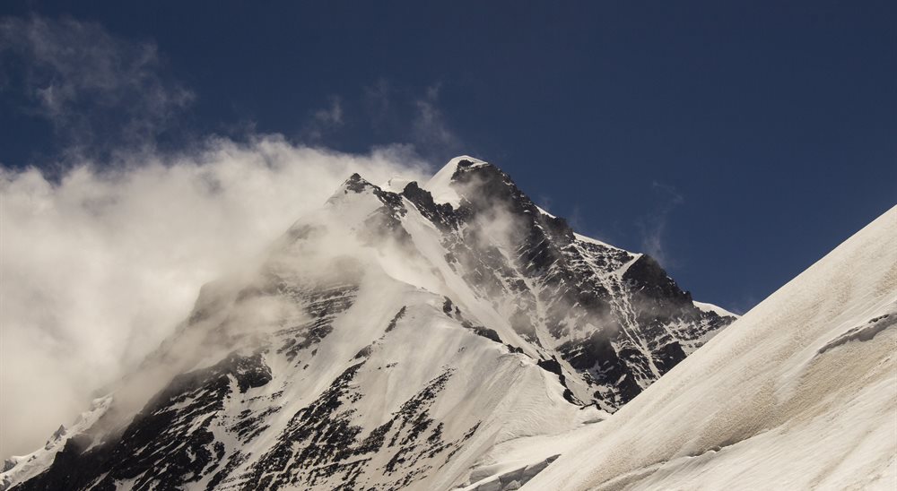
Today we start early and continue on towards Gangotri base camp which is approximately 4 kms from our campsite. A short while into our trek, we get our first glimpse of Auden’s Col. The view is absolutely spectacular. Covered in white, the col appears benign as it straddles a precarious ridge from the mighty Jogin I on the east and an equally formidable ridge running from the Gangotri III peak on the North West.
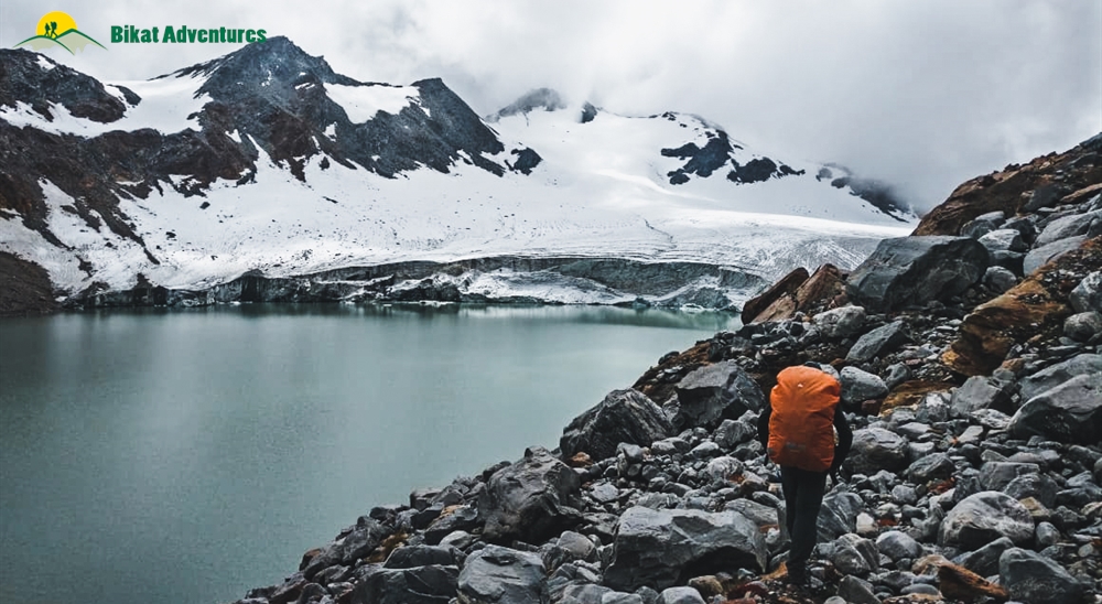
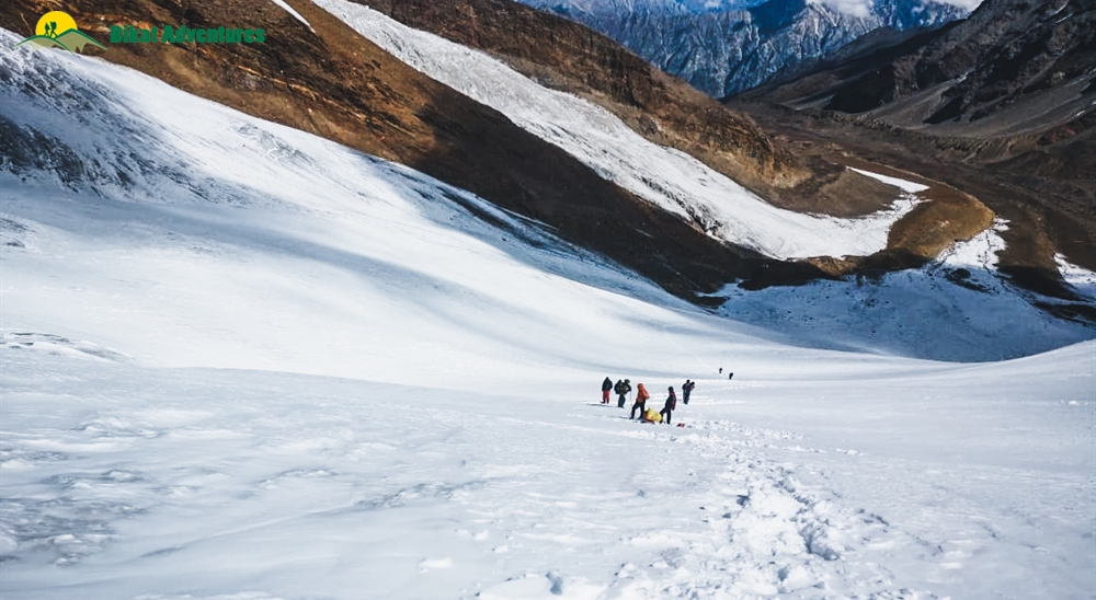
Gangotri base camp to Auden's Col base camp is a relatively short walk of 4 km, but quite difficult due to the altitude, terrain, and snow – we have now left the slopes of the valley behind and have entered the world of moraines. After a few hours of trudging through moraine-covered snow, we reach the wild and desolate Auden's Col base camp. On our way today, we will pass a high-altitude lake by the name of Sukha Tal which is a beautiful azure lake hidden in a moraine bowl.
Day 7
Auden's Col Base Camp (4,720M) to Khatling Glacier Camp (5,000M) via Auden's Col (5,490M)
Distance: 5 km
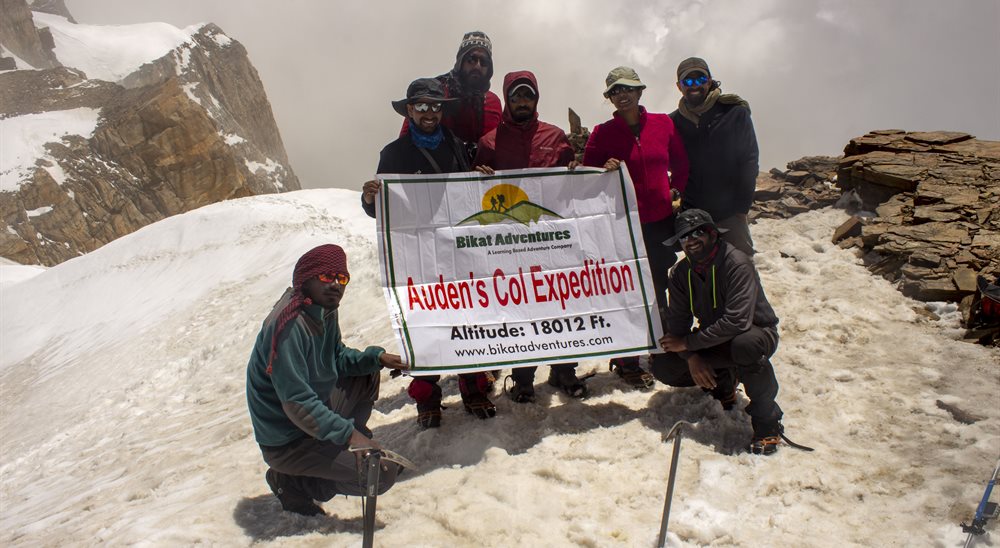
Today is THE day. We will be crossing the formidable yet spectacular Auden’s Col which lies at the confluence of four huge massifs: Jogin I and Gangotri III flanking us on either side with the Jogin glacier behind us and Khatling lying in front of us. Expect this to be a tiring day.
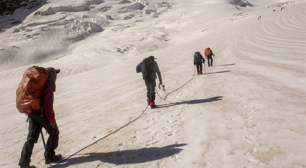
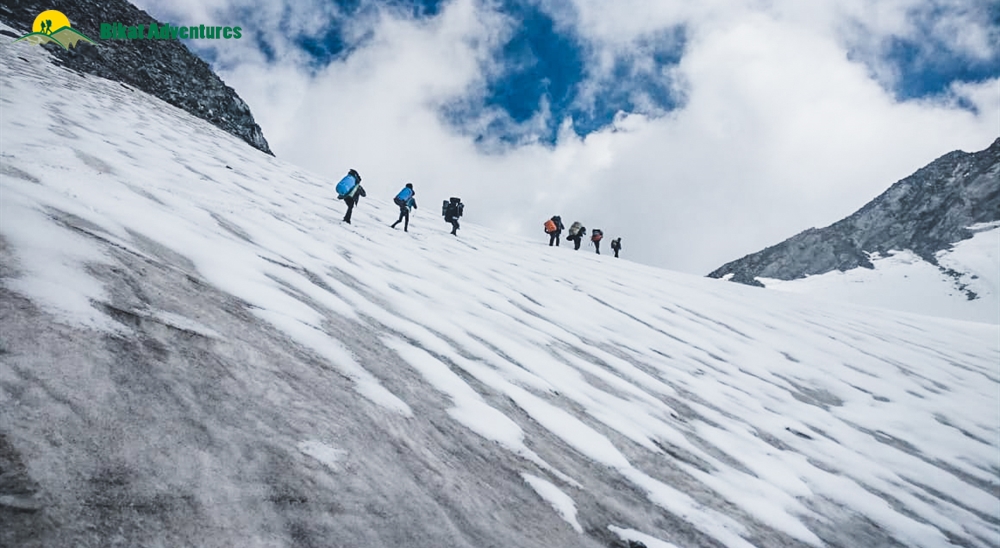
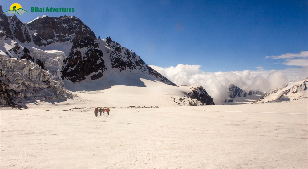
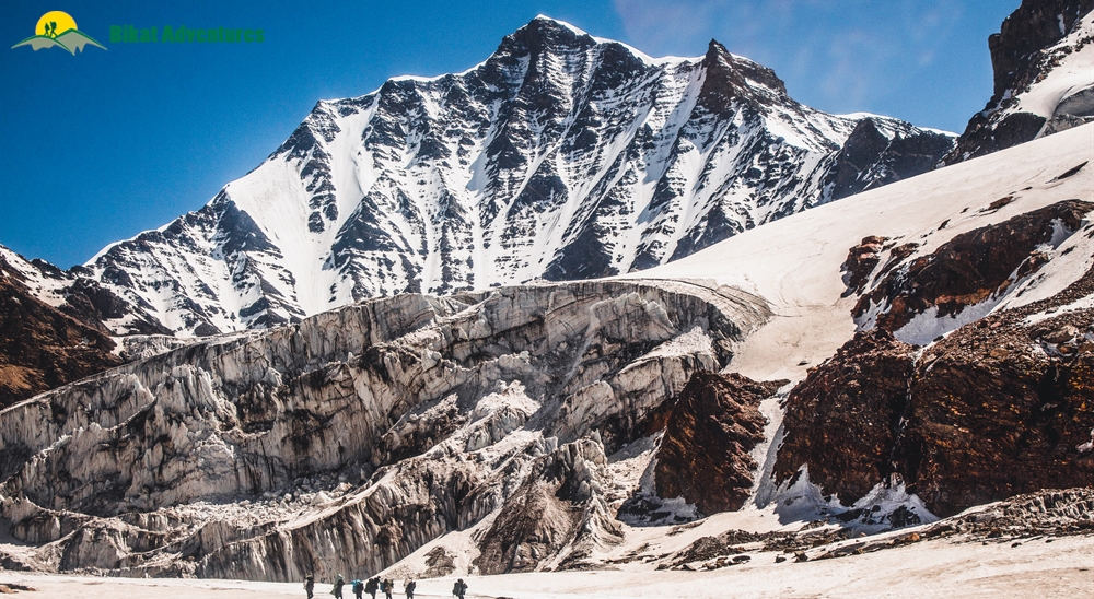
We continue on the moraine-ridden terrain until we reach the glacier. After a short while on the glacier, we hit a patch of ascent with a gradient between 30-50 degrees which will need to be navigated with caution. We rope up for this steep patch, which spans close to 1.5 kms, for utmost safety. The climb up to the col should take close to 3 hours. However, the climb up is not the main challenge for today.
The descent from the col is tricky and requires navigating a steep and narrow gully inclined at an angle of 70-75 degrees. Once this gully is crossed, however, the glacier flattens out – the broadened valley giving way to views of massive icefalls, glaciers and formidable peaks in the region. A short walk down the glacier brings us to our camp for the night.
Day 8
Khatling Glacier Camp (5,000M) to Zero Point (3,870M)
Distance: 10 km
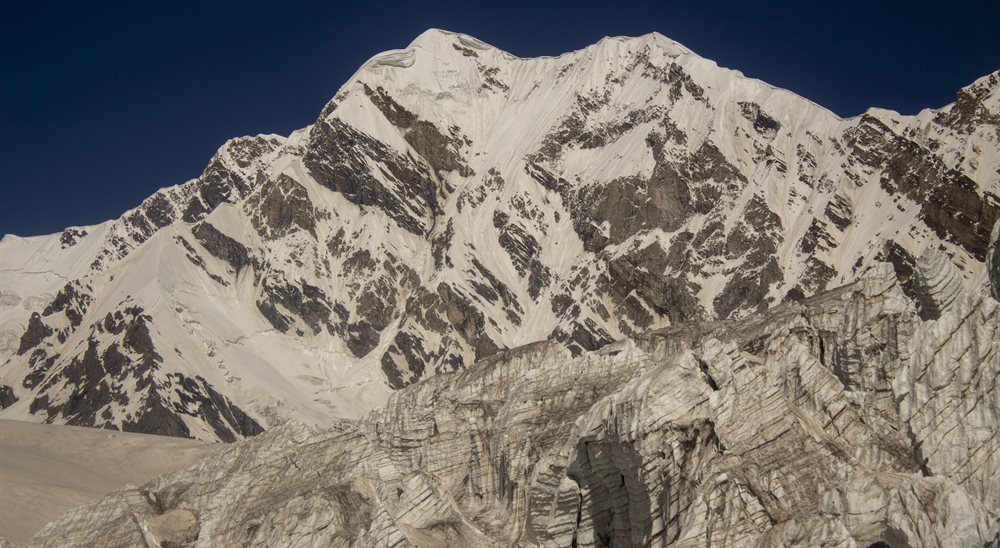
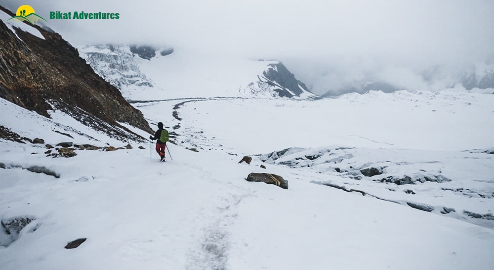
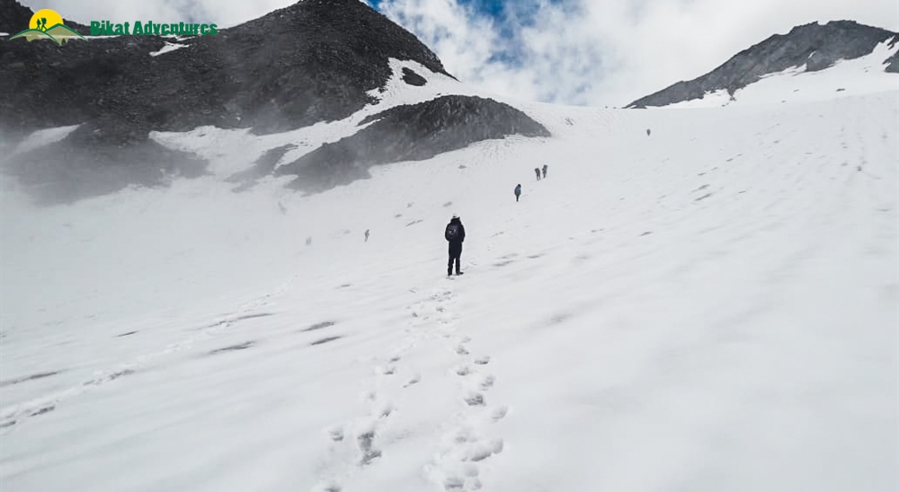
We have successfully crossed the pass and are now on the other side, but the challenge has only just begun. Today is going to be one of the longest days of the expedition and also the most demanding. We will be crossing the forbidding Khatling glacier today, which is almost 10 kms long and extremely challenging to navigate. As one of the most heavily glaciated regions in India, the Khatling glacier is a moraine-rich land full of hidden, open and deep crevasses for all the 10 kms. This unmarked route over loose gravel and scree with sections of steep ascents and descents demands extreme caution with each step forward. Towards the end, we are reunited with a marked trail which leads us to our campsite for the day by the snout of the Khatling glacier.
Day 9
Rest Day at Zero Point (3,870M)
Since the last couple of days have been extremely taxing, we rest at Zero Point today.
Day 10
Zero Point (3,870M) to Chowki (3,580M)
Distance: 7 km
Today we will be leaving the land of snow and making own way to the warmer reaches of the valley. After 3 kms of continuing our walk along the river, we reach the meadows. Chowki, our grassy campsite after spending days in rocks and snow, is a 4 km walk from here.
Day 11
Chowki (3,580M) to Masar Tal (4,135M)
Distance: 8 km
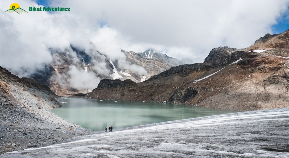
We will be making our way to one of the most isolated lakes in the Garhwal region, Masar Tal, today. Stationed at an altitude of 4,135M, this pristine, high-altitude lake rests to the east of the snowy Khatling glacier. The route starts off as a steep ascent with a view of Thalay Sagar- a gorgeous peak of 6,904M that lie 10 kms southwest of the holy site of Gaumukh. After the initial ascent, we cross a ridge over the valley which takes us straight to Masar Tal. We camp by this scenic lake.
Day 12
Masar Tal (4,135M) to Vasuki Tal (4,135M) via Mayali Pass (5,000M)
Distance: 12 km
Onwards to another glacial lake today, Vasuki Tal is at an altitude of 4,135M. Today’s trail begins with a steep ascent over boulders on a ridge to Masar Top. The path, then, descends slightly before climbing up the glacier to reach the top of Mayali Pass – another hidden gem of Uttarakhand. The descent from here is as precarious as the one we left behind when we climbed down from Khatling glacier. This section will require the use of fixed ropes on which we will rappel down. We continue our descent down all the way to Vasuki Tal which is our campsite for the day.
Day 13
Vasuki Tal (4,135M) to Kedarnath (3,590M)
Distance: 7 km
We will finally be making our way to Kedarnath today – which happens to be one of the holiest shrines to Shiva. As one of the twelve Jyotirlings, Kedarnath sees a lot of pilgrims in the months when the area is not buried under snow. Kedarnath is a 7 km trek from Vasuki Tal which takes about 3-4 hours to cover. We visit the temple in the evening and spend our night in a warm bed in a hotel, after days on cold, uneven surfaces.
Day 14
Kedarnath (3,590M) to Gaurikund (1,985M)
Distance: 14 km
We trek down this easy, well-marked trail of 14 kms which takes us directly to Gaurikund. We will be spending our night in a guesthouse/hotel.
Day 15
Gaurikund (1,985M) to Dehradun (430M)
Distance: 252 km Drive
The drive back down to Dehradun is alongside the fierce Ganga River. It should take close to 9 hours to reach. Expect to get to Dehradun by late evening.
Day 16
Reserve Day
In case of bad weather or other difficulties which might set us off schedule during the course of the entire expedition, Day 16 is set as a reserve day. This will only get used if unexpected and unforeseeable conditions present themselves at the last minute preventing us from reaching our destination as planned. In case this day is used, there is an extra charge of INR 4500 per person. The same will be collected by the trek leader at the end of trek.
What's Included
- Meals During the Expedition (Starting lunch on Day 2 till Dinner on Day 13)
- Hotel Stay in Gangotri, Kedarnath & Gauri Kund on twin/triple sharing basis
- Services of a English Speaking Trek Leader certified in AMC (Advance Mountaineering), special rescue course from NIM, Emergency wilderness Responder course
- Forest fee, permits & Camping Charges (Upto the amount specified for Indian Nationals)
- 4 season camping tent , Thermal rated sleeping bags & mattress
- Micro spikes, Ice Axe, Gaiters, Carabiners, Harness, and Helmet, as required
- UIAA Safety Equipment like Static Rescue Rope, Harnesses, Carabiners & pulleys with the Leader
- First Aid Certified Local Trek guide with extensive trek experience of the route, Cook, Helper
- Services of Porters for carrying common camping equipment like tents (twin sharing basis), sleeping bags & Services of kitchen stuff
- Exhaustive first aid kit with a portable oxygen cylinder of 5 ltrs capacity
What's Not Included
- Forest Charges for carrying still/video cameras etc.
- Meals during hotel stay & any kind of road journey
- Personal expenses like tips, telephone calls, laundry, etc
- Travel Insurance, if any
- Anything which is not mentioned in Inclusions list
Are you Eligible for this Adventure?
BRS Level Required
This makes it mandatory for you to have high-altitude experience of preferably multiple treks marked at level 5 on the BRS. The altitude, the terrain and the nature of the climb demand a certain level of skill and a need for you to be aware of how your body reacts to the various features of high altitude environment.
If you do not know what level of BRS trek would suit you best, worry not! Fill out this Form:

we will send you a progression chart to help you comfortably get out of your comfort zone in order to level up and ultimately reach your highest potential in the big, bad world of outdoor adventure.
Packing List
This is a list of essential items for individuals doing the trek with Bikat Adventures. This list contains only those items which the participants are required to bring with them. The list excludes those items which are provided by Bikat Adventures on the trek. We have divided the items into five categories. All the items in the list are essential except for those marked as optional.
Trekking Gear
- Ruck sack bag with rain cover. Qty -1
- Day Pack Bag - Recommended for treks with summit day
- Head Torch with spare Batteries. Qty -1
- U V protection sunglasses. Qty -1 Here is how you can choose the best sunglasses for trekking.
- Water Bottles: 2 bottles of 1 liter each
Footwear
- Non-skid, deep treaded, high-ankle trekking shoes Qty -1
- Pair of light weight Slipper/Sandals Qty -1
Clothing
- Quick Dry Warm lower or Track Pants. Qty - 2
- Full sleeves T-shirts/ Sweatshirts. 1 for every 2 days of trekking
- Pair of thick woolen socks. 1 pair for every two days of trekking
- Thermal Body warmer Upper & Lower. Qty-1
- Undergarments. Qty - 1 for every day of trekking
- Warm jacket closed at wrist & neck .Qty-1
- Full sleeves sweater. Qty -1
- Rain wear ( Jacket & Pants ) . Qty-1
- Pair of waterproof, warm gloves. Qty-1
- Woolen cap. Qty-1
- Sun shielding Hat. Qty -1
Toiletries
- Personal toiletries kit (Small Towel, Toilet paper, paper soap, Bar soap, toothbrush, toothpaste, cold cream, etc.)
- Sun screen lotion small pack. Qty -1 Here is your Sun Protection 101 to stay safe in the bright sunny outdoors.
- Lip Balm small pack. Qty-1
Utensils
- Small size, Light weight & Leak proof lunch box. Qty-1
- Plate. Qty- 1
- Spoon.Qty-1
- Tea/Coffee (plastic) Mug.Qty-1
Miscellaneous
- Camera (Optional)
- Carry your medicines in plenty in case you have any specific ailment. Consult your doctor before joining the trek.
- Dry fruits, Nuts, Chocolate bars (Optional)
Frequently Asked Questions
Why Bikat?
Small Group Size
Our batch sizes are capped at 15 for smaller treks with the trek leader and trekker ratio of 1:8. This ratio, in our years of experience, has proven to deliver the best trekking experience for individuals as well as groups. Capping the size of the group ensures individual attention to each trekker so that no signs of distress or need during the trek go unnoticed. It also helps to form a more cohesive cohort with better group energy which helps define the rhythm and pace of days on the trek. As you go higher up on the BRS scale, since the stakes are higher, expeditions have an even smaller group size with the ratio of expedition leader to climber set at 1:2.
Qualified Trek Leaders
We follow a rigorous regime of hiring and training our experts in the field. Each trek leader is a certified mountaineer with years of experience in the field. In addition to their qualification, they also go through practical and situational training to tackle any and all kinds of sudden conditions that may present themselves on the ground. Being unpredictable is the core nature of the mountains but being ready for any circumstance as best as possible is a controllable asset that we try to nurture. Our field experts are also trained in basic medicine and first-aid response. Watch: Forerunners - The Making of A Trek Leader At Bikat Adventures
Guided Progression
Since Bikat Adventures is a learning-based organization, we help you climb up the ladder of difficulty within the sphere of outdoor adventure systematically. Our on-ground training modules are designed to handhold you through the upskilling process so that you are ready to take on bigger challenges.
Equipment Quality and Check
All the gear used on our treks and expeditions is tried and tested, maintained for good quality, and is overall top-notch in quality and condition. We are continually looking to obtain the best of everything there is in the market so as to ensure optimum safety.
Support Systems
Along with the staff you see on-ground, we have a team of superheroes working in the background to give you the best experience possible. Our background team also comprises local staff from each area who know the region best. Having local support helps with studying the area, pre-planning, execution, and in receiving timely support in case of emergencies in these remote locations.
Communication
Our on-field staff is in constant contact with our teams based in primary locations so as to eliminate any avoidable delay in reaching additional help and support when required. We try to use the best tools for communication available, including satellite phones, in regions where they are not restricted.
What our customers Say


Cancellation Policy
Cash refund
Cancellations up to 60 days prior to departure date
Between 60 days upto 30 days prior to departure date
Between 30 days upto 10 days prior to departure date
Less than 10 days prior to departure date
Voucher refund
Cancellations up to 30 days prior to departure date
Between 30 days upto 15 days prior to departure date
Between 15 days upto 10 days prior to departure date
Less 10 days prior to departure date
Please Note:
- Cash refund is applicable only in case of bookings made without using any promotional offer code or Cancellation Vouchers or Discounts. "Cash Refund will be processed in 7-14 working days."
- This is only a brief of cancellation terms. For finer details please refer Detailed Cancellation Policy.
Blog Posts
Opinion
Two weeks ago, on the 23rd of September, two weary trekkers with their porters approached our camp at around half past seven in the evening. They were from a different trekking group and were attempting Auden’s Col alongside us. The worried exp...
Read full
Experiential
“Screw this, I’m never coming back here again. Kalindi Khal is much better than this shit show”, Depender, our guide, calls out as he enters the kitchen tent. Kamal grunts in agreement as he brings the stoves to life, sputtering pit...
Read full
Opinion
Kang La V/S Auden's Col
If you’ve been hiking for a few years, you’ve probably heard of Auden’s Col. The holy grail of trekking in the Western Himalayas - this impossibly high, glaciated pass between the monstrous Gangotri ...
Read full
Similar Adventures

Kalindi Khal Expedition
The Toughest Expedition of India
Uttarakhand
15 Days
BRS 6
5940 m
Rumtse to Tso Moriri Lake Trek
Experience all 4 season in the course of one trek
Ladakh
11 Days
BRS 6
5440 m
Kang La Trek
A Challenging Crossover Trek between Himachal and Jammu
Himachal
12 Days
BRS 6
5465 m


