Saach Pass Cycling Expedition
An Off-beat Cycling Expedition in Himachal
Available Batches
Available Batches
About Sach Pass
Brief Itinerary
Detailed Itinerary
Day 1
Arrival in Manali (2,050M)
The cycle expedition starts from Manali, which is a very popular tourist destination and hence extremely accessible. If you need guidance on how to get to this high-altitude backpacking center, this article (How to reach Manali) might come handy.
Day one is reserved for the participants to make their way into Manali and get settled into their accommodation in a Manali hotel. First half of the day is to get comfortable with the mountain air and our fellow riders. While the body acclimatizes, we take this time to get together with the group and delve into the happenings of the next few days - schedule, what to expect, route, basic do's and don'ts, how to maintain the sanctity of the environment and such matters of importance. It is a relatively easy day but very essential for what's to come next!
Day 2
Manali (2,050M) to Marhi (3,360M) (Click to View GPS data)
Distance: 37.5 km
Today marks the first day of our exit from Manali to ride towards our destination for the day – Marhi, which is a small town between Manali and Rohtang Pass. We are gaining 1,300M of altitude on our first day of riding in the mountains which can prove to be strenuous but is good preparation for the days to come. The route includes cycling up a series of hairpin bends on smooth, well laid-out roads. We also cross scenic mountain villages like Palchan, Kothi and Gulaba on our way today. We spend the night at Marhi which is just 16kms short of Rohtang pass. It offers some of the best views of the mountains in the Pir Panjal range of Himalayas.
Day 3
Marhi (3,360M) to Sissu (3,130M) via Rohtang La (3,978M) (Click to View GPS data)
Distance: 49.5 km
The day starts on a high as we ride the 16kms of slopes up to Rohtang Pass (3,978M). After waiting here for a bit to celebrate the crossing of the pass, to devour all the beauty that this high-mountain marvel has to offer, we start our journey onward. But not before we soak in all the gorgeousness of this terrain and the panoramic views of the snow-covered peaks in the region. The steady descent from Rohtang Pass is the definition of pure, unadulterated joy. This downward ride, with the breeze in your hair, takes you alongside Chenab River straight to Gramphu. From here we will encounter stretches of flat land as we cross the raging torrent of the river at Khoksar and continue the short and easy ride up to Sissu at the foothills of the Pir Panjal Range. Sissu (also known as Khagling) is a small town in the Lahaul valley of Himachal Pradesh. It is located on the right bank of Chenab River. This is where we spend tonight.
Day 4
Sissu (3,130M) to Udaipur (2743M) (Click to View GPS data)
Distance: 70 km
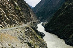
We continue our ride today alongside Chenab River on the Manali-Leh Highway all the way till Udaipur which is a small town 53 kms to the north of Keylong. It is most popular for the temple of Markula Devi, an incarnation of Goddess Durga. The route today is a mix of easy and moderate patches. The first five kilometers from Sissu are gradual ups and downs followed by a 12 km long downhill ride till Tandi Bridge. Tandi Bridge is at the confluence of two rivers – this is where the Bhaga River merges into the mighty Chenab River. The area is extremely picturesque. From here on, the trails run slightly uphill but it’s a gradual incline and hence remains manageable. The route changes to humps that take you up and down the smooth roads of the National Highway, all the way into Udaipur. You will see patches of green all throughout the way as we pass small villages along the way. It should take close to 6-7 hours of riding to get to our destination. We rest our weary selves for the day at our campsite which is a massive ground surrounded by tall trees in the middle of a forest, by the river.
Day 5
Udaipur (2,743M) to Purthi (2,287M) (Click to View GPS data)
Distance: 50 km
Today is an exciting day. Still riding alongside Chenab River, our constant companion on this expedition, we leave the smooth roads of the NH behind and turn this ride into a back-breaking off-road adventure. The route for today consists of continuous patches of gradual incline and descent. The road till 6 km before Purthi is fairly smooth but on an upward slope after which you will find yourself riding on kachcha trails up until the campsite. The trail takes us through multiple villages, border crossing and forests with tall Deodar trees. Its beauty lends to making this a breezy ride. The campsite for the day faces the village.
Day 6
Purthi (2,287M) to Killar (2,600 m) (Click to View GPS data)
Distance: 30 km
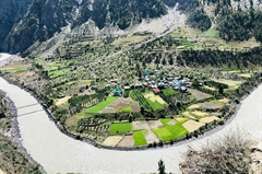
We continue our off-road adventure today from Purthi to Killar. With an approximate height of 315 M to be gained today, the trail alongside the river has gentle humps taking you up and down. The last 10 km to reach Khillar is a steady uphill ride. Killar, our destination for the day, is a small scenic village which takes you away from the river.
Day 7
Killar (2,600M) to Sach Pass (4,414M) (Section 1) (Section 2)
Distance: 74 km
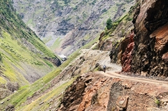
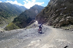
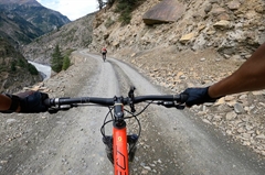
Today, is going to be a very long and harsh day. We will leave our loyal companion, Chenab River to take its route while we make a diversion to go the other way. The pass lies at an altitude gain of almost 2000M covered across 40 km. The first 10 km out of Khillar is a downhill ride. The remaining route is all uphill on kachcha roads as you start to notice the tree line thinning out to slowly making an exit.
We lose all the altitude we had gained through the day as we make our downward journey back to Killar at 2,600M. The downhill climb requires some caution as it is an off-road route. Expect this day to be the longest yet as this 70 km ride is likely to take anywhere between 13-15 hours to complete.
Day 8
Killar (2,600M) to Bairagarh (2,149M)
Today we go further down to Bairagarh which lies at an elevation of 2,149M. On your way down, you start to notice the tree line making a reappearance.
Day 9
Bairagarh (2,149M) to Chamba (996M) (Click to View GPS data)
Distance: 80 kms
We cover a long distance today but it is fairly easy for we will mostly be going downwards from an altitude of 2,149M all the way down to Chamba at the elevation of 996M. Close to 70% of the ride today is downhill and we cross the same river multiple times to keep things interesting. There are only 10-15kms spread across the day with patches of uphill climb. The route is very scenic and the roads, smooth, putting today in the category of easy but fairly lengthy. Expect to cover the distance today in 8 hours.
Day 10
Chamba (996M) to Dalhousie (1,970M) (Click to View GPS data)
Distance: 44 km
Today is going to be hard but beautiful. Since a height gain of almost 1000M is on the agenda, it is going to be an uphill ride, through and through. After the first 30 Km, we reach the infamous open ground of expansive beauty at Khajjiar, which is regarded as the Mini Switzerland of India. From there on, the route gets more interesting by the kilometer. The ride up till Dalhousie is through thick forest lands that lead you directly into this popular hill station, which too wears the greens as its primary colour. Expect to reach Dalhousie within 6-7 hours of starting your ride.
Day 11
Dalhousie (1,970M) to Dukhar to McLeod Ganj (2,082M) (Click to View GPS data)
Distance: 57 km cycling + 69 Km Drive
The last day is a fairly straightforward one which goes by in a jiffy. Well, not really, but you know what we mean! The ride is smooth, the roads are smooth, and they all lead you into this neat town of Mcleod Ganj which is a spiritual hub and a very popular tourist destination with a lot to explore.
What's Included
- All Meals during the expedition ( Starting Lunch on Day 2 till Lunch on Day 10)
- Entry Fee,if any (Upto the amount charged for Indian nationals)
- Camping Charges,if any (Upto the amount charged for Indian nationals)
- All stays from Day 1 to Day 10
- Support vehicle
- Services of a First Aid certified expedition leader & Asst. Leader in group of 12.
- Services of support team include expedition cook,helper.
- Certified first aid support & kit includes Oxygen Cylinder.
- 1 bag, preferably a rucksack (Up to 80 liters), brought by the participant to be accommodated in the support vehicle. Please avoid suitcases and trolley bags.
What's Not Included
- Bicycle Rent
- Meals during Hotel Stays in Manali & McLeod Ganj
- Any Kind of Insurance
- Any expense of personal nature
- Any expense not specified in the inclusion list
Are you Eligible for this Adventure?
BRS Level Required
This makes it mandatory for you to have high-altitude experience of preferably multiple adventures marked at level 5 on the BRS. The altitude, the terrain and the nature of the climb demand a certain level of skill and a need for you to be aware of how your body reacts to the various features of high altitude environment.
If you do not know what level of BRS trek would suit you best, worry not! Fill out this Form:
we will send you a progression chart to help you comfortably get out of your comfort zone in order to level up and ultimately reach your highest potential in the big, bad world of outdoor adventure.
Packing List
This is a list of essential items for individuals doing Sach Pass Cycle expedition with Bikat Adventures. This list contains only those items which the participants are required to bring with them. The list excludes those items which are provided by Bikat Adventures on the expedition. We have divided the items into two categories. Items in Catagory A are essential for everyone. Items in Catagory B are only for participants bringing their own bicycles for the expedition. All the items in the list are essential except for those marked as optional.
Catagory A : Clothes & Accessories
- Cycling Helmet - 1
- Cycling Jersey or Any Dry Fit T-Shirt or Cotton T-Shirts -2
- Cycling Shorts -2
- Track Pant (Preferably Warm & Quick Dry) -2
- T-shirt full sleeves -2
- Undergarments – ( 6 to 8 )
- Rain Coat of Good Quality -1
- Warm Jacket (Preferably Water proof jacket) - 1
- Thermal Inners Upper & Lower - 2
- Woolen Sweater - 1
- Woolen Glove – 1 Pair
- Riding Glove – 1 Pair
- Woolen Cap – 1
- Sweat Band or Bandana or Gamchha - 1
- Hand Towels -2
- Cotton Socks – (6 to 8 pairs)
- Light Cycling / Sport Shoes - 1 pair
- Sandals - 1 pair
- Big Towel – 1
- Water Bottle -1
- Polaroid U V Sunglasses -1
- Small Day Pack/ Waist Pack -1
- Energy Bars or Chocolate Bar or Dry Fruits
- Personal Toiletries
- Lip Balm
- Sunscreen Lotion (SPF – 50 or above)
- Hand or Head Torch with Spare Batteries
- Pan card or Passport or Voter Id Card or Aadhar Card (State govt. ID cards not accepted on the route )
- Medication in plenty for specific conditions, if any. Consult your Physician about this.
Catagory B : For bike – Only in case you are not renting from us
- Bike Reflectors Front & Rear – 1 each
- Spare Tubes – 4 Nos.
- Brake Shoes -1 Set
- Brake cables – 2 Set
- Gear cables – 1 Set
- Spokes – 5 Nos
- Lock (for cycle) – 1 Set
- Spare Tyre – 1 No.
Frequently Asked Questions
Why Bikat?

Small Group Size
Our batch size for cycling expeditions is capped at 12 with the expedition leader and participant ratio of 1:6. This ratio, in our years of experience, has proven to deliver the best cycling experience for individuals as well as groups. Capping the size of the group ensures individual attention to each participant so that no signs of distress or need during the expedition go unnoticed. It also helps to form a more cohesive cohort with better group energy which helps define the rhythm and pace of days on the expedition.

Experienced Expedition Leaders
We follow a rigorous regime of hiring and training our experts in the field. Each expedition leader is a certified mountaineer with years of experience in the field. In addition to their qualification, they also go through practical and situational training to tackle any and all kinds of sudden conditions that may present themselves on the ground. Being unpredictable is the core nature of the mountains but being ready for any circumstance as best as possible is a controllable asset that we try to nurture. Our field experts are also trained in basic medicine and first-aid response. Watch: Forerunners - The Making of An Expedition Leader At Bikat Adventures

Guided Progression
Since Bikat Adventures is a learning-based organization, we help you climb up the ladder of difficulty within the sphere of outdoor adventure systematically. Our on-ground training modules are designed to handhold you through the upskilling process so that you are ready to take on bigger challenges.

Equipment Quality and Check
All the gear used on our expeditions is tried and tested, maintained for good quality, and is overall top-notch in quality and condition. We are continually looking to obtain the best of everything there is in the market so as to ensure optimum safety.

Support Systems
Along with the staff you see on-ground, we have a team of superheroes working in the background to give you the best experience possible. Our background team also comprises local staff from each area who know the region best. Having local support helps with studying the area, pre-planning, execution, and in receiving timely support in case of emergencies in these remote locations.

Communication
Our on-field staff is in constant contact with our teams based in primary locations so as to eliminate any avoidable delay in reaching additional help and support when required. We try to use the best tools for communication available, including satellite phones, in regions where they are not restricted.
What our customers Say
Cancellation Policy
Cash refund
Cancellations up to 30 days prior to departure date
Cancellations between 30 days to 15 days prior to departure date
Cancellations within 15 days prior to departure date
Voucher refund
Cancellations up to 5 days prior to departure date
Cancellations within 5 days prior to departure date
- Cash refund is applicable only in case of bookings made without using any promotional offer code or vouchers
- This is only a brief of cancellation terms. For finer details please refer Detailed Cancellation Policy.
Blog Posts

Similar Adventures
Manali Khardung La Cycle Expedition
The perfect quest for anyone looking to push their limits
Ladakh
12 Days
BRS 6
5602 m
Tawang Bum La Cycling Expedition
Explore the Best Of Arunachal Pradesh on Two Wheels
Arunachal Pradesh
11 Days
BRS 6
4630 m
Leh Tso Moriri Cycling Expedition
A Breathtaking Expedition across a land of superlatives
Ladakh
9 Days
BRS 5
4850 m
