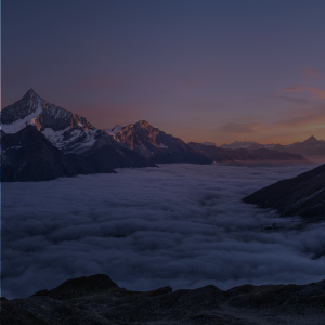
Pin Parvati Pass Expedition
The Wildest Cross-Over Trek of India
Available Batches
Available Batches
Brief Description
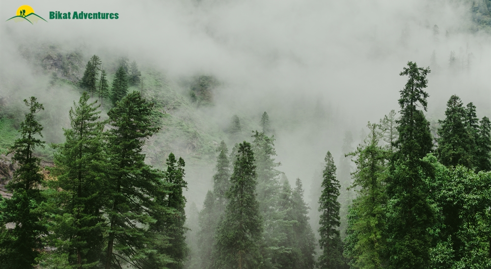
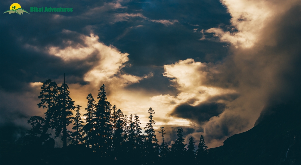
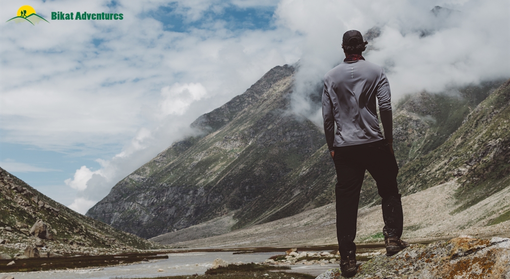
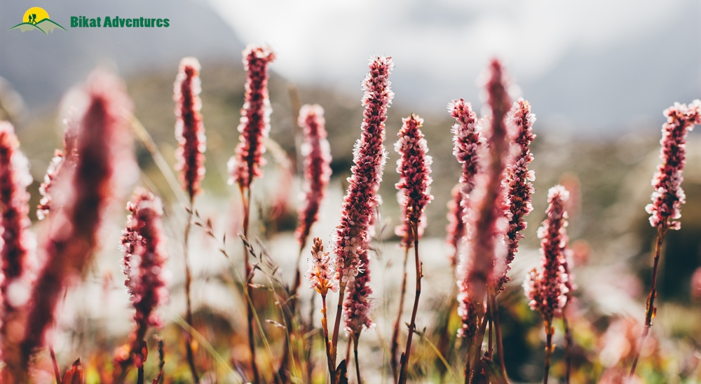
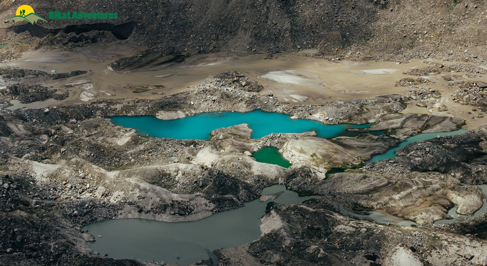
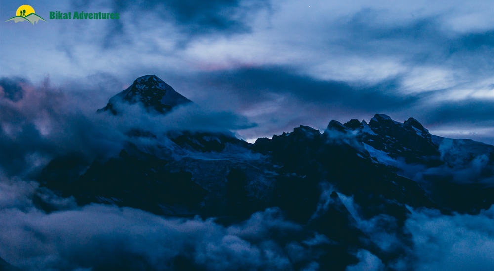
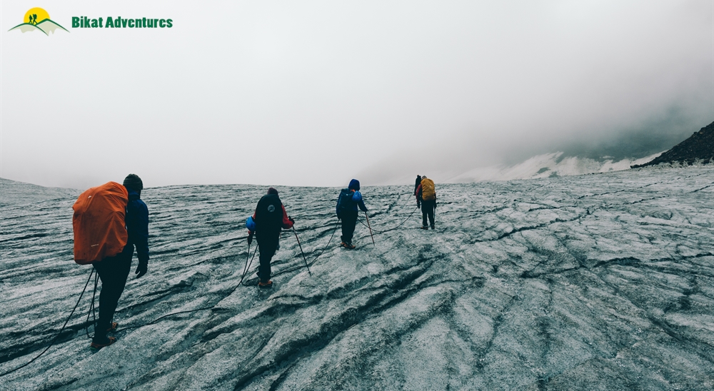
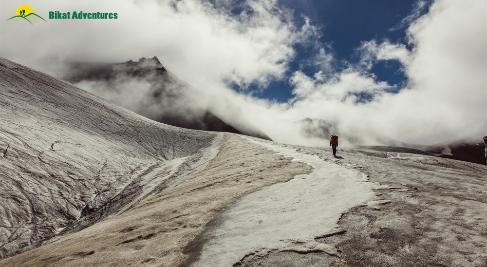
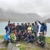
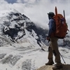
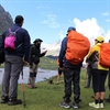
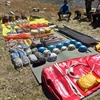
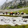
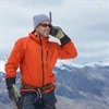
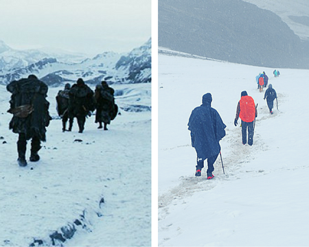
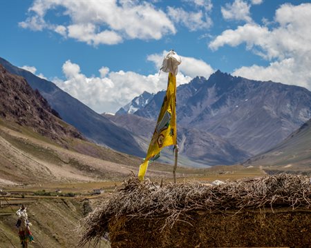
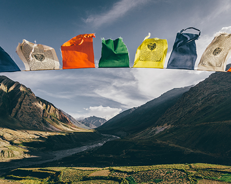
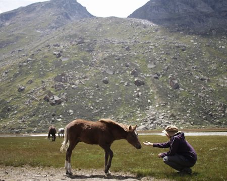
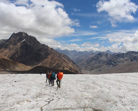
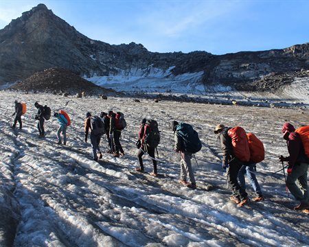
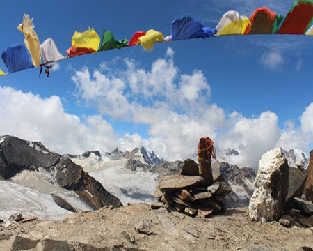
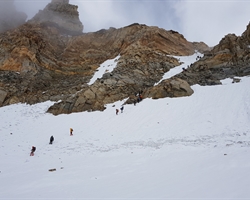
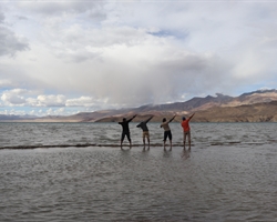
Gallery


Brief Itinerary
Detailed Itinerary
Day 1
Bhuntar (2,000M) to Barsheni (2,580M)
Distance: 50 kms
Duration: 2.5 hours
Today is a relaxed day – one which includes assembling at Bhuntar and then driving up to Barsheni, which is the trail head for Pin Parvati Trek. Bhunter is 11 kms from Kullu, Himachal Pradesh. The airport at Bhuntar connects the place to all the major cities making it easily accessible. The drive from Bhuntar to Barsheni is 50 kms and should take about 2.5 hours to complete. From here, we trek to Kalga which will take less than 20 minutes to cover. We spend the remainder of the day going over the itinerary, getting acquainted to our fellow trekkers and settling into our accommodation for the day.
Day 2
Kalga (2,280M) - Kheerganga (2,960M) (Click to View GPS data)
Distance: 8 kms
Duration: 6 hours
Kalga is a charming little village in Parvati Valley in the Kullu district of Himachal Pradesh. This beautiful establishment doubles up as the trail head for the popular Kheerganga trek which sees a lot of tourists each year. It also serves as a trail head for this trek.
The trail begins with a sharp descent until we hit the riverbed. Post this, it is a moderate climb all the way up to Nakthan which is an even smaller settlement. It accommodates close to 20-30 households with a few options of refreshments and snacks if you want to fill your tummies for the trek ahead. The village sits to the left of the roaring Parvati River and lies at a halfway mark on the trail to Kheerganga. Bordered by neatly laid out rows of apple trees on both sides of the village along with the variety of colours bursting out from the flora in and around the village, this tiny settlement is nothing if not refreshing. This is the landscape we follow all the way to Rudranag Temple. The Rudranag temple is 30 minutes from Nakhtan village and gets its name from the serpent-like waterfall near the temple.
Soak in the beauty of the place, for from here on, it is a steep climb up to Kheerganga. From Rudranag, we cross the wooden bridge over to the other side of the fierce Parvati River and follow the well-marked trail all the way to Kheerganga.
A lot of streams that need crossing welcome you all through the trail. It is not overly strenuous though, for there are plenty of rest points all the way to the campsite for the day. Kheerganga is a small colony of temporary tent shelters. It’s bang in the middle of a massive meadow with a hot water spring just by your tents. If you decide to jump into this pool of warmth to take a bath, know that it is likely to be your last during this entire trip!
Day 3
Kheerganga (2,779M) to Tunda Bhuj (3200M) (Click to View GPS data)
Distance: 11.37 kms
Duration: 4-5 hours
We make an early start from Kheerganga through the flower-strewn meadows on to our campsite for the day. At the beginning, the trail is muddy as opposed to the slightly rocky terrain we encountered the day before. The trek today is mostly through flat terrain with a few patches of ascent. It takes you through dense forests. More than the climb itself, there is a higher likelihood of delay to get to the campsite because of the picturesque landscape which might demand frequent and long halts just to soak all the beauty in. It is commonplace to chance upon families living in these thick forests going about their lives as you navigate your way through the trail.
The last bit for today is fairly steep, in a mucky terrain followed by a short walk through the meadows. When you start seeing the massive, foamy waterfalls on the other side of the river, lending to the dreamlike vibe of the place, know that you have reached your campsite for the day!
Day 4
Tunda Bhuj (3,200M) to Thakur Kuan (3,620M) (Click to View GPS data)
Distance: 5.24 kms
Duration: 3-4 hours
We will start the day right after an early breakfast. If you feel bad about leaving the beautiful campsite of Tunda Bhuj behind, worry not! The route today is strewn with meadows and waterfalls too. We have 400M of height to gain today, which means that it is a fairly easy day except for the tricky section at an hour’s mark from the beginning of the trail. It tends to get a bit precarious because of the possibility of landslides. Since we are now slowly moving towards the end of the tree line, the terrain starts to get a bit rocky – it would serve you well to exercise caution on this section. Our campsite for the day is a vast expanse of pasture land right next to the bustling Parvati River. There is a trolley bridge close to the campsite which you can check out in case you reach well before dark.
Day 5
Thakur Kuan (3,620M) to Odi Thatch (3,815M) (Click to View GPS data)
Distance: 9.66 kms
Duration: 4-5 hours
Today is going to be one thrilling day for the two bridges which need crossing to get to our next campsite! After a mild ascent, there is a steep rise in the trail which gets you to the first bridge. Once you descend down to the river, you will encounter a massive boulder which needs to be crossed to continue on the trail. This massive boulder bang in the middle of the ferocious Parvati River is the first bridge which will make your palms sweat. It goes by the name of Pandu Pul 1. Just when you would have recuperated from this little river-crossing-in-style adventure, you will come across another 20 feet boulder just chilling in the middle of the thundering river giving you a strong sense of deja-vu! This one’s called Pandu Pul 2.
After this queer, double adventure, the trail now simmers down and is a fairly straight walk till Odi Thatch. This narrow trail with multiple routes spread across different directions is a shepherd trail. Remember to follow the person in front of you closely so as to not get lost in this labyrinth. Thatch means meadows and living up to its name, this galactic-looking campsite of Odi Thatch is in the middle of a vast pasture land.
Day 6
Odi Thatch (3,815M) to Mantalai (4,096M) (Click to View GPS data)
Distance: 10.31 kms
Duration: 5-6 hours
If the day before can be labelled most thrilling, today earns the title of being the most fun! The trail for today is pretty straightforward with no harsh ascents or descents except for the last 300M to the lake. It’s a fair walk in the park along the banks of the pleasant and refreshing Parvati River. Halfway to our destination today, we get to a place called Mini Mantalai which is a junction for all the thousands of tiny streams which have made their way to this vast expense from different directions. This wide open land sees the merging of these many water bodies and is a marvel to witness. From Mini Mantalai, to get to the campsite for today, we now have to make a steep ascent of close to 300M which is manageable to negotiate. On the other side of the ascent lies the glacial lake, Mantalai – our campsite for the day on the banks of the lake surrounded by the mighty Himalayas.
Day 7
Mantalai (4,096M) to Base Camp I (4,800M) (Click to View GPS data)
Distance: 4.45 kms
Duration: 5-6 hours
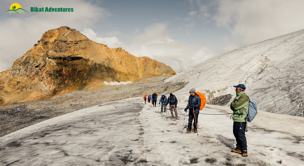
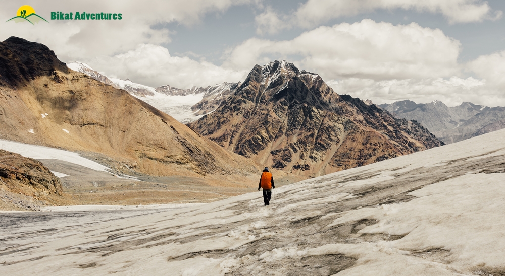
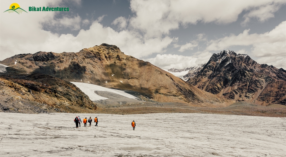
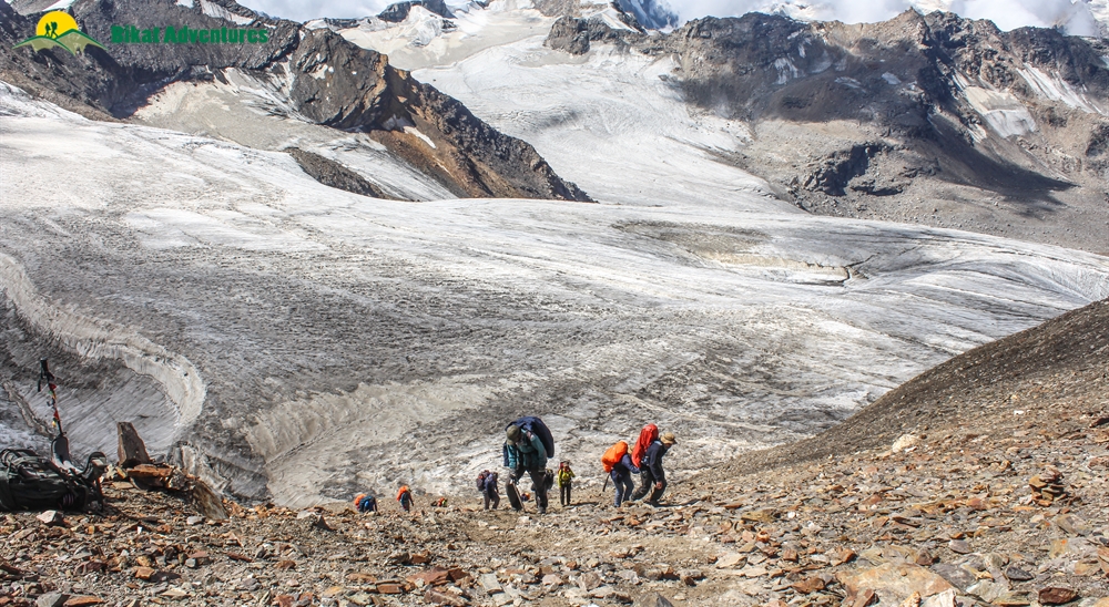
Today is a long and hard day with a height gain of almost 800M. Considering the challenge for the day, we make an early start, at the break of dawn while the sun is still hiding behind the high peaks in the region. At the start, the trail is a bit muddy with large sections of loose scree which require extreme caution to be navigated. Once this section is crossed, we begin the long and hard ascent for the day. On reaching the spur, the trail eases up a bit with gradual ascent until we hit the moraine section of the climb. The moraine section is only a kilometer but takes the longest time to traverse through. It is a fairly steep climb made much more difficult by the rocky terrain. On reaching the campsite, it won’t be long before you realize that we are camping on the edge of the Parvati glacier. Even otherwise, but especially on moonlit nights, the glacier is a sight to behold!
Day 8
Base Camp I (4,800M) to Base Camp II (4,800M) via Pin Parvati Pass (5,289M) (Click to View GPS data)
Distance: 6.37 kms
Duration: 7-8 hours
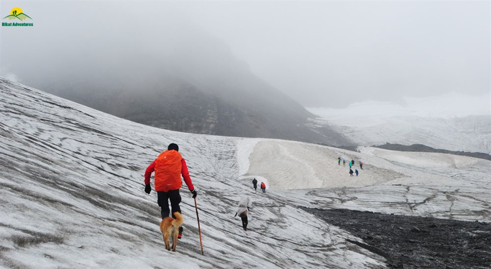
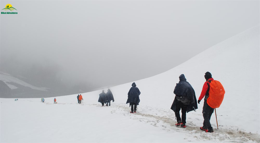
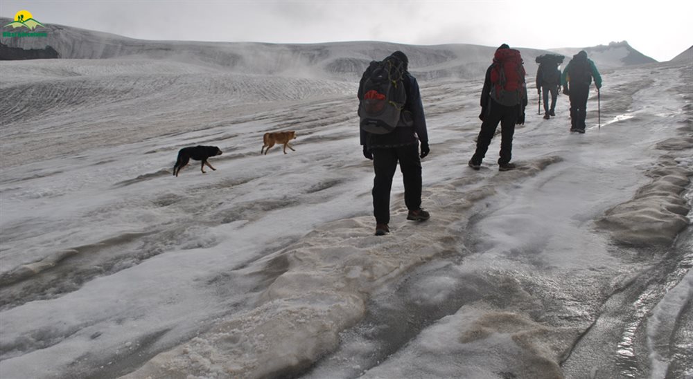
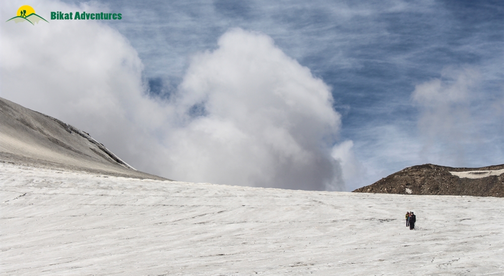
Today is THE day! We pass the cross today and make our way into Spiti - a completely different world on the other side. Since it is going to be a long day, we make an early start, much before the break of dawn so that we get some firm ice to walk on. As the day starts to go up, the ice becomes unstable and hence much harder to walk on. Take one good look at the lush Parvati Valley before we bid it adieu to emerge in the cold desert of Spiti Valley. Today requires negotiating long distances on glaciers. It would serve well to exercise caution and to keep very close to your fellow climbers. Don’t be surprised if you chance upon a few open and many hidden crevasses which can prove to be extremely dangerous. On crossing the glacier, the last bit to get to the pass is a steep climb of close to 300-400M. This climb will take you straight to the top of the pass which gives you a glimpse into the two distinct valleys - the Parvati valley to one side and the Pin Valley on the other.
Our campsite for the day is close to a kilometer and a half away from here. This should not take very long since it is mostly just descent.
Day 9
Base Camp II (4,800M) to Wichkurung Thatch (3,500M) (Click to View GPS data)
Distance: 11.83 kms
Duration: 6 hours
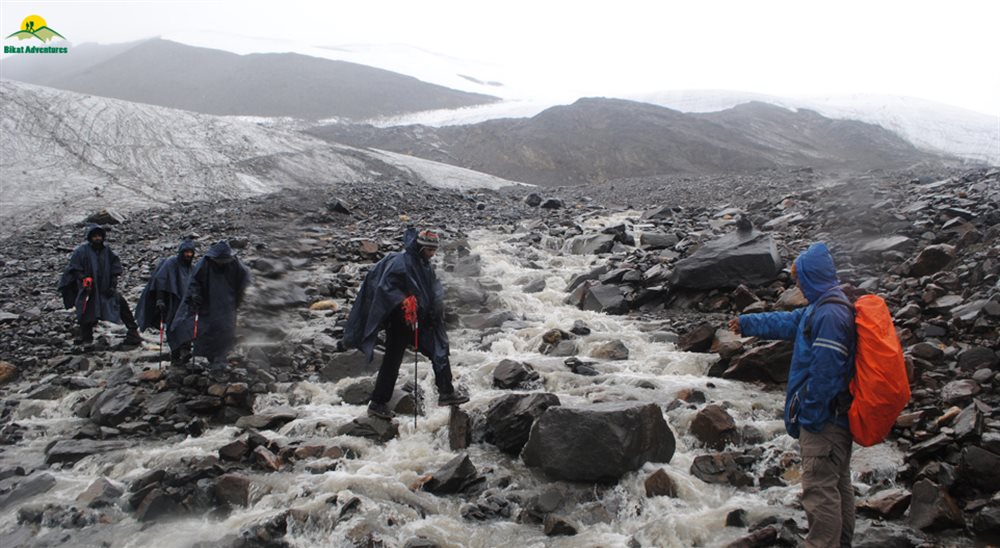
We again make an early start. The trail descends down sharply for around 3Km. Another 1.5kms will bring you to a river crossing section post which the descent continues. Three more kilometers and we cross the river over to the other side. We continue walking on this trail by the river till we reach our campsite for the day. After around 1.5 km there is a stream crossing, after that the decent still continues. The trail after crossing the river is fairly flat and easy which is a welcome change of pace after the last two days which have been tough.
Day 10
Wichkurung Thatch (3,500M) to Mudh (3,970M) to Kaza (3,800M) (Click to View GPS data)
Distance: 15.26 kms
Duration: 5 hours + drive to kaza
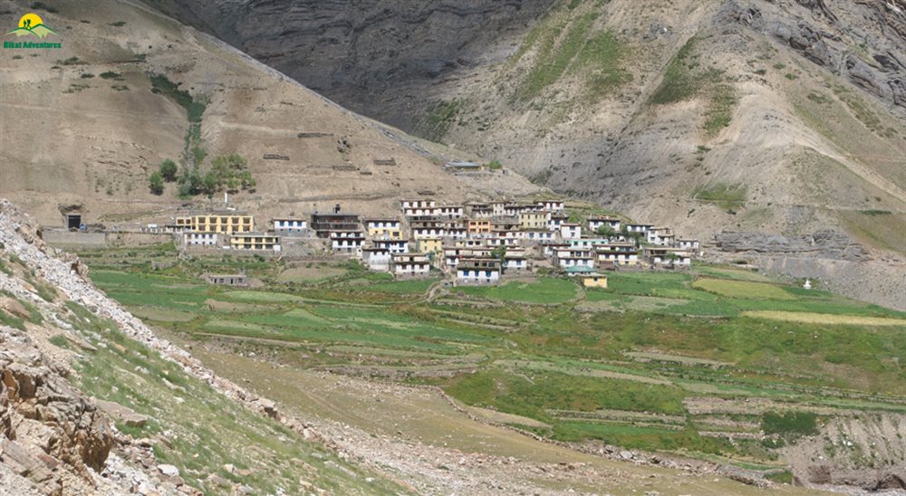
The trail today enters a wide-open valley with numerous streams spread across its floor. With the colors of the earth, spilling out of its dry cracks in the form of tufts and a strong smell of the herbs following you on the trail like a stalker, we stop for lunch near the water. Our destination is not too far from here. This trail leads us straight to the Mudh Village in the desolate, galactic Pin Valley. After you explore the peculiar mountain culture and are done introducing your taste buds to their local Himalayan cuisine, we hit the road again, this time to drive two hours to the town of Kaza. This is where we end our trail for the trek. Expect to reach Kaza late evening. Do remember to book your accommodation in this town before you lose network at the beginning of the trek.
Day 11
Kaza (3,800M) to Manali (2,050M)
Kaza is the largest township and a commercial hub of the Spiti valley. Famous for its monasteries and local shopping, there are a lot of small hamlets close to Kaza, for you to explore. A window into how people co-exist with the exotic wildlife of the terrain, their peculiar houses, lifestyle and means of livelihood in this barren land are every bit as fascinating as the trail for the trek.
To head out of Kaza, you can either hire private cabs or look into local buses. It is a good idea to arrange for your transport out of the town one day in advance. You can also opt for transporation with us. For the extra cost please refer the transportation add on section above.
Day 12
Buffer Day
In case of bad weather or other difficulties, Day 12 is reserved as a buffer day. This will only get used if unexpected and unforeseeable conditions present themselves at the last minute. But you are advised to account for the buffer day while planning your travel. In cases when this day is used an extra amount of INR 5000/- per person is payable and same is collected by trek leader in kaza.
What's Included
- Veg Food (Starting Dinner on Day 1 till lunch on Day 10).Three Meals a day
- Gamow Bag (HAPO Chamber) - 1 per batch
- Portable Stretcher - 1 per batch
- Stay in Hotel/Guest house on triple Sharing basis in Pulga.
- Satellite Phone & Radio Set for emergency communication
- Forest Permits/Camping Charges/Permits, Trek Permit Fee/IMF Permission (Upto the amount charged for Indian nationals)
- Camping tents on twin sharing, Temp rated sleeping bags, mattress
- Micro-spikes, Gaiters, Helmets, Harness, and carabiners, as required
- Mountaineering course certified Trek Leader with Wilderness Emergency Responder & special rescue course from NIM Uttarkashi
- First Aid Certified Local guide, cook, helpers
- Porters or mules for carrying common luggage
What's Not Included
- Meals during road journeys
- Any kind of Insurance
- Any expense of personal nature
- Any expense not specified in the inclusion list
- Carriage of personal rucksack
- Meals during Hotel Stay
Are you Eligible for this Adventure?
The length of the trek, the long distances, the demanding terrain and high vertical gains every day make the trek suitable for seasoned trekkers with extensive experience in the Himalayas. If you are a frequent trekker in the Himalayas, are familiar with altitude and acclimatization related difficulties and are looking for your next challenge, Pin Parvati Pass (5,298M) would be an excellent choice to make.

BRS Level Required
This makes it mandatory for you to have high-altitude experience of preferably multiple treks marked at level 5 on the BRS. The altitude, the terrain and the nature of the climb demand a certain level of skill and a need for you to be aware of how your body reacts to the various features of a high altitude environment.
If you do not know what level of BRS trek would suit you best, worry not! Fill out this Form:

we will send you a progression chart to help you comfortably get out of your comfort zone in order to level up and ultimately reach your highest potential in the big, bad world of outdoor adventure.
Packing List
This is a list of essential items for individuals doing the trek with Bikat Adventures. This list contains only those items which the participants are required to bring with them. The list excludes those items which are provided by Bikat Adventures on the trek. We have divided the items into five categories. All the items in the list are essential except for those marked as optional.
Trekking Gear
- Ruck sack bag with rain cover. Qty -1
- Day Pack Bag - Recommended for treks with summit day
- Head Torch with spare Batteries. Qty -1
- U V protection sunglasses. Qty -1 Here is how you can choose the best sunglasses for trekking.
- Water Bottles: 2 bottles of 1 liter each
Footwear
- Non-skid, deep treaded, high-ankle trekking shoes Qty -1
- Pair of light weight Slipper/Sandals Qty -1
Clothing
- Quick Dry Warm lower or Track Pants. Qty - 2
- Full sleeves T-shirts/ Sweatshirts. 1 for every 2 days of trekking
- Pair of thick woolen socks. 1 pair for every two days of trekking
- Thermal Body warmer Upper & Lower. Qty-1
- Undergarments. Qty - 1 for every day of trekking
- Warm jacket closed at wrist & neck .Qty-1
- Full sleeves sweater. Qty -1
- Rain wear ( Jacket & Pants ) . Qty-1
- Pair of waterproof, warm gloves. Qty-1
- Woolen cap. Qty-1
- Sun shielding Hat. Qty -1
Toiletries
- Personal toiletries kit (Small Towel, Toilet paper, paper soap, Bar soap, toothbrush, toothpaste, cold cream, etc.)
- Sun screen lotion small pack. Qty -1 Here is your Sun Protection 101 to stay safe in the bright sunny outdoors.
- Lip Balm small pack. Qty-1
Utensils
- Small size, Light weight & Leak proof lunch box. Qty-1
- Plate. Qty- 1
- Spoon.Qty-1
- Tea/Coffee (plastic) Mug.Qty-1
Miscellaneous
- Camera (Optional)
- Carry your medicines in plenty in case you have any specific ailment. Consult your doctor before joining the trek.
- Dry fruits, Nuts, Chocolate bars (Optional)
Frequently Asked Questions
Why Bikat?
Small Group Size
Our batch sizes are capped at 15 for smaller treks with the trek leader and trekker ratio of 1:8. This ratio, in our years of experience, has proven to deliver the best trekking experience for individuals as well as groups. Capping the size of the group ensures individual attention to each trekker so that no signs of distress or need during the trek go unnoticed. It also helps to form a more cohesive cohort with better group energy which helps define the rhythm and pace of days on the trek. As you go higher up on the BRS scale, since the stakes are higher, expeditions have an even smaller group size with the ratio of expedition leader to climber set at 1:2.
Qualified Trek Leaders
We follow a rigorous regime of hiring and training our experts in the field. Each trek leader is a certified mountaineer with years of experience in the field. In addition to their qualification, they also go through practical and situational training to tackle any and all kinds of sudden conditions that may present themselves on the ground. Being unpredictable is the core nature of the mountains but being ready for any circumstance as best as possible is a controllable asset that we try to nurture. Our field experts are also trained in basic medicine and first-aid response. Watch: Forerunners - The Making of A Trek Leader At Bikat Adventures
Guided Progression
Since Bikat Adventures is a learning-based organization, we help you climb up the ladder of difficulty within the sphere of outdoor adventure systematically. Our on-ground training modules are designed to handhold you through the upskilling process so that you are ready to take on bigger challenges.
Equipment Quality and Check
All the gear used on our treks and expeditions is tried and tested, maintained for good quality, and is overall top-notch in quality and condition. We are continually looking to obtain the best of everything there is in the market so as to ensure optimum safety.
Support Systems
Along with the staff you see on-ground, we have a team of superheroes working in the background to give you the best experience possible. Our background team also comprises local staff from each area who know the region best. Having local support helps with studying the area, pre-planning, execution, and in receiving timely support in case of emergencies in these remote locations.
Communication
Our on-field staff is in constant contact with our teams based in primary locations so as to eliminate any avoidable delay in reaching additional help and support when required. We try to use the best tools for communication available, including satellite phones, in regions where they are not restricted.
What our customers Say


Cancellation Policy
Cash refund
Cancellations up to 60 days prior to departure date
Between 60 days upto 30 days prior to departure date
Between 30 days upto 10 days prior to departure date
Less than 10 days prior to departure date
Voucher refund
Cancellations up to 30 days prior to departure date
Between 30 days upto 15 days prior to departure date
Between 15 days upto 10 days prior to departure date
Less 10 days prior to departure date
Please Note:
- Cash refund is applicable only in case of bookings made without using any promotional offer code or Cancellation Vouchers or Discounts. "Cash Refund will be processed in 7-14 working days."
- This is only a brief of cancellation terms. For finer details please refer Detailed Cancellation Policy.
Blog Posts
Experiential
With Season 8 ready to be launched, Game of Thrones has really taken the world by its storm. And we have taken our fanaticism for the world-famous to show to next level by finding the counter locations of Game of Thrones in Pin Parvati Pass Trek...
Read full
Experiential
So here is what’s going to happen. I will show you some epic pictures and you’ll go like ‘man that’s awesome’ and when you go and see those places for yourself, your heart will skip a beat, because experiencing something...
Read full
Informative
Precautions and Planning on Pin Parvati Pass Trek
The Pin Parvati Pass trek is a brilliant crossover trail from the lush Kullu valley to Spiti’s arid expanse. As opposed to most Indian Himalayan trails that have been traversed by shepherds for...
Read full
Informative
You are never alone in the mountains. There is life all around you; in the waterfalls, you see in the distance, the flowers that bloom in the valleys, the stars that fall from the sky at night, or the animals hopping about and munching and hunting th...
Read full
Informative
This is going to a be picturesque story. Be prepared to get blown away by what I am going to show.
Pin Parvati Pass trek is, by far, the most beautiful trek I have ever been on. From forests to meadows, to rivers, to lakes, to walking on a massive g...
Read full
Informative
Pin Parvati pass trek
Situated at the height of 17,380 feet, Pin Parvati Pass trek is one the most beautiful treks in the Himalayan range that starts from Phulga village of Kullu, Kasol and ends at Mud village of Spiti and vice-versa. ...
Read full
Similar Adventures
Auden's Col Expedition
A Stunning Cross-Over from Gangotri to Kedarnath - Not for the Faint-Hearted
Uttarakhand
16 Days
BRS 6
5490 m

Kalindi Khal Expedition
The Toughest Expedition of India
Uttarakhand
15 Days
BRS 6
5940 m
Parang La Expedition
An Ancient Trade Route between Spiti and Ladakh
Himachal
12 Days
BRS 6
5580 m


