“Nothing needs to be impossible for you. After all man is six feet taller than the mountain he climbs. Only the will resolute has to be there”- commented by J.B.Auden to Swami Probhodhananda. Swamiji dreamt to trek to Badrinath from Gangotri across a high pass- Kalindi Khal and came to Auden to enquire about the route and Auden encouraged him with those words. That was 1939. Six years later in 1945, six Indian Sadhus led by Swamiji embarked upon this difficult trekking expedition with Dileep Sigh as guide. They crossed the Kalindi Pass- the highest pass (5948 m) on 22nd July 1945 and eventually became the first Indian team to achieve that remarkable feat.

Standing on top of Kalindi Khal 64 years after that remarkable feat, I was reflecting on those words of Auden. Swamiji who completed this expedition along with the 05 other ascetics who were ill prepared, but had the determination, courage and dream in their eyes. We were 13 trekkers in strength, well equipped and well fed. However the level of difficulty faced by us during the trek was more, because unlike them we are only trekkers but not believers.
Once again,call of mountains is strong. This time,it’s a call to trek in Garhwal Himalaya and in the Land of Gods. The team has been planning to take the tough Kalindi Pass and we have been looking for a way to join. Kalindi Pass Trek starts from Gangotri and ends in Badrinath. Two of the most holy places in the Hindu Culture.
At the highest point, it reaches 5967 mts and the route passes from glacier to glacier. This trek will be more challenging than the Annapurna Circuit we did last year and for the following reason..
- The trek starts at 10,000 ft demanding the body to acclimatize quickly.
- The highest point is close to 20,000 ft and the incremental altitude will add to the challenge.
- Trek passes through quite a few glaciers and will be unlike the tea house trek of Annapurna,to say the least.
- Portions of the trek might involve crossing crevassed snow fields.
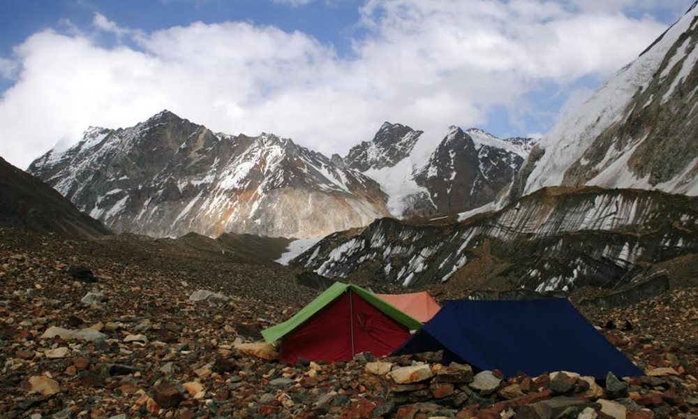
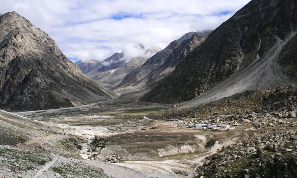
It all started through a casual discussion and soon we realized that a group of passionate 14 trekkers were ready to explore the route going to Badrinath from Gangotri across the Kalindi Khal. It is quiet difficult around 100kms of the trek that commences at Gangotri (3048 mts), passes through Gaumukh (3092 mts), Nandanban (4500 mts), Vasuki Tal (5300 mts), Kalindi Base (5590 mts), Kalindi Khal (5948 mts), and then descends to Arwa Tal (3980 mts), Ghastoli (3600 mts) and ends at Badrinath (3100 mts). The route passes through one of the most breathtaking mountains cape under the shadow of great peaks of Garhwal- Bhagirathi 2, 3 &1, Shivlinga peak, Vasuki peak, Kedar dome, Meru Peak, Sudershan Peak, Chandra Parbat, and Satopanth and so on. One can experience all types of trekking as the route passes through boulders, glaciers and snow.
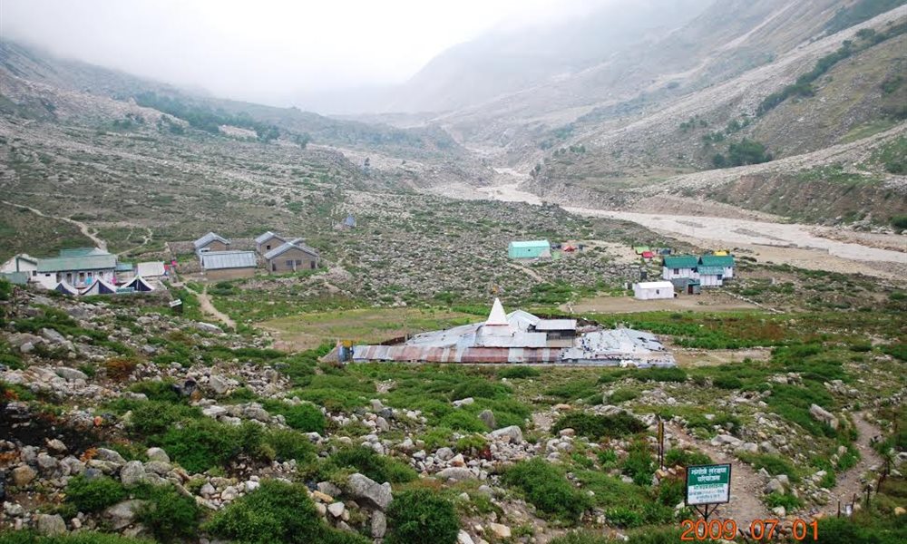
So on a rainy evening of June 27th 2009 I reached Uttarkashi from Dehradun. Rest of the 13 members joined me at the desired hotel on the 28th June. After finishing with our purchasing and packing provision, we left for Gangotri on 29th June along with 28 porters and 2 guides Govind and Buddhi of Yeti Adventure. Our inner line permit was kept ready for us by the organizer Shambhu. We reached Gangotri in the evening and went for a leisure stroll to see the Suryakund and Gaurikund. After paying our homage worships at the Gangotri Temple we went to the market for our final purchase and returned back to the hotel. We retired to bed early since we had to be fresh the next day to hit the strenuous trail.
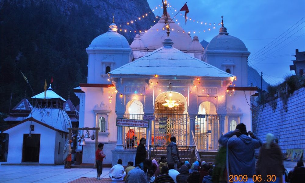
Gangotri Temple

Way to Bhojbasa
Restinmg site
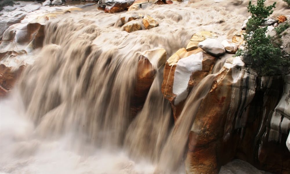
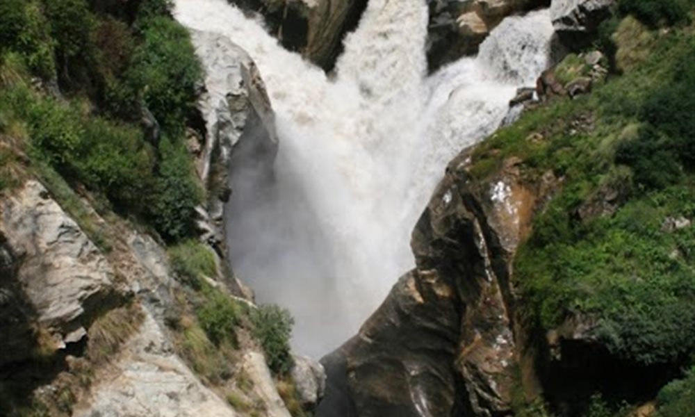
Suryakund waterfall
Gaurikund
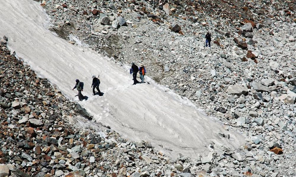
Kalindi Khal (Pass) Trek- Gangotri to Bhojbasa
Terrain: Mud path
Distance: 14 kms.
Trek:Easy
The next day on 30th June we were off to Bhojbasa. The track goes through the right bank of Bhagirathi. We had lunch under the shade of Chir trees at Chirbasa. By late afternoon we were at Bhojbasa- so named after its abundance of Bhuj trees. But now the trees seem to have vanished. Mostly they were cut down for fuel to supply hot meal and warmth to thousands of pilgrims and trekkers who visit Gaumukh every year. Next day early morning we could see the splendid view of Bhagirathi peaks.
Way to Bhojbasa
Bhojbasa campsite
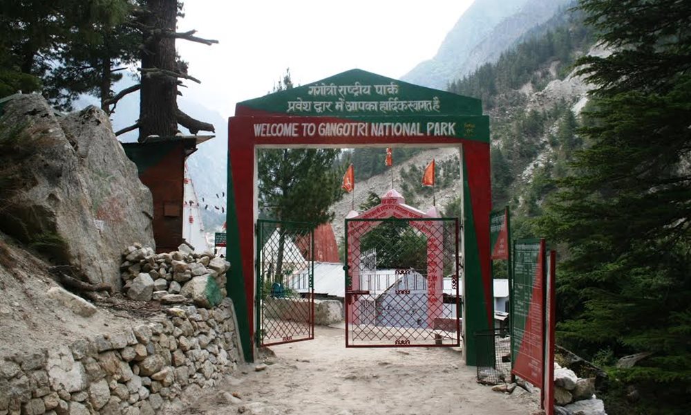
Gangotri Natonal Park Entrance
Kalindi Khal (Pass) Trek- Bhojbasa to Tapovan
Terrain: Mud path and Moraine
Distance: 10 kms.
Trek:Moderate
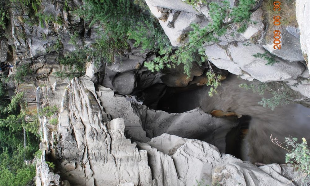
After our breakfast we started for our next destination Tapovan on 1st July 2009. On the way we had to pass Gaumukh (the cows mouth)-considered by the Hindus as the holiest place on earth. The scenic beauty is spellbinding. Gaumukh surely resembles the open mouth of a cow, but then several Gaumukh snouts resemble like the Gaumukh. It’s uniqueness is a stunning splendor. Looming in front of us was the gigantic Bhagirathi peaks and on the right was the Shivlinga. Uniqueness about this mountain is that the architecture resembles of our favourite Idol Ganesha.
GAUMUKH
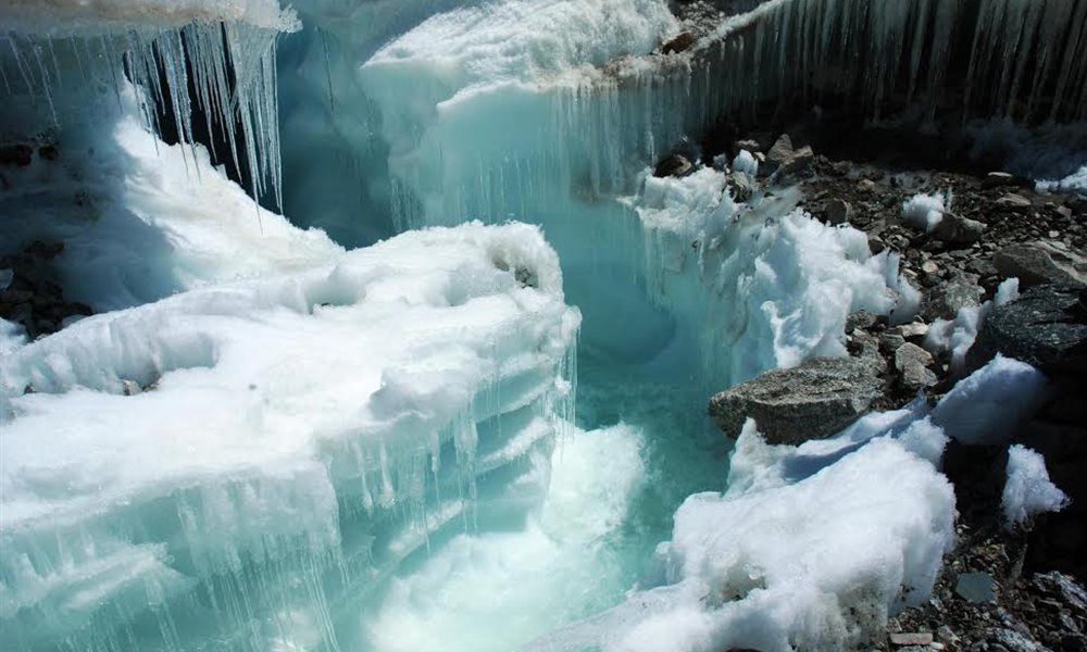
Gaumukh is not only the source of Bhagirathi, as described in religious scriptures,It is only the visible source of Bhagirathi. Above Gaumukh, I saw numerous rivulets in Gangotri and Raktavarna glacier, running a short distance and then diving under the river bed, flowing underneath and emerging together at the Gaumukh.
Ganga, the holy Indian river said to have descended from heaven at Gangotri. In the past the snout of Gangotri glacier, the main source of Ganga or the Bhagirathi was at Gangotri. According to the findings by the geologists of Garhwal University published in Telegraph on 26th Feb 2001, the Gangotri glacier has receded 850meter in the last 25 years. They have estimated that the Gangotri glacier has receded 40 to 50 kms since the last ice age. I shudder to think what will happen in the next 100 years? Most probably Gangotri glacier will disappear along with Ganga. This mighty river will be a dry river bed. In 15th March 2005 “The Telegraph” reported that Gangotri glacier is receding at an average rate of 23 meter/year.
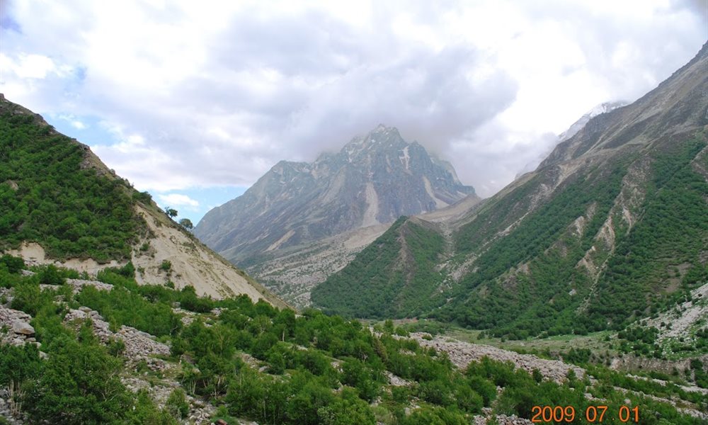
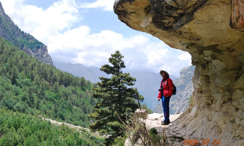
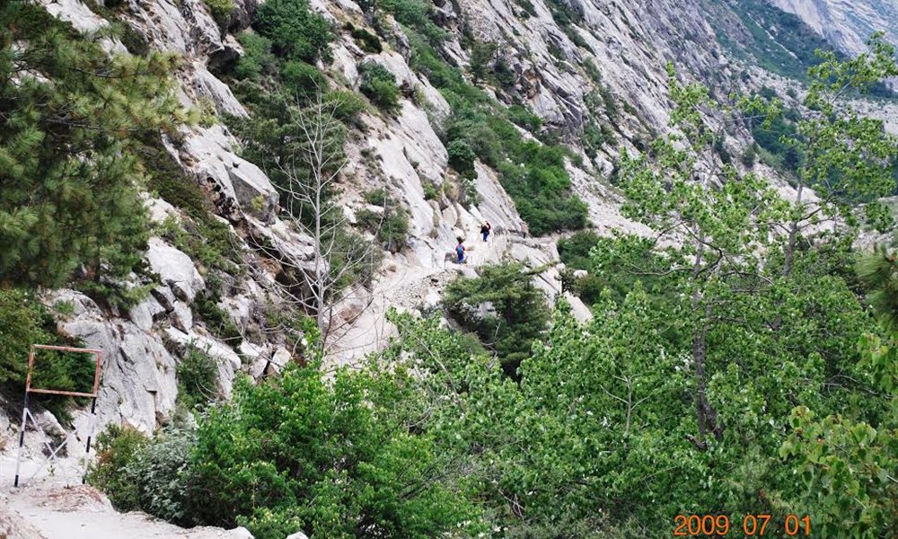
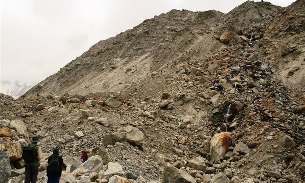
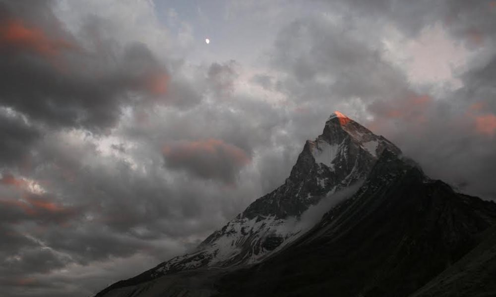
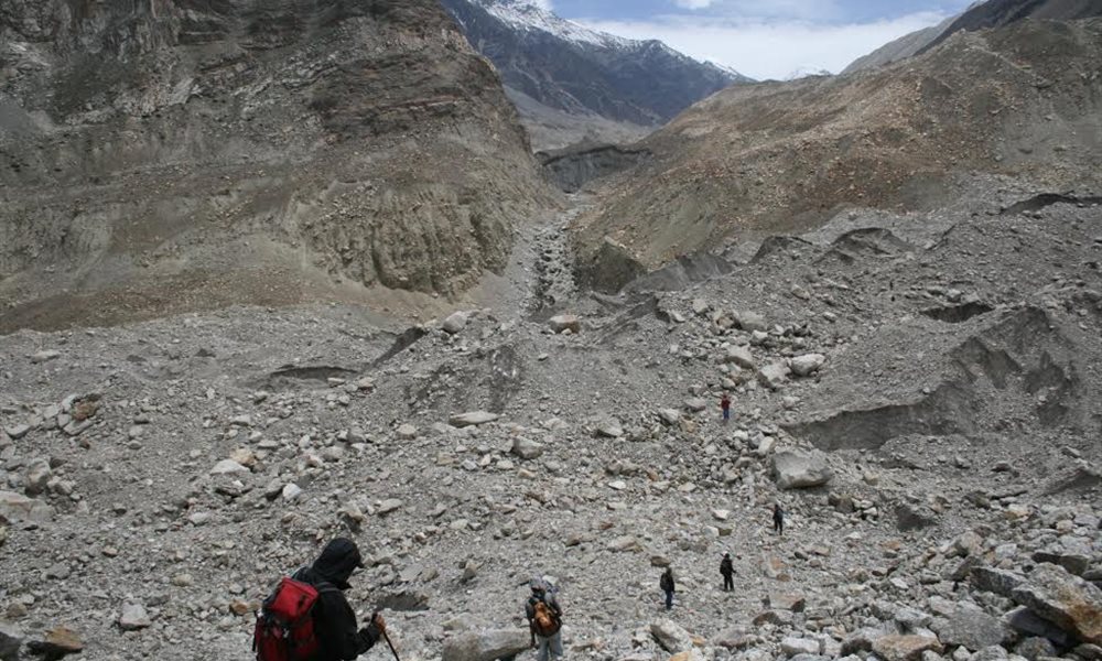
But, one cannot stop and admire the scenery forever. One has to move on and we were off to Tapovan. Till Gaumukh it was a well defined track, but now we were hopping from one unstable boulder to another equally unstable boulder. One has to be very careful while passing through these boulders. The trick is to transfer ones weight to the next boulder before it goes off your feet. Occasional landslides greeted us on the way, it was non eventful. We were all tired but the cool breeze was keeping us fresh. Finally after the strenuous climb we reached Tapovan. Just as the name it had great scenic view. On the left stood the massive Bhagirathi peaks and on the right Shivlinga peak. I captured the ultimate golden peak shots of these mountains during the evening sunset.
Shivling peak changing colors
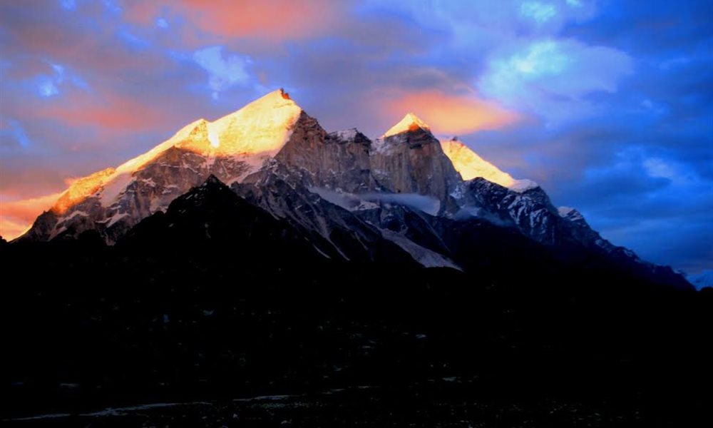
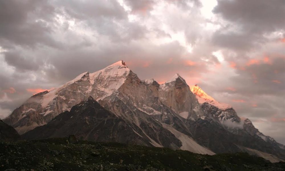
Bhagirathi peak
Tapovan campsite
Meru peak
Kalindi Khal (Pass) Trek- Tapovan to Nandanvan
Terrain: Moraine
Distance: 10 kms.
Trek:Moderate
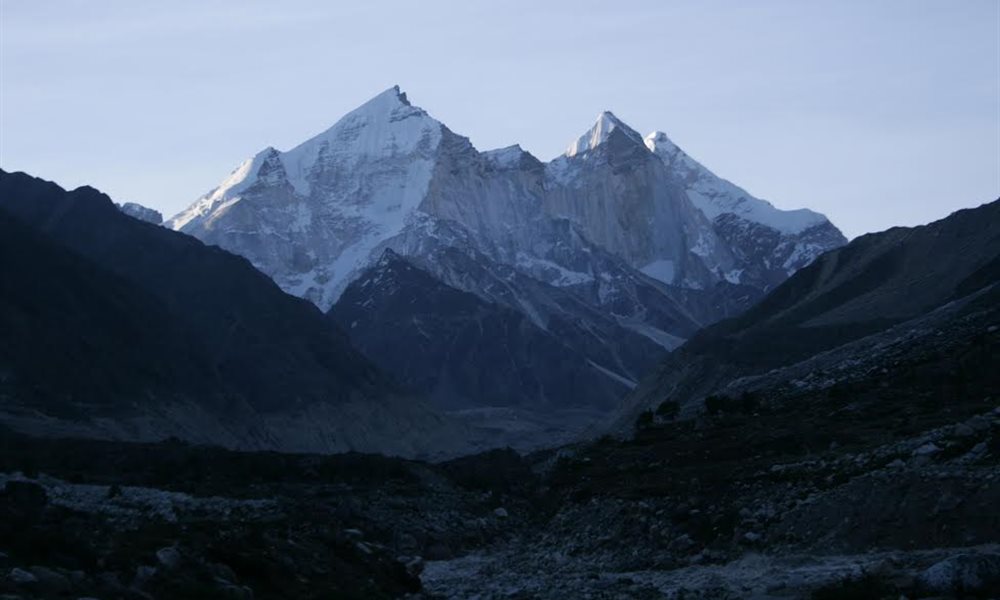
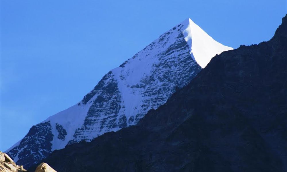
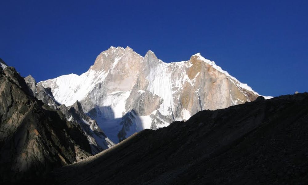
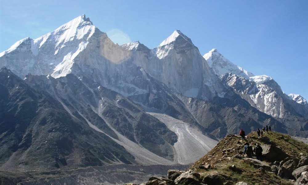
On 2nd July 09 we started for our next destination to Nandanvban. Route was getting difficult day by day. We had to cross the unstable boulders, steep ridges of the glaciers and finally after passing through 4 to 5 long ridges we finally reached Nandanvan- a small grassy valley of exquisite beauty, almost surrounded by snow peaks- Bhagirathi 2,3&1, Kedar dome, Kedarnath peak tip, Karchakunda and Shivlinga peak.
Shivling peak
Way to Nandavan
Kedarkantha tip
Nandanvan Campsite
Kedarkantha at the back
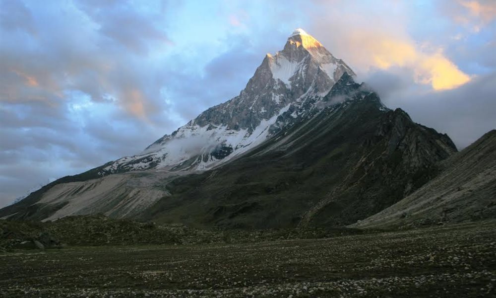
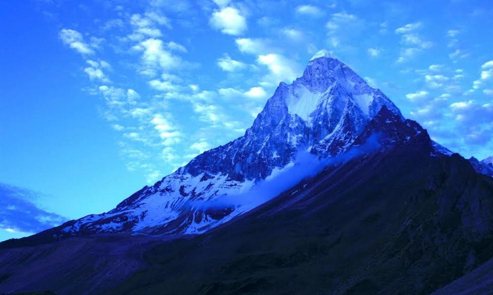
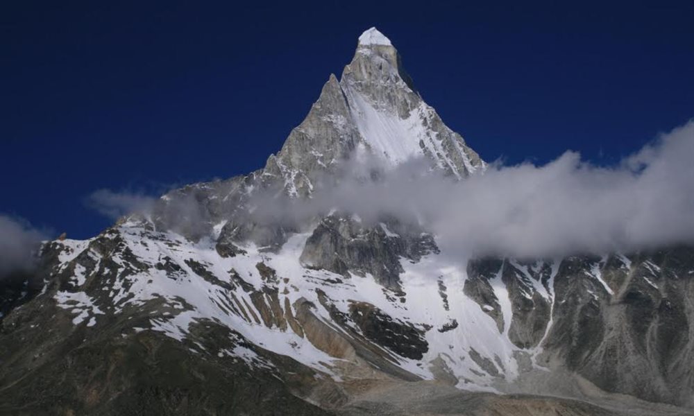
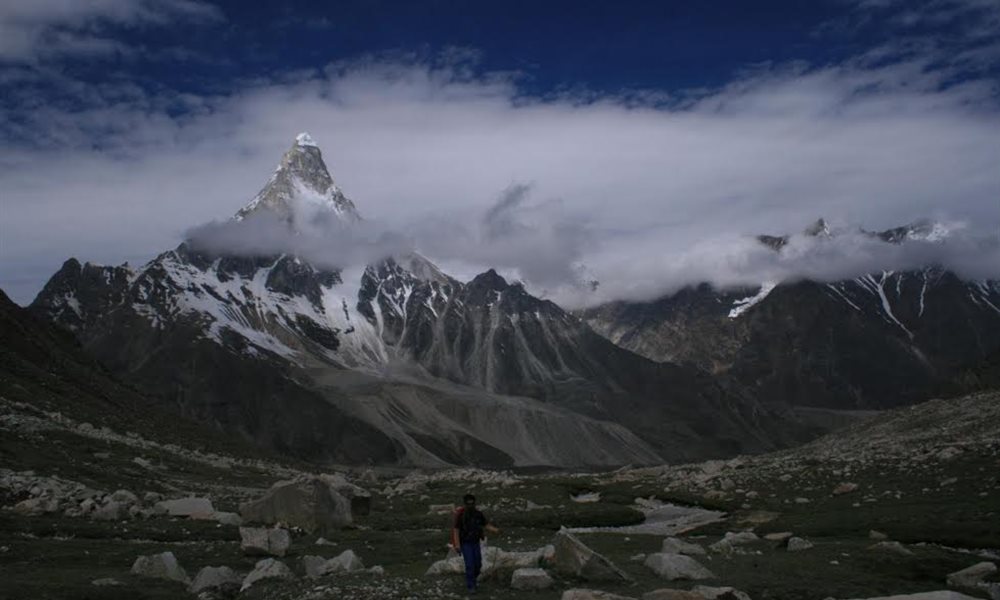
The most stunning peak dominating the Nandanban is undoubtedly the Shivlinga. It is hard to believe that a 6540 meter peak would be so rocky, devoid of snow and that’s why climbing Shivilinga peak was very difficult and after many unsuccessful attempts only in June 1974 a team from Indo-Tibetan was successful. The peak has such a forceful presence, and that’s why it is been also called as the Matterhorn of the east.
Kalindi Khal (Pass) Trek- Nandanvan to Vasuki Tal
Terrain: Ridge walk
Distance: 10 kms.
Trek:Moderate
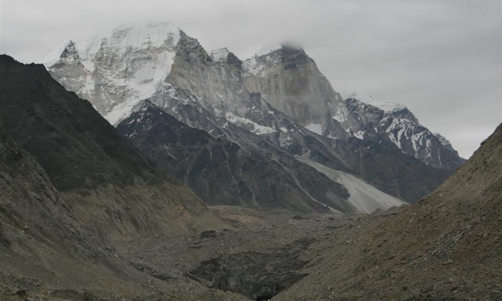
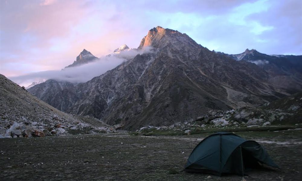
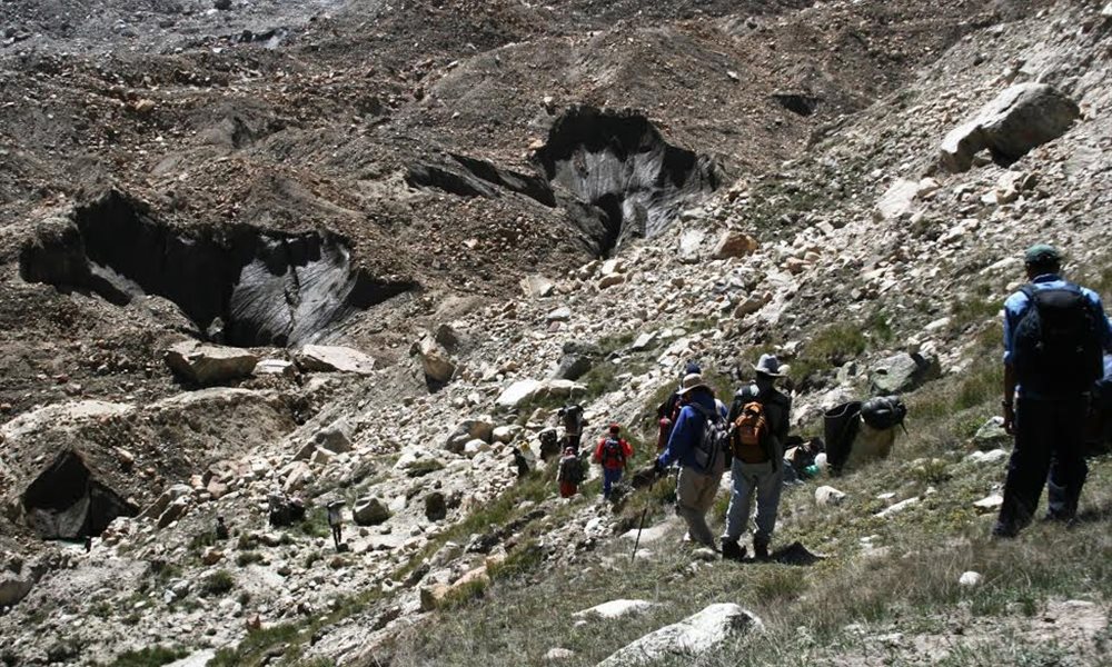
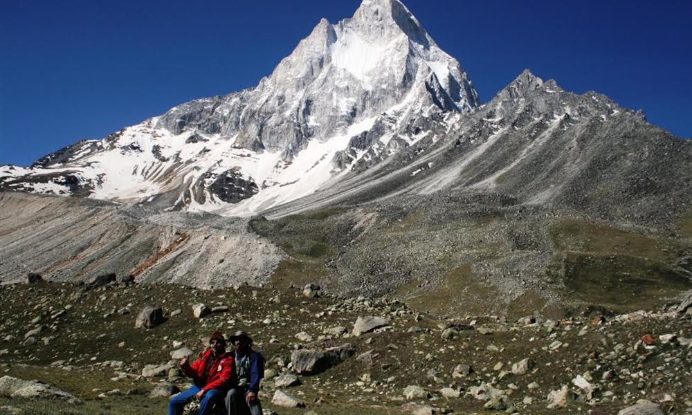
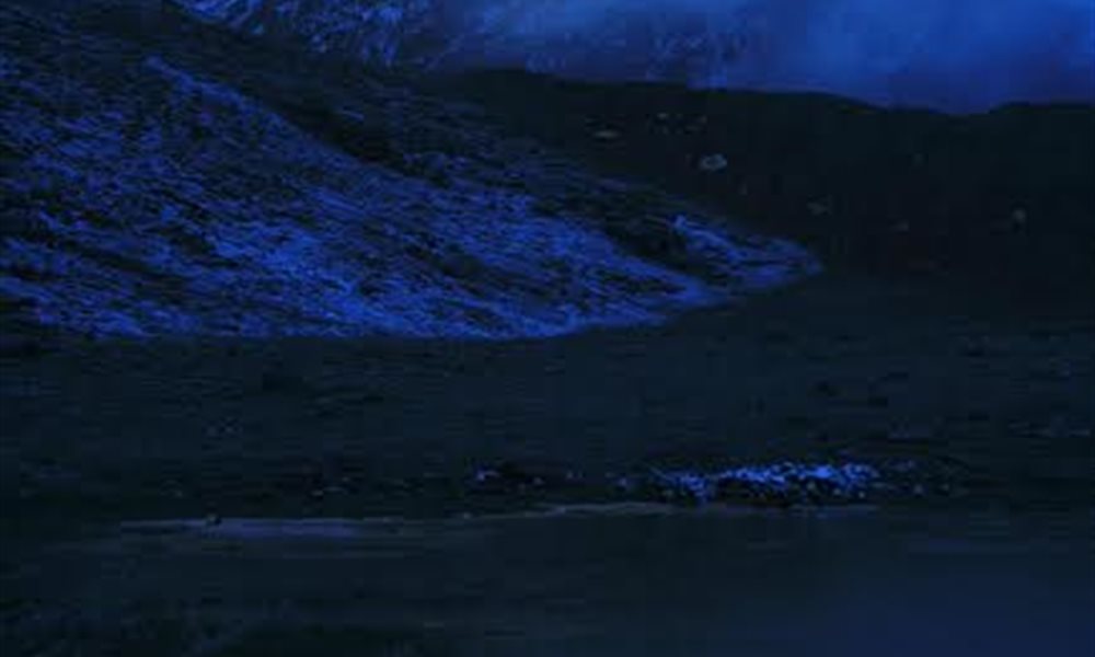
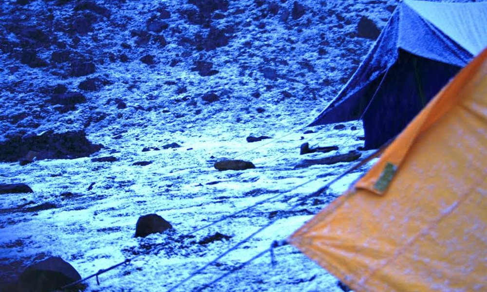
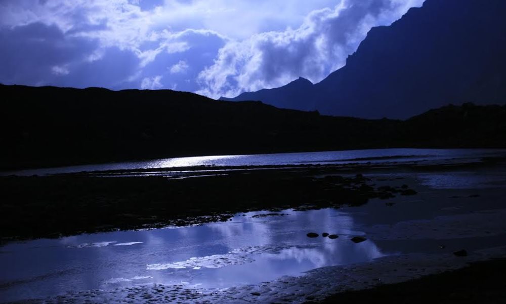
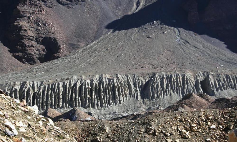
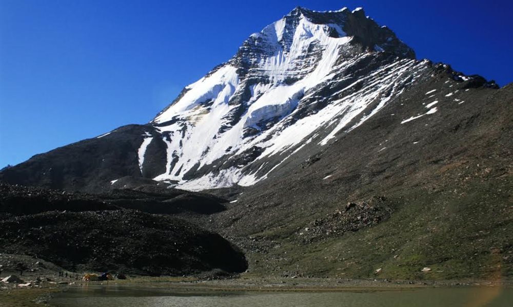
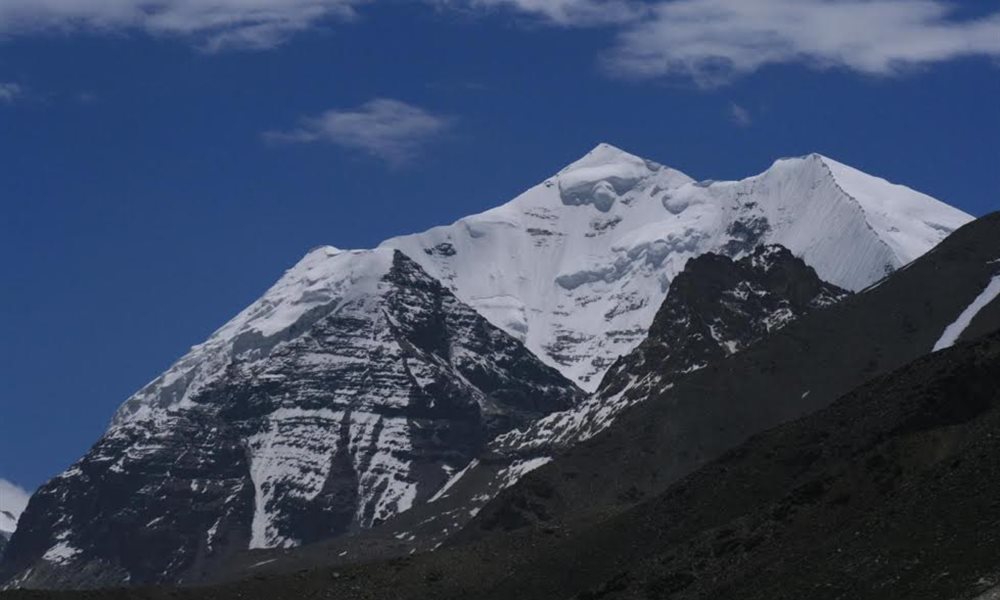
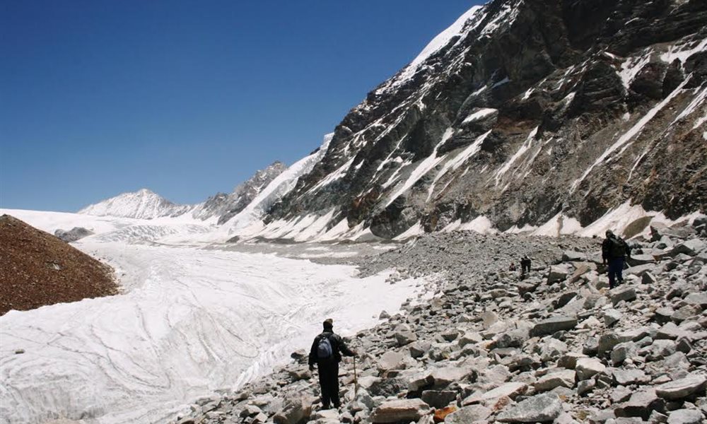
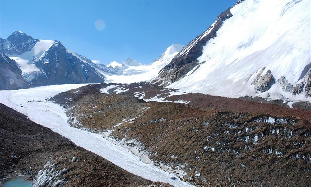
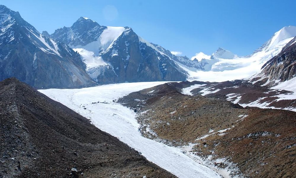
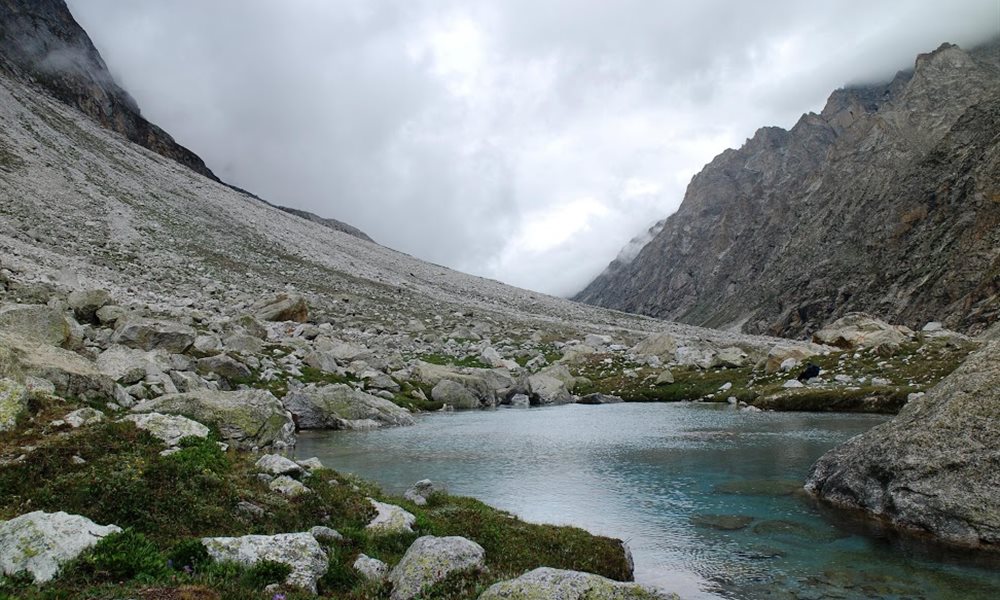
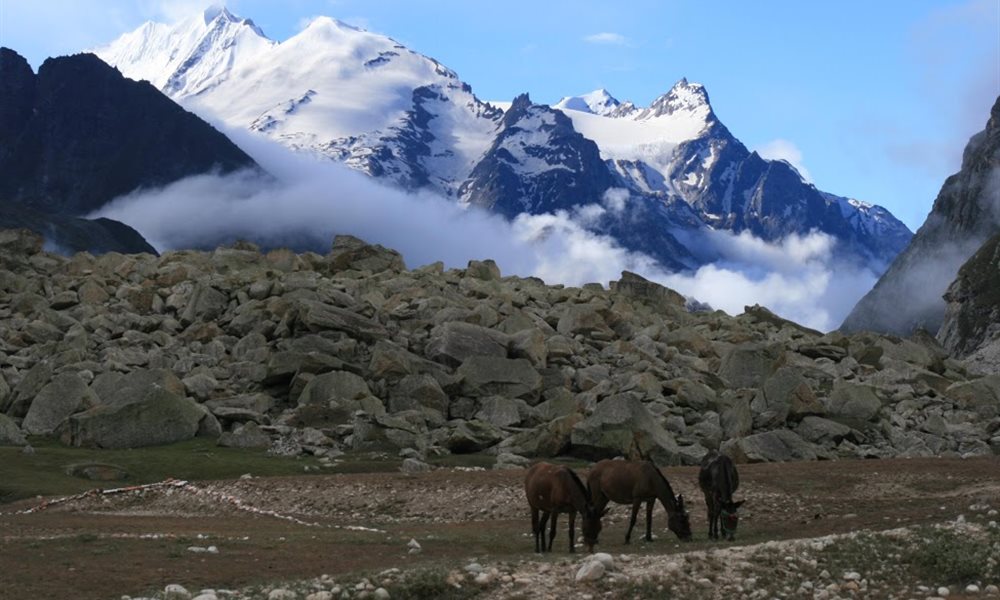
Next destination camp on 3rd July 09, was Vasuki Tal under the shadow of the Vasuki peak. The track onwards till Kalindi glacier lies on the left lateral moraine of Chaturangi glacier, a 16km long colourful glacier which emerges from the foot of Mana mountain range and converges with the Gangotri glacier. Merger of many glaciers such as Khalipet, Vasuki, Sundar, Suralaya and Sweta augments Chaturangi, on its downward journey. Since expedition parties visit Vasuki Tal on their way to mountain peaks, there was a faint track to follow. But the slow and constant movement of a glacier frequently changes the track. So we were trekking on a track with no track at all. Walking as such a height of 5300 mts itself is challenging and then to cross the last ascend before Vasuki Tal, we had to climb a steep rocky patch and the only balance was a rope support on the left side. Balancing was getting a bit tough at that altitude. By the time we reached at the top, our energy was almost drained. The camping site was beautiful. Scene was the Vasuki lake surrounded with the Vasuki peak and Bhagirathi Peaks. We were lucky to enjoy the snowfall which was awesome, as if it was welcoming us with its shower. We were happy with the thought of next day being our rest day for acclimatizing there before hitting the next altitude ahead. Next morning as I stepped out of the tent, a deep blue cloudless sky greeted me. The lake water was reflecting the image of Bhagirathi peaks. The Vasuki snow peak (6790 mts)was seen showing its hood spread like the great puranic serpent –Vasuki-guarding forever for unwarranted intrusion. Behind Vasuki on the SE was seen Satopanth (7070mts) peeping out.
Bhagirathi peak
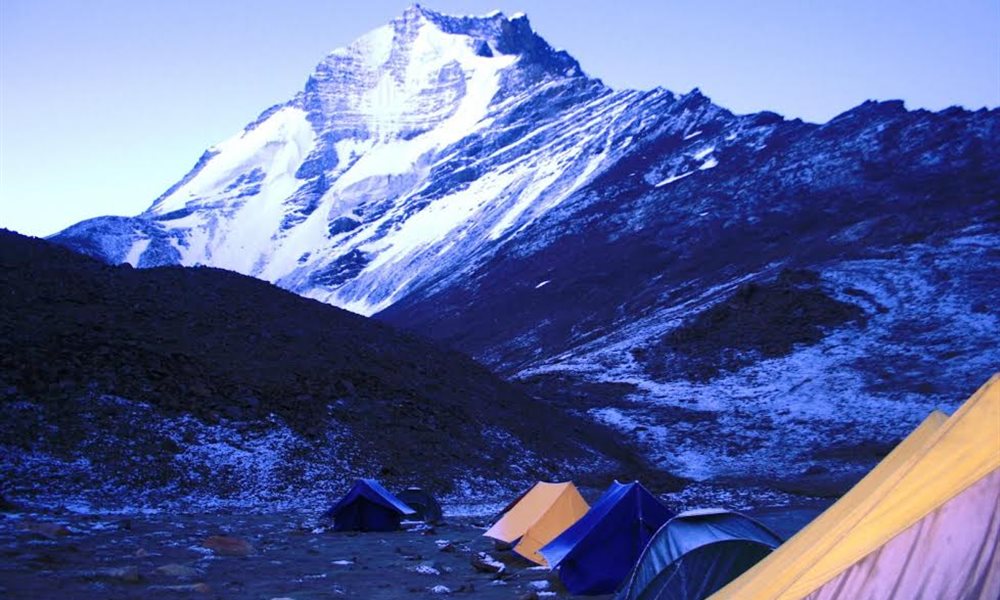
Vasuki peak and Campsite
Scenery near Vasuki Tal
Vauki peak
Chandra peak
Way to Vasuki
Chaturangi glacier
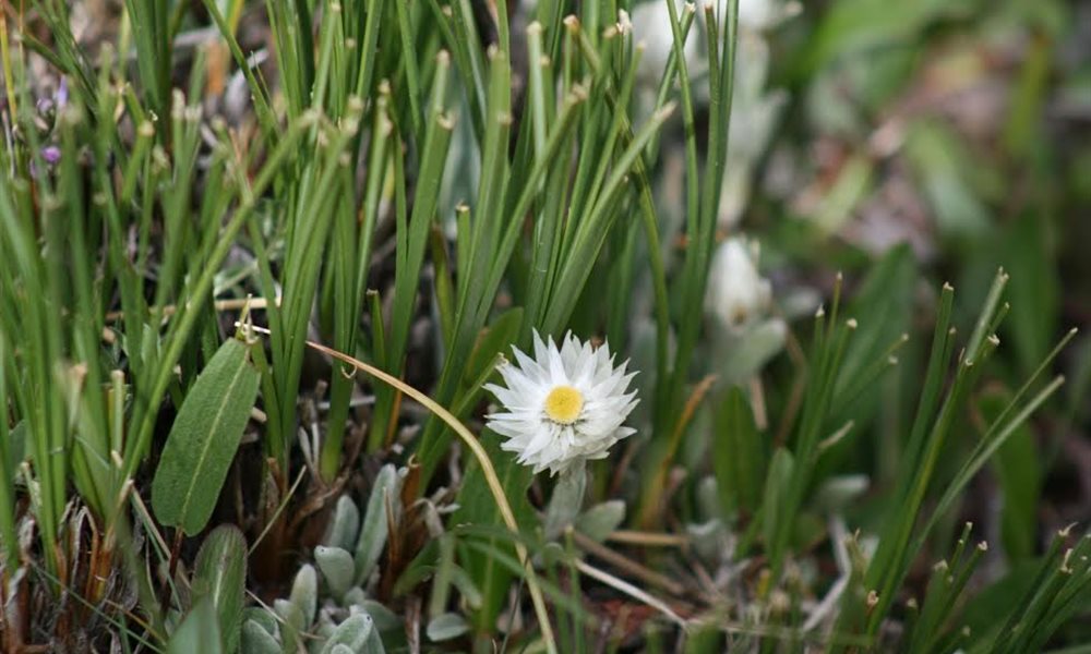
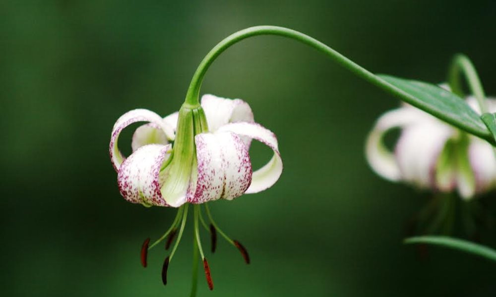
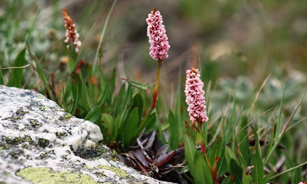
Colorful weed
Kalindi Khal (Pass) Trek- Vasuki Tal to Khara Pathar
Terrain: Ridge walk
Distance: 10 kms.
Trek:Moderate
On 5th July 09 we continued our journey ahead climbing the left lateral moraine of Chaturangi glacier reaching Khara Pathar,camp site was on moraine rocks surrounded by mountains.
Way to Khara pathar
Campsite
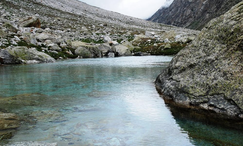
Glacial lake
Crevasses
Satopanth
Rock view
Rock gate - crevasse
Kalindi Khal (Pass) Trek- Khara Pathar to Sweta Glacier
Terrain: Moraine walk
Distance: 10 kms.
Trek:Moderate
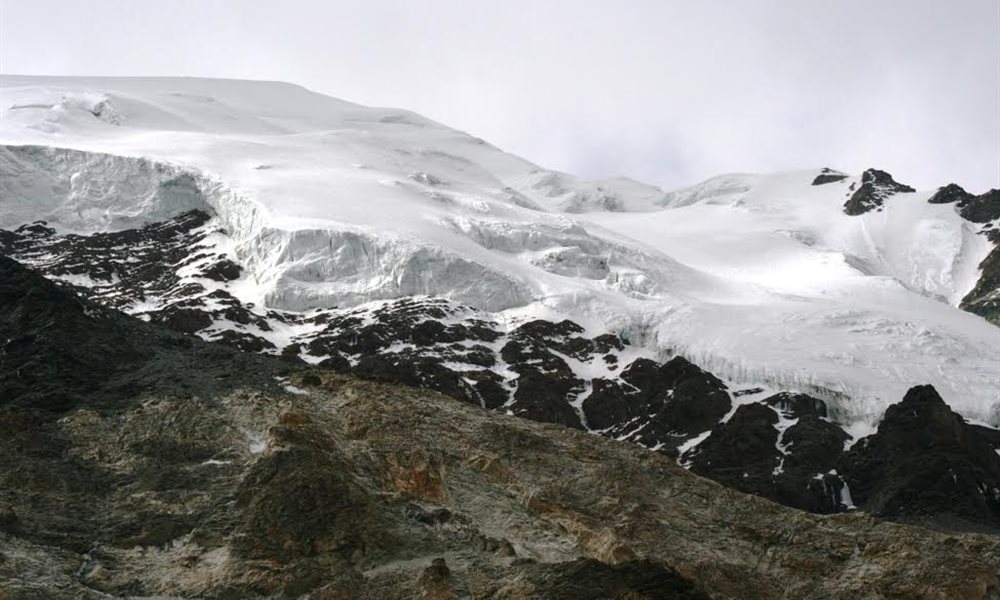
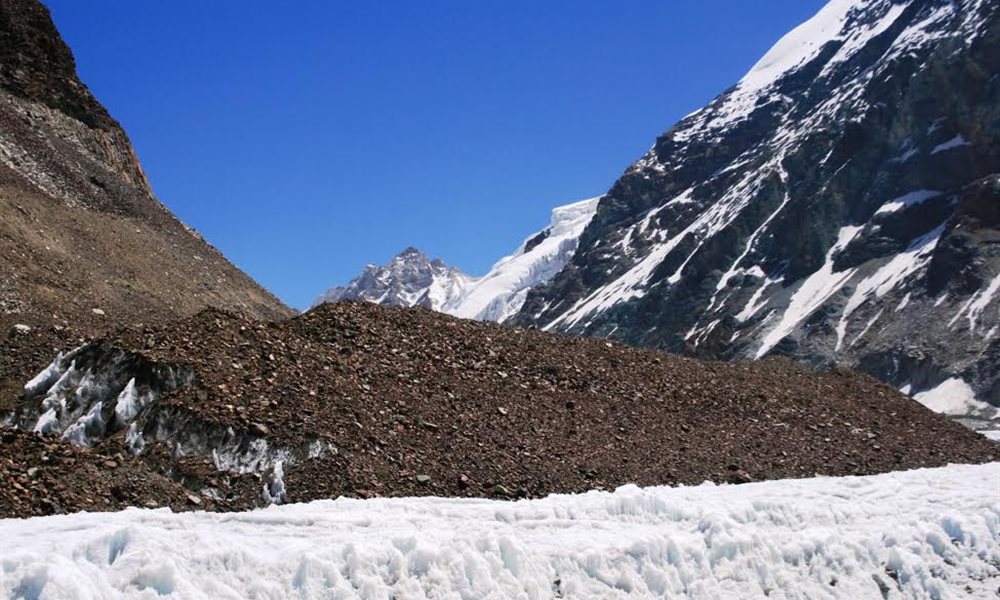
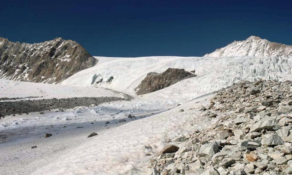
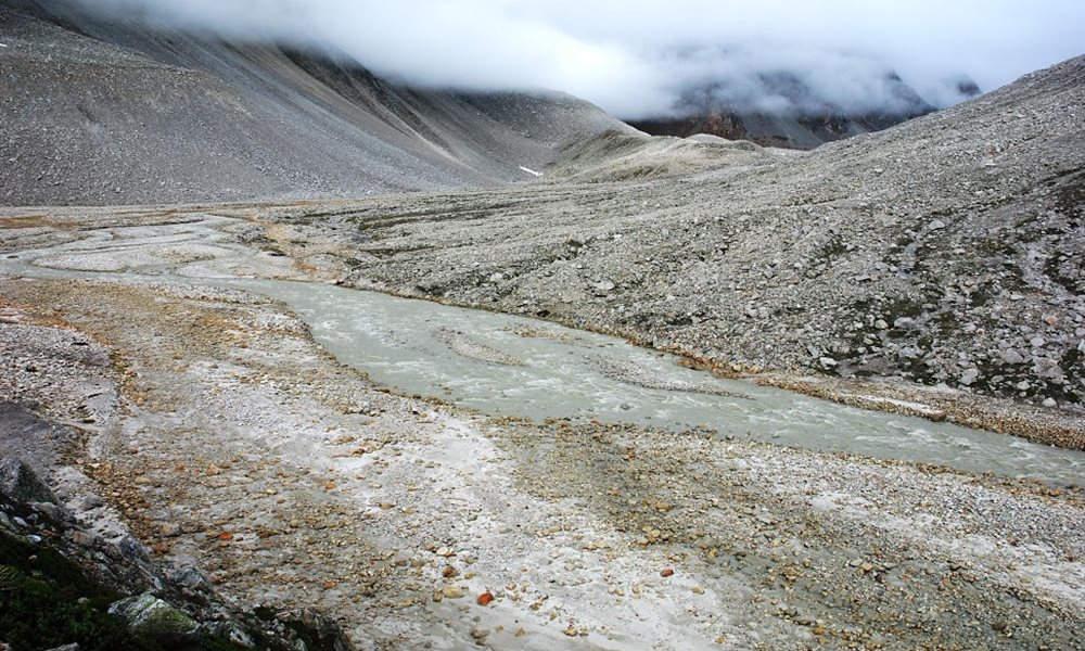
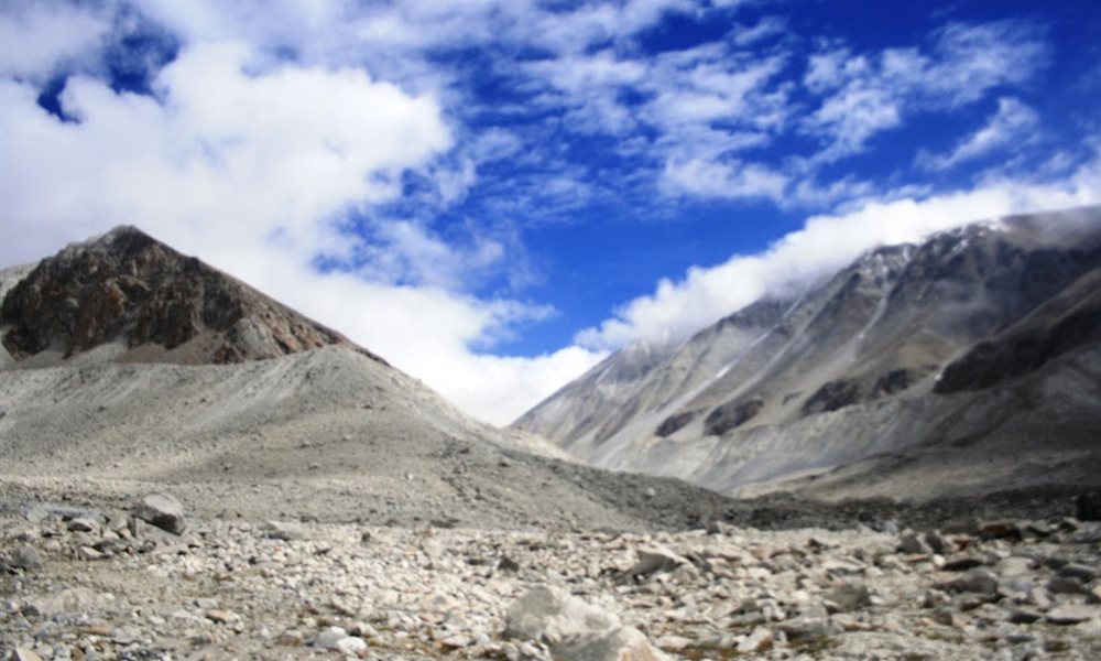
On 6th July 09 we walked through the ridges, glaciers. Our next destination was Sweta glacier, approximately 8kms away. Measurements here are not that accurate as there are no mile posts. The view from Sweta glacier was fascinating. We could see many snow pinnacles, peaks such as Vasuki, Bhagirathi, Avalanche peak etc which were very clearly seen.
Sweta Glacier
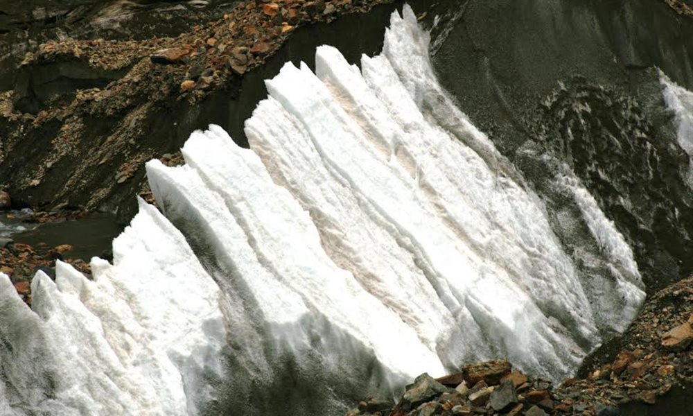
Ice Pinnacles
Sweta glacier campsite
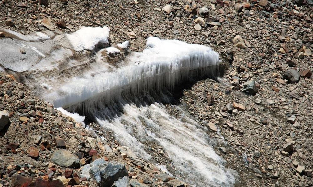
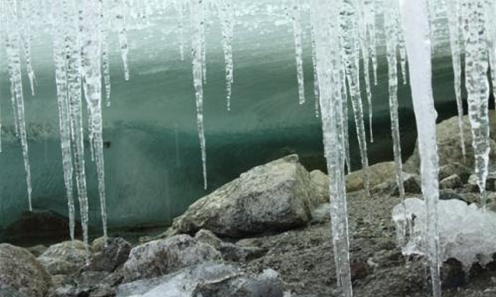
Glacier Icicles
Avalanche peak
Kalindi Khal (Pass) Trek- Sweta Glacier to Kalindi base
Terrain: Moraine walk
Distance: 10 kms.
Trek:Difficult
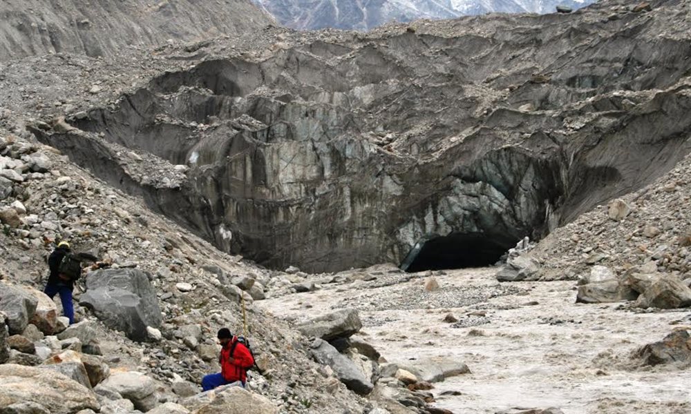
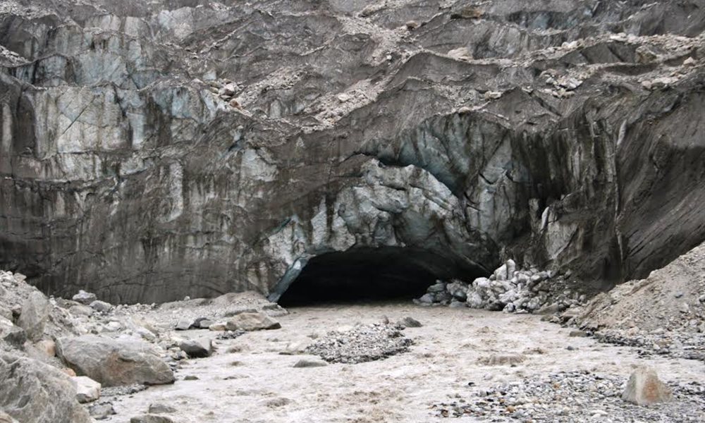
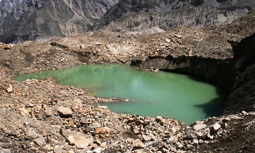
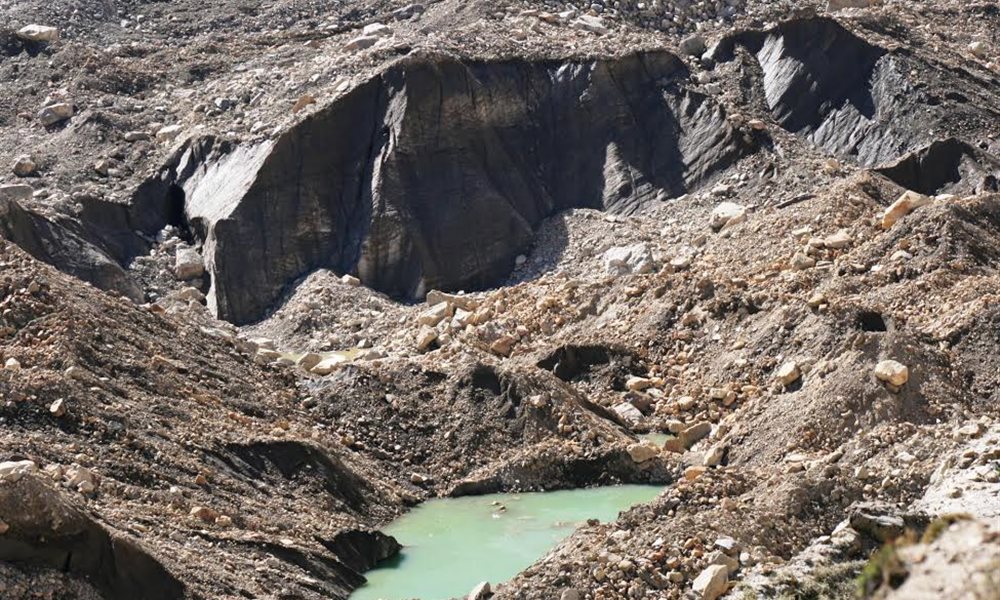
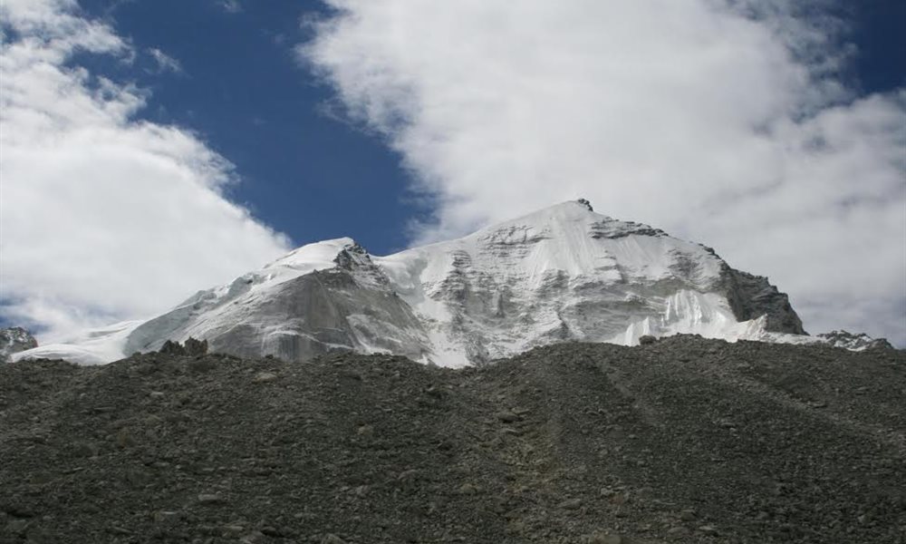
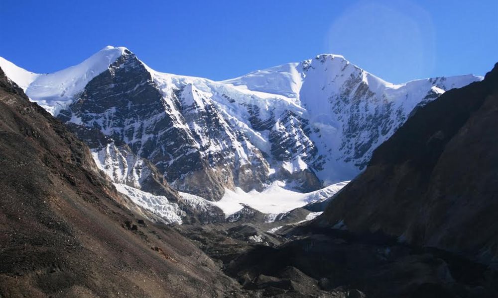
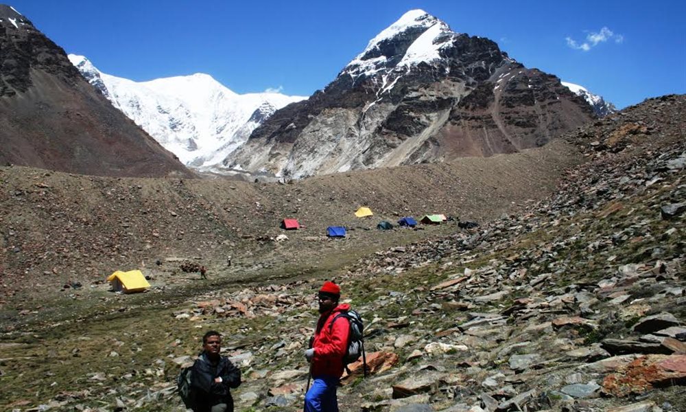
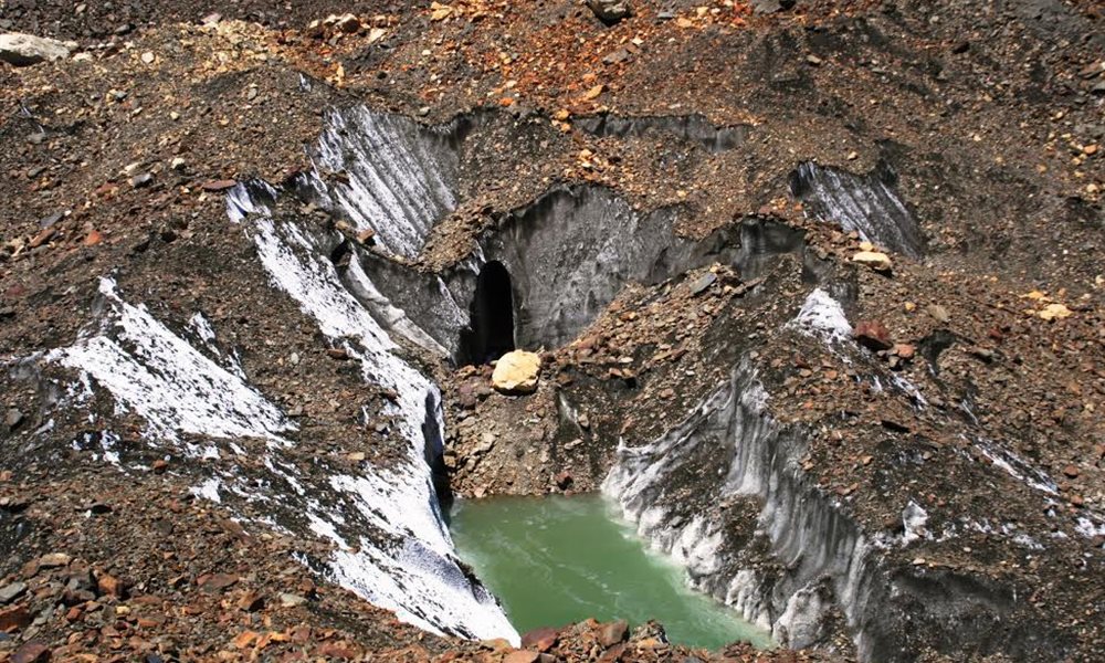
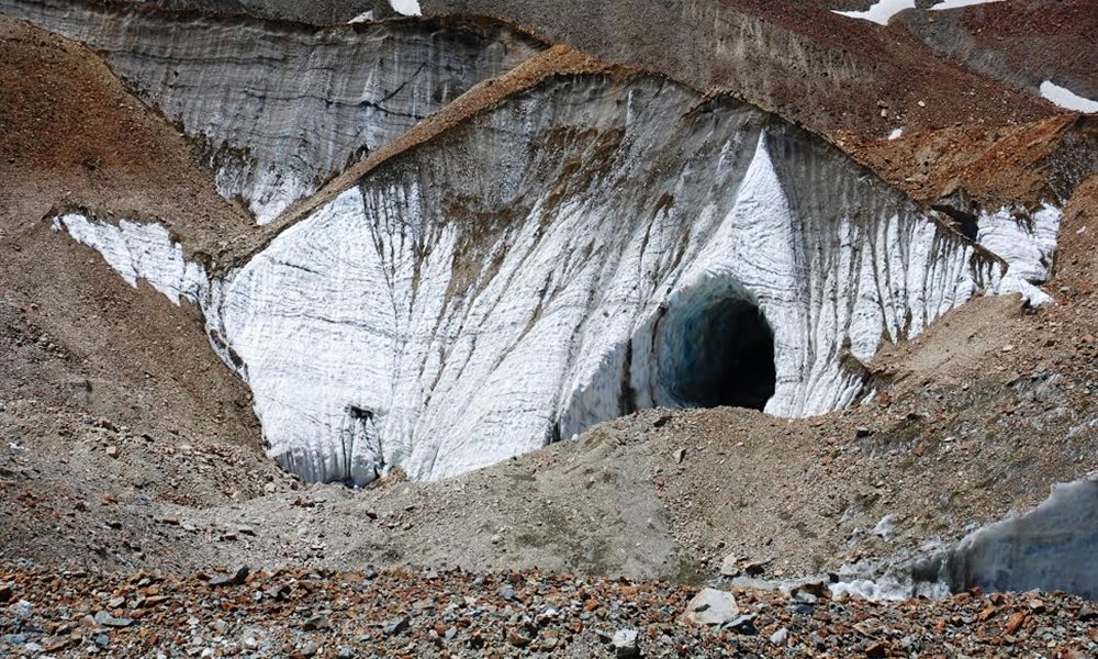
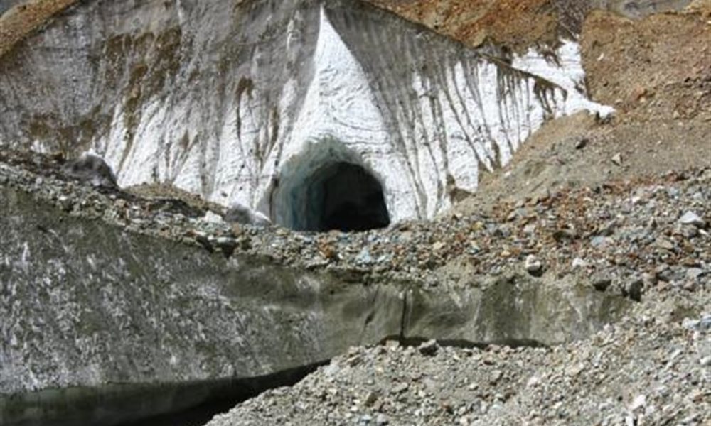
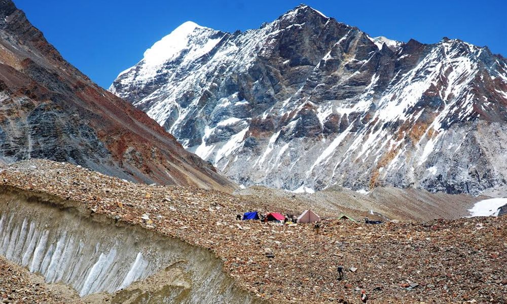
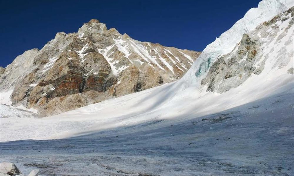
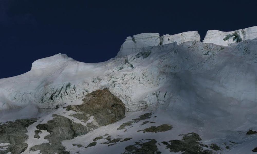
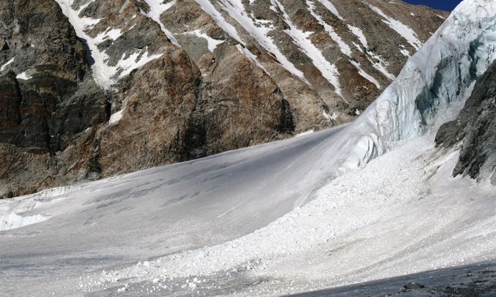
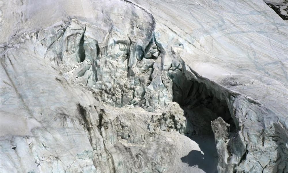
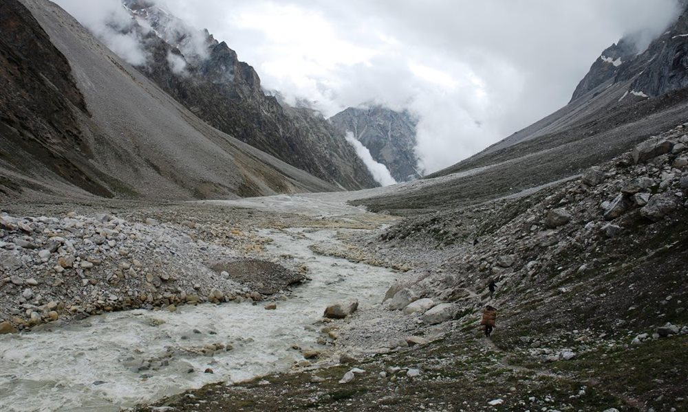
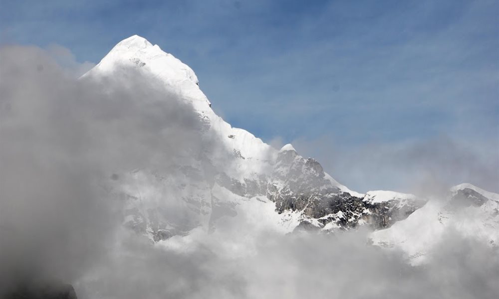
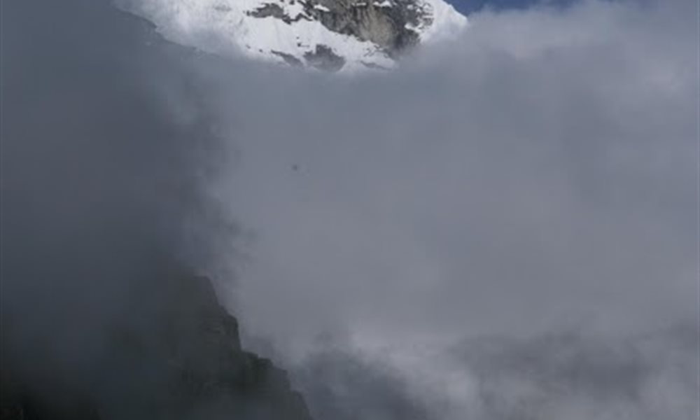
Next day 7th July 09 was a big stretch. We crossed many glacier ridges, snow patches, on the way had beautiful glimpses of crevasses, pinnacles, glacial lakes, huge boulders balancing itself on the ridges. After crossing the glacier patch we finally reached Kalindi Base where our tents were put near the confluence of Chaturangi and Kalindi glaciers. Our cook prepared sweet souji and we offered that as a prayer to the great Kalindi Mountain for fulfilling everybody’s dream and carrying us safely through the pass without any obstacles. The next day view of the Kalindi peak along with the pass and Avalanche peak was stunning. The Kalindi range was visible. We could see the crevasses, pinnacles and the avalanches happening.

Way to Kalindi camp
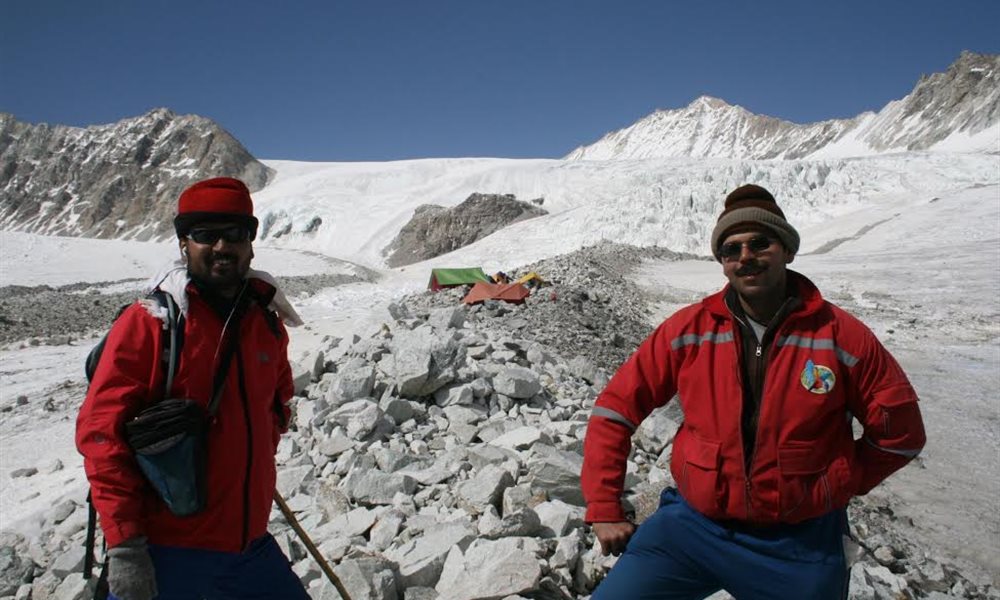
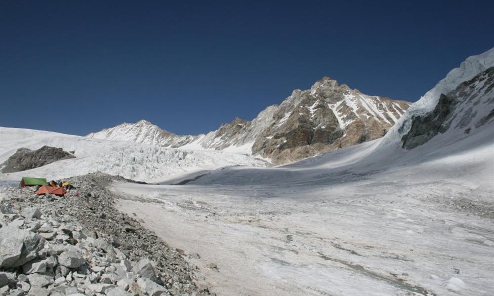
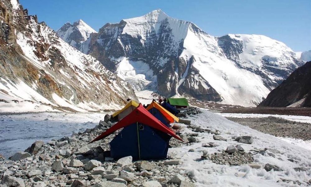
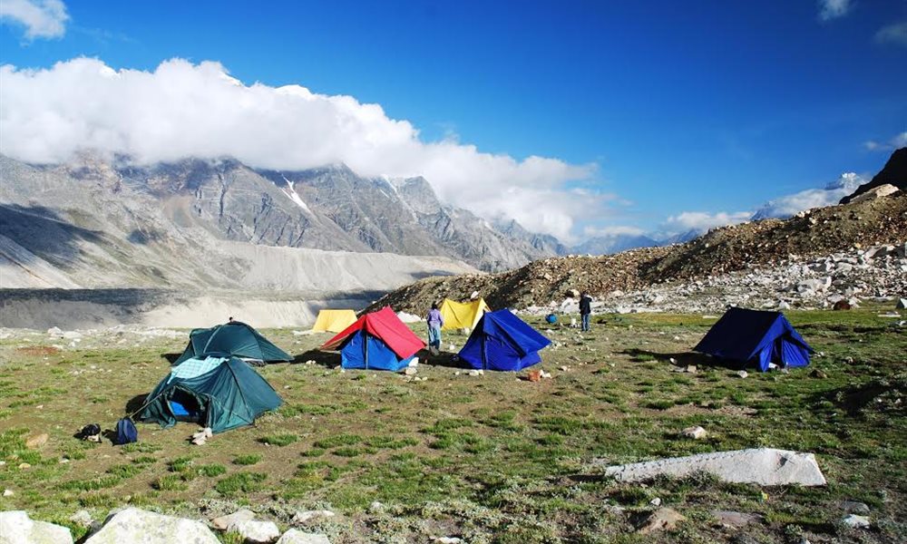
Kalindi base campsite
Praying to Kalindi mountain
Avalanche peak
Kalindi pass
Avalanche glacier
way to kalindi pass
Kalindi Khal (Pass) Trek- Kalindi base to Raj Paraw
Terrain: Moraine walk
Distance: 10 kms.
Trek:Difficult
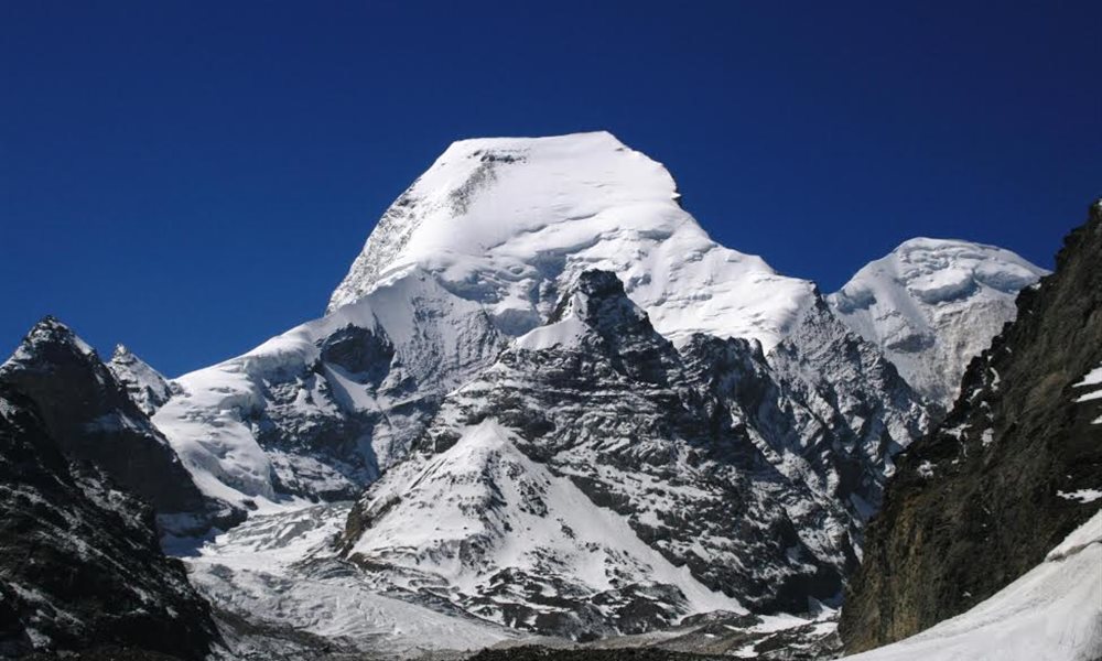
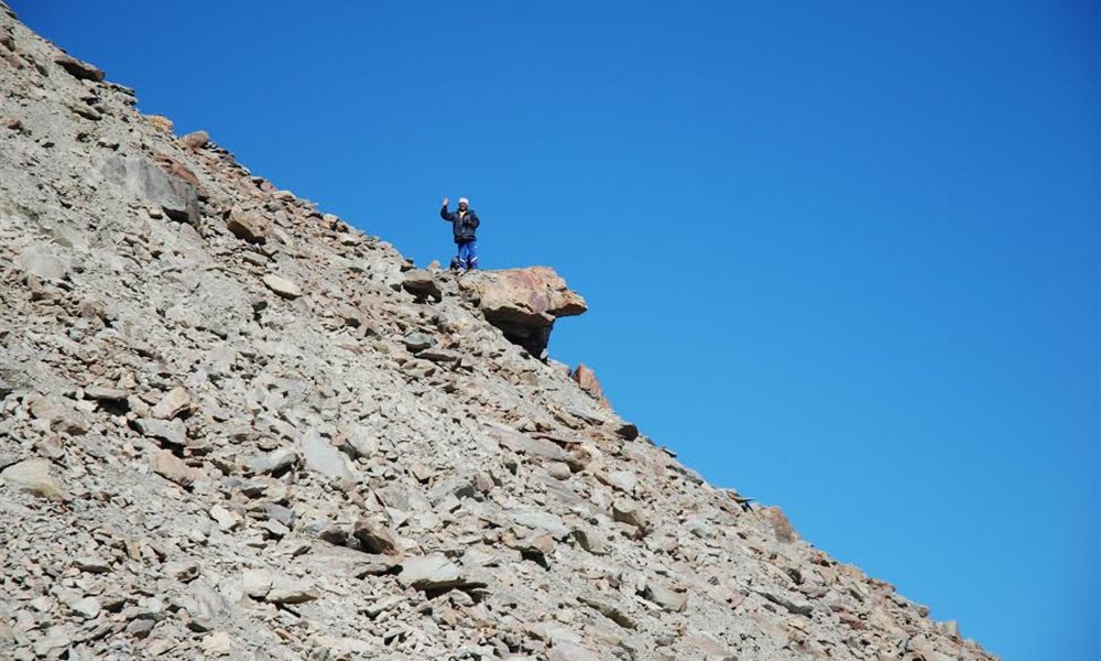
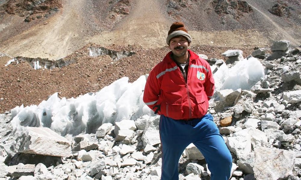
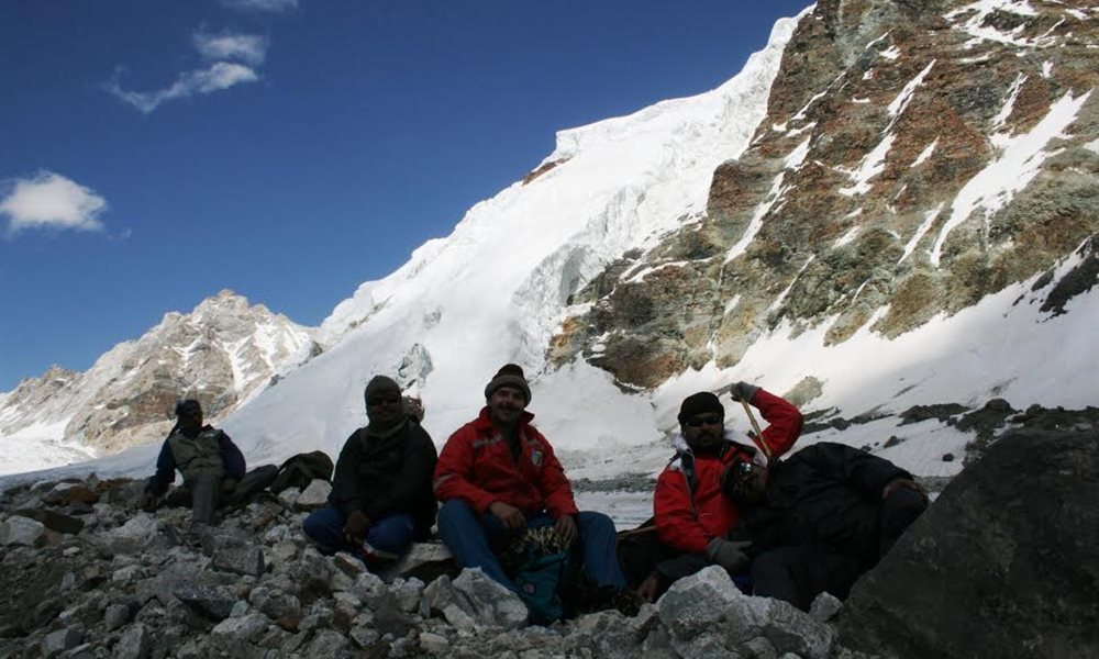
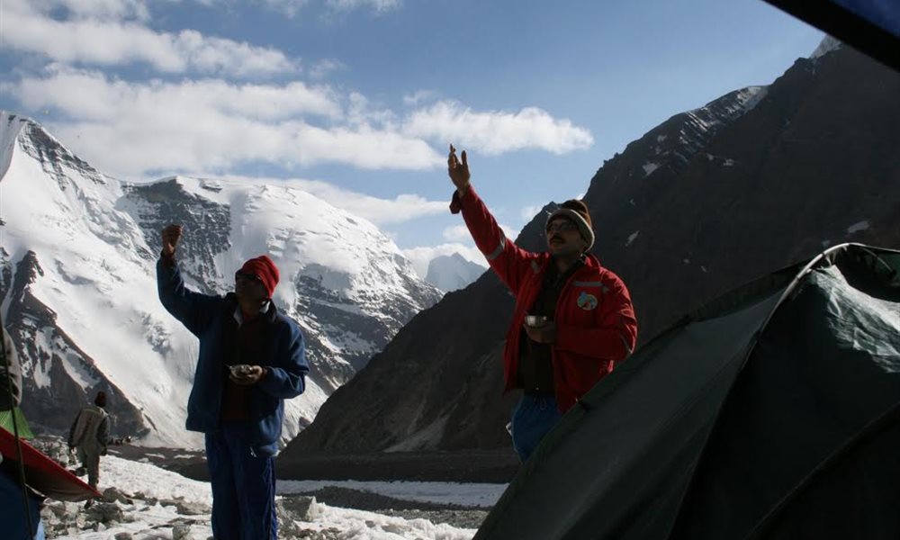
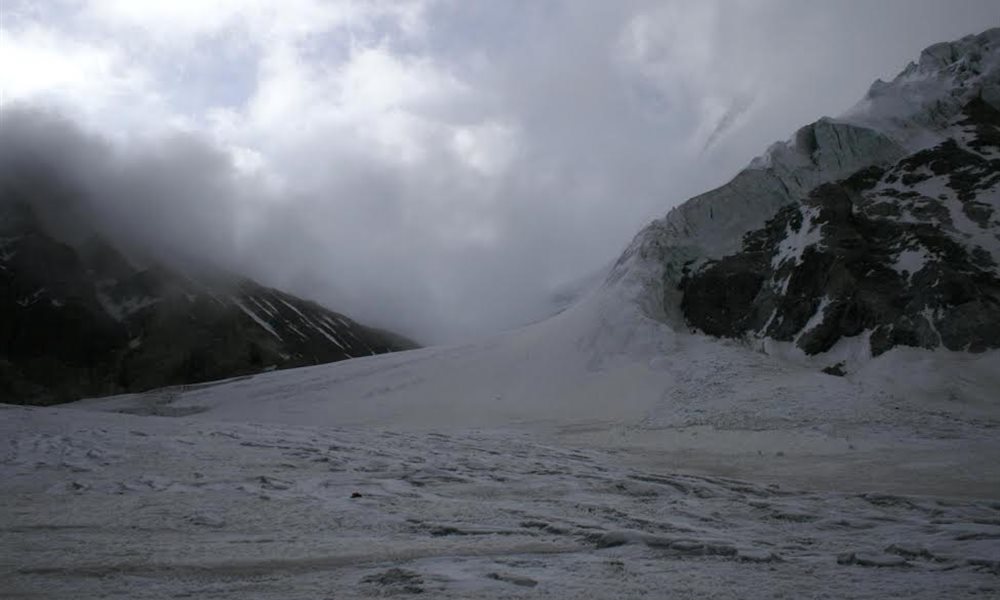
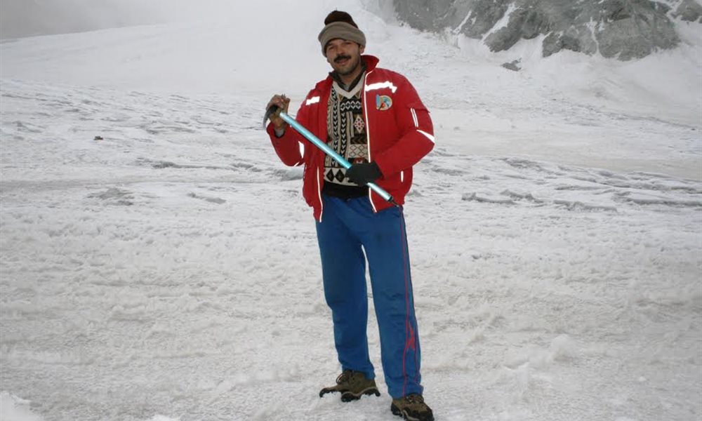
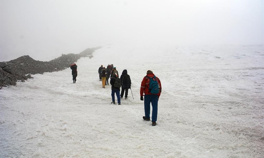
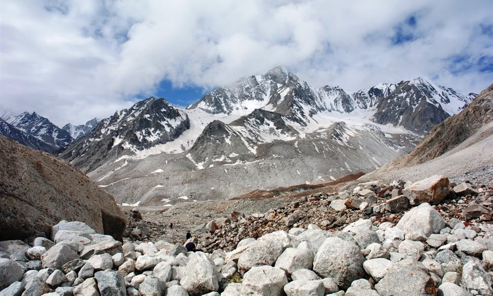
On 8th July 09 was a big day for all of us. We were waiting for that day anxiously, as we were all going to reach our dream destination at 19,600 ft- Kalindi pass. We started early moving like a zombie, crunching on hard ice from Kalindi base camp site. We were at 5500mts, numb and dumb, moving through a sort of a haze. Only the thought that we had to move forward kept us all going. The only concern bothering me at that moment was when will this wide ice field with the crunching hard ice under my feet will end? We all were following each other’s footsteps with our guide Govind leading us ahead. Suddenly we all were shaken with the voice calling for help behind us. Accidentally one of our trek member Dilip had slipped in the crevasse. Luckily at that moment our guide Budhi and another trek member Dhanraj caught hold of him firmly. Immediately we contacted our guide Govind to help us rescue him out from the Crevasse. We were successful in saving him. I also accidentally stepped into a crevasse but manage to arrest myself half way and was removed out by Govind. Fortunately this difficult life risking trail came to an end and we reached the Kalindi Pass. Slowly the mist disappeared from the air and the weather had become clear. We clicked great pictures of our team members. For me it was a moment of pride and honor holding the King Fisher Airlines flag at that height. I was exclusively sponsored by my company for this adventurous trip. We couldn’t wait much and had to start our descend quickly, as the weather started getting bad. Everybody was madly scampering down. Suddenly I found myself drowning in the snow, everybody was having a tough time, and it was becoming difficult to walk in the snow. Our legs were getting locked up to knee length and balancing ourselves was getting difficult. Where the route was tough, we would literally sit in the snow and slide down. That’s the best art to prevent ourselves from drowning in the snow. Luckily we could pull everybody out. After clearing the descend from a steep rocky patch with loose moraines, we saw in front of us the fantastic view of various Himalayan snow clad mountains, special amongst them was the Kamet peak.
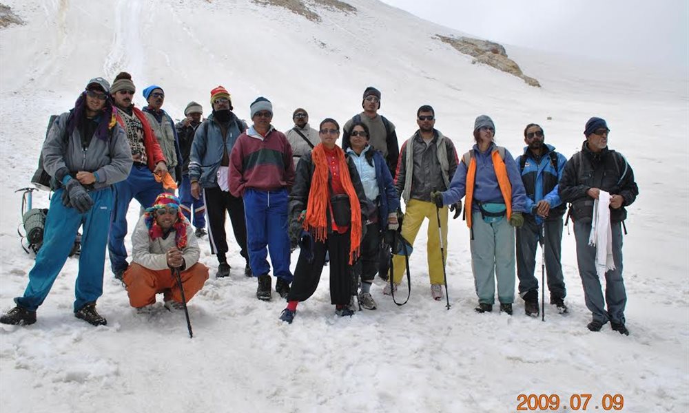
Kalindi pass completed
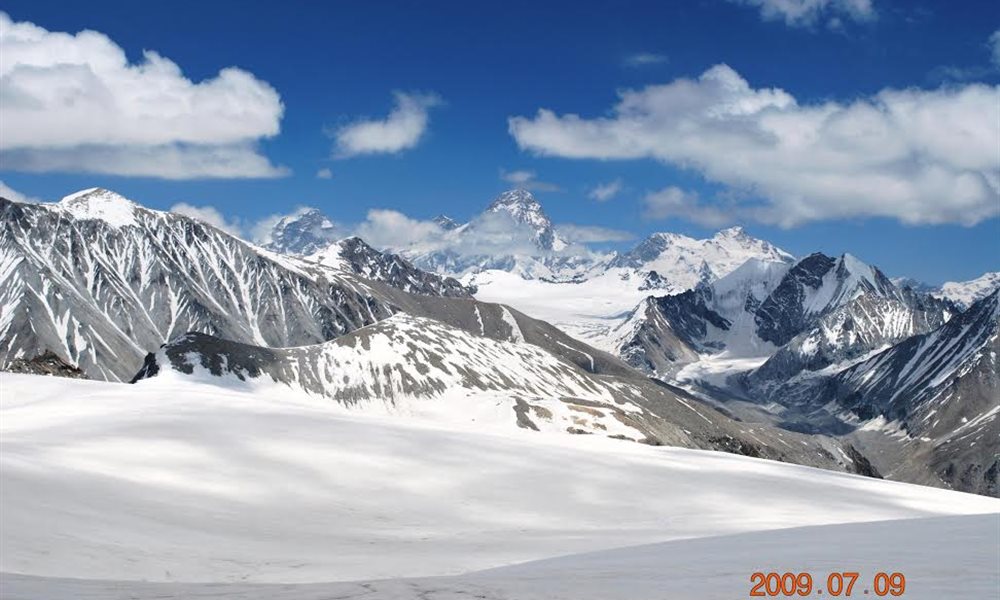
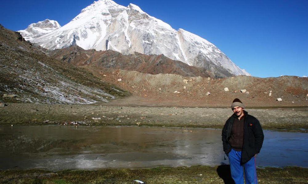
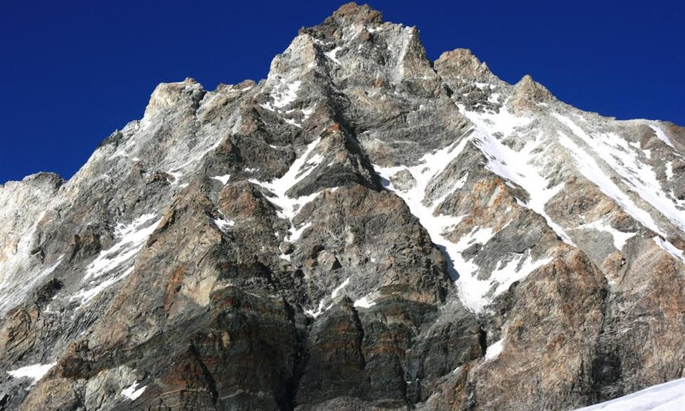
Kamet peak
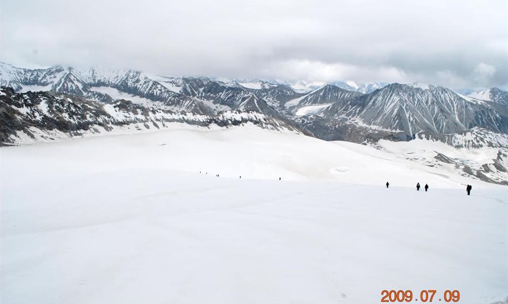
DESCENDING DOWN FROM KALINDI PASS
Now comes the most disheartening part of our trek. No one knew what was planned ahead for us. Our trek member Dilip suddenly collapsed into semi-conscious state. We immediately gave him first aid and tried to get him off the snow field area. But we failed to do so because we couldn’t control his weight and also got stranded with him in the snow. Our guide Budhi did a great job, he rushed down to get some porters and other safety aids for help. Meanwhile our remaining 10 members had reached down and were safe on a ridge. Another guide Govind accompanying rest of the members, came up as he got the message from Budhi. He also tried his level best to move him, but could not. Dilip’s health was getting worst and our only intention at that time was to get him down as soon as possible. It is said that in mountains the best medicine is the immediate descend of a person which works out to be miracle and life saving pill. At last after waiting there for 03 hours on the snow field finally the porters arrived and Dilip was carried down. We 04 members also followed them down. The route to the camp Raj Paraw was very slippery, steep and filled with unstable loose boulders. Finally we reached at camp site. We were extremely exhausted. I was with Dilip in the tent, required medication was given to him. But unfortunately as no one can challenge destiny at 12am he passed away. We could not digest the fact that he was no longer with us. Even after achieving the highest pass we were no more in the mood for celebration as we had lost our dearest member of our group. All sort of thoughts started lurking in my mind, will I be able to make it to Badrinath, what has Kalindi Mountain in her mind, who’s the next victim and so on.
Kalindi Khal (Pass) Trek- Raj Paraw to Arwa Nala
Terrain: Rock debris
Distance: 8 kms.
Trek:Moderate
Next day the 9th July 09, we left Dilip’s body in the tent. The body was to be carried down on a stretcher. But for that our guide Budhi had to travel down to Ghastoli & get the stretcher collected. Along with help from some more people the body would be carried down the next day on a stretcher. With heavy heart we had to leave his body in the tent & descend down.
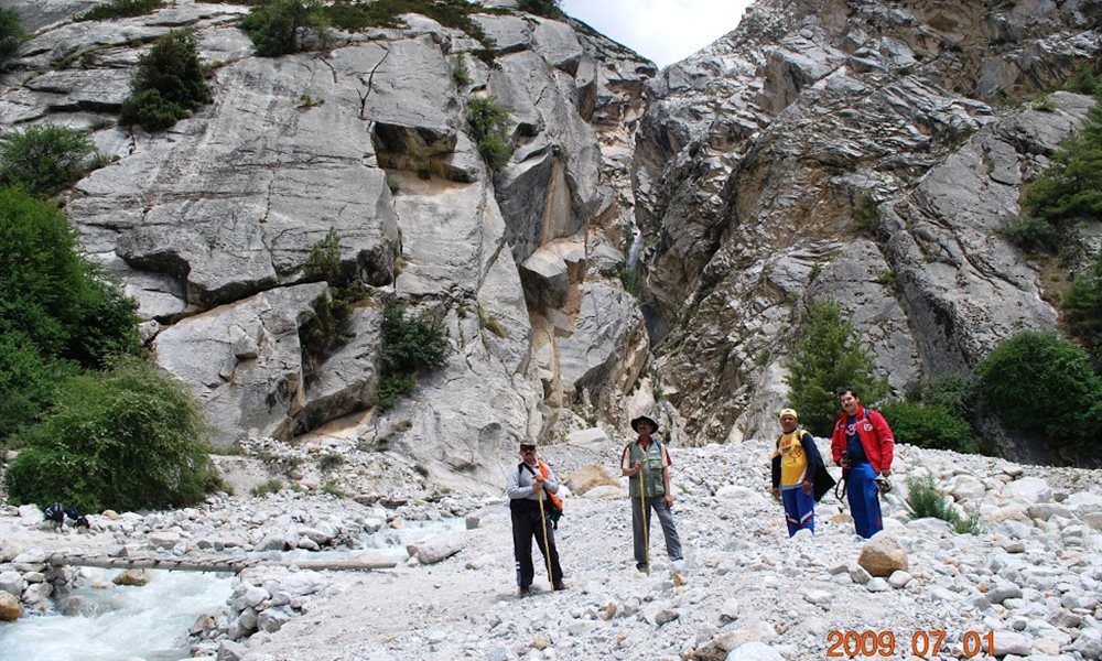
Actually we were planning to cover the distance of 25 kms going straight to Ghastoli through the Arwa valley. So far on our trek we had not attempted to cover such a long distance in a day. However, it is also impossible owing to extremely difficult terrain of Arwa valley because walking on loose stones is not that easy. To save time our guide Govind suggested that we do river crossing with the help of a caniber and cross the river Arwa. Everybody was a bit tensed seeing the force, but one by one we all managed to cross it. I was a bit scared no sooner I stepped inside the water, it was freezing cold. Somehow gathering my courage and with the help of the caniber tied to the rope I pushed my body as I did not want to freeze myself in water with hypothermia and finally reached the other side. The strong current of the river was moving towards me with great force.
Our stop was at Arwa valley, after reaching the tent we were feeling mentally and physically low after the tragic incident. We tried to divert our minds keeping ourselves busy in the tents. Next day Govind and the porters were going to get the body down and meet us at Ghastoli directly as planned.
Next day 10th July 09 we started our journey for Ghastoli. It was a tough stretch crossing many ridges, with boulders. Towards our left we saw the Saraswati river flowing. Now I was facing difficulty in walking because the toe nails on both my feet were suffering from frost bites.
I had developed frost bite on my feet because I had spent almost 02 to 03 hrs on the snow along with Dilip after crossing Kalindi Pass. My toes were hurting me badly, so eventually my walk had slowed down a bit. We enjoyed passing rain showers on the way. Due to rains the trail had turned more slippery. Climbing from 1 hump to the other hump from last few days, we were literally fed up with boulders and finally reached the rock band. Rocks are faithful- at least you know where you are stepping. Reaching Ghastoli was an effort indeed which we all successfully cleared it. We were greeted by the Indo-Tibetan police and we all sat inside the aluminum tent and enjoyed the hot tea and biscuits offered by them. It was like a treat for us after a tiring and exerting walk. The ITBP camp was surrounded by many colorful flowers of different species along the river side. On the other side was the Parvati river in between the rocky mountains. The water flowing was bluish green in colour. That night tent accommodation site and the food was provided to us by the ITBP people. We were their guest for the day. This arrangement was done for us by our very own trek members Mr Subhu and Ms Malikha.
Meanwhile Govind arrived with Dilip’s body. Our trek members Dhanraj and Dipak made arrangements to take the body to Gopeshwar for the final formalities and postmortem. It was decided that Dhanraj and Dipak would leave early as they had the responsibility to take the body to Mumbai. At night they left Gopeshwar. We wished them happy journey and hit the bed early as we were all tired and homesick.
Way to Arwa tal
Ghastoli ITBP camp
Way to Ghastoli
A beautiful lake at Ghastoli
Ghastoli campsite
Kalindi Khal (Pass) Trek- Ghastoli to Badrinath
Terrain:Road
Distance: 14 kms.
Trek:Moderate
On 10th July 09 in the morning we saw the splendid view of the Nar Parvat and left from Ghastoli. After thanking the ITBP staff for their co-operation we started for Badrinath. Route was now easy, we were back on proper roads. In between we were lucky to get lift from trucks that were carrying stones and other construction material to Mana village. Rest of the journey was easy going. When we were nearing the Mana village we could see the crest of Badrinath temple from a distance. I just felt a sign of relief and asked my inner instinct, despite enduring such pain, such exhaustion, why did I come here in the first place. Upon which my inner silent ascetic replied “to see the beauty around and to feel the errie thrill and ethereal excitement”. I just recalled a few lines of the Bengali poet-Jibanananda Das, who writes-(I have walked in Babylon through the night, alone/ why so, I don’t know, even after thousands of busy years. The journey never really ends. The aim is not to reach but to move on and on. Sun always moves. His light is incessant. So keep on moving on.
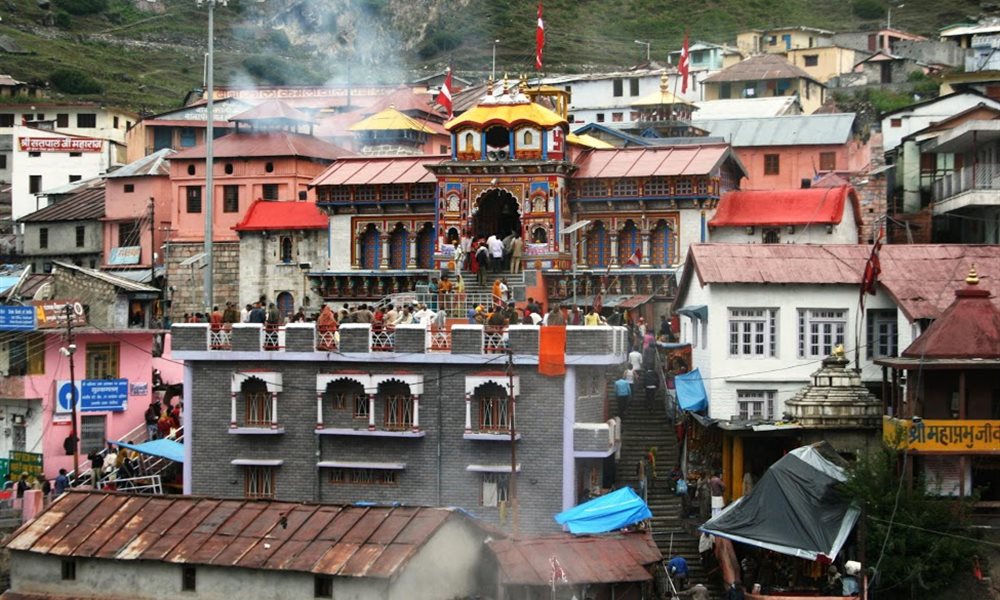
Badrinath temple
Beautiful secenery on way to Mana Village
Peaks around this area:
- Shivling- Shivling (6,543m) is a two summit mountain which rises not far from the snout of the Gangotri Glacier.It belongs to one of the most beautiful peaks in all Garhwal. Due to its unusual shape and easy access. Shivling is very popular among climbers.
- Kedar dome- Sumeru Parbat 96331m, left) and Kedar Dome (6831m, right) from the North West.The outstanding and high summit of Kedarnath (6490m) looks from the side of the Kirti Glacier like a big white mountain.In the East a razor- sharp, semirocky and semi-corniced ridge joins the main peak of Kedarnath with its subsidiary feature Kedar Dome---Kedar Dome has the gentle North West flank that provides perhaps the easiest and most frequented climb in the Gangotri.
- Bhagirathi- Bhagirathi 2,3 & 1 (left to right 6512m,6454m,6856m) from the West. The highest peak of the Bhagirathi Group forms a complex and topographically complicated massif. Bhagirathi Parbat has three major peaks. It stands at and dominates the end of the valley leading up to Gaumukh which is the end of the Gangotri Glacier and the source of the river Ganga. The upper part of the river Ganga is also called Bhagirathi, and both the mountain and the river are named after King Bhagirath. This King is said to have forced the Goddess Ganga to descend from the heavens in the form of raging torrent in response to Bhagirath’s intense and determined austerities.
- Sumeru- Meru North (6450m).The Meru Massif above the upper parts of the Bhrigupanth, Meru and Kirti Valleys.From the East, Meru looks like a long jagged ridge falling down with 800-1200m high, vertical slab walls. The ridge contains a number of peaks, the most eminent of them being-Meru North(6450m) and Meru South (6660m). Apart from these Meru West(6361m0 LIES ON THE RIDGE THAT CONNECTS Bhrigupanth and Meru North.
Our deepest condolence- For our dearest member Dilip Samel who passed away in this trekking expedition- “May his soul rest in peace”.
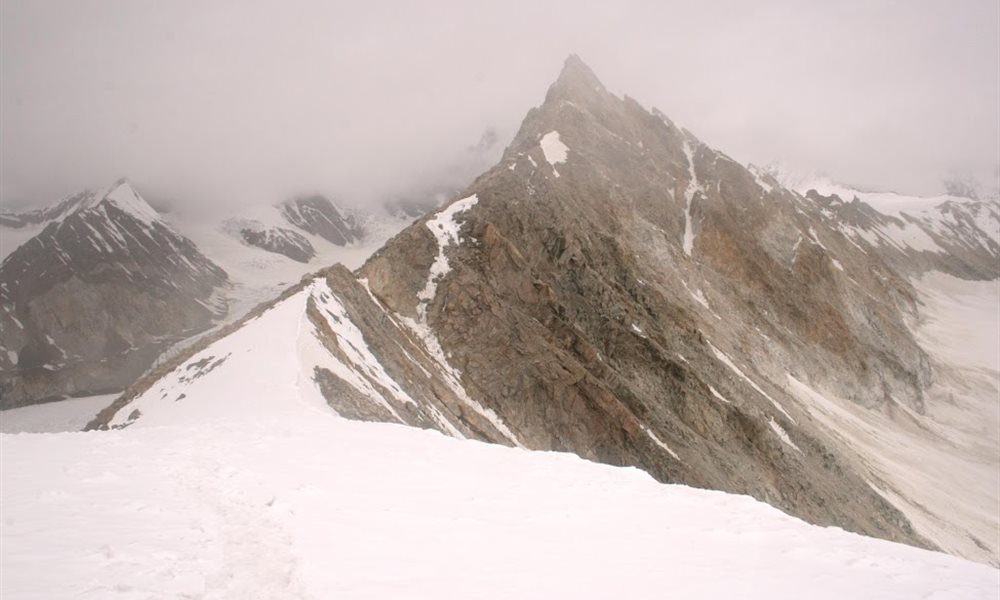
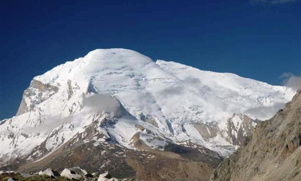
Kalindi peak
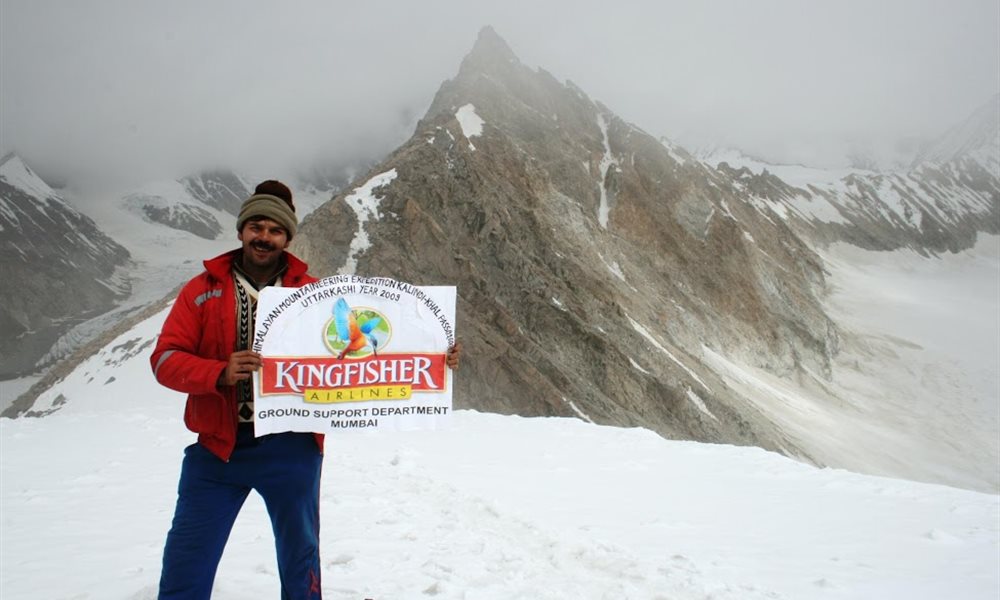
Kingfisher banner held high
Trek Itenary:
27th June - Dehradun to Uttarkashi - by taxi stay in hotel.
28th June – Rest day.
30th June - Gangotri to Bhojbasa - by trek 3600m - stay in camp
1st July - Bhojbasa to Tapovan - by trek 4000m - stay in camp
2nd July - Tapovan to Nandanvan - by trek 4200m - stay in camp
3rd July - Nandanvan to Vasuki Tal - by trek 5000m - stay in camp
4th July - Rest day
5th July - Vasukital to Khada Pathar - by trek 5200m - stay in camp
6th July - Khada Pathar to Sweta Glacier - by trek 5800m - stay in camp
7th July - Sweta Glacier to Kalindi Base - by trek 6000m - stay in camp
8th July - Kalindi Base to Raj Parav - by trek 5000m - stay in camp
9th July - Raj Parav to Gastoli - by trek 4500m - stay in camp
10th July - Gastoli to Mana Badrinath - by trek 4000m - stay in camp
11th July - Badrinath to Chamoli - by taxi - stay in hotel
12th July - Chamoli to Rishikesh - by taxi - stay in hotel


")


