
Why Parang La :
It all started when we got an enquiry call from a person in Gujrat about Parang La trek in Feb 2016. He introduced himself as Jasmin & told me that he had earlier planned a trek to Pin Parwati pass with Bikat Adventures in Sept 2015 but could not make it as the dates didn’t suit him. He was very keen & confident to do this one with us & we could not say no to him. The only thing that I knew about Parang La trek at that point of time was that it ends in Ladakh region. As we did not had any fixed departures for Parang La at that point of time in our annual calendar so we decided to take it as an exploratory trek & confirmed the same to Jasmin. Read more about Bikat Explorations. After screening of the applicant’s request based on their past trekking experience, we formed a team of 4including me which went ahead with the exploration starting mid of August.
Let me introduce my team members here who will be a part of our long arduous journey from Spiti valley to Ladakh for the next 7 days. Jasmin who initiated all this is from Gujrati business family & has a rich experience of Spiti & Ladakh Himalayas as hiker, biker & as a normal conventional tourist. He had done Pin Parwati trek in Aug 2015 & that promoted his thoughts for Parang La this time around. He brought with him his college day’s friend Jignesh who had a similar background & both were associated with Youth Club since their college days. Then comes Pawan who is an IT professional based out of Mysore & had Rookpund under his kitty twice since he was not able to make it for the first time due to bad weather.
Getting together in Manali:
It was decided to meet in Manali on 16th Aug & start our journey ahead to Kaza on 17th. Jasmin & Jignesh reached in time on reporting day & we checked into the Himachal Tourism Tourist lodge dormitory located on the banks of gushing Beas River. Pawan was the last to arrive as he was already backpacking in Kasol for last few days. I checked with all 3 regarding the List of Essential Items they need to carry for our exploration. There were certain stuffs which were missing & we decide to the get them from Market before it closes down. We filled our bags with dry fruits specially Raisins, Dates, Amla Candy (Indian Gooseberry) & my favorite Anjeer J . I prefer them more than the chocolate because it never keeps your mouth dry which is essential when you are hiking in dry & arid region like Ladakh or Spiti. Before going to bed I discussed the plan with the group that we will try to complete the trek in 06 days instead of 09 &everyone was looking at each other with a sense of disagreement & were apprehensive about the plan. Sensing the mood I decided to discuss to plan in detail with our local guide & team members once we reach Kaza in order to avoid any long discussion that night. We all went to sleep by 2300 hrs by putting off the lights but Pawan was not able to sleep because of some bed bugs & sound of snoring prevailed only after few hours.
Kaza- The Childhood Dream:
It was a program aired on Discovery Channel when I was in school that gave me the first glimpses of Kaza & I always dreamed of coming here. I started trekking around 9 years back but never got a chance to explore this place & knew that it was late coming for me but as the saying goes “It’s better to be late than never”. We all started at around 06:30 AM from Manali in a shared tempo traveler & meandering our way through uphill climb of lush green valley reached Marhi for our first pit stop for breakfast. This 1.5 hours long journey flashbacked me to our 2012 self-supported Manali Leh Cycling Expedition and I could recall even the slightest of the bend in the road. We continued our journey & crossed Rohtang pass without any sign of traffic & human chaos as all shops on the pass are removed on the orders of NGT (National Green Tribunal). We crossed Gramphu (3200 Mts) at around 09:15 AM with Chandra river flowing on your left side & dense patch of Bhoj Patra (Himalayan Birch) tress on the right slopes of the road. After having a brief halt for lunch at famous Chandra dhaba popularly known as Chacha Chachi ka dhaba at Batal & a visit to Kunzum mata temple at Kunzum pass we reached our destination of the day at around 3:30 PM where we were greeted by my old WhatsApp friend of 2 years Urgian Chhering popularly known as UC whom I was meeting for the first time.
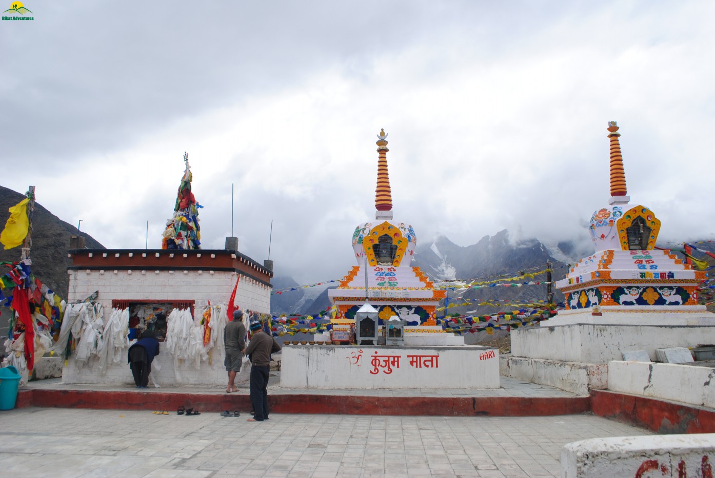
Kunzum Mata Mandir
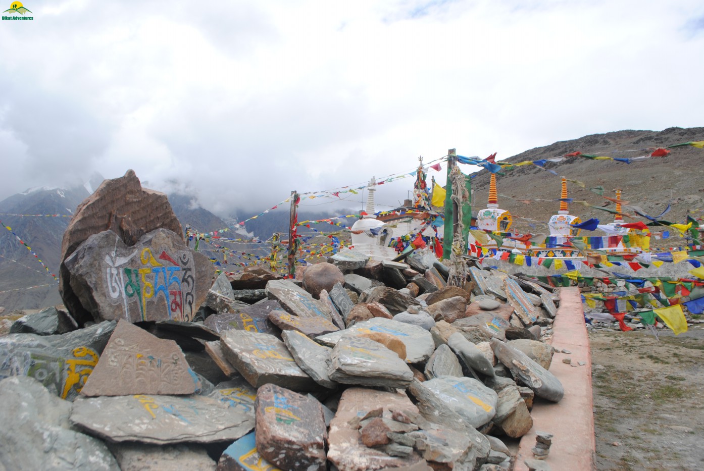
Cluster of flags at Pass
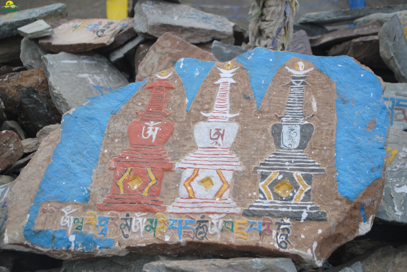
Om Mantra engraved on stone
He had arranged for our stay in his hotel along with the complete logistical arrangement for our exploratory trek. After freshening up we strolled in the tiny but buzzing market of Kaza as it was the starting of La Darcha festival & people from all around the valley were gathering to celebrate the same. We were lucky that we got to witness the opening ceremony of this festival which was scheduled from 17th to 19th Aug. Earlier the fair used to be held at Kibber maidan in Spit in the month of July. This used to be the meeting point for traders from Ladakh, Rampur Busher and Spiti. It used to offer a good barter ground for them but now is celebrated in Kaza on 03rd week of August every year. After dinner & watching few performances in the festival, we all retired to our bed & the tiredness of long road journey gave us a uninterrupted sleep.
Acclimatization &Chicham Home Stay
After a sound sleep I woke up early & was treated with a beautiful view from my washroom window & I decided to take an acclimatization walk towards that top along with Pawan as he was also ready by that time. Jignesh & Jasmine were both enjoying their hotel bed so we decided not to disturb them.
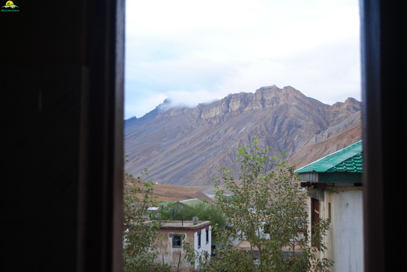
View from my washroom
That walk was very refreshing as it gave us a top view of beautiful Kaza with its lush green fields & Spiti River flowing by its side. It started drizzling & we walked back to our hotel room after an hour of walk. I got to know from UC that Spiti never receives heavy rain like what we experience in plains & drizzling is what they are used too. That complete day was cloudy & it created doubt in the minds of all of us, whether we are going to experience the same clouds & rain in our upcoming climb to Parang La. I called up Girish & asked for the weather forecast of the Spiti valley for next 4 days so that we can plan accordingly. We planned with our local guide, a young boy of 19 years age who had done Parang La more than 3 times in this season alone. I planned for a 6 day itinerary from Chicham to Karzok with almost 17-18 Kms of trekking daily. Jignesh & Jasmin were very concerned with the plan as they had AMS & high altitude of Parang La at the back of their mind. I assured them of the daily altitude gain that we would doing & the flexibility of the plan. In the evening we started for Chicham after paying a brief visit to the famous Key monastery. By the time we reached the famous trolley bridge across a 110m deep gorge of Chicham, it was almost dark& the first thought that came across my mind was that of similar trolley bridge we crossed during our Pin Parwati Pass Trek. The home stay in Chicham was arranged in a typical mud house which is generally very warm from inside & had dry composting toilet. The toilet generally has two floors, the first section and the ground floor. The upper section has a hole in the middle and a mixture of mud and ash in one corner along with a local shovel. After every use shovel full of mud and ash is thrown into the hole. Lower section collects the human waste that is decomposed over time and used as organic manure in the fields.
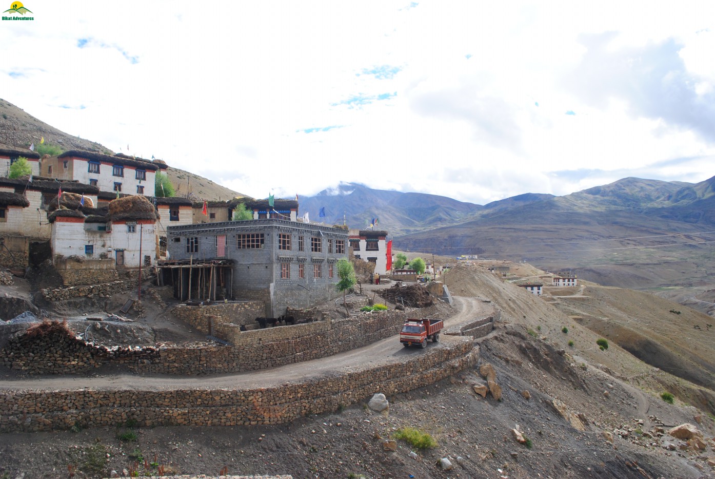
Chicham Village
After having local bread/chapatti with mix veg in dinner, we all went to sleep looking forward to some exciting days of our lifetimes.
Beginning- Chicham to Thaltak:
After experiencing the dry compost toilet in morning & a brief pranayamasession we all geared up ourselves for Thaltak, the destination for the day. After the morning briefing we started at 09:00 AM sharp & crossed the last house of the village with herds of Yak crossing by.
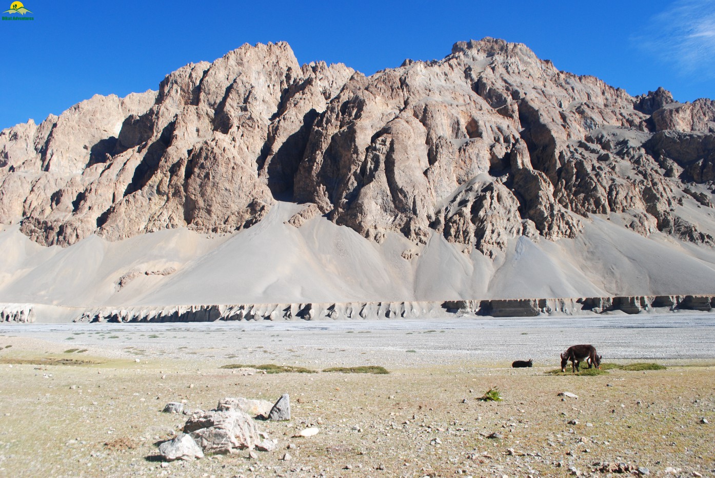
Herds of animals out for grazing
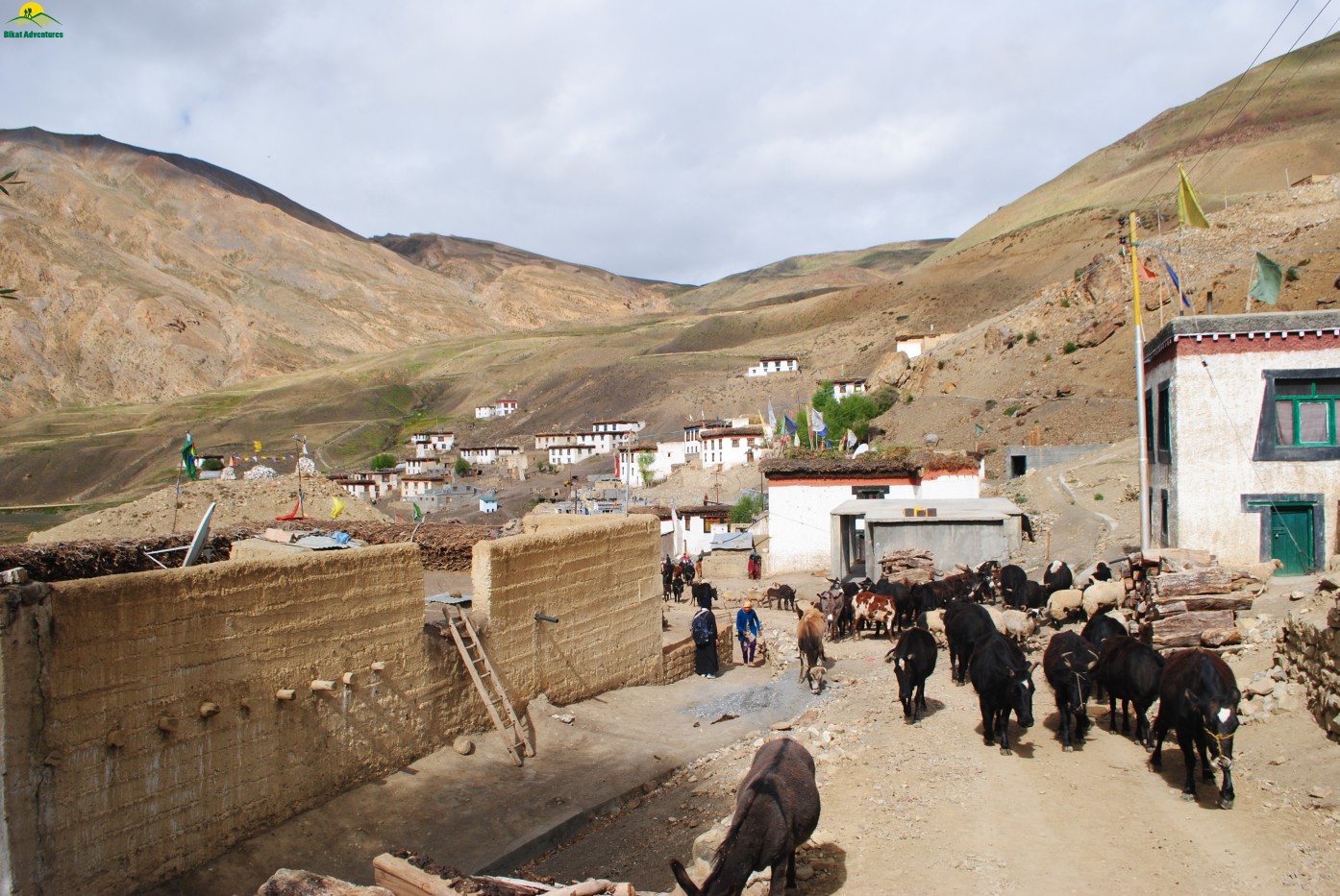
After 45 minutes of walking through the paved metallic road we reached Dumla, a good campsite with agricultural fields & a stream of water passing through it. The Dumla campsite is at an altitude of around 4000 mts and is almost 5 Kms from Kibber & a good first day halt for those starting from Kibber.
Top view of Dumla as seen from paved road
Dumla campsite
As we started ascending towards Thaltak we were joined by a group of 4 from some Himalayan club in Darjeeling & group of 9 Swiss people who were planning for Mentok Kangri-II after completing Parang La.
First ascent after Dumla campsite
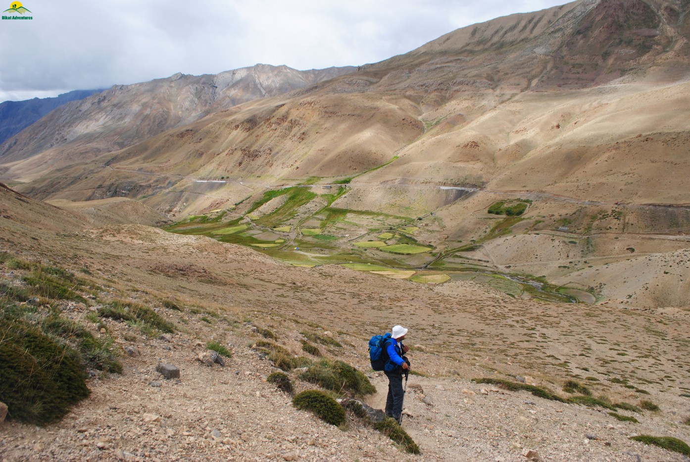
Now the high altitude was showing its effect & it was getting difficult to ascent so we took frequent breaks to recollect one’s breath. It almost looked like a train crawling up the Thaltak meadows with frequent pit stops in between. This was my first trek in the dry region of Himalayas and I could now sense the lack of oxygen even at an altitude 4000 mts whereas all my treks in Himachal & Uttarakhand of almost same altitude never gave me that challenge. I think it’s all because of the vegetation that those regions have whereas here I cannot find a bush or plant leave aside any tree of that sort. All that we could find is the local grass or bush know as Thama.
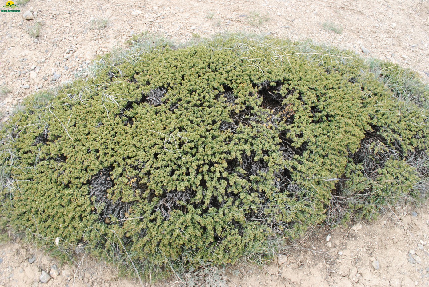
Common grass or bush locally name 'Thama'
While approaching Thaltak the Kanamo Peak was visible on the right side of the trail surrounded by mountains devoid of any snow or vegetation.
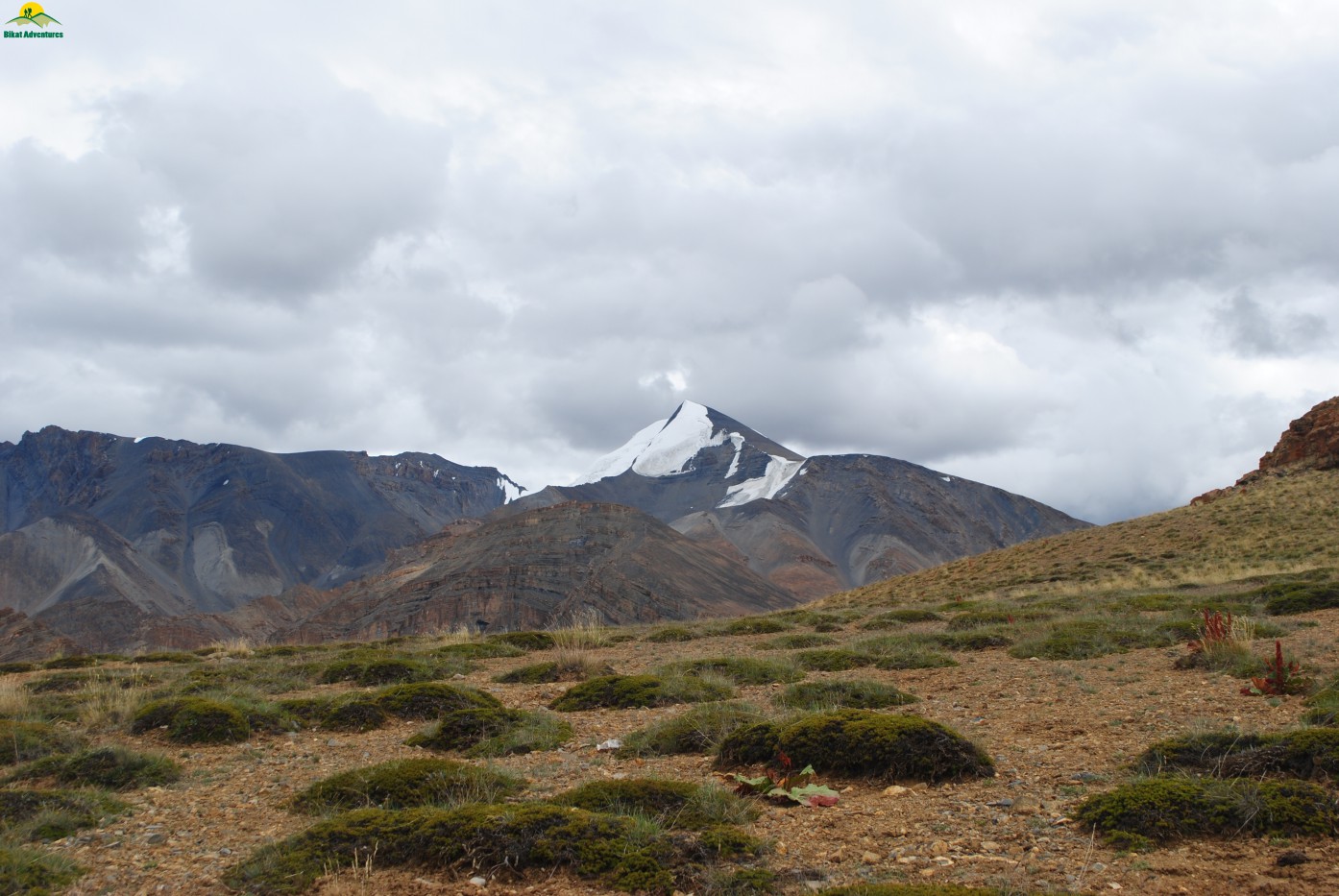
Kanamo Peak in the background
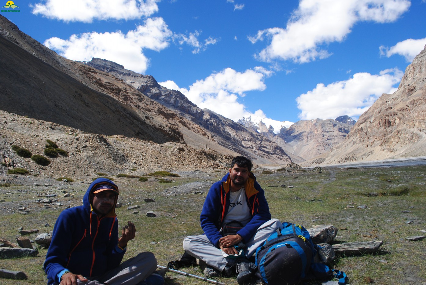
I reached our campsite at Thaltak (4693 M) overlooking a deep valley/gorge at 02:15 PM hours followed by Jasmin & Jignesh. Pawan was the last one to reach at 02:30 PM & it was quite visible from his appearance that he was not feeling well & maybe it was the onset of mountain sickness.
Thaltak campsite as seen from trail
When everyone reached the campsite & we were having our evening tea it started raining & suddenly weather became so pleasant with a breathtaking view of complete rainbow in front of us. Everyone was so mesmerized for a moment that no one spoke to each other & started clicking pictures.
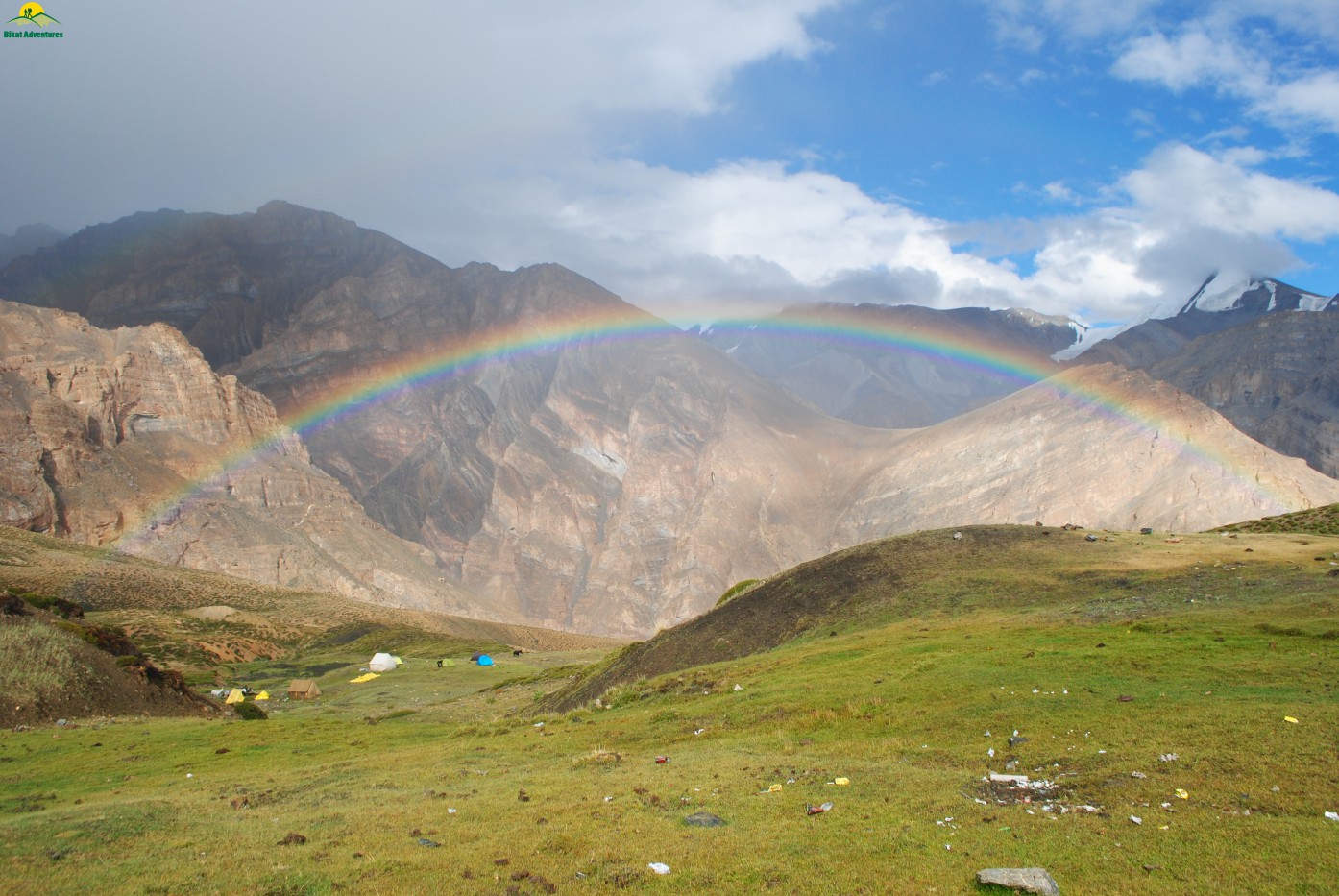
Rainbow delight at Thaltak Campsite
My GPS recorded 8 Km of trekking, 636 M of ascent & 144 M of descent for the day. Pawan was not feeling well & I was not sure whether he would be able to continue trekking the next day. Jasmin suggested Diamox to Pawan which he himself was taking from the moment he landed in Manali. I personally never favored or recommended this drug to anyone because I believed in natural acclimatization of the body. Though I was over ruled here & all 3 started their taking their Diamox dose daily from here onwards. The medicine did show its effect & Pawan was feeling a bit better. We had a light dinner of Thukpa & went to sleep thereafter. I was worried about Pawan’s health & made up my mind that if his condition doesn’t improve, I will send him back to Kaza without taking much risk.
Thaltak to Borojen:
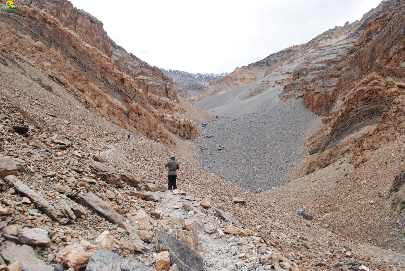
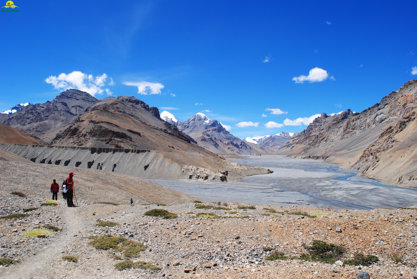
The next morning we woke up to a clear sky & I immediately went to Pawan’s camp & enquired about his health & how he was feeling. I was relaxed when he told me that he had a good sleep for 3-4 hours but the tiredness was visible on his face. We decided to offload the backpack of all 3 so that they can walk freely, at their own pace. After breakfast we started at around 07:15 AM. The initial trail was narrow with loose rocks & steep downhill hike of 1 hour & 450 M took us to the bottom of valley.The Rong Nalla/river was onto the right side of the trail & the valley was devoid of any sunshine. We crossed a small makeshift bridge made up of wood & concrete over the Nala& continued our hike over boulders & small rocks along thebed of the river in upstream direction. After a hour of walk along the river bed, we climbed the steep scree in north east direction to reach Jugtha which is another camping site. After a brief rest we moved further towards our target, the entire trail was devoid of any vegetation & the patterns on the mountains & ridges directed that these ranges of mountains
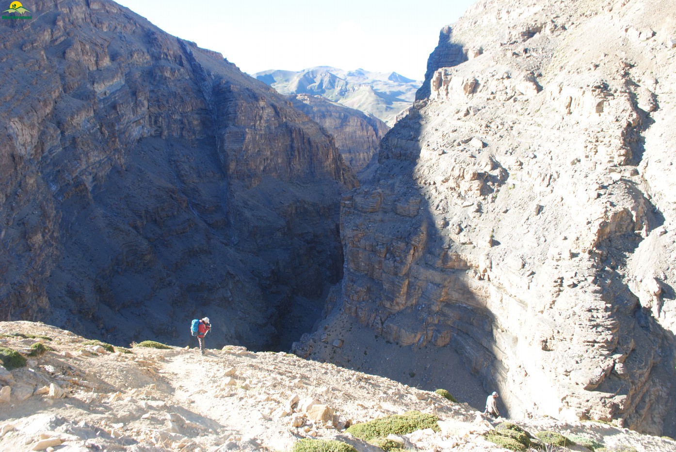
Steep descent for Rong Nala
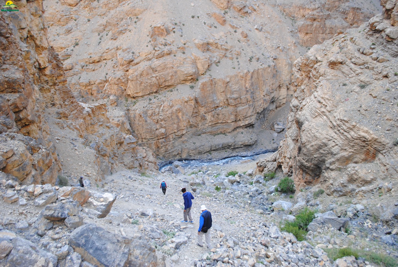
Careful descent down the valley
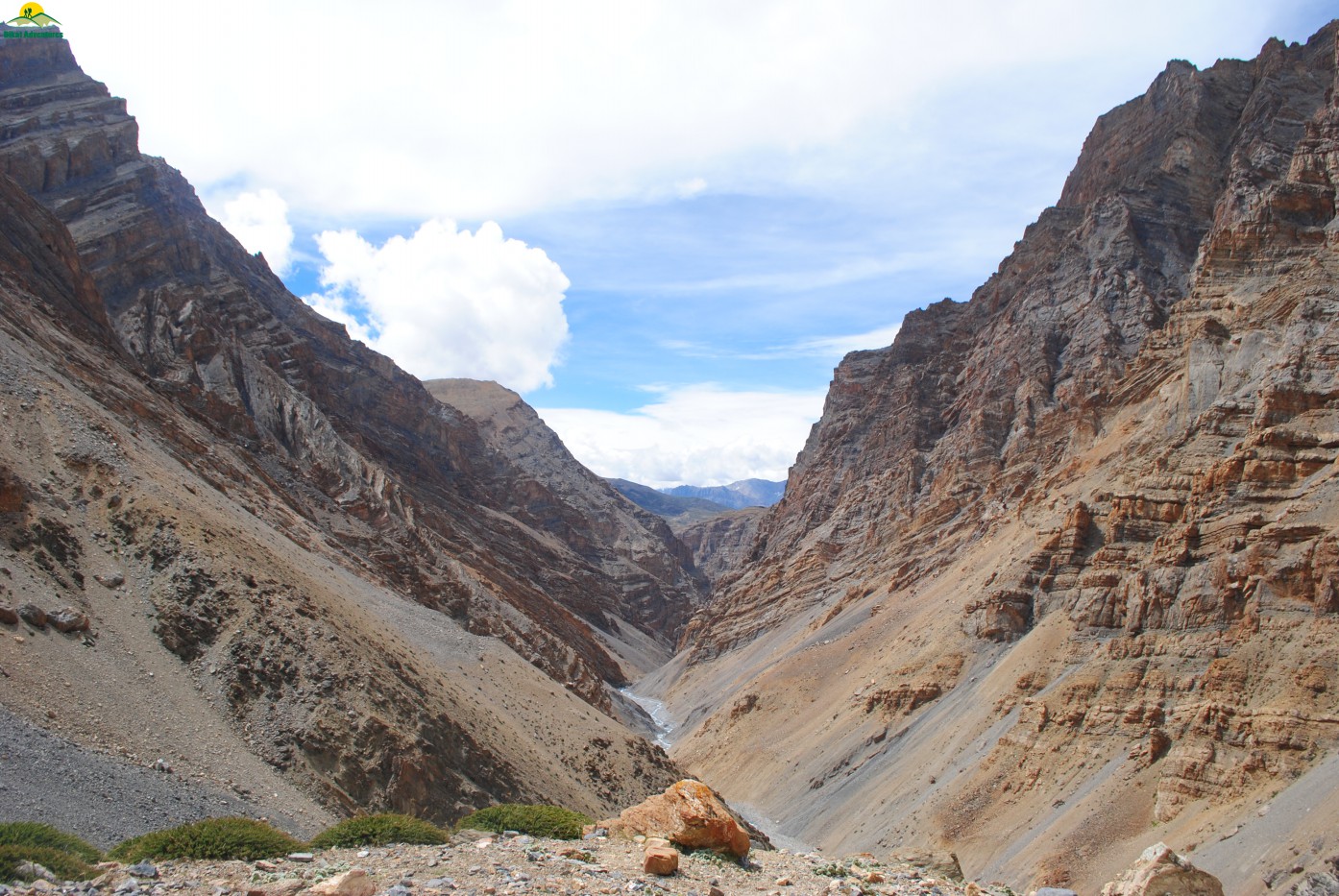
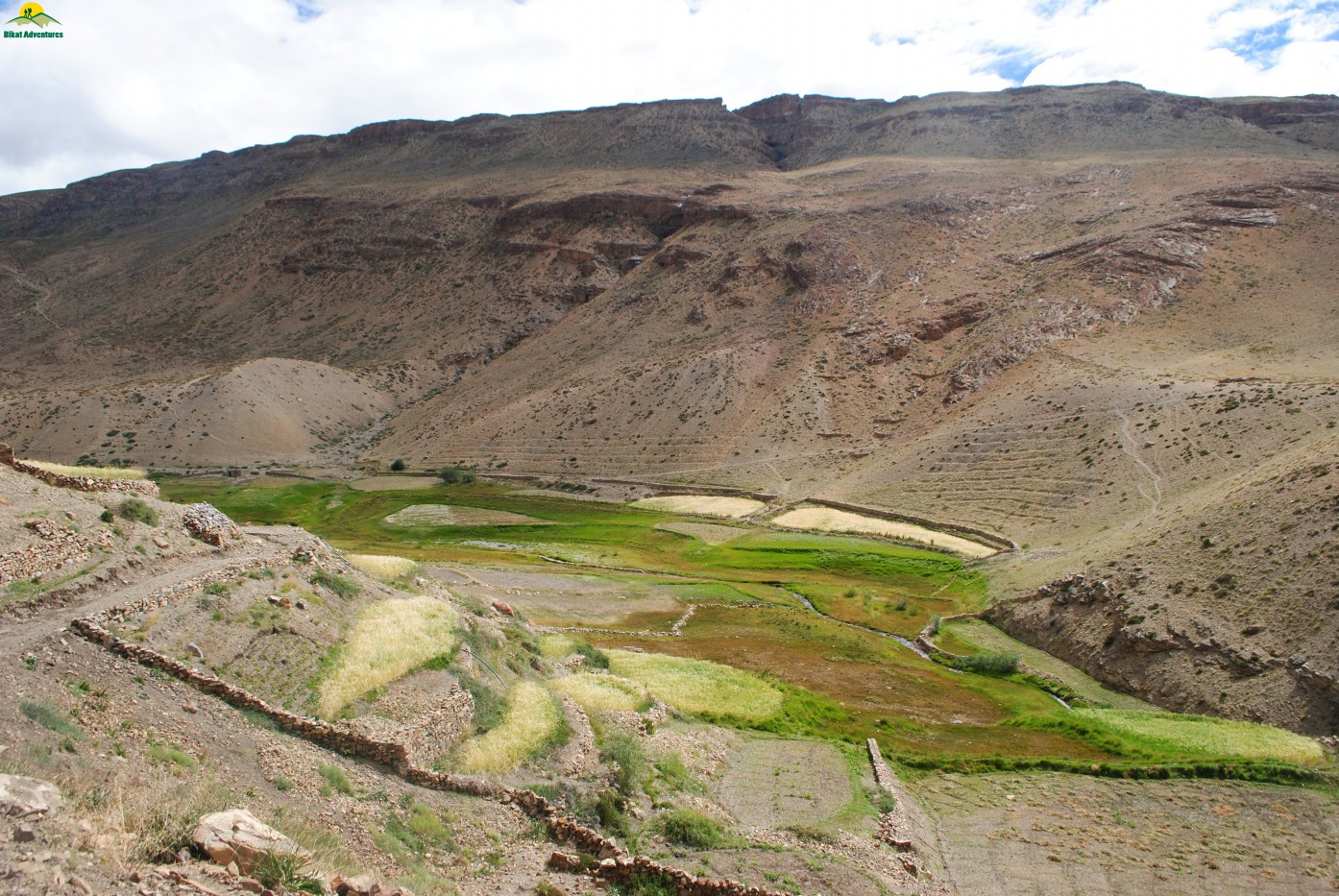
Valley as seen from Jugtha campsite
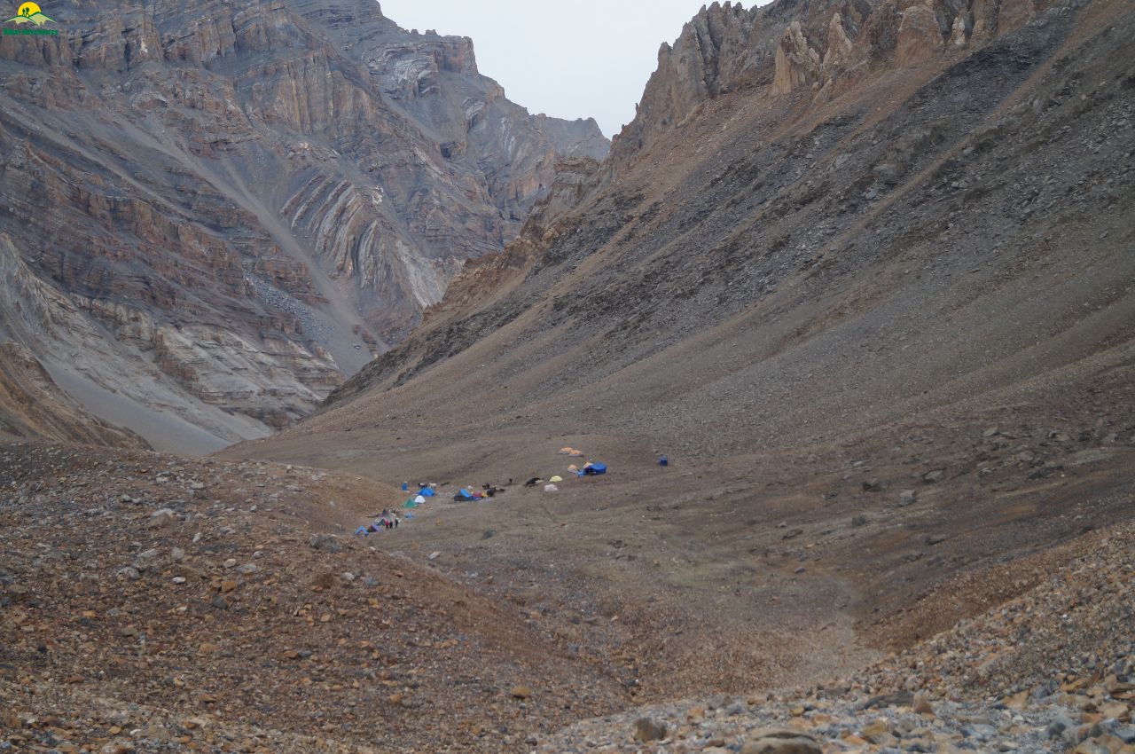
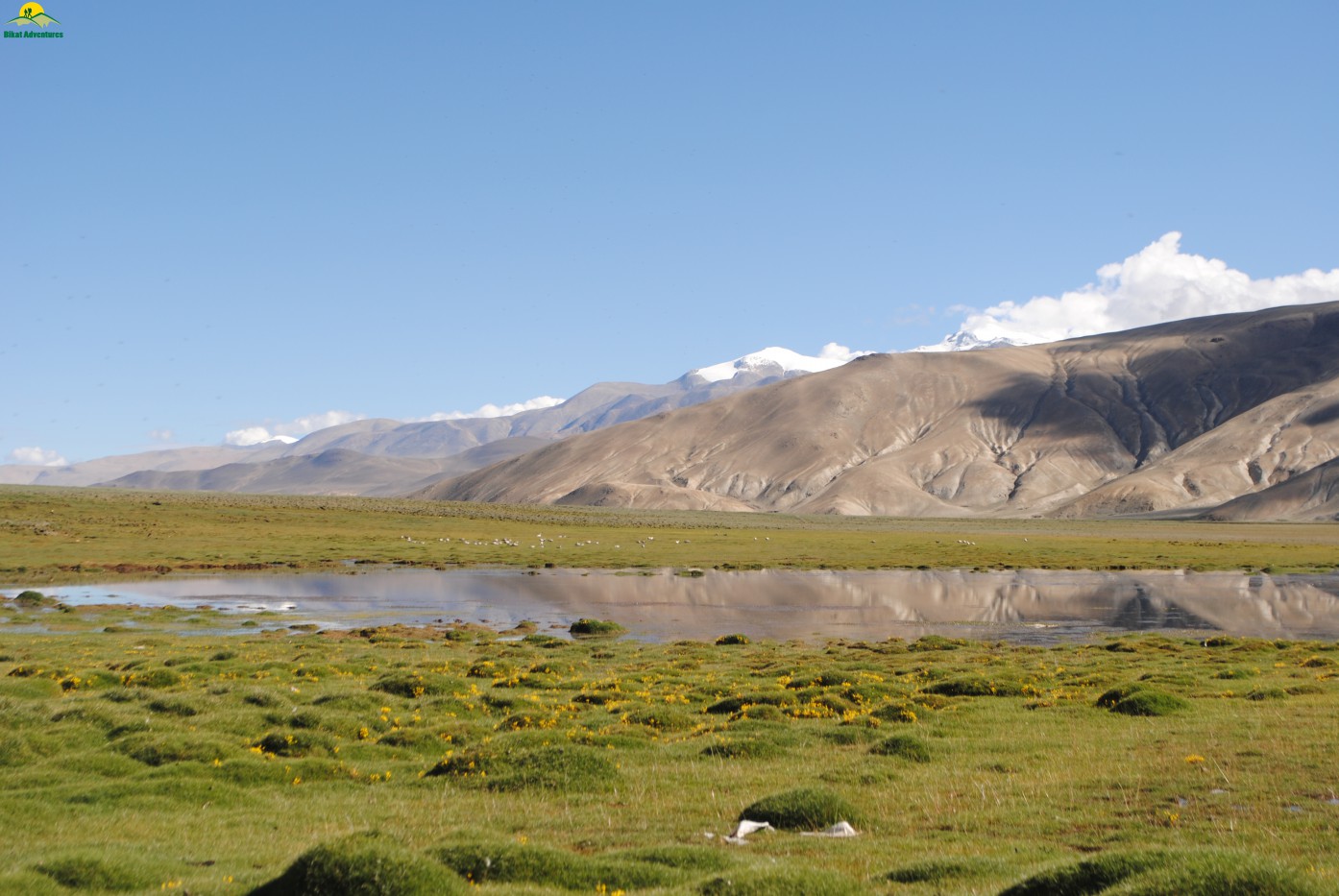
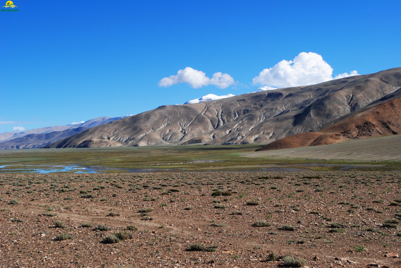
were under the sea for a long time. The best part about trekking in this region is the quality of picture one gets owing to clear blue sky & even an ordinary picture looks like a great work of photography. As we gained height, breaths were becoming shorter & the number of halts increased exponentially. After ascending for almost 07.50 hours on scree, boulders & loose soil covering almost 12 Kms we reached our campsite of the day Borochin(5100 M) at around 03:00 PM.
Trail towards Borochin campsite
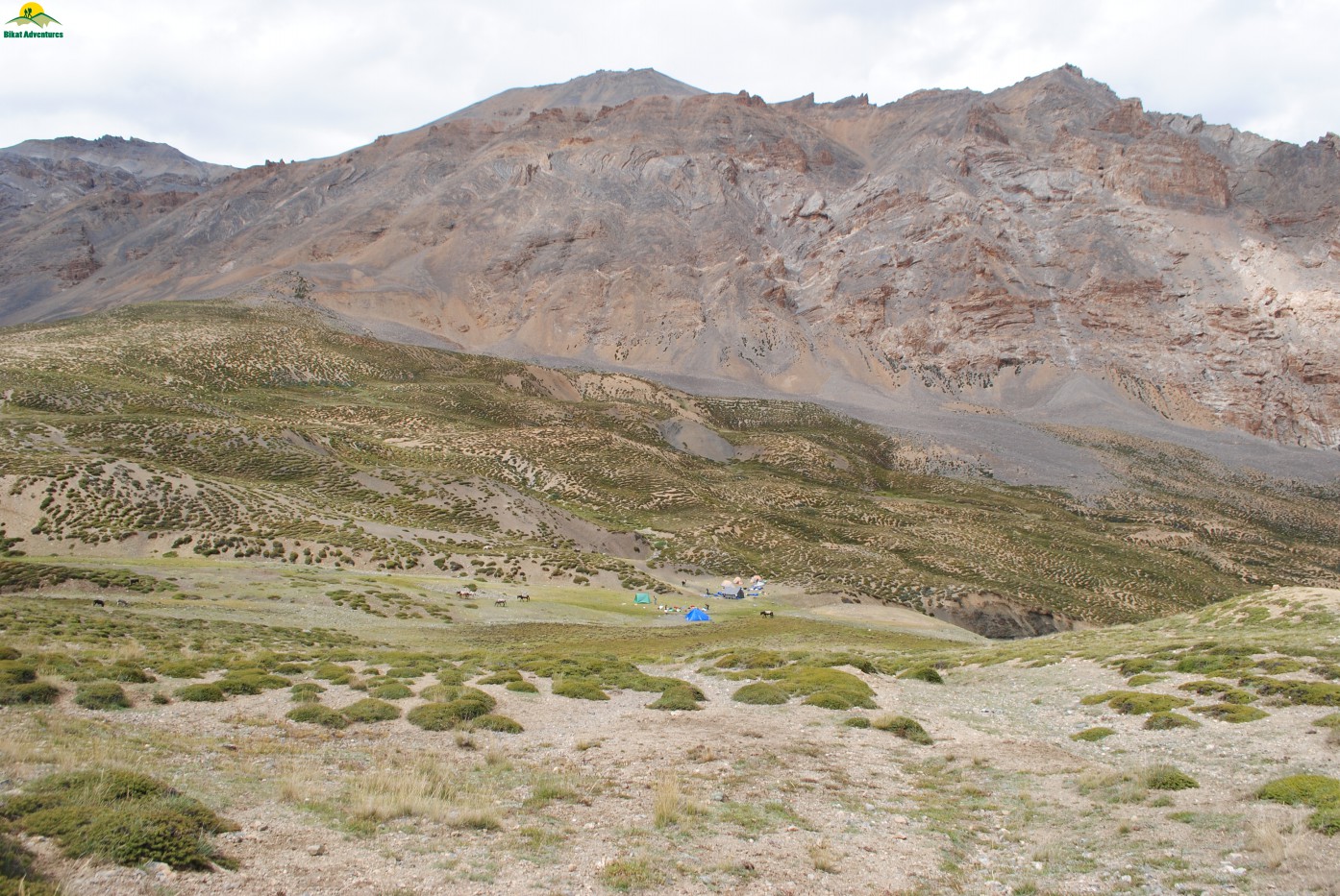
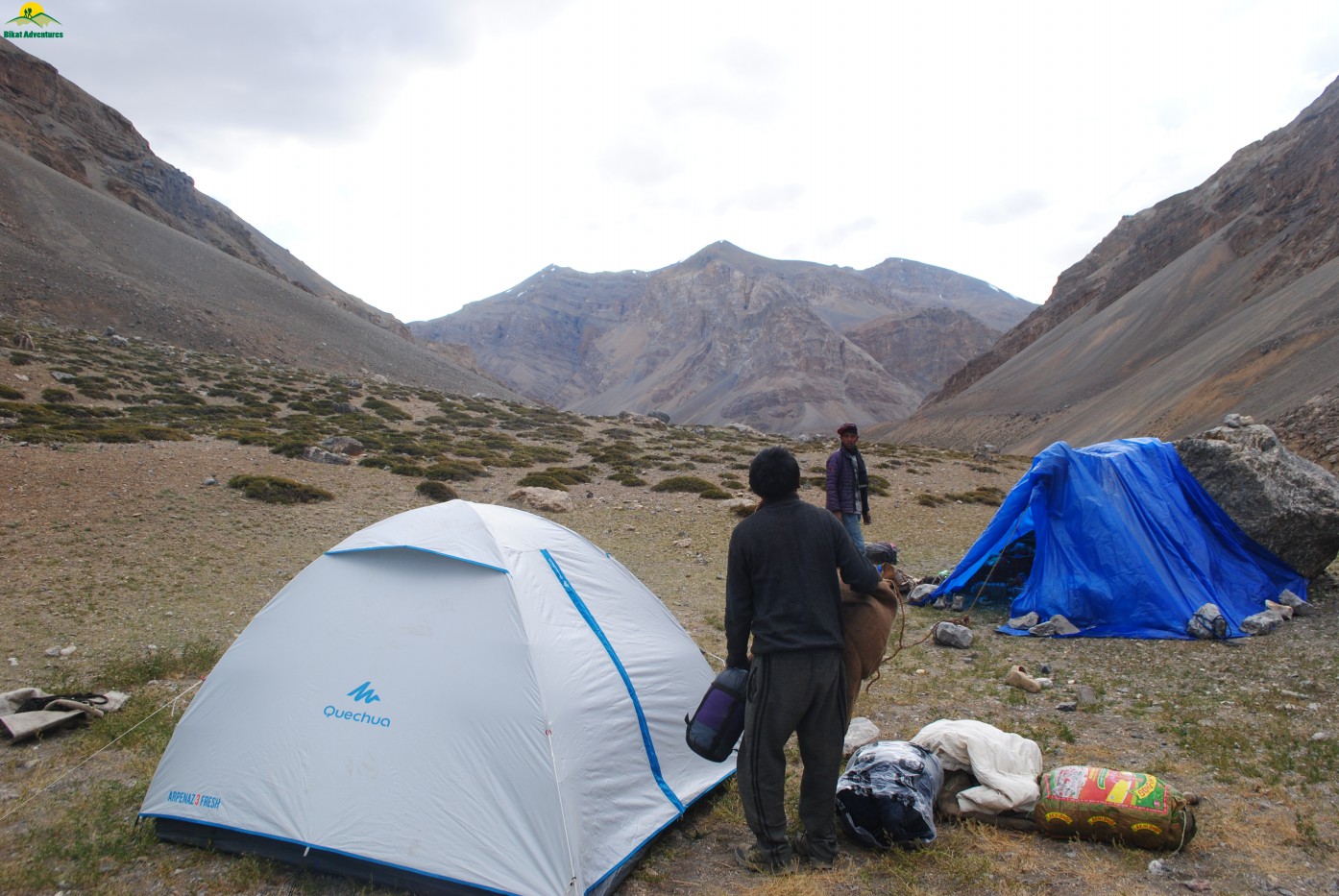
The day was quite long & hard as we climbed almost 857 M in the day. This very small campsite is on a bed of small rocks & scree at the foot of Parang La. The source of fresh water at the campsite is a small stream. After having tea & soup we went for a height gain to a next campsite Thakchu (5300 M).
Borochin campsite seen from Thakchu
The weather deteriorated in the late evening as clouds came down to our camps & there was mix of light snowfall& drizzles. We had our dinner early today & went to sleep by 07:00 PM so that we can start early for the big day ahead. In the middle of night I heard someone vomiting in the next camp only to realize the next morning that it was Pawan who was struggling with his health since day one.
The Pass Day -Borochin to Datang Kongma
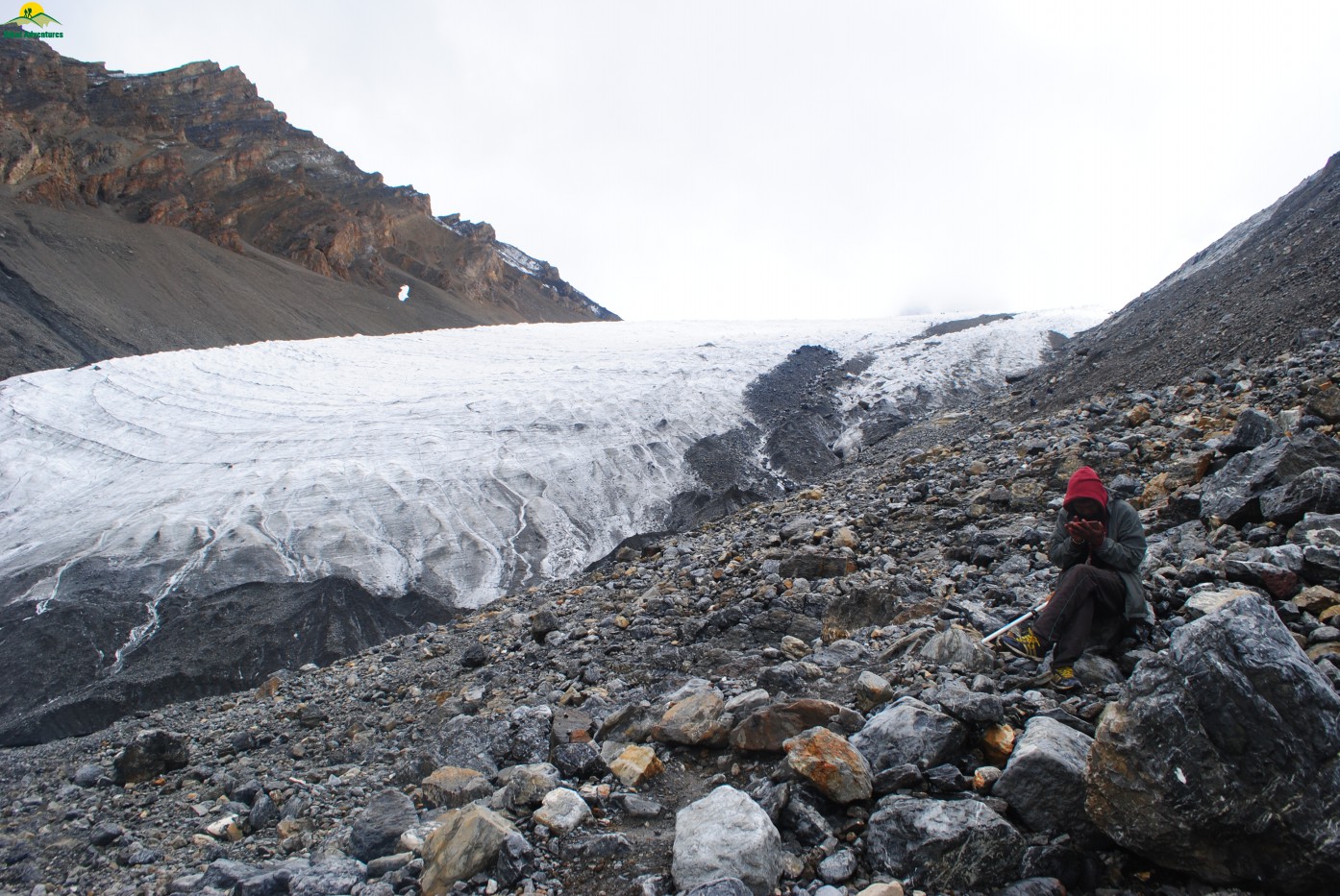
We woke up to a really bad weather with complete cloud cover as it was raining throughout the night. The fog had reduced the visibility to only few meters& the hope of having a clear view of mountain ranges from Parang La top was very bleak unless the weather improves drastically. After having a light breakfast of sweet porridge we started the climb at 06:40 AM towards the pass & crossed the campsite of Thakchu in next hour& half. It is a campsite with small water fall making its way down a rock face with space available for only few tents. By that time the snowfall started & it was wet snow that made things worst as we were slowly crawling towards the pass. The struggle to breathe started & I could see with my eyes wide open the overtaking of our support staff. I was breathing like a dog with my mouth wide open, maybe the effect of my arthritis was taking over as I felt a reduced lung capacity. When we were almost 100 meters from the pass our mules crossed us & the mule man offloaded my backpack as the weather was getting worst with strong icy wind blowing across the pass. We reached the pass (5540 M) at 10:30 AM after almost 4 hours of climb. There was complete white out in the back ground & it was difficult to stand there due to strong wind. We all took group photographs in a hurry & made some videos & started our descent on the other side of the valley.
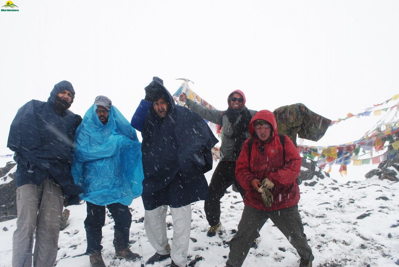
Celebration amid Snow storm at Parang La
I have heard about some great views of the Spiti and the Changthang valleys from the pass along with the view of Parilungi peak but weather has complete whiteout for us in place. We started our descent very carefully with Tenzin (our mule guy) leading from the front. Tenzin has closely worked with Army & ITBP in their expeditions & patrolling work in the region for the past 18 years. The minutest of the geographical details of complete region was on his fingertips as he guided us through Parang La glacier.
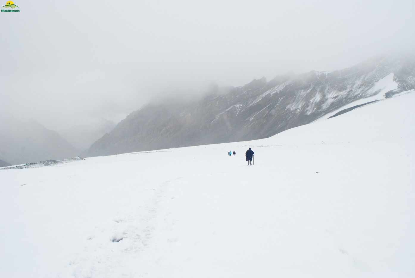
Long walk over Parang La glacier
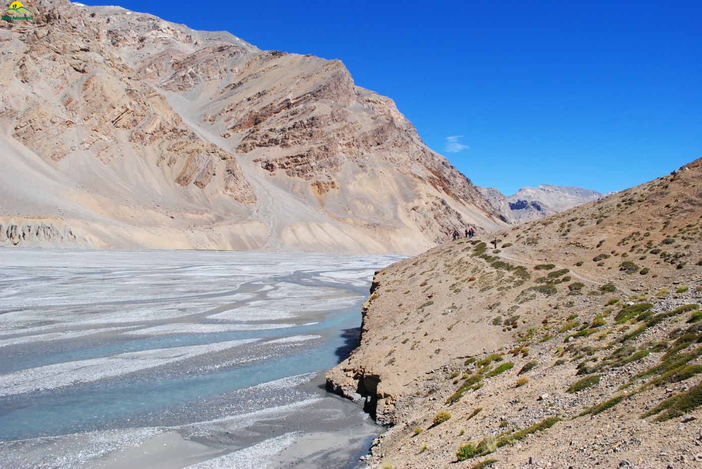
Being late August one can see open crevasses on the route & the sound of gushing water beneath could be heard at places. I & Pawan were quite ahead on the glacier & I could see Jasmin & Jignesh lagging behind by good few hundred meters. We decided to wait for them so that we all can negotiate this glacier together but even after waiting for more than half hour there was no sign of Jignesh & Jasmin. The first thought that crossed my mind was that either of them had fallen into crevasse & I decided to go back& check. Then suddenly appeared Jignesh telling me that Jasmin is attending the call of nature in the middle of crevasse prone glacier & there is no need to worry. This is the second time in 2 days where Jasmin was attending the nature’s call when we are in the middle of something very difficult to negotiate which reminded me of some local saying in Haryanvi “Sikaar ke Waqt Kutiya Hagaayi”. Nevertheless we crossed the glacier after 2 hours of continuous walk & reach the snout of glacier giving rise to Pare Chu River at 12:30 PM.
End of the glacier
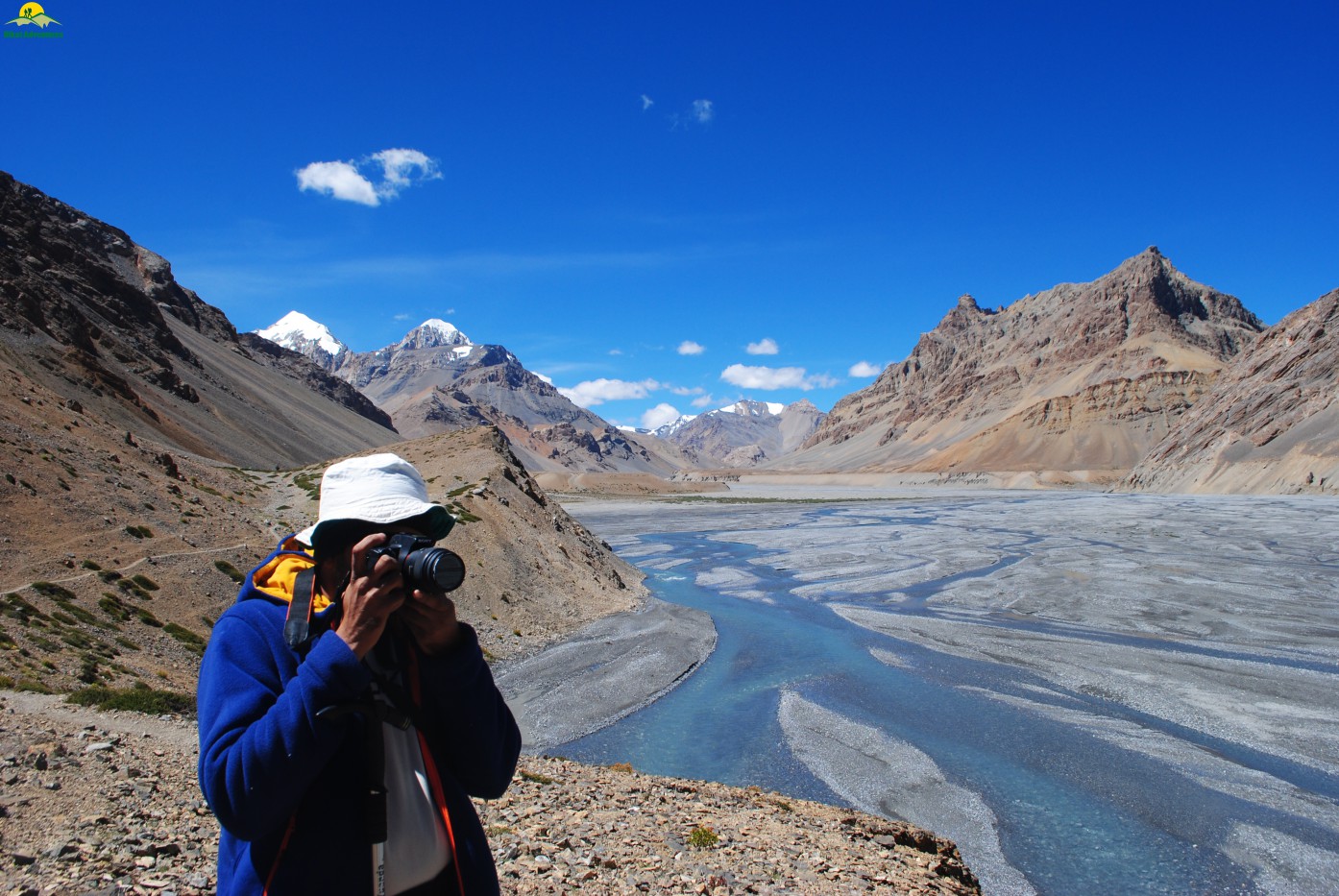
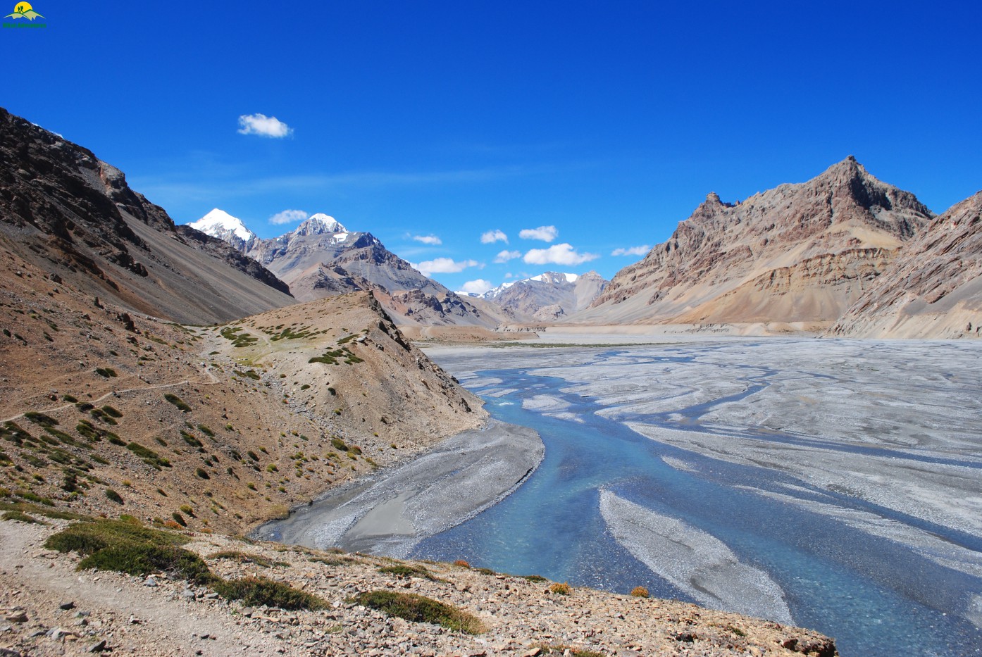
The river flows northeast of Parang la to Norbu Sumdo in southeast Ladakh. Its journey in Ladakh is for about 30km & after that it turns southward towards Chumar and enters Tibetan territory at Lemarle. There are certain streams joining the main one where one can refill bottles for drinking as you are not going to find any stream for next 2-3 hours. We had our lunch of semi cooked Pulao at Lakku camp (around 5040 M) & moved forward negotiating scree & loose rocks & gravel.
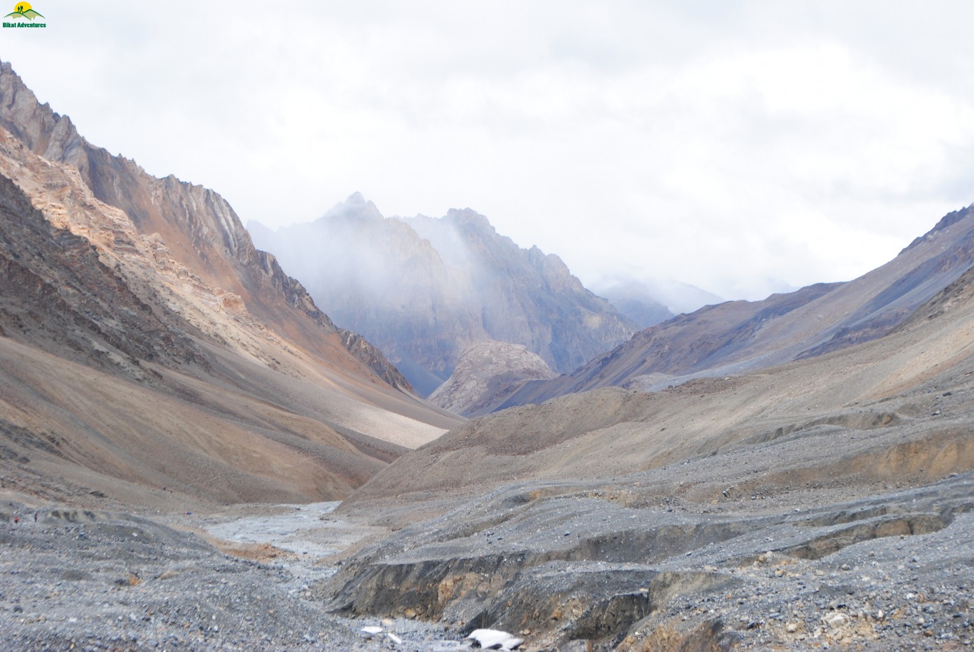
View of the valley after glacier walk
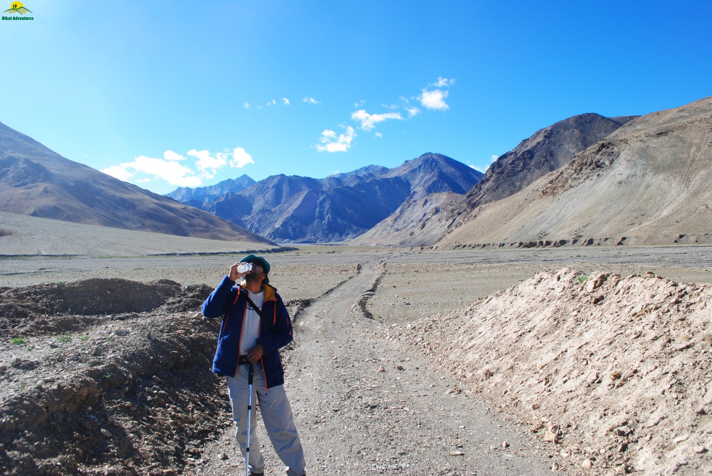
The river bed was on our right side completely dry & devoid of any moisture. The streams were running beneath & one could only hear the sound with visibility as clear up to 2-3 Kms. After walking for almost 4 hours on the vast river bed& crossing numerous streams & some with shoes removed, we reached our campsite Datang Kongma at 05:25 PM.
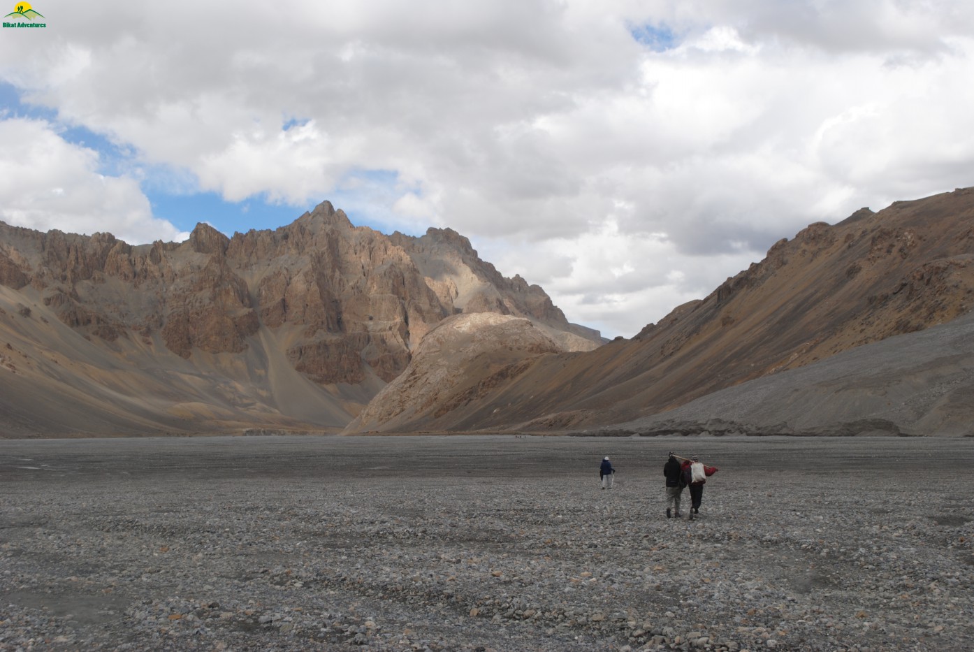
Unending walk on the river bed
It was a long day for all of us as it took us approx 10 hours & 27 minutes from Borochin campsite to this one with the total ascent of 548 M & descent of 771 M covering a distance of 19Kms. I was expecting some kind of discontent among my fellow trekkers due to this overstretching of trekking distance & there came a flier from Jasmin once he reached the campsite. He blasted at me & said “Do you want all of us to get killed? Can’t you imagine the situation Pawan & Jignesh are going through”. I politely nodded & told Tenzin to take some food & a mule to carry Pawan back to the campsite. After about an hour and half, glimpses of Pawan sitting on mule surfaced & everybody relaxed. After having dinner we discussed & decided to finish the trek in 7 days rather than 6 which was planned earlier as it was getting difficult for few among us to bear the long trekking distance on daily basis were average altitude was going to be around 4600 M. Everyone slept good all thanks to the long & tiring day.
Campsite at Datang Kongma
View opposite to our Datang Kongma campsite
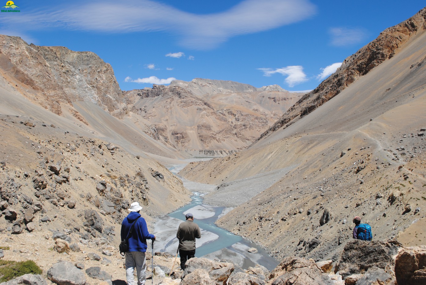
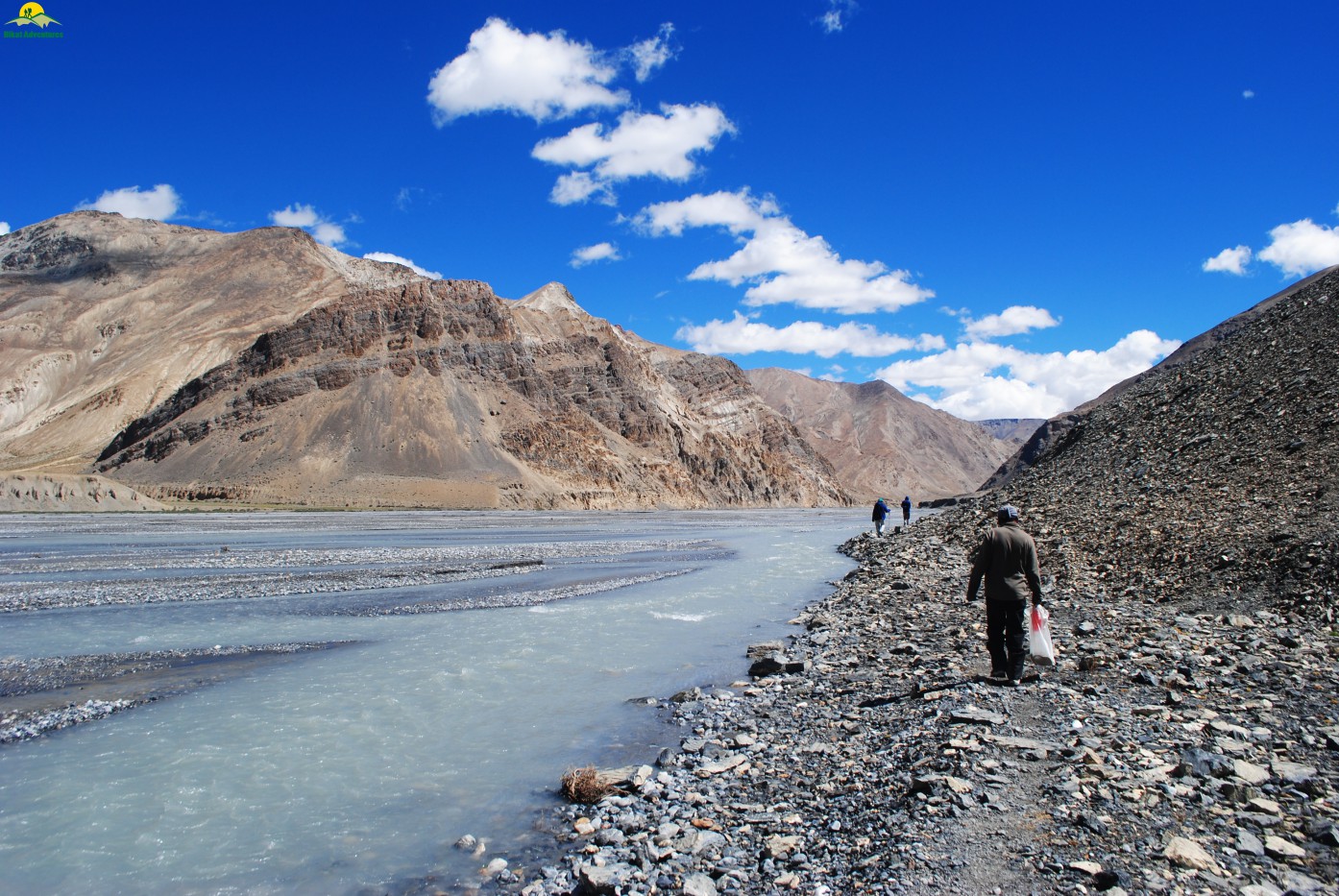
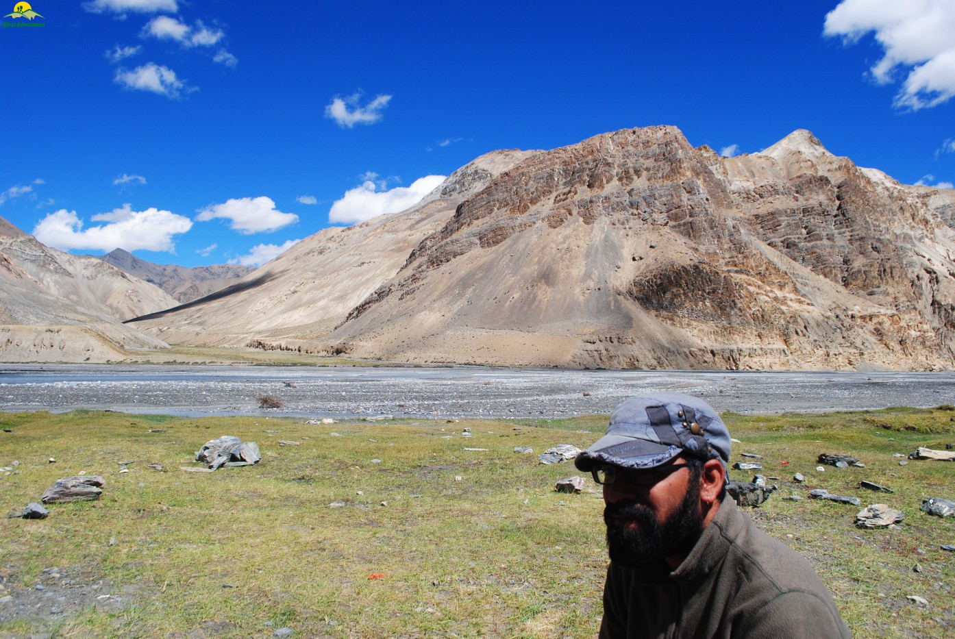
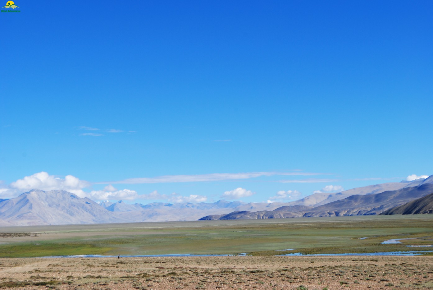
The River bed- Datang Kongma to ShenPausa:
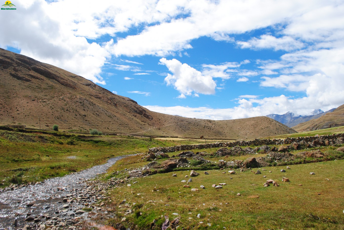
We started the day a bit late by our standards and after having breakfast left the camp at around 08:30 AM & decided to camp wherever we will reach by 03:00-04:00 PM. The tiredness of constantly being above an altitude of 4500 M was visible on everyone’s face& the body language was sluggish as your body never recovers much at such an altitude. During the early trek, La Tsoma Nalla flows along the left side of the Datang Yongma campsite. The entire trekking for the day is on the river bed with channels of stream flowing on your left with occasional climb.
Fellow trekkers from a Bengal club
Jasmine with his magical eye
Pare Chu in the background
Unending walk along the Pare Chu
There is no sign of vegetation except for the local bush/grass called Thama & only motivation is crystal clear blue sky & mountains in all its color. You just have to keep filling your water bottle & walk endlessly as if you walking into eternity. At one point of time I was fed up with the same repeated scenery which was following us for pass 3 days & I started asking myself, why the shit I choose this trek? There is challenge only till day 3 till you cross the pass & after that its only miles & miles of walking. We ended the day early (taking a lesson from the previous day where I was charged with attempt to murder of my fellow team mates) at 04:00 PM with a total walking distance of 16.5 Kms in 7 hours & 30 min.
Channels of streams
The ascent for the day was gradual at 290 M & descent at 396 M but still we were hovering at an altitude of around 4700 M. Today we had our dinner earlier & people in the camp started getting their appetite back. We discussed the plan for next day & it was decided to camp at Norbu Sumdo (gateway to Ladakh) to achieve the target of completing the trek in 7 days.
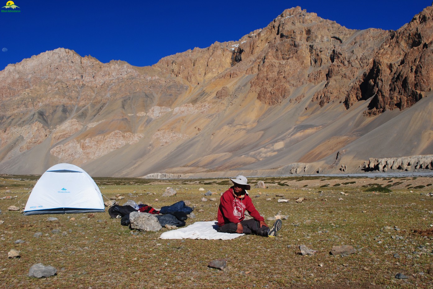
Camping at Shen Pausa
The Pleasant Left Turn- ShenPausa to Norbu Sumdo
We were very excited for the day as we were told by our local guide Namkha that we will be entering Ladakh with major crossing of river Pare Chu before complete change in the landscape & scenery. It was a much needed change as everyone was bored to the fullest with the same pattern of mountains, vegetation & no traces of any animal other than your accompanying mules/ass. After having early breakfast of porridge & corn flakes we started the trek at 07:30 AM & crossed the first campsite Phalum Phada at 09:45 AM. This campsite has some huge rock structure, small shallow caves which act as a natural shelter for the traders in earlier time. This campsite was also used as a transit point for trade between Spiti & Ladakh valley.The next in the line was a major campsite of Rach Lamo situated at an altitude of around 4600 M & we reached there at around 10:20 AM.
Walk towards Racho Lamo
Jasmin & Jignesh (R to L)
After having lunch in the mid way we were heading towards our final challenge of the day – River crossing to take that left turn for our camping destination. We thought of waiting for our support staff so that we all can cross the river together. While waiting at one end of the river with our shoes & trousers removed, we saw a phenomenon which is quite common in this valley & the reason for all erosion/degradation of rock faces & features – The Dust Storm. It was quite strong & we all had to duck down to let it pass.
Pawan ready for a pose
Namkha our local guide checked at different points in river from where we could cross it safely & we finally got one cross section where the current was bearable. We all negotiated the river current by making a human chain followed by our support staff. This was the last time we were interacting with the river as we were leaving it to its course towards Tibet & after taking a left turn things changed dramatically. For the first time in 6 days we were treated with lush green meadows,small yellow flowers & few streams of water. Welcome to Norbu Sumdo, the gateway to Ladakh.
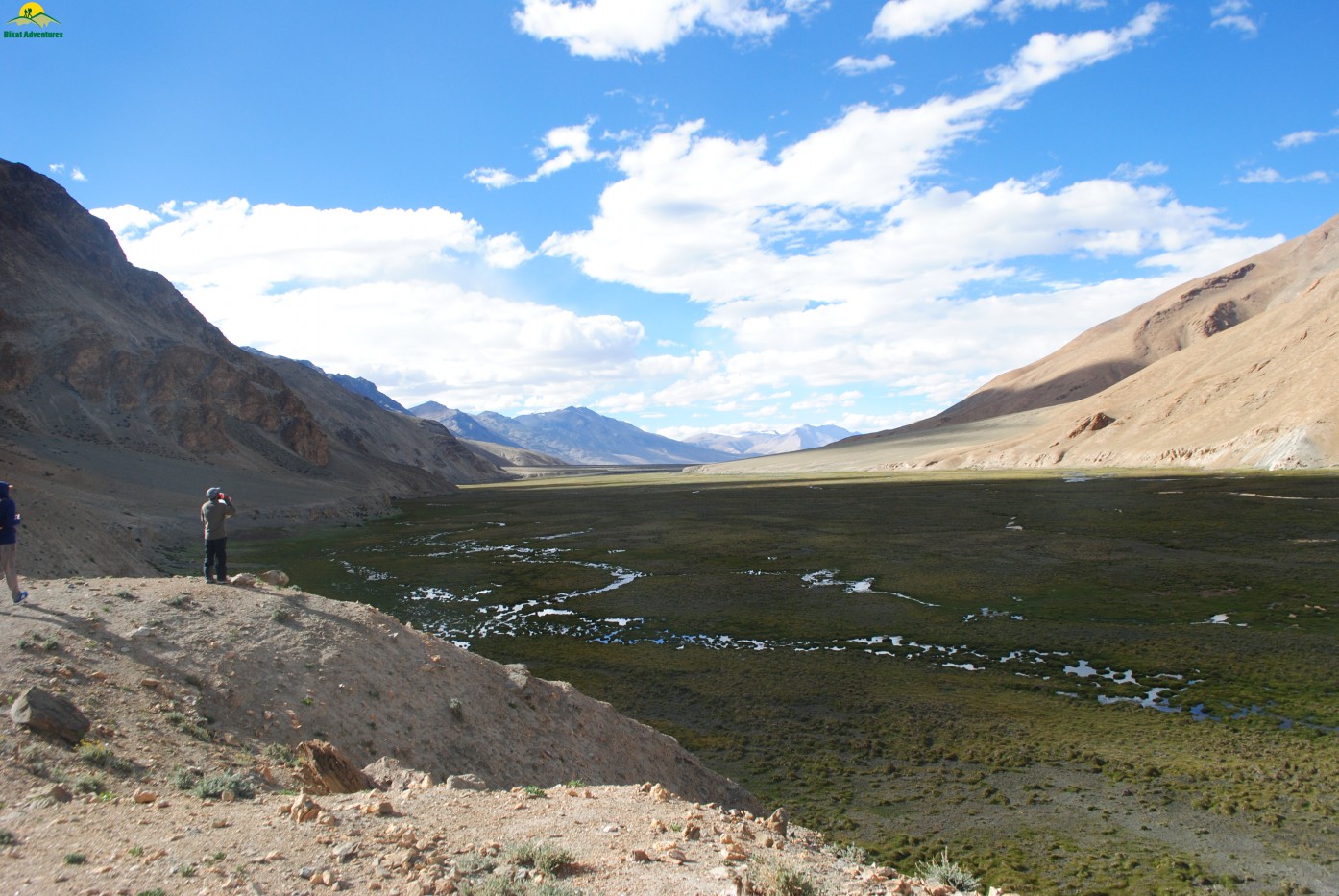
Norbu Sumdo- Gateway to Ladakh
Today we covered a total distance of 21.5 Kms & it took us 9 hours & 8 mins. The descent at 302 M was more prominent than ascent 193 M.This campsite has a elevation of around 4585M &gives a far off view of things to come up on next 2 days & one can identify the final destination Karzok by a distant mountain feature/spur. This campsite was full of life with quick appearances of mammals like Kiang (wild ass), a black wolf & marmot. To make the matter more pleasant the menu in the dinner was egg curry & aloo matar & we all had the best of meals in last 6 days. The excitement to see Tso Moriri &completing the trek was slowly creeping in &it’s thought took me to sleep.
Campsite at Norbu Sumdo
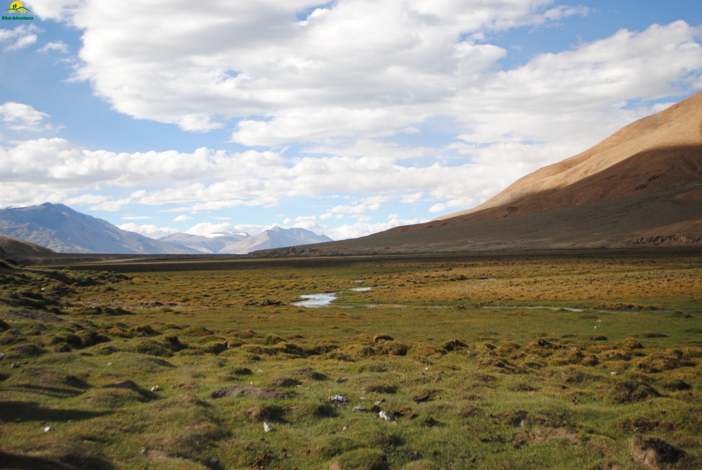
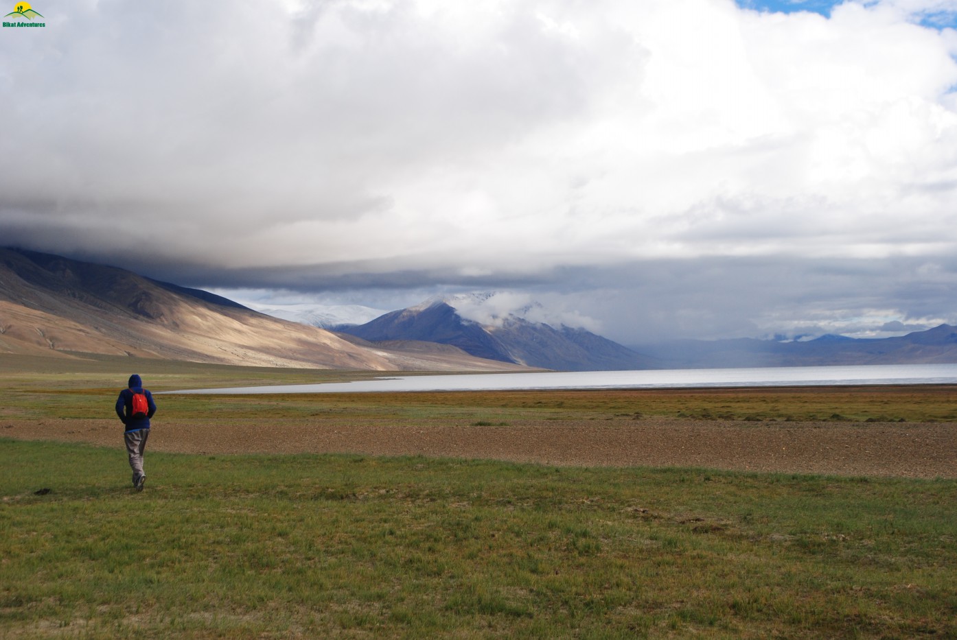
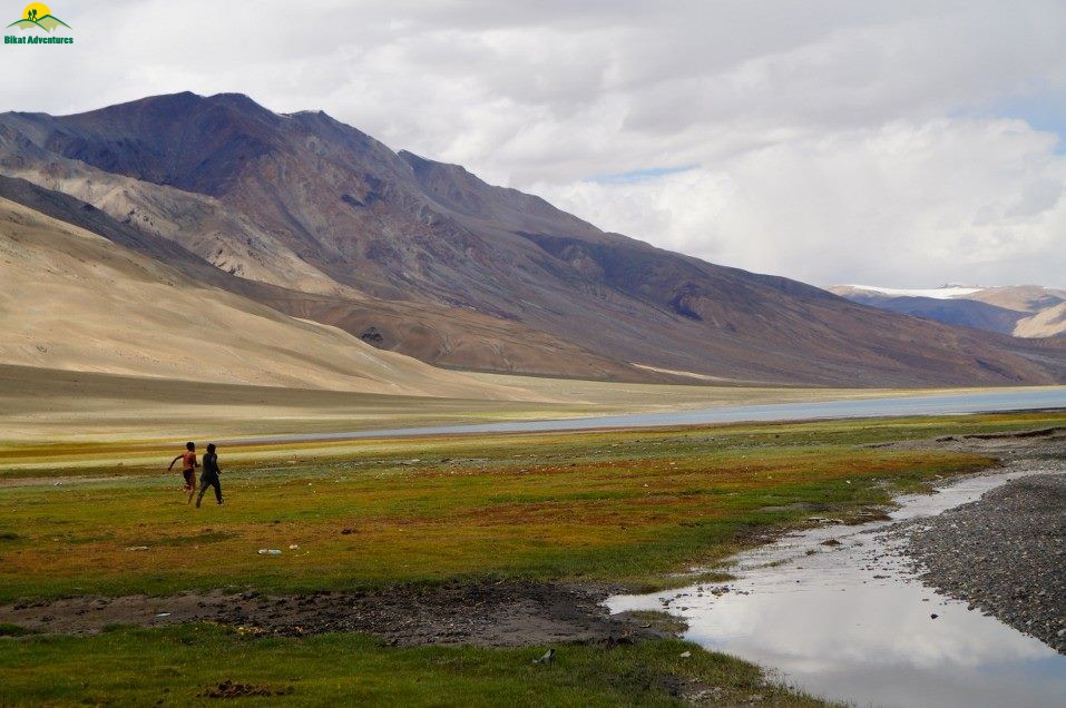
The Glimpses of Blue Beauty- Norbu Sumdo to Kiangdom:
Again the harsh barrenness of the valley, for which Spiti & Ladakh are known for, took over & the distance for the day was marked on dusty trail with no signs of rejoice.One can see Mentok peaks in the background which is approachable from Karzok village. The trail looked like someone has used it for off-roading by bringing in their 4W drive vehicle & the guide told us that there is a plan for a road from Karzok till Norbu Sumdo. The dark shades of barren mountains looked like some molten lava has recently solidified to bring in that shine.After starting the day at 07:30 AM we reached our campsite at Kiangdom by 12:45 PM covering a distance of 14.5 Kms with almost little descent of 76 M. The arrival of the campsite was marked by sudden change in the color pattern from dusty brown to green with glimpses of blue shades of Tso Moriri. Today we had a plenty of time & I decided to take a bath in one of the streams. Few among us decided to go for a bath in Tso Moriri but they failed badly as the approach to the lake was marked by only ankle deep water. They somehow made the customary ritual of bathing by splashing some water on their body and came back to take bath in one of the streams which ends up in the lake. The celebration of arrival to the gateway of lake was marked by mashed potatoes momos & trademark red chili sauce in the dinner. We all sat together till late in the night as it was going to be our last camping day & everyone was relieved that we all completed the trek with any major problem. Everyone including me was skeptical about the completion of the trek as altitude & long distance was going to be a major hurdle & the way all teammates were on Diamox forced me to believe that it is not going to be a cake walk. I was very happy the way everyone pushed oneself to their limit & slept really well for the next & final day.
Norbu Sumdo at its best
Trail enroute to Kiangdom
Ever shining mountains of Ladakh
First glimpse of approaching kiangdom
Kiangdom Campsite
Getting ready for a dip Tso Moriri
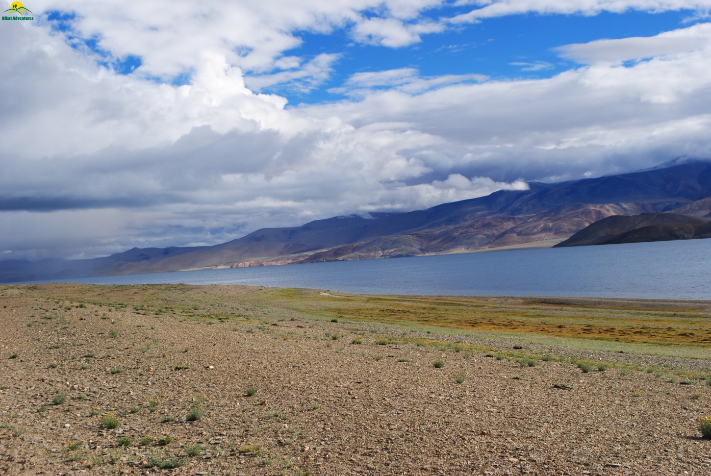
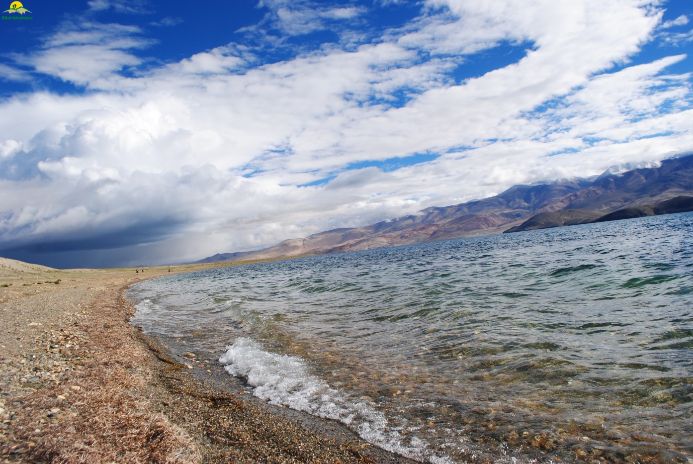
Tribute to Bikat Bike Trip 2010- Kiangdom to Karzok
This day was going to be the day dedicated to Bikat as we were to trek almost the entire day along the Tso Moriri Lake. I would like to take you back to 2010 when Bikat Adventures in its nascent stage planned for self supported motorcycle trip to Ladakh with Tso Moriri on its visit list rather than Pangong Lake. I was a part of team & all because of my road accident on that trip where I toppled my bike with 60 liters of petrol, we cancelled the plan to visit lake. None of the Bikat members (Girish, Deshwal, Ritvij, Gujjar & Jadu) since then got any chance to visit Tso Moriri & I was first among them to got this chance again. I dedicated my today’s trail to them with few videos & loads of photography from every possible angle (though I don’t know much about angles & photography: P). Today’s walk gave all the views of the lake with every possible color. My words can never do justice to the view which one encounters. I will leave that to a few pictures that attempt to capture a small fraction of the beauty what was there. The final few hundred meters was a steep climb to Karzok village where we were greeted by the picturesque view of the village with old monastery in between. Today we covered a distance of 21.5 Kms in 8 hours & 22 min. The ascent for the day was 226 M & descent was marked at 179 M. This village is a paradise for bikers as there are some good camps specially catering to their needs. You can easily find the mix of local (Indian), foreign tourist coming here mainly for some serious climb (Mentok Kangri peaks) or visit to monastery & lake. We checked into a descent hotel for the night & see off our staff the same day for their return journey to Chicham. The return journey takes them 3 days from Karzok & that’s why they charge you for that 3 extra days. Karzok is a strict dry village with no permission for alcohol in any form so one has to wait till Leh to celebrate the completion of the trek. We left for Leh the early next morning as the road distance is around 220 Kms & it takes almost 5-6 hours to reach Leh.
Trail along Tso Moriri
Shore of Tso Moriri
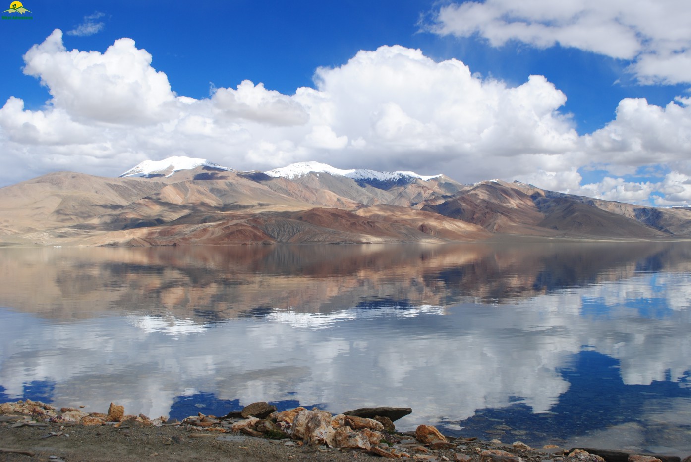
Reflection of the clouds
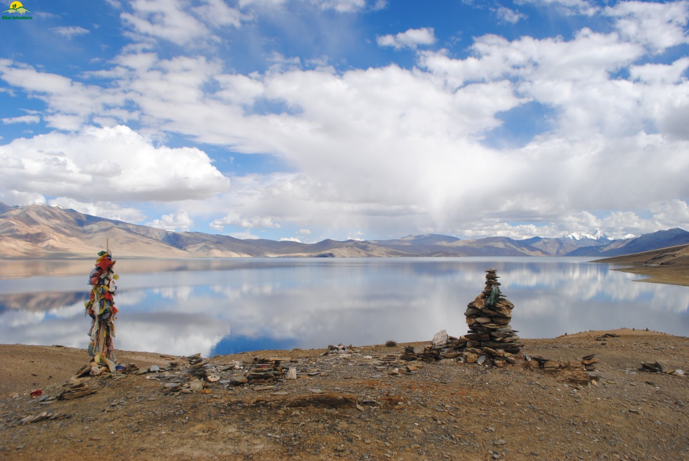
Final click of the lake
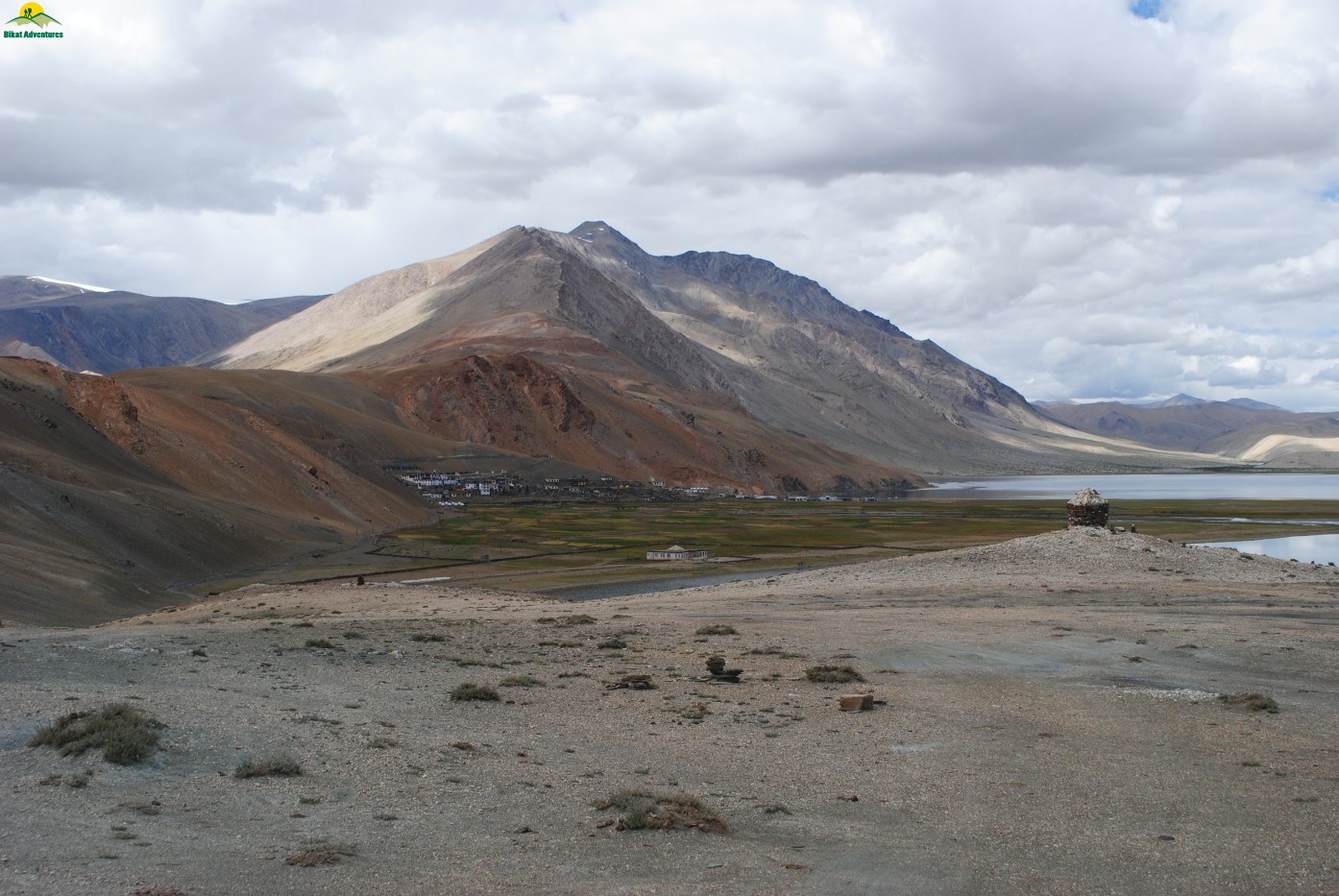
Approaching Korzok in the background
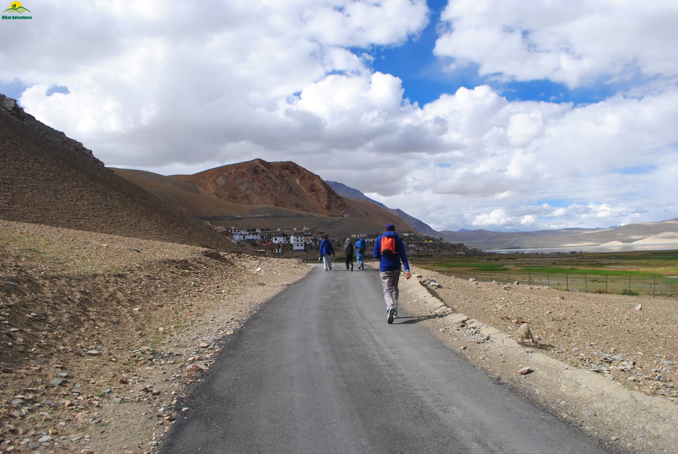
Last few steps
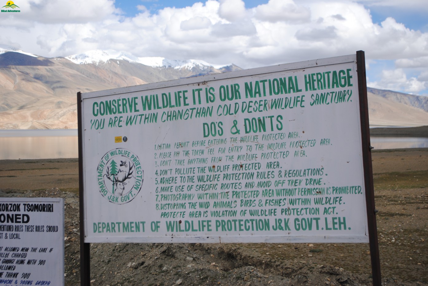
Signboard at the entry of Korzok village
Final Words
"I dedicate this trip to Gathiya, Sev& few Gujrati sweets which brought the best in Jasmin & Jignesh and pushed my friends to the top of their limits & saved them from sure shot hunger death"


")


