Let's talk magic; let's talk Dzo Jongo. Located in the heart of Markha Valley, Ladakh, Dzo Jongo (West) at a daunting altitude of 6,260M, takes you through the dry, desolate expanse of land that is Markha Valley. The mountain has two main summits. It is a trekkable peak from its East face and a technical peak from its West face – which is to say it’s got something for everybody! While the East face is frequented for its relatively simpler ascent, the West face is the ‘true’ summit of the peak and we decided to give it a shot! We made our first successful ascent up its technical West face and we have much to say about its beauty!
The stillness of the mountain along with its smooth, long-drawn icy slopes with sections of 80° ice walls make Dzo Jongo a mix of calming and challenging. While it's brutal at times with its tough gradients and chilly high-altitude winds, it's also breathtakingly beautiful. A look up to the skies at the crack of dawn when on your way to the summit, is to experience real magic and to witness the mountain in all its glory!
This marvelous peak has been overshadowed by its much popular neighbours, (6,400M) and Kang Yatse II (6,250M) for much too long. With the mystery of its existence, the story of the two summits and its magical terrain, Dzo Jongo has an intriguing personality of its own and deserves all the limelight it can get.
We are thrilled to take you through this gallery of true beauty that was put on an exhibit by this urban legend of a peak that is Dzo Jongo (West).
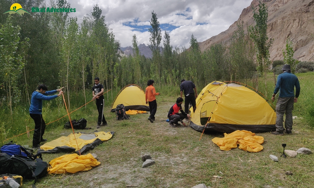
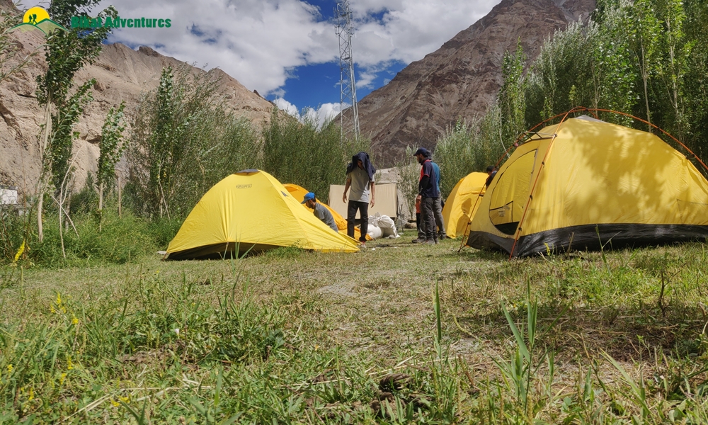
Drive up to Skiu:
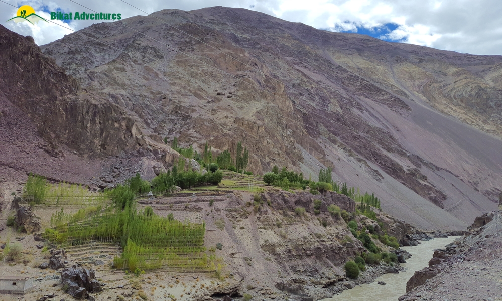
An ascent up this enchanting peak calls for crossing the rugged land of Markha Valley which is quintessential of the peculiar landscape of Ladakh. The drive from Leh to Skiu goes through a flat and desolate plain alongside river Indus until we reach its confluence with the distinctly coloured Zanskar River. In this short drive, we witness barren mountains of all shapes, forms and textures – slabs of rock neatly stacked one on top of the other, chunks of rock resting on each other haphazardly, sheets of rock hard-pressed into each other, loose rocks, mountains made of mud, and much more. The entire set up looks like an experimental playfield of forms for the creator where He dumped all the discarded versions of His clay models.
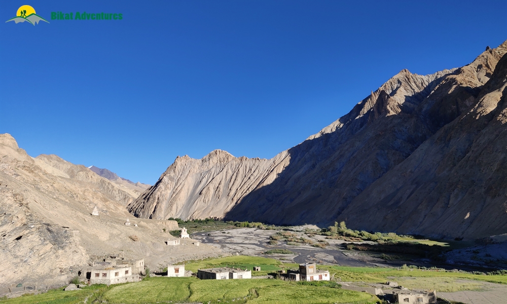
After coming through some of the driest areas you will witness, the campsite of Skiu is amongst the many scattered and tiny hamlets spread out in the area turning browns into greens for all the fields of the locals. The freshness of vegetation is a sight for sore eyes in this otherwise galactic, mud land!
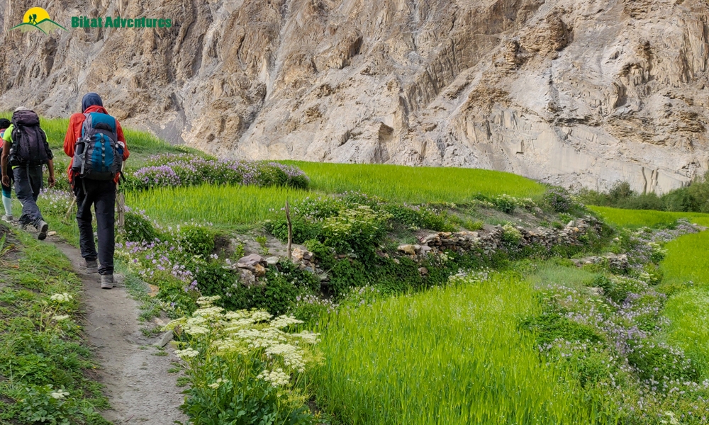
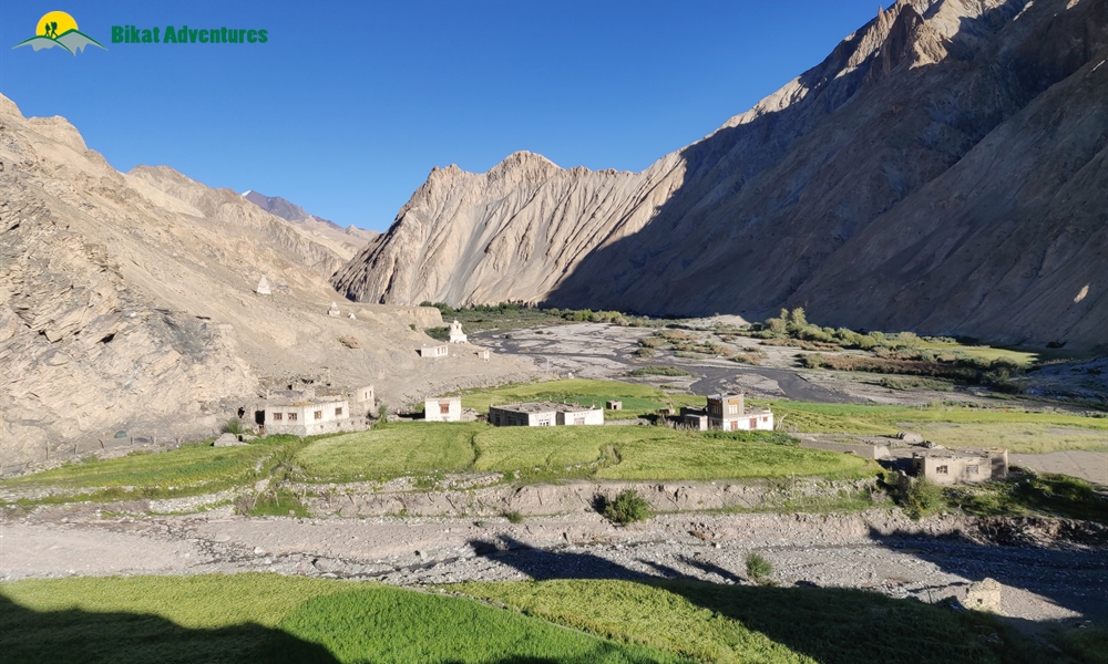
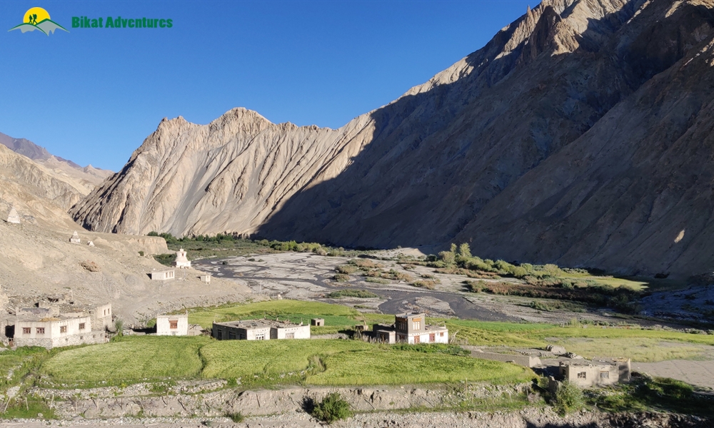
Skiu to Markha Village:
The first thing you notice on entering Ladakh is that it is extremely dry making your throat all scratchy and your face burnt from the unobstructed heat that the land receives all day under the harsh sun. Marka valley is a long extension of this parched feeling. Imagine walking in the harsh sun on wide, open lands with no respite from the heat in the form of shades from a tree, surrounded by mountains that look like they could come crumbling down at any point; they just aren’t doing it out of the goodness of their hearts! This is Markha valley trek – a civilization of mud, heat and insurmountable beauty of a peculiar kind.
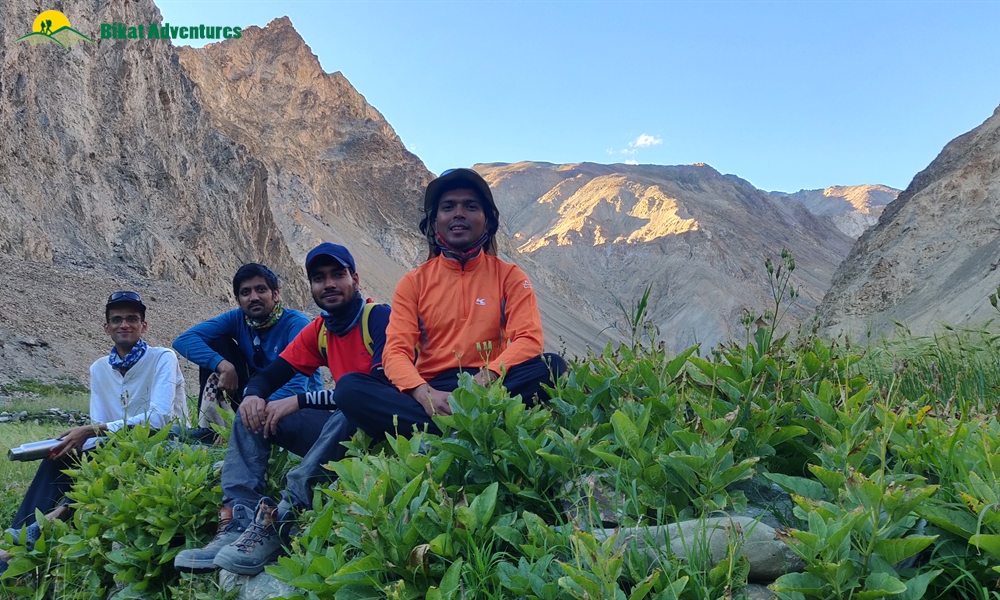
The trek from Skiu to Markha is an assortment of pointed rocky peaks, poplar trees, and muddy trails. The constancy of the landscape make the trek seem like a picture through which we walk for 5 days to get to the camp of Dzo Jongo (West) – quiet and still with no sign of human life around. The river shining silver in the bright, harsh sun is the only thing that mimics movement in this otherwise static landscape – snaking through the bed of the valley in gushing streams. The trail is mostly dirt roads and the rocky sea bed.
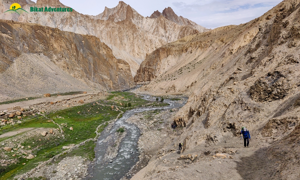
Markha Village to Lower Hunkar:
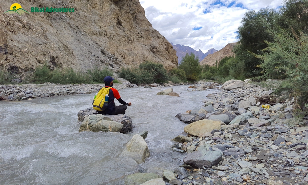
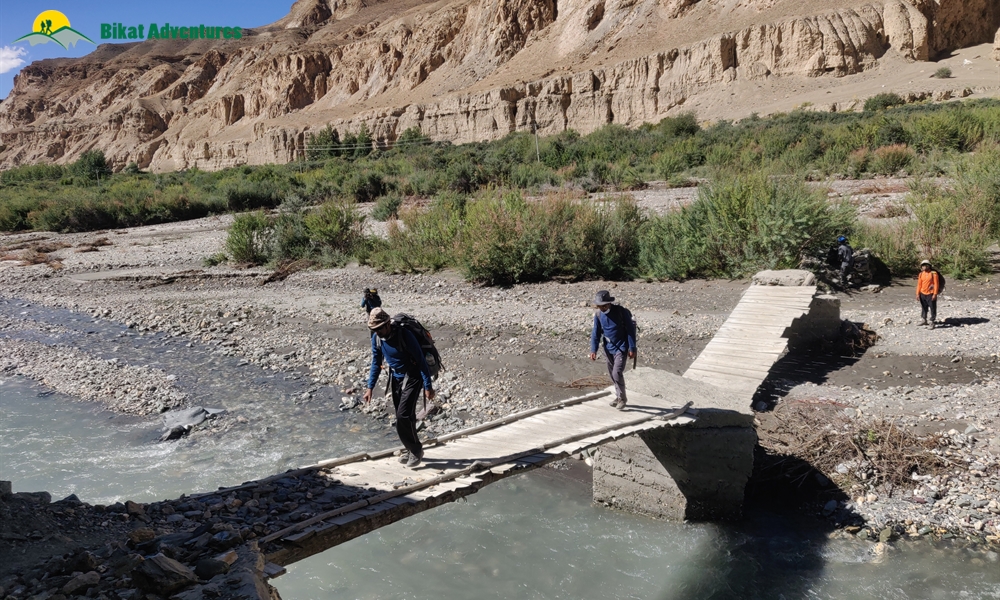
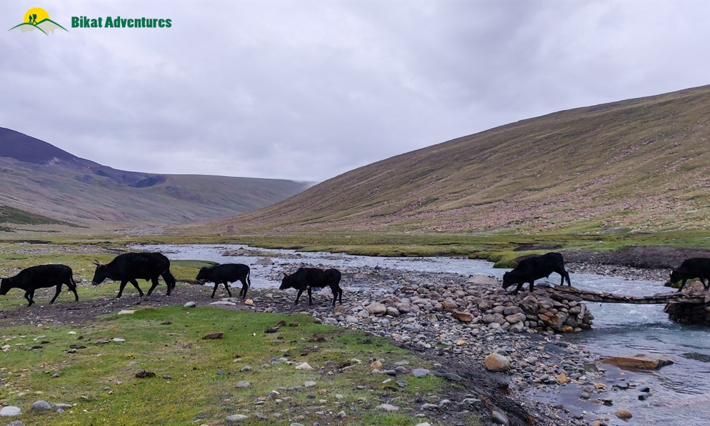
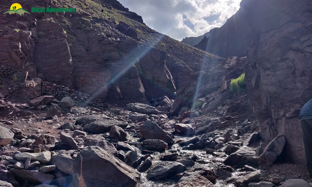
The thing about going through Markha Valley is that we may or may not have to cross a lot of water bodies along the way. The water levels here are extremely unpredictable. Depending on the level of the water, you will either find yourself wading through waist deep current or cross the stream in a hop, skip and jump.
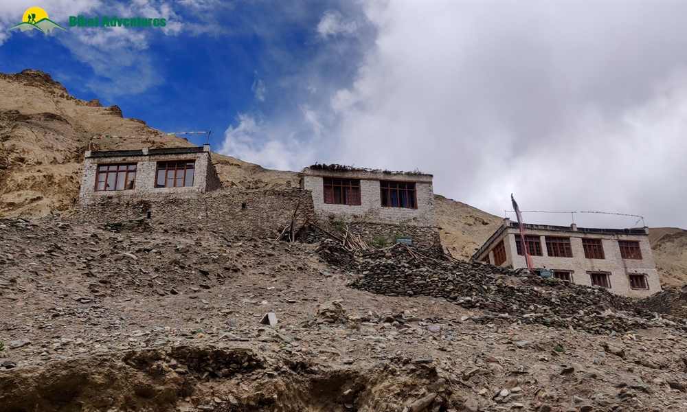
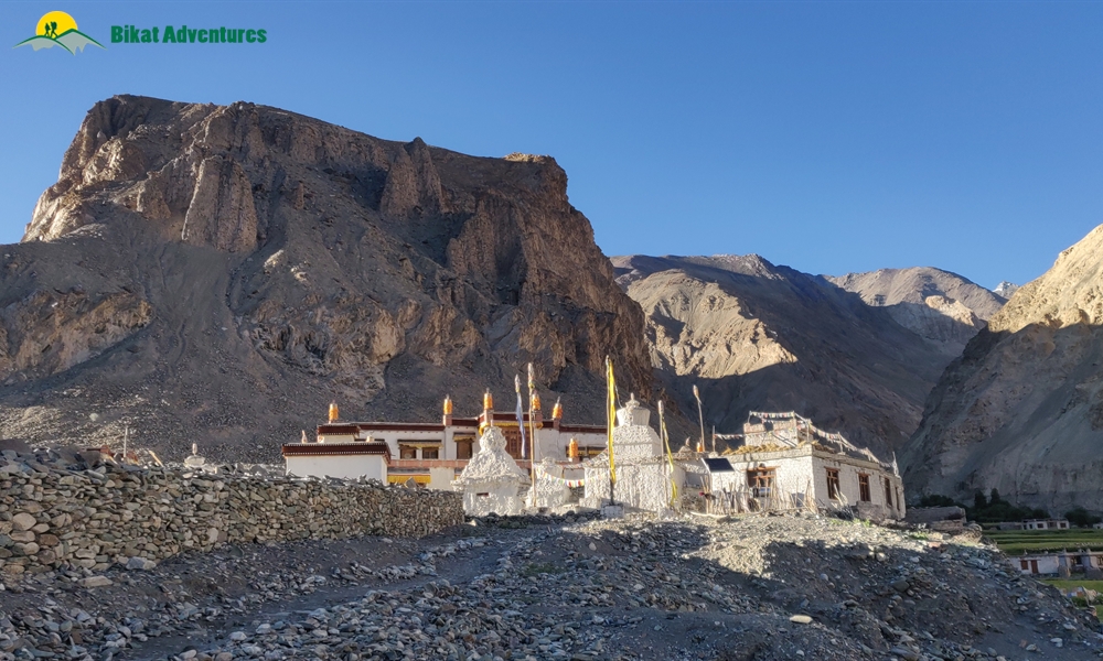
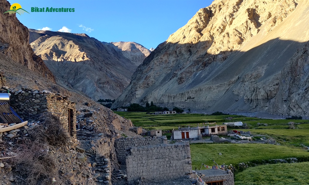
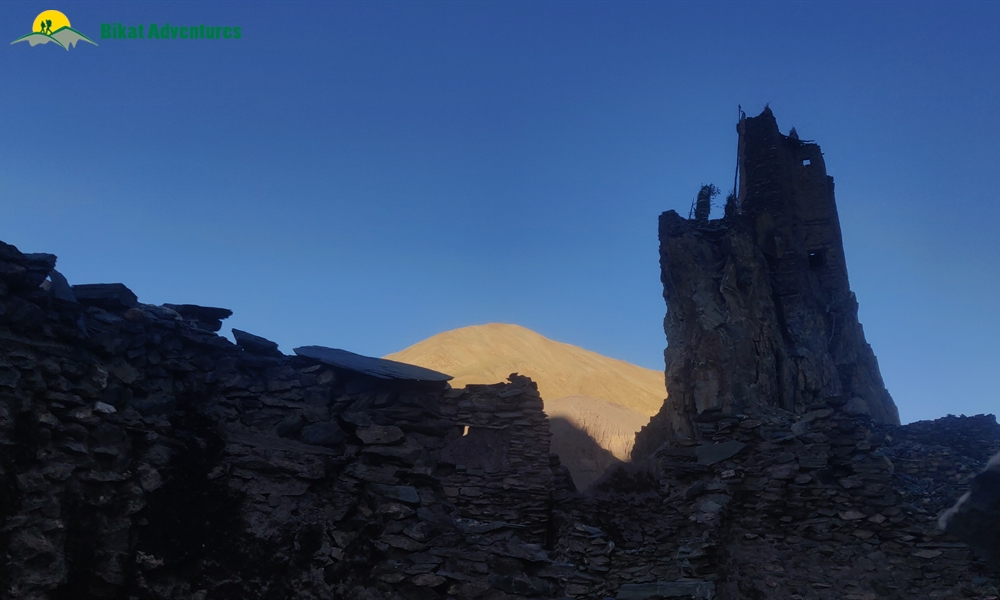
The route is literally a walk through interesting and abandoned structures such as monasteries and forts. One of these is Tacha Gompa – a monastery high up on a steep incline, precariously standing dressed in mud on top of a muddy mountain. Lower Hunkar, which is one of our campsites, is a clearing where large bushes end and the landscape opens up to views of mountains disappearing into each other. While the trail misses an uneven terrain which can get monotonous at times, constantly dipping your feet in icy water has a way of jolting you back to attention.
The campsite at Lower Hunkar is in the middle of wheat fields with the houses of faraway villages standing guard around the tents, in the background.
Lower Hunkar to Nimaling:
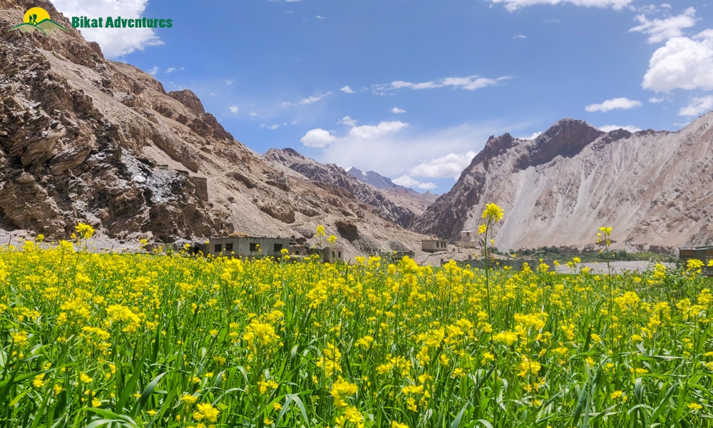
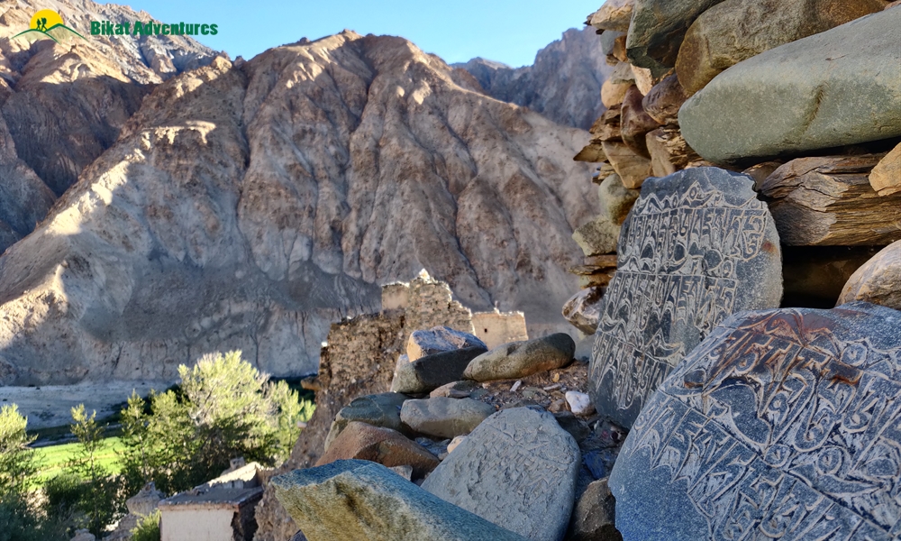
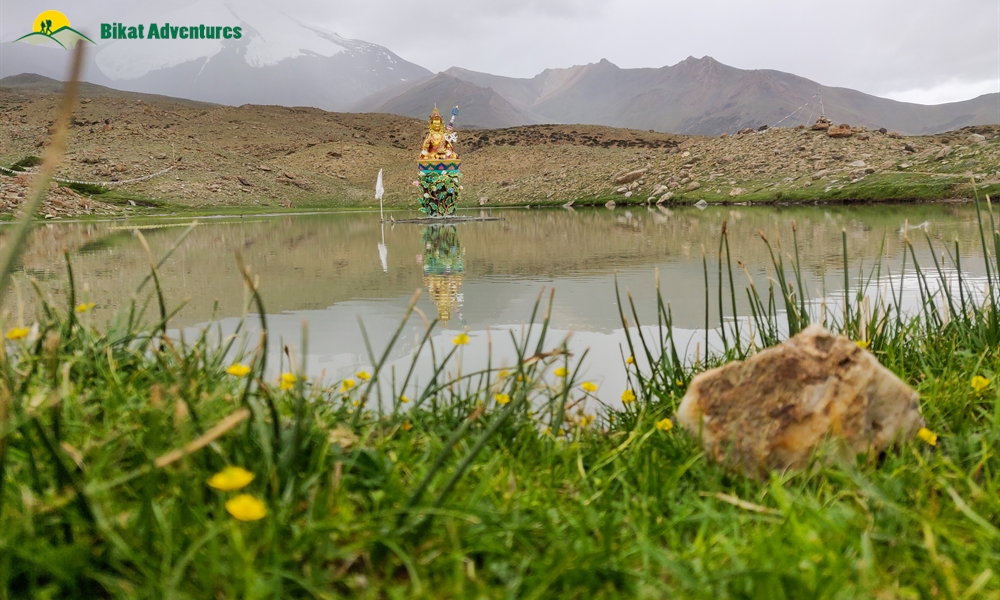
Every village in this valley is adorned with prayer flags which add to the colour palette of the otherwise dichromatic color scheme. Another peculiar feature of Markha Valley are the religious boulders called Mani stones you find in every village and on the trail between the many villages. These are stone plates and rocks inscribed with Buddhist mantras adding to the inimitable vibe of the valley. Mani stones are placed alongside the roads and rivers or sometimes placed together to form a mound as an offering to the spirits of the place. The beliefs of the locals dictate that these structures be crossed from the left. This os a continuation of their belief of the universe revolving in a clockwise direction forming circular patterns which are seen as a repetitive pattern in all Buddhist customs.
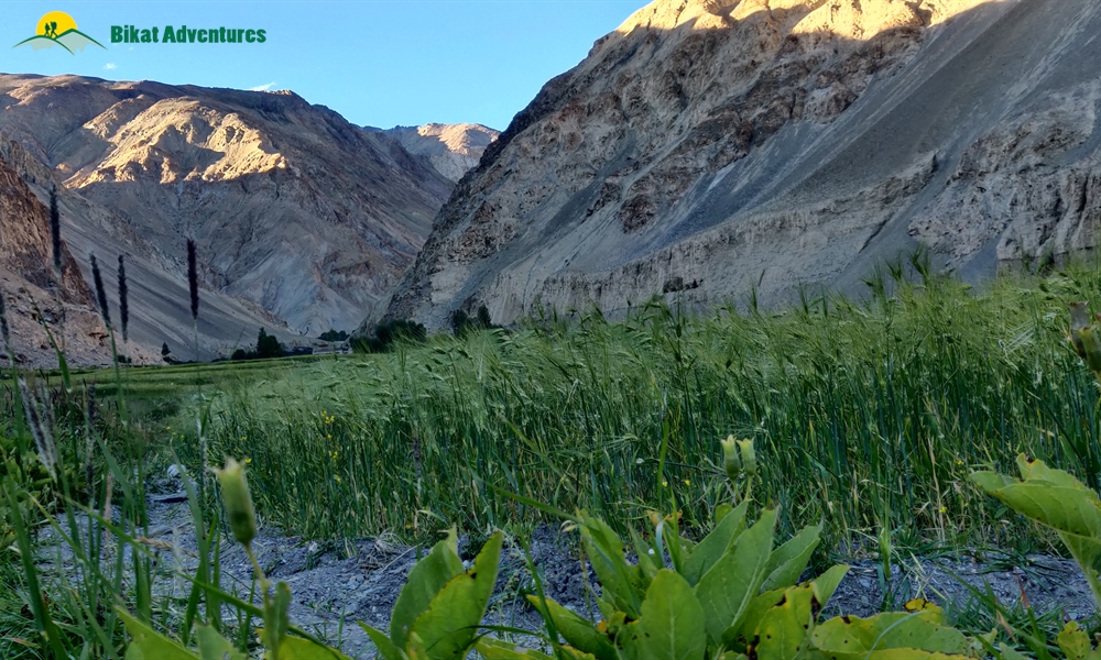
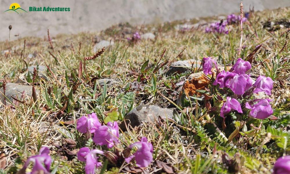
The fields in every village form peculiar geometric patterns adding to the atypical aesthetic of the place. The peaks in this region look like cardboard mountains, sturdy but bent in places in strange ways ready to crumble with one harsh blow. Nothing in the valley is in any hurry except that one lost cloud in the otherwise blue sky which is trying to go places. Yellow and pink flowers add to the chiaroscuro as every blind turn revels a different view holding new secrets waiting to be uncovered.
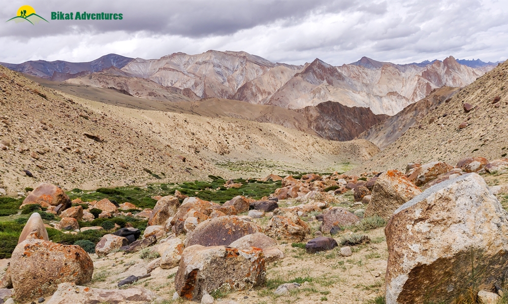
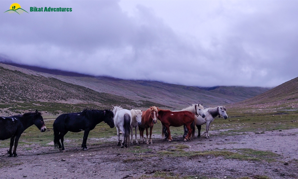
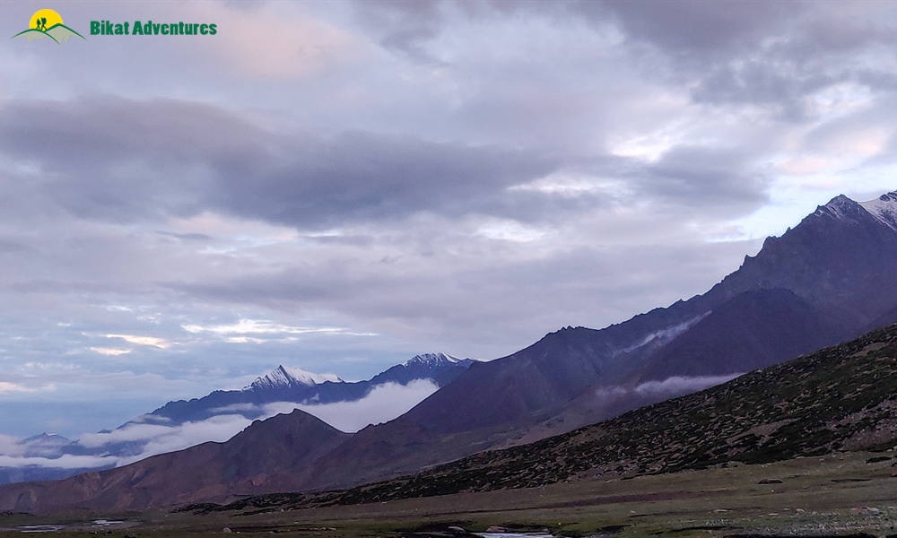
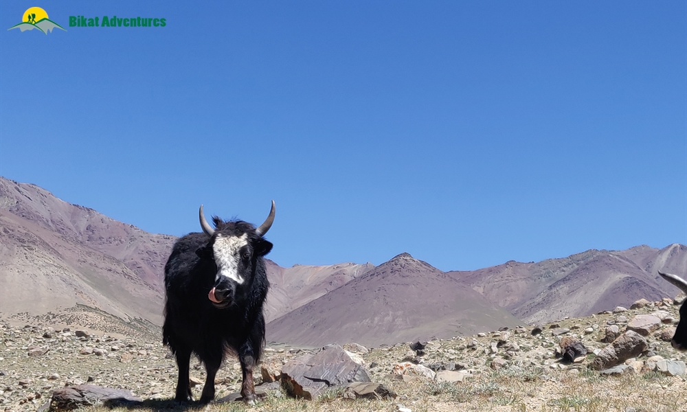
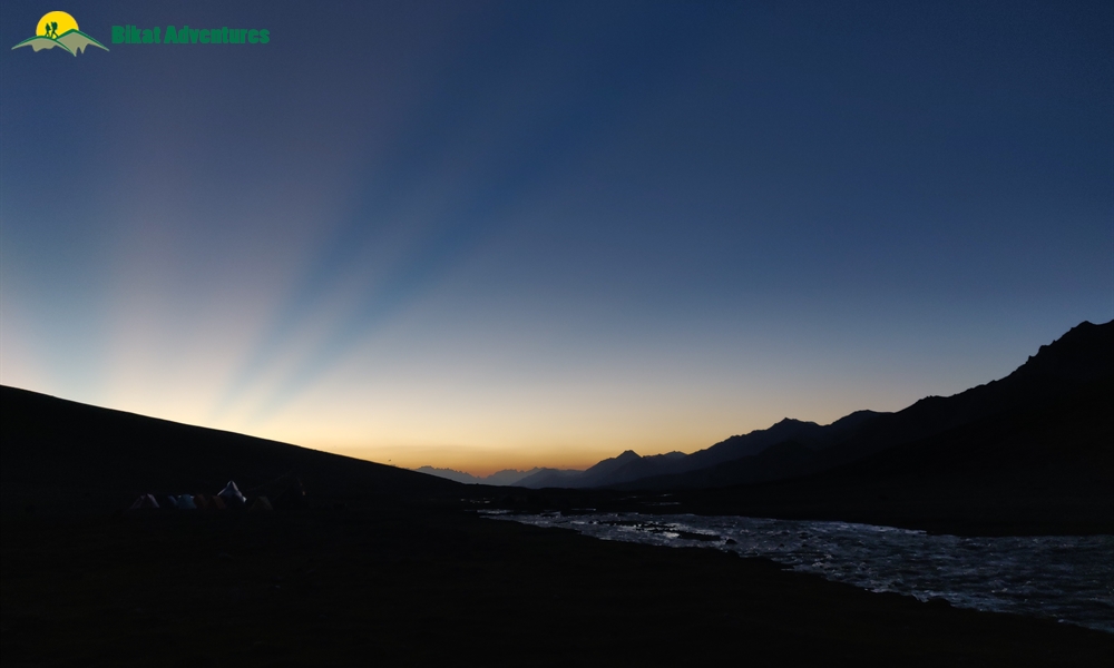
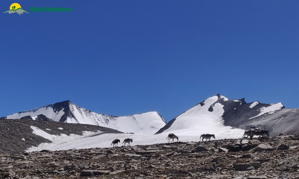
Keep a lookout for cute little rodents called pika which are extremely spry and plenty of marmots who zoom past your field of vision like a fast-moving bullet. Nimaling at 4,535M is this mostly flat terrain rife with these rodents, horses, donkeys and herds of yaks going about their business. The sunset from this campsite is not something you want to miss.
Nimaling to Dzo Jongo (West) Base Camp:
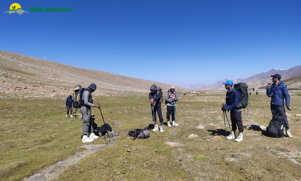
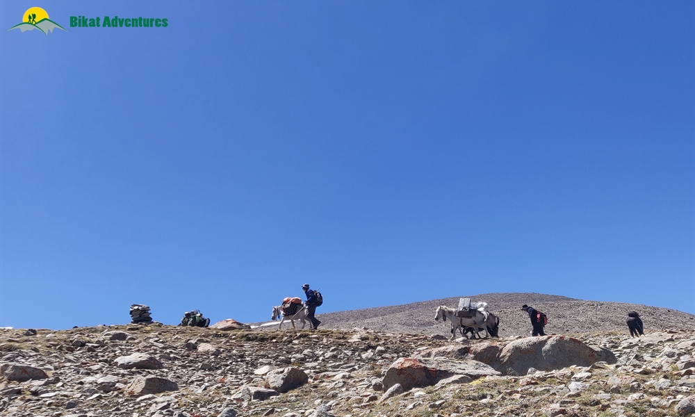
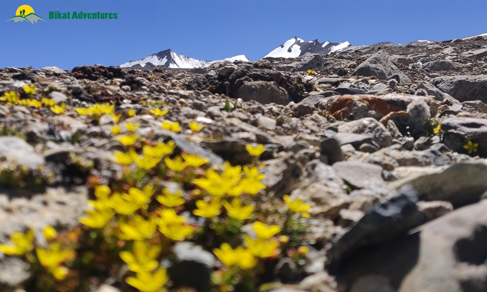
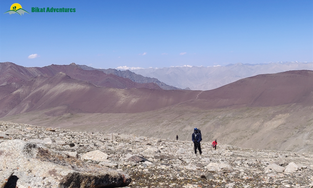
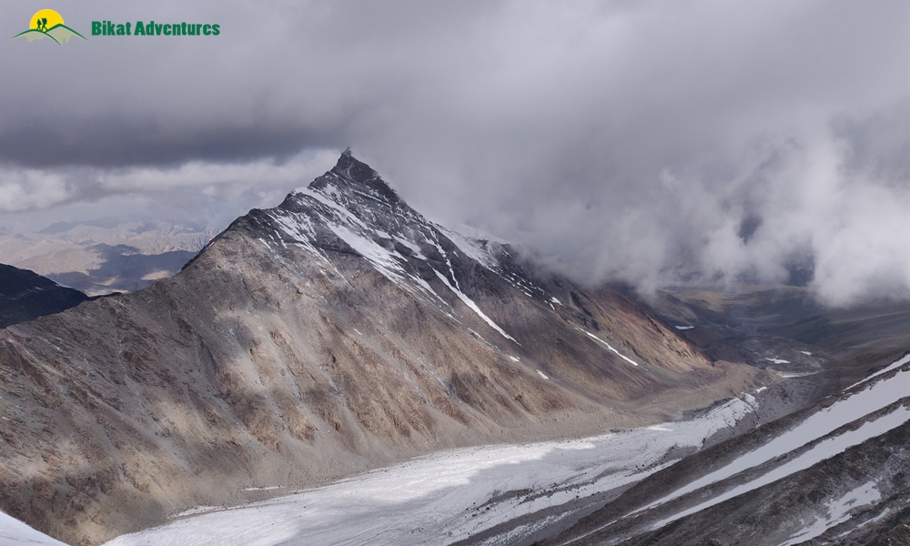
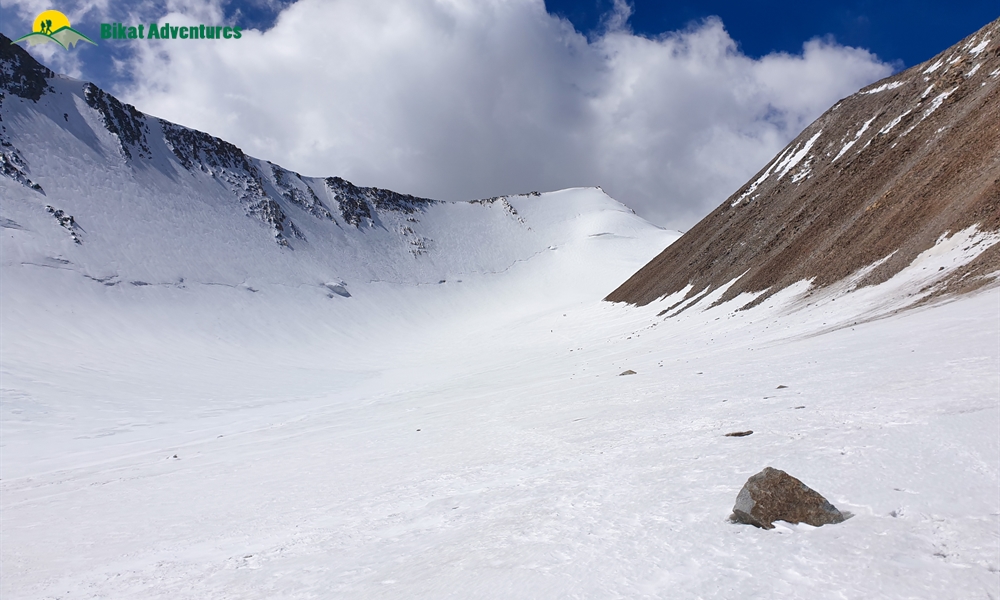
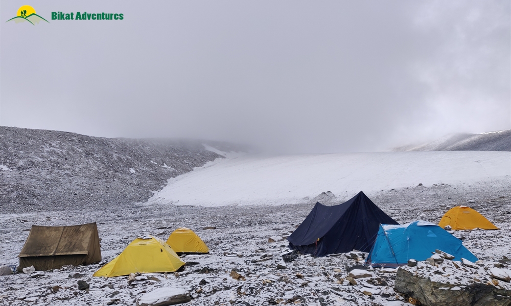
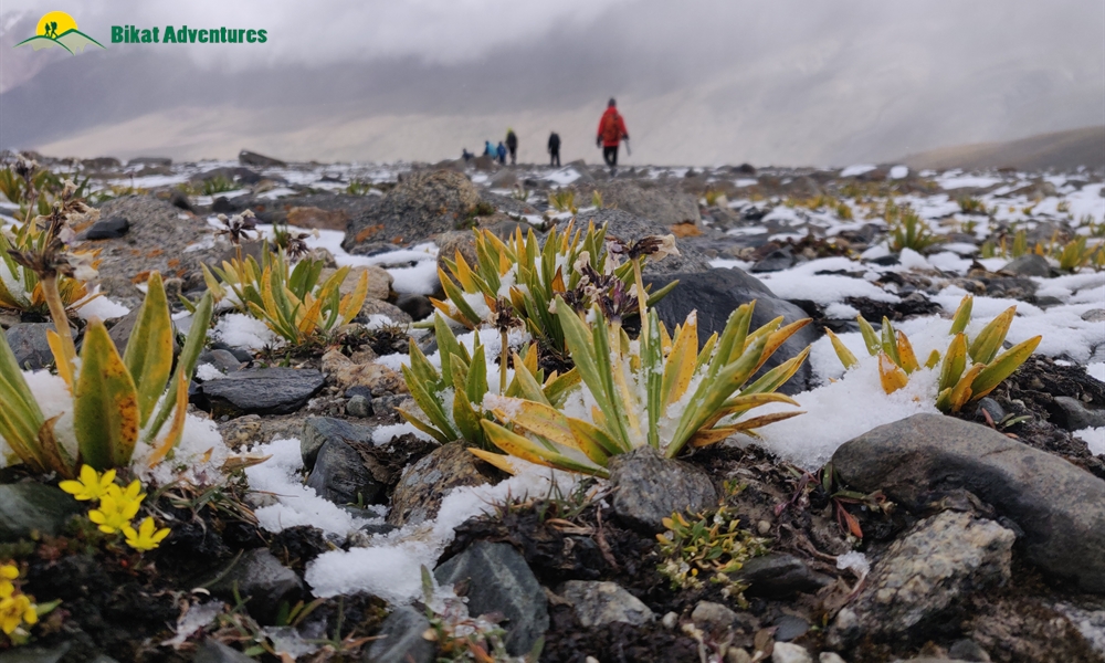
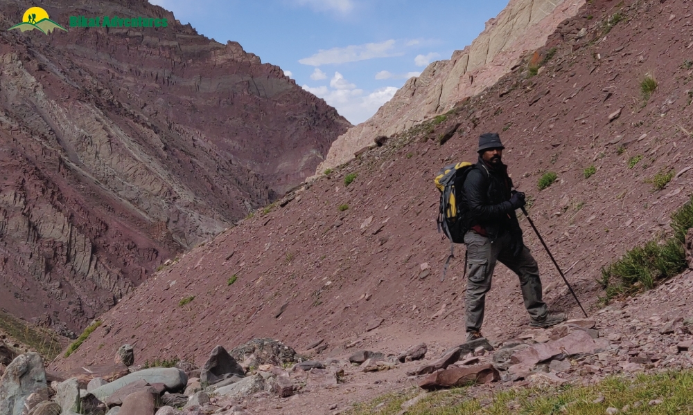
The basecamp for Dzo Jongo (West) lies on the rocky slopes after crossing the plain ground of Nimaling which takes you straight towards a blind turn that leads into the valley. The route is a series of huge humps of ascent. The mountain full of scree and loose rocks is deceptive to say the least. Each time you make it to one top, you are introduced to a new top. This stretch which deceives you all of five times, changes colour with every new hump as the view opens up to accommodate an ever-increasing panoramic of mountain ranges in the region. Kang Yatse is now lost in the many folds of these slopes but you could spend hours looking into peak finder discovering newer mountain peaks. Small flowers spread across the floor give colour to the otherwise monochromatic landscape with the bright orange moss on the rocks pitching in to make the walk up more pleasing to the eye.
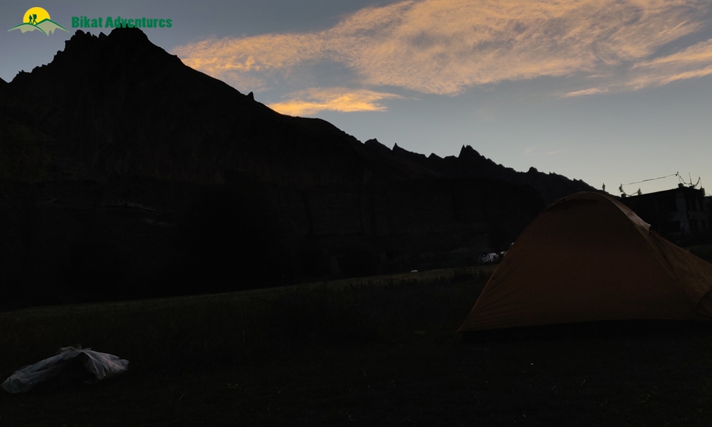
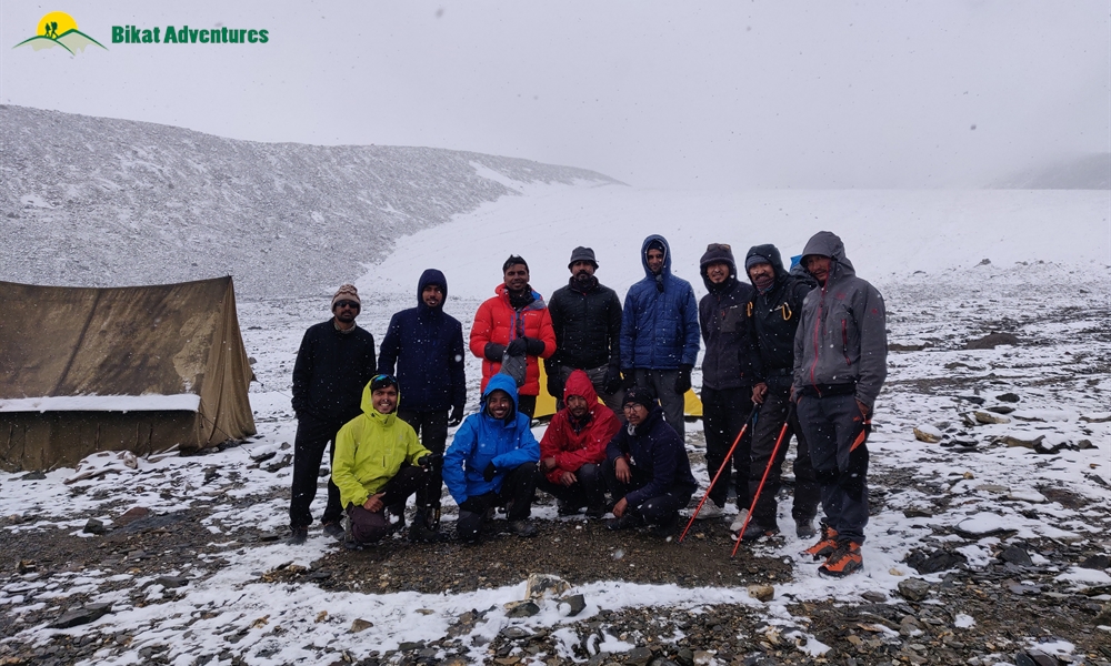
The base camp for this exquisite peak is quite an extraordinary experience in itself for we camp on a bed of sharp rocks and spend a night at 5,500M with the fierce winds constantly knocking on our doors.
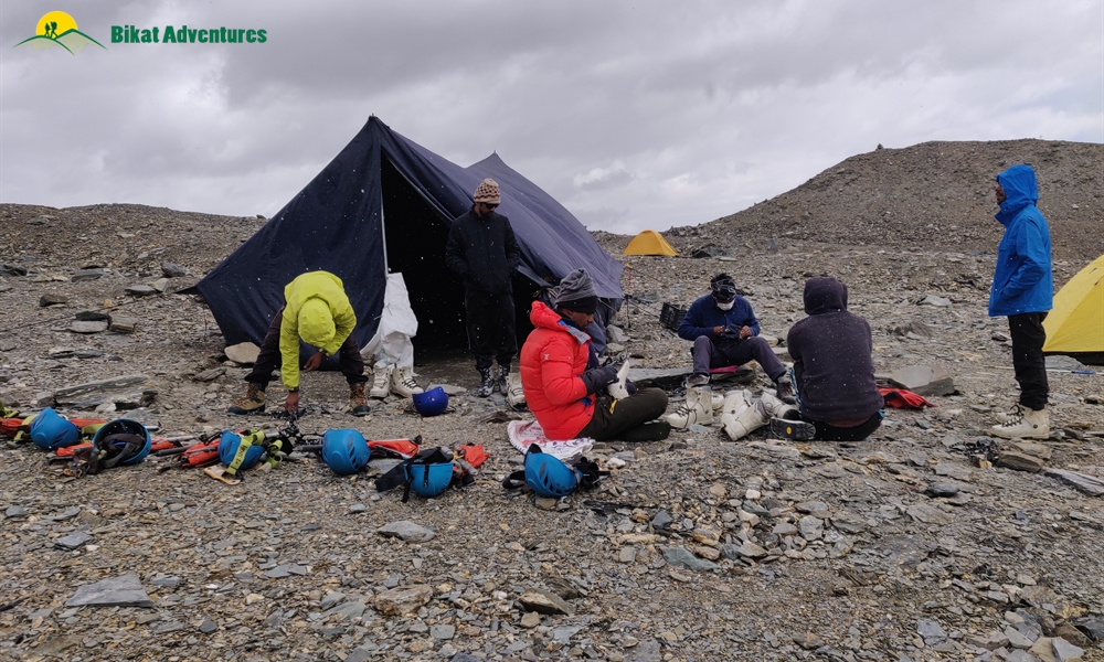
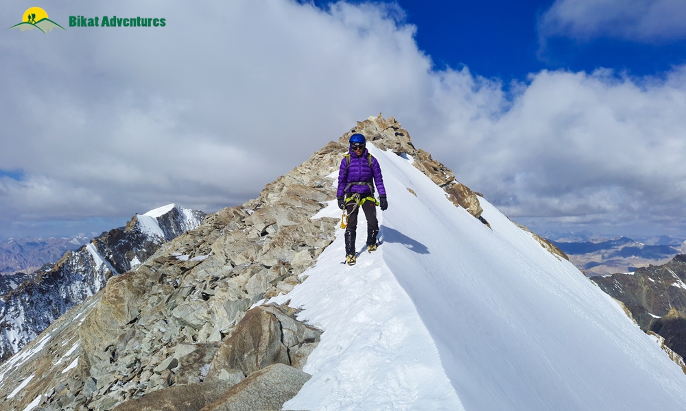
Summit Day:
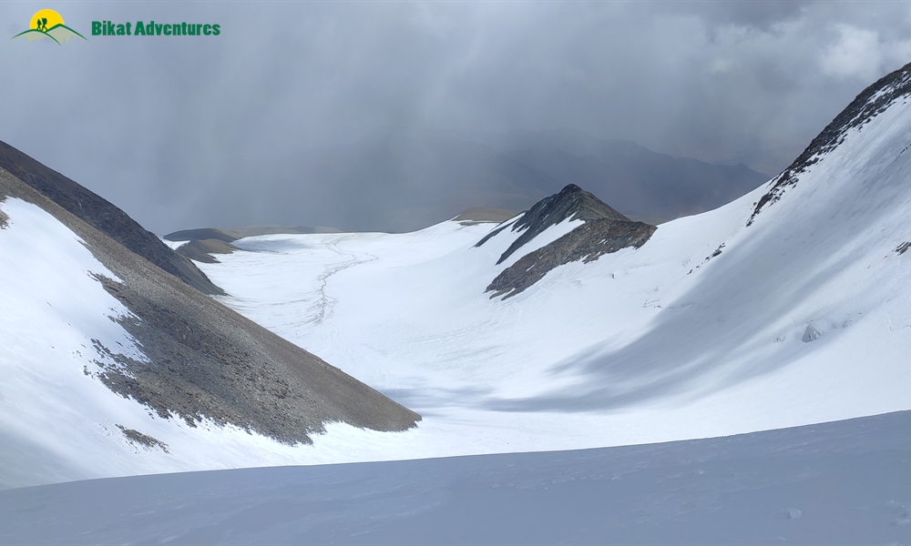
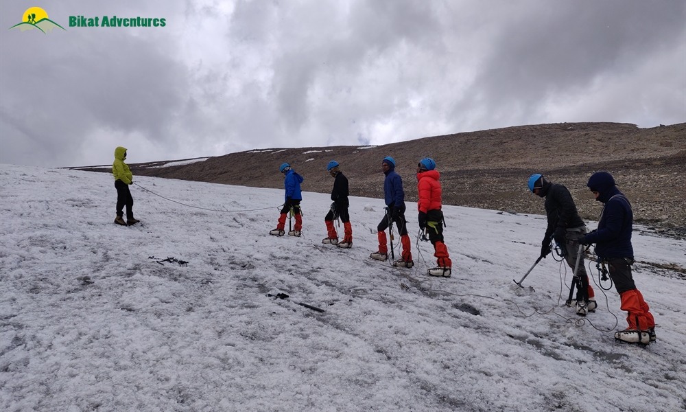
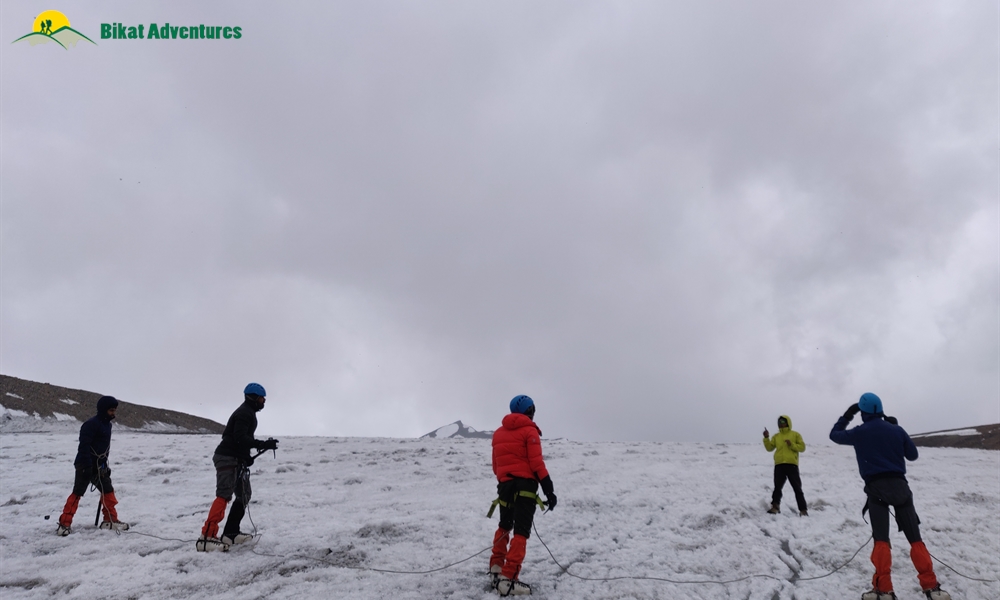
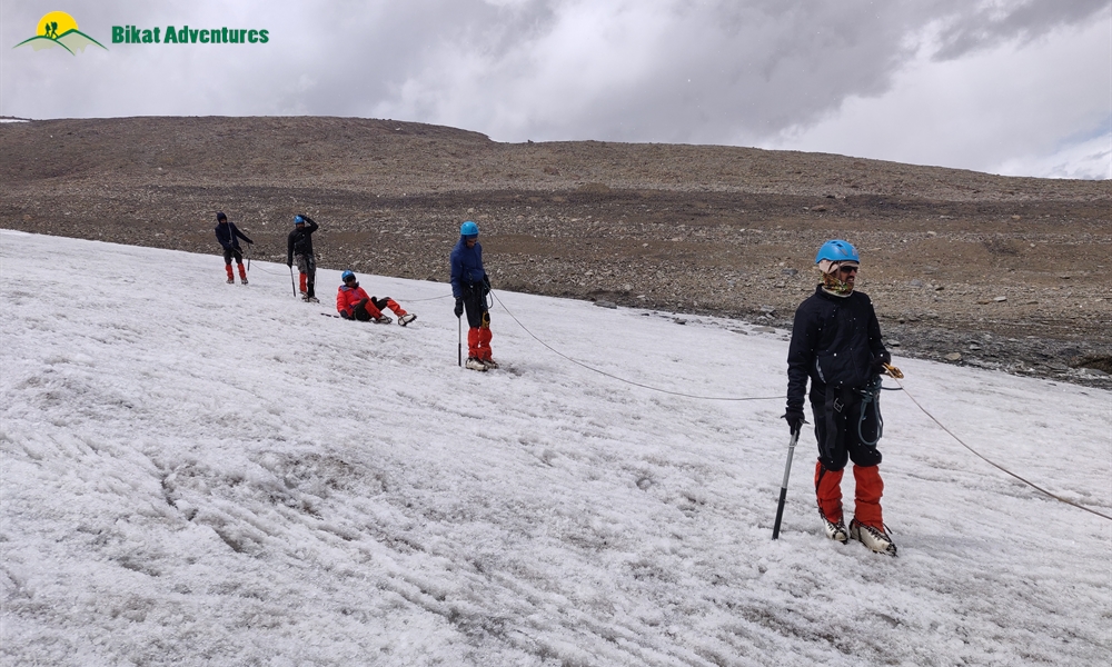
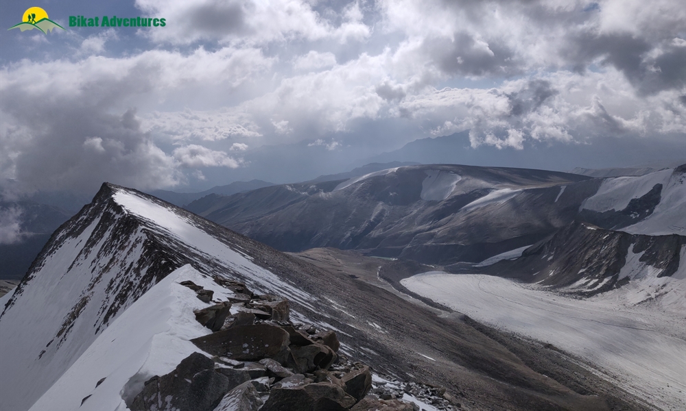
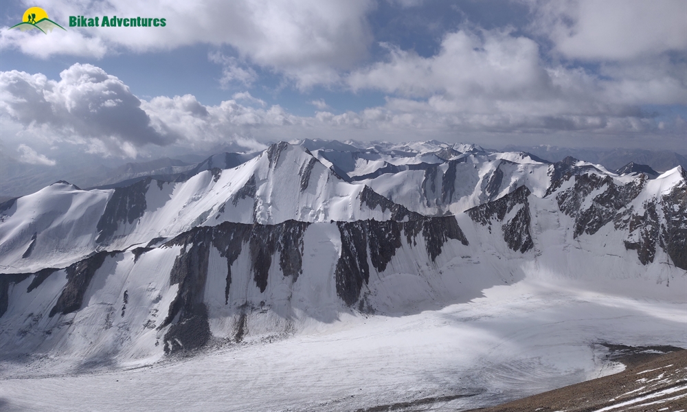
The summit push introduces you to a different world of beauty. After a flat but rocky terrain from the base camp, we reach the slope of the mountain. The west face lies to our right. On crossing a few small streams, we get to the base of the mountain from where we start our ascent. The entire route from here on is only in snow and ice. The winds here are fierce enough to make you yearn for the morning sun for some solace from the cold. The sunrise on this curve of the planet, however, happens as late as 6 AM, hence it is a long night of walking in the cold.
Full of steep inclines on a 60-65 degree gradient, the climb requires the use of mountaineering techniques such as fixed ropes and roping up.
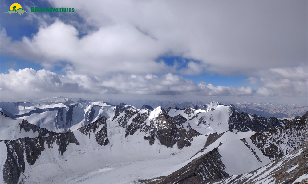
The summit of Dzo Jongo is mesmerizing for the expanse of mountain ranges all around, the last ridge walk, its buttery slopes and the way they appear in daylight.
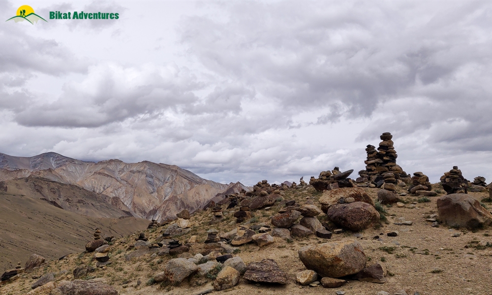
Komgmaru La Pass:
We climb down to Leh through Kongmaru La pass which lies at an altitude of 5,236M and has the ability to single handedly put this expedition on the top of your must-do list. As we start our trek towards this high pass, the sun blushes all shades of red, from pastel to a bright orange as the clouds run amuck in all directions. The sunlight makes the snow on the peaks shine like wildfire adding to the drama of the landscape. At Nimaling, the river flows urgently from the meadows towards the mountains as the many animals, in their morning glory, romance the land below.
The pass provides for magnificent views of Kang Yatse 1 and 2 and also Dzo Jongo. Adorned with prayer flags, the wind on the pass is fierce. Locals climb the pass very frequently to make phone calls – the pass receives high speed internet and a strong phone network which you lose 5 step on either side of the pass.
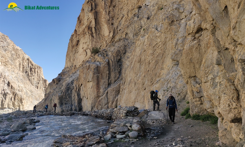
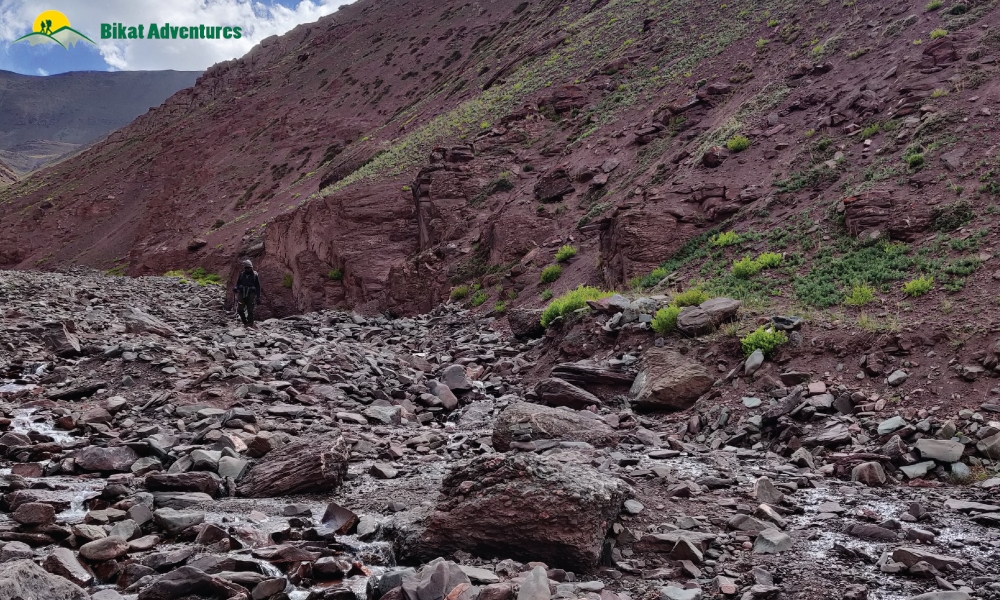
The descent from this pass takes you on a narrow trail, through gorges and water crossings with the valley appearing and disappearing on every turn. The terrain is interesting in its colours with rocks across the colour palette, to geological formations with massive walls of rocks standing vertically on either side of you and the gush of water filling up these narrow passageways to the strangest and most interesting fauna you will ever see.
Everything about the Dzo Jongo expedition is like walking through an exquisite art exhibition put on by the harsh, yet mysterious forces of nature.


")


