Brahmatal is a divine glacial lake situated deep inside the Gharwal region of Uttarakhand, Himalayas. Ancient stories say that the creator Brahma meditated on the shores of this lake to get spiritual insights. True to its name, this place is a stunning part of the creator's masterpiece celebrating the different faces and phases of nature.
The trek to Brahmatal begins from the base village Lohajung at 2300 M. The trail initially runs through dense oak and rhododendron forests, transitions to the cradle shaped Bekaltal lake at 2800 M, gains elevation towards Jandi Top with a wide fish-eye view of peaks like Nandaghunti and Trishul and finally ends at Brahmatal lake and Brahmatal top at 3856 Mts.
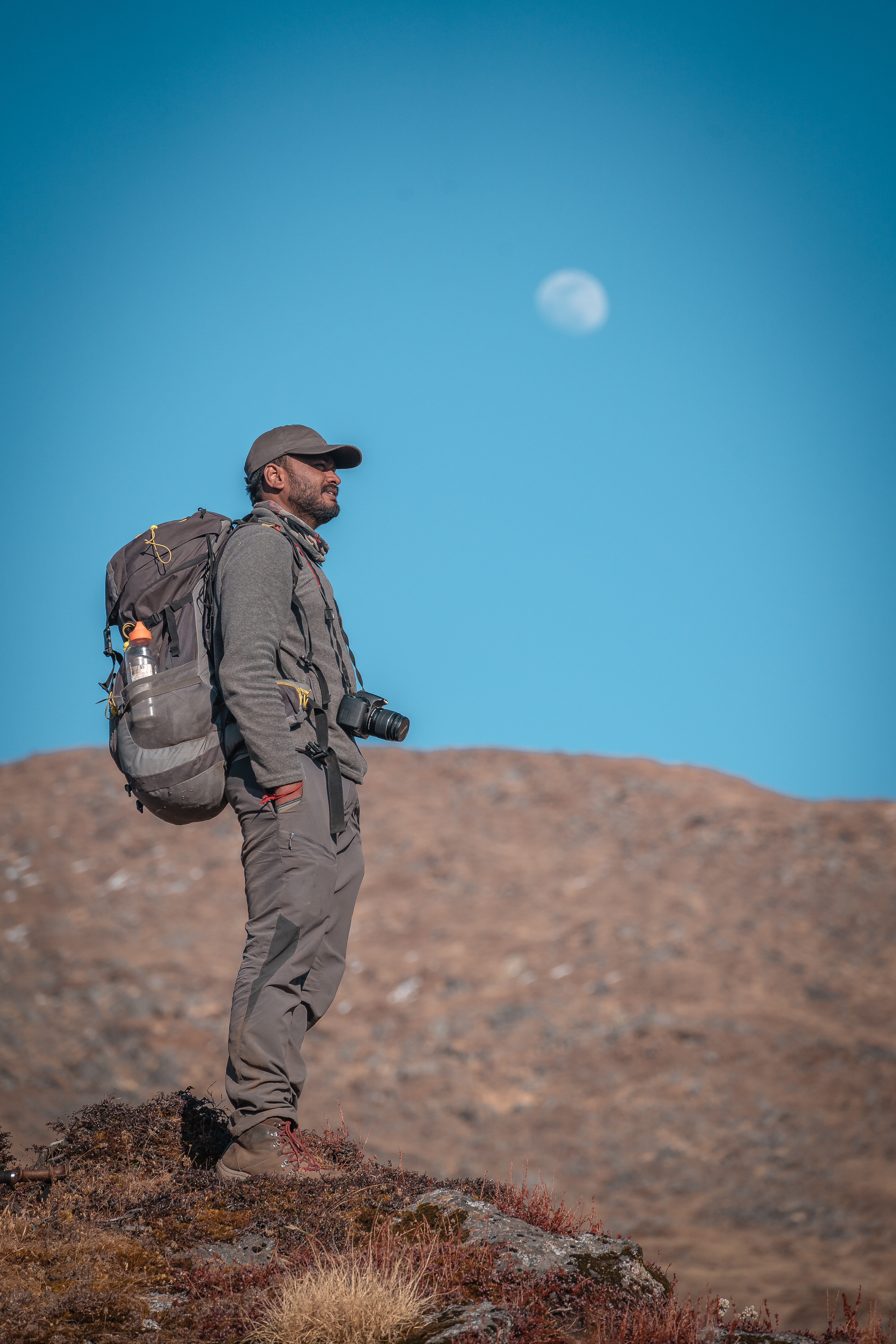
Brahmatal is one of the easiest treks of the Himalayas. With minimum ascents and a reasonable altitude gain, it is an ideal winter trek for beginners. The alluring aspects of this place are experiencing the campsites situated deep inside the woods, walking on moonlit meadows while gazing at stars, meditating near the glacial lake, and a close-up view of the massive titans of Trishul 1, 2, and Nandaghunti Peak.
Day 1: Drive from Dehradun to Lohajung
Highlights: The hill station of Mussoorie and The Three Prayags
If you choose our means of transportation, we will start our journey from Dehradun ISBT at 6:30 am and drive to Lohajung, the base village of Brahmatal. It takes around 10 -12 hours and 300 Km to reach the base village. The route towards Lohajung is filled with spiritual spots and colourful culture.
Once we reach the outskirts of the Dehradun city, the road slightly elevates and we will be driving alongside the beautiful Ganga river. 43 km from here, we enter Rishikesh where you can spot many adventure enthusiasts getting ready for Rafting. Sacred temple structures and cosy looking cafes line the left side of the road while the right side is flanked by long metal bridges.
We will stop for breakfast at Byasi (60km from Dehradun). The journey after Byasi gets exciting! We will be passing through three of the five iconic confluences of the Alaknanda River (Devprayag, Rudraprayag and Karnaprayag) on the way to Lohajung.
At a distance of 40 km from Byasi lies the first confluence, Dev Prayag. It is the place where the mighty Alaknanda river and Bhagirathi river become one and takes on the name of Ganga. Around afternoon we will stop for lunch at Srinagar located on the banks of the Alaknanda river. The lunch stalls here witness many comic battles between monkeys and shop owners over delicious looking parathas stacked up on the storefront. The route from Srinagar gains more elevation and will be accompanied by small hills and mountains of the Alaknanda range.
The Rudraprayag lies in this stretch, not far from Srinagar. It is the confluence of the Mandakini and Alaknanda rivers.
About 33 km from Rudraprayag is the third confluence of Karnapraya, the meeting point of the Alaknanda and the Pindari River. Each confluence is unique in its setting and is a delight to behold!
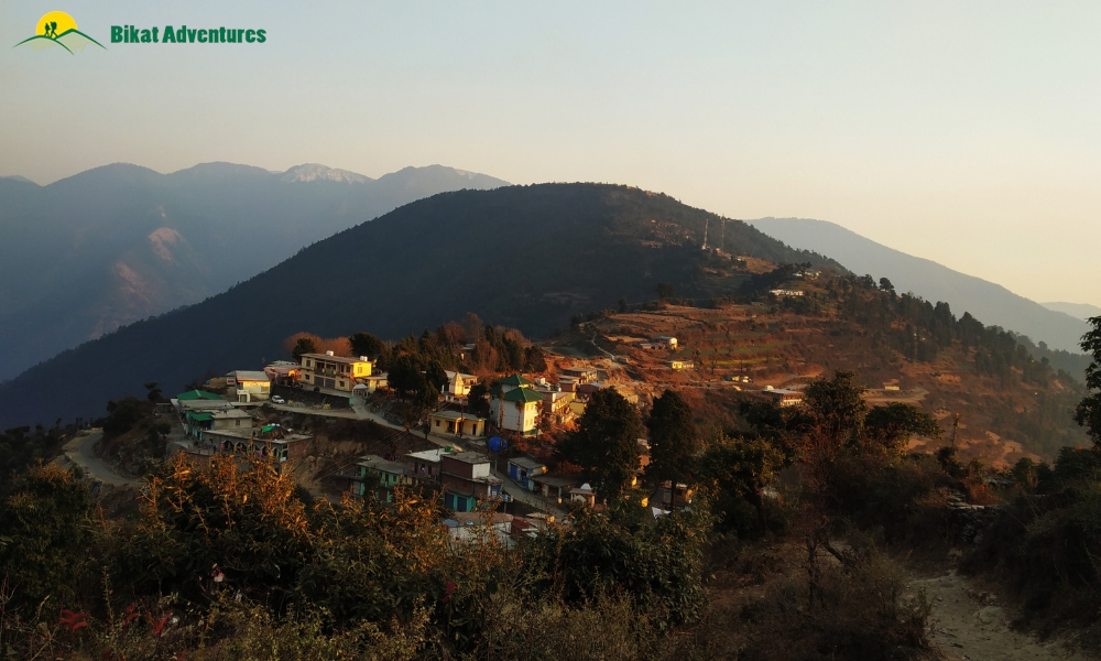
Lohajung, located in the Chamoli district of the Garhwal Himalayas, is 86 km from Karnaprayag.
Lohajung is one of the famous villages of Uttarakhand. Set at a height of 2300 Mts, it serves as a base camp for treks like Brahmatal, Roop Kund, Ali Bugyal, and Nandaghunti. Here, you can find many interesting spots to sit and enjoy a beautiful sunrise.
Day 2 – Lohajung to Gujreni (5 km , 2750 M)
Highlights: Views of Nanda Ghunti Peak, Navali and Bagdi Bugyals, rhododendron blooms in spring, Lower Bekaltal campsite
Today, we will begin our journey at 9 am from the base camp and hike to the Gujreni campsite. It takes 5kms and 5 hours to reach there. Before starting for the trek, catch the beautiful sunrise from behind the Bakshi Bugyal on the right and silver clouds passing through the Nandaghunti peak on the left.
For the first 3 km, the trails are well paved and easy to walk. You will pass by the Mandoli Village and the confluence of the Kali and Pindari Rivers along the way.
At the 3km mark, we reach Begum top, a small clearing accompanied by Dhabas. This makes for an excellent resting point overlooking the expansive Navali and Bagdi Bugyals.
The trail from the Begum top will take you inside a forest of towering oak and rhododendron trees that allow little sunlight in. The rhododendron trees bloom during the late winter and early spring season covering the trail in pretty colours of orange and red. During the winter months, these paths are covered with pristine white snow and no flower blossoms.
Keep your eyes peeled for some interesting flora and fauna along the way like the Rhodo tree flower, wild buckwheat, common mina, large-billed crow, and oriental turtle dove.
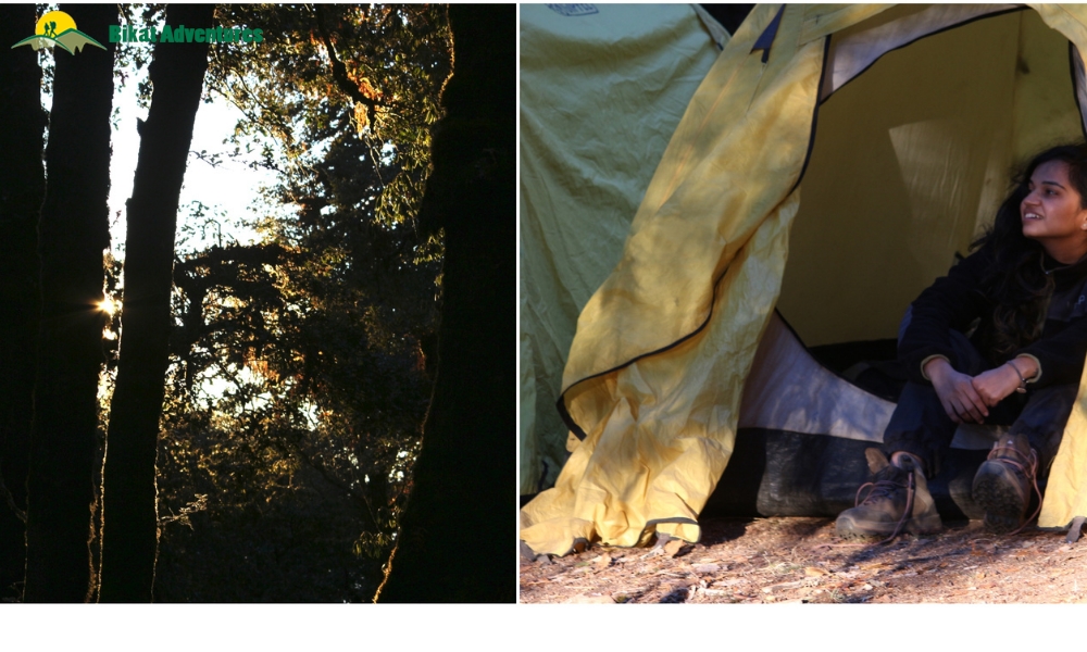
At a 20 minute hike from here, you will come across two streams. The second stream which is the Gujreni stream will eventually lead you to a beautiful clearing set in the backdrop of lush forests. This is the campsite for the day.
This region carries the heady scent of fresh wood and is surrounded by dense Oak and Rhododendron forests. Rejoice in the seclusion and silence of the campsite for it offers an opportunity to look inwards as much as outwards.
Day 3 – Gujreni Campsite to Brahmatal Campsite (9 km, 3400 M)
Highlights: Bekaltal Lake, Talindi Top, Jhandi Top, Brahmatal Lake
We will begin our journey at 9 am. The trail from Gujreni to Brahmatal has some steep ascents and vast meadows accompanied by amphitheatre views of some well-known peaks in the region. It will take around 8 hours and 9 km to reach the Brahmatal campsite.
The trail heading out of the Gujreni Campsite dives into a thicket of forests and maintains a moderate ascent throughout. You will catch the first glimpse of Mt. Trishul through the towering woods here. At a 2 hour hike away, lays the Bekaltal lake.
Bekaltal means Frog Lake (Bekal is ‘frog’ and Tal is ‘lake’) and there is an interesting story behind how it got its name. People living in Lohajung worship a snake deity. The snake deity is considered as the protector who saves the villagers from calamities and problems. The deity had a faithful frog as his help. The frog followed Snake God wherever he went. As a reward for his loyalty and to set up a base for him, the Snake God created a small serene lake which is the Bekaltal. This spiritual lake is covered by tall oak trees and it reflects them on their emerald green surface.
The trail running out of the Bekaltal lake dives straight into dense Oak and Rhododendron forests. It is a steep incline for the next two kilometres. The canopy of the forests is almost impenetrable, keeping most of the sunlight out.
At the 2km mark, the nature of the trail changes. We exit the forest area and walk into an open expanse of land. The uphill winds pick up some pace from here. It is a flat walk all the way up to Talindi top, a little clearing that opens up to some fantastic views of Mt. Trishul and Mt. Nanda Ghunti. The meadows continue sprawling ahead at a slight elevation from Talindi top for the next one kilometre culminating at the next viewpoint, Jhandi Top. The views from Jhandi Top surpass the ones offered earlier at Talindi Top. You can spot Nanda Ghunti Peak, Mt. Trishul 1 & 2 and the infamous Ali Bugyal and Bedni Bugyal from here.
Read: WHY DOES TIME SLOW AT BRAHMATAL? – A PHOTO STORY
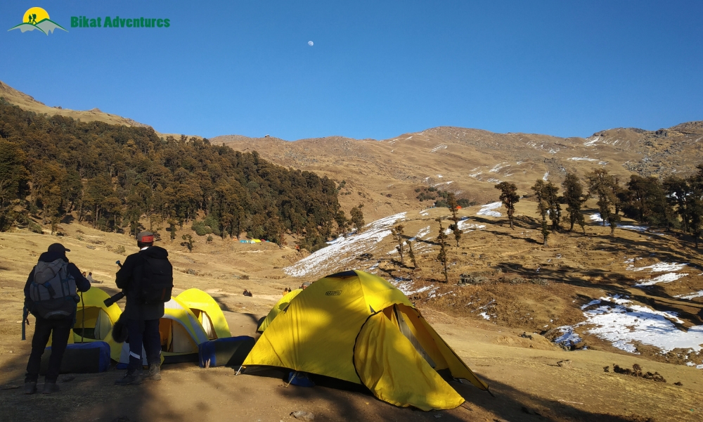
Jhandi Top marks the highest point on the ridge. From here, we will descend downhill to reach the campsite of Brahmatal.
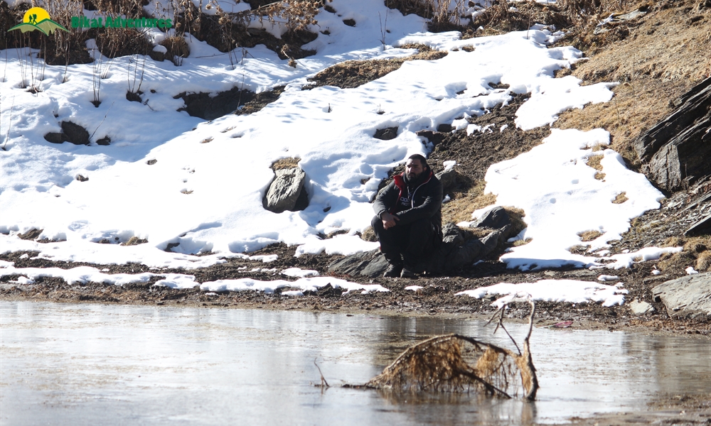
The sunset and moonrise are beautiful to watch from this campsite. Once you set up tents, you can also visit the Brahmatal Lake which is only 500 M from here.
Personal Tip: Visit the lake a little after sunset and wait until the moon has risen and you can see the moon’s reflection on it. It is an enchanting sight!
The temperatures here drop as low as -10 degrees post-sunset. To ensure, you are layered (at least 4 layers) adequately to protect yourself from the cold.
Day 4: Brahmatal Campsite to Brahmatal Top (3 km, 3856 M)
Highlights: Brahmatal Lake, Brahmatal Top
We begin the day early today and leave the campsite at around 5 AM after breakfast. This day of the trek is the most fascinating visually and the terrain is relatively easy to negotiate. There is also the added advantage of leaving our backpacks behind at the campsite.
We take the route towards the Brahmatal Lake and follow the trail that climbs out of it. Beyond the lake, the trail ascends moderately and envelopes into a ridge.
As you steadily gain altitude, you will notice the Brahmatal lake retiring in the valley below. In the winter season, this area is usually covered in a sheath of white snow making it no less than a Winter Wonderland while the lake glistens under the morning sunshine.
The first ridge is a stretch of gentle ascent that leads you to the final ridge climb.
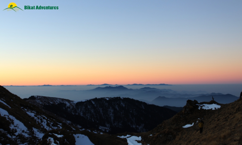
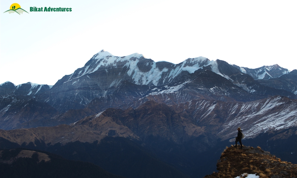
The final ridge eventually opens up to a spectacular canvas of snow-capped mountain ranges standing so close to you that you feel like you are watching them on a theatre screen.
You will be able to spot the massive peaks of Mt. Trishul 1 & 2, Nandaghunti peak, Hathi-Goda peak, and the tips of Bethartoli, Maiktoli and Tharkot peaks. After spending some quality time there we will head back to our campsite and rest for the day.
Day 5 – Brahmatal to Lohajung (11 km)
Highlights: Retracing the path back to the Base camp
After a scrumptious breakfast, we begin our trek back to the base camp. We will be covering a maximum of 11 km today in 8 hours. The route is the same as the one we took to the Brahmatal Campsite.
Things you didn’t notice on your way to Brahmatal catch your attention during descent.
For the first four kilometres, we will trace our tracks to Jhandi Top. That will be the only ascent for the day. From Jandi Top, we will start descending for another 7 km and directly reach Lohajung.
Day 6 – Drive back to Dehradun
After breakfast, we will be starting for Dehradun at 9 AM. The journey will once again take you through the three confluences of Karnaprayag, Rudraprayag and Devprayag. Expect to reach ISBT Dehradun by 8 PM.
In case, you plan on travelling back to Delhi the same night, consider booking a bus that starts at around 11-12 PM to account for any delays we might encounter on the way.


")


