
Rupin Pass - Not Just Another Adventure
Having unofficially resigned from the job to pursue my new venture, Rural Odyssey, for promoting tourism in Indian villages, promoting their culture & art forms and generating source of income for village folks, I was still in doubt. Some unanswerable questions were still haunting, What if I fail? What if things didn’t turn up as per the expectations? I decided to go on a trek, somewhere far and not in a bigger group, where I can think about what I want to do and where I want to go. I reached out to Girish and Ritvij if they are planning any exploration treks, for a while I was willing to do exploration treks for Bikat Adventures. On the 20th evening, I got a call from Ritvij enquiring if I want to explore and plan “Rupin Pass trek" for them. I agreed immediately! I was waiting for this!
I googled some facts about the Rupin Pass, 3kms of altitude gain in 3 days and ~70kms of hiking distance, starting from Dhaula in Uttarkashi and ending at Sangla in Himachal Pradesh. I was excited! I knew this was going to be one hell of an experience. After Manali-Leh cycling in 2014, I don’t think if I pushed myself to this extreme. Now, while writing this experience I can easily say Manali-Leh cycling was much easier than Rupin Pass in 3 days. Weather guys predicted more or less clear sky on 26 -29 with mild rain on 29th. We decided to leave Delhi on the 25th night, reach Dhaula on 26 evening and start the trek on 27 morning. This wasn’t just another trek for me, this was the beginning of a new life, answers to some tough questions.
Finally, it was 25th evening, I met Agasty and Ashish, sailors from Mumbai and the trek mates. We were ready to roll and boarded the evening bus to Dehradun. Wandered a bit in Dehradun to inquire about our next bus and we started our journey to Netwar on another bus, this time quality of bus was not with us and asses were at stake. Traveling brings out the best in everyone, strangers were talking & sharing as if they know each other for ages! Approximately 180 km and nearly 10 hours on that bus killed us to an extent and definitely killed our asses. At Netwar we met our guide ‘Chaen Singh’ and porter ‘Vinod Singh’, took a shared taxi to Dhaula and in the process, we did the biggest mistake of the day. We decided to sit on the top of a taxi! Oh dear! That 45 minutes of pain almost brought tears to eyes. I’ll never ever repeat this mistake or maybe I will, I absolutely enjoyed the view of zig-zag roads through dense forests with gushing Rupin river running along. It was getting dark already by the time we reached Dhaula, three of us took a quick dip on the side of Rupin river, one dip in that icy cold water relieved all the muscles. We decided not to pitch tents for the night and stay in a local place instead, it was dirt cheap and the guy cooked some really delicious food for us. The night came to an end with amazing food, few drinks and lot of chatter. I felt lively again, no rattling to trouble the peace of mind. I didn’t realize when I fell asleep!
Day 1 - (Dhaula - ~1600m to Jhaka - ~2620m, ~26Km)
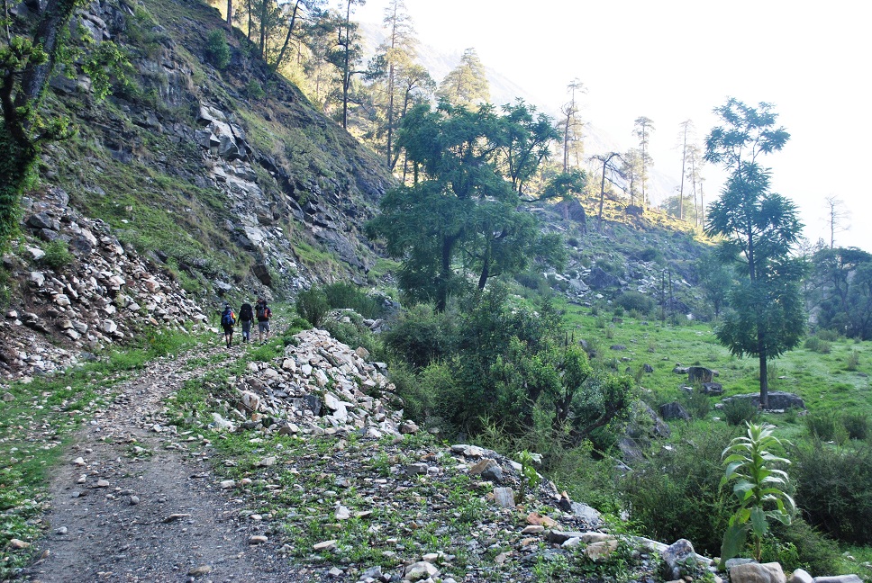
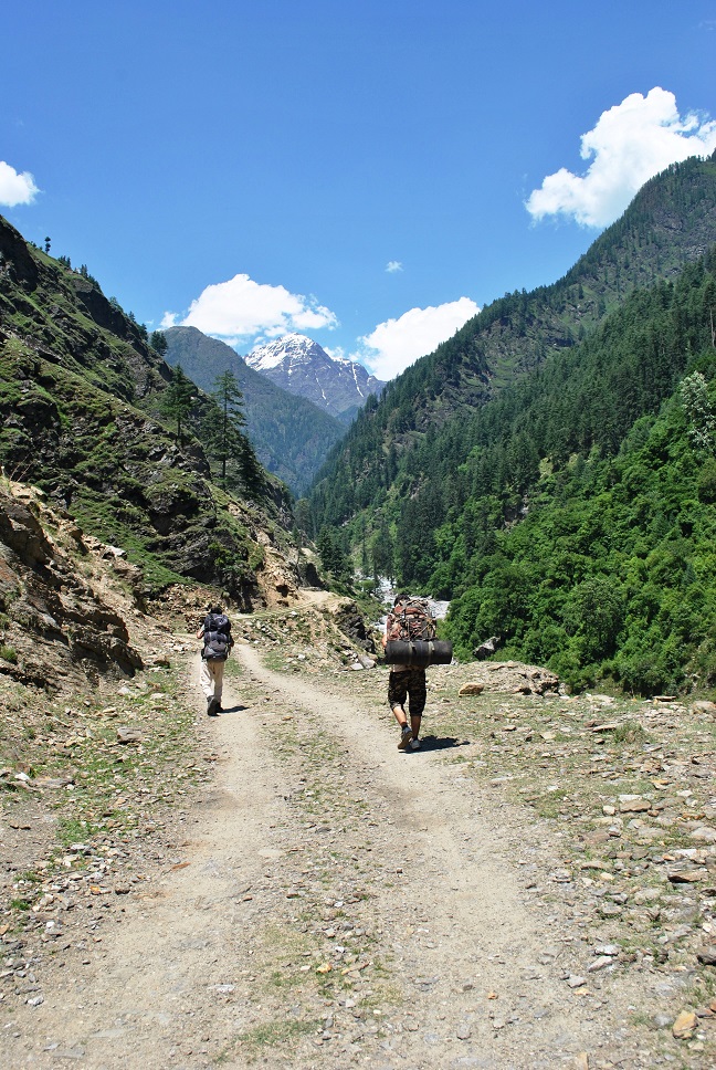
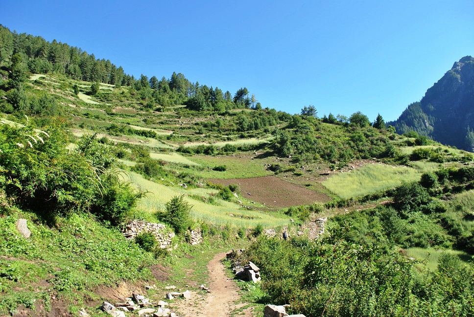
We woke up around 5 in the morning as we had a long day of hiking ahead of us. Had Maggi in the breakfast, yes! The mountain guy still had some stock left, and packed Aloo parathas for lunch and started off our first day sharp at 7 am. We started off by passing a few lovely pahaadi houses, an easy gradual climb and soon we realized the intensity of the sun as we came out in open. We already knew it wasn’t going to be easy but the sun was not in the mood to help us either. We took some steep & small shortcuts and within an hour we were right across the village Dhyuni. Tin sheds of the houses were shining bright, the valley gets bigger in size and we could see another stream coming from Supin glacier meeting the river Rupin. There were less trees on our side, the other side of the river looked so green that it was making us jealous. Nonetheless, we had to keep moving, strength was still intact and scenery was amazing! Immediately came the mammoth steep climb of 30 mins which took us to an altitude of 2100 m and now we had some trees on the trail to give us shed. I think Chaen Singh made us took the shortcut, normal trail was long but not so steep. We grabbed our breaths back and started moving again, it was a long lovely downhill trail to village Sewa. With dense pine forests above our heads, we walked passing some potato & barley fields, apricot and apple trees were in abundance. Sadly, June is not the season for these fruits, could have used some.
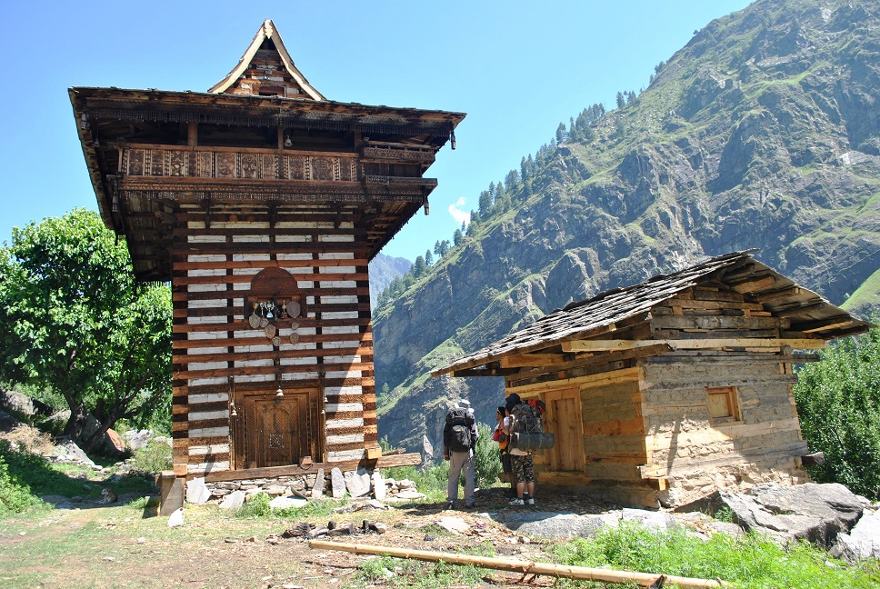
Sewa, at an altitude of ~2010m, is a small village with not many people living around. We interacted with an old lady there, sitting on top of a boulder and crushing some kind of a local grain with a 6-foot long stump, it was a delightful sight. The most charming thing in the village is Mahasu Devta temple. A towering 2-3 story temple is a unique sight at such a place, adorned with medals, coins both old and new and an electric clock. Chaen Singh told every 5 years a fair is held in the village to worship the Mahasu God and every single person in the village takes part in the one or the other ritual.
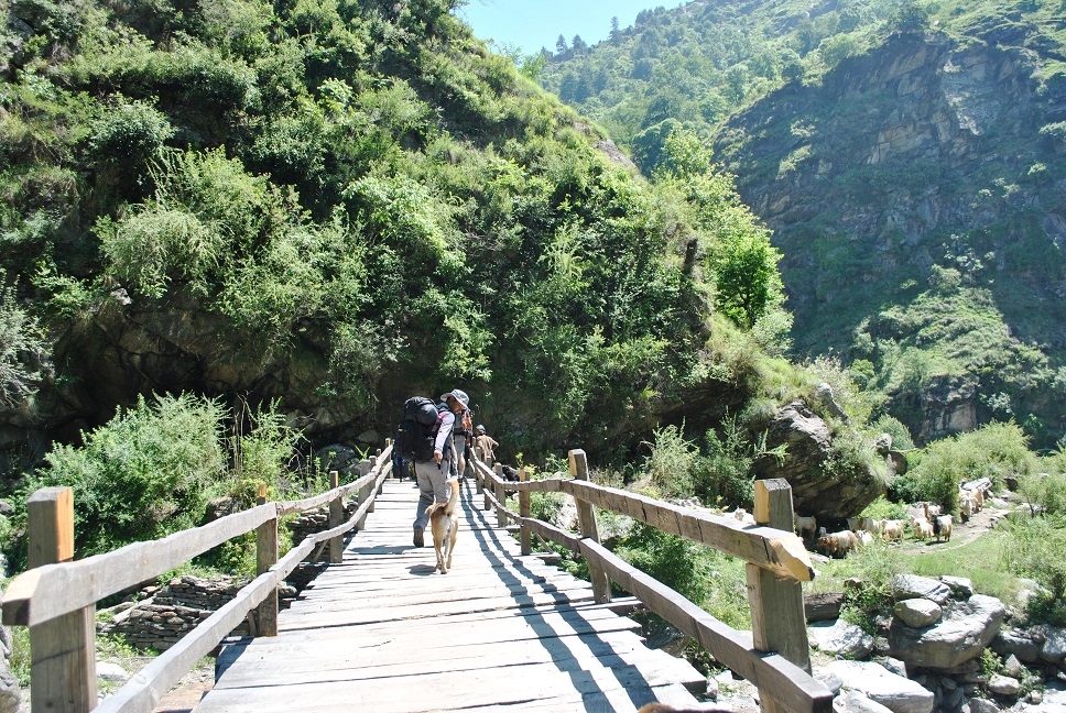
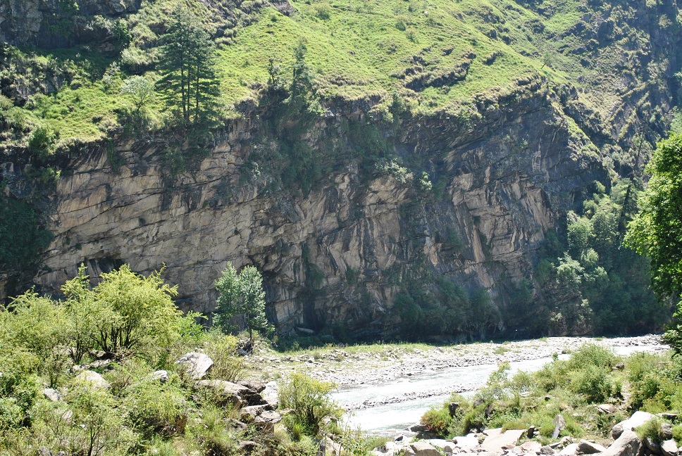
We continued the downhill walk for next 3-4 km and on the way crosses a wooden bridge over a stream dividing Uttarakhand and Himachal Pradesh. A big chunk ff walk is along the Rupin bed and the sight is so gorgeous that you can’t stop yourself from taking pictures. Four hours since we started and we had covered nearly 13 km, we were not tired but we wanted to relax a bit by the riverside and enjoy the gushing sound of river Rupin. I wanted to go to the other side of the river, there were some amazing rocks to climb. Sadly, we didn’t have time to do that and there was no way I could’ve crossed that ferocious river. We decided to have lunch there to save lunch time later, the place was so serene and calm we wanted to spend the maximum time there.
From there we started the uphill walk and reached the road head at Ghusangu within 10-15 minutes through a dense forest. From Ghusangu to Jispun, its 9km long arduous walk on the road, mostly gradual climb except for the last few Kms which is a steep uphill. This walk is without a doubt the worst part of this trek, with not even a single tree on the stretch to give you shade and the scorching mountain sun sucks all your juices. This 2 hour of walk on the road left us all exhausted, damn irritating. Finally, after sweating it out we reached Jispun and took the much-needed relief from the scorching sun with tea from a local shop.
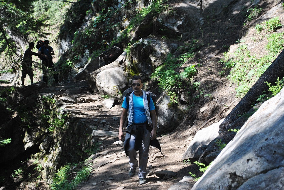
After a fair bit of rest, we started moving again. I thought we’ve already crossed Jispun but the village is in two parts, lower and upper, hardly 15 minutes of uphill climb. Surprisingly, Jispun has few very good general stores from where we grabbed some chocolates, toffees, and stuff for our stove. And finally, we said goodbye to Sun and entered the forest trail towards Jhaka, an easy & steep downhill trail where high Deodar and walnut trees keep the sun away. After the treacherous walk on the road, 30 minutes of the dark downhill walk was a cakewalk. This downhill trail took us to a mystical dark fold in the mountains and very close to the river bed. It was a closed V, with a stream coming down from the joint through dark and dense forest. Rocks so high that the top was hardly visible, gushing water from the stream & nearby Rupin river, chirping birds and winds making a mystical sound through the leaves, one can easily spend hours there. My eyes were exploring those rocks. Damn! I wanted to climb those rad structures, I was full of energy again. This was unquestionably the best part of the day.
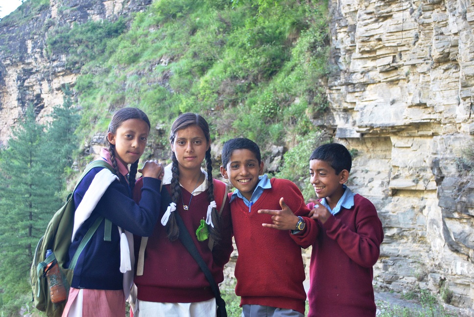
Jakha is hardly 3-4 Kms away from this point, and we were there at 4 in the evening. We knew there’s a steep climb to Jhaka but we didn’t want to rush it. We knew no matter how slow we walk we can make it to Jhaka before dark. Many kids on their way back from school(Jispun) to Jhaka passed us, everyone smiling and joining their hands to greet us. It was certainly contagious! After 30 minutes of rest, we moved again and this time it was the steep climb to Jhaka. But its surely a beautiful trail, carved out of the rock structures on one side and cliff on the other side. Don’t forget to look back here, its an amazingly beautiful valley facing your back. Slowly we kept marching, few stretches of this trail are literally like a steep rocky staircase, we were exhausted. I entered into a cycle of 50 steps and rest, without realizing I left Agast and Deo way behind me. I joined some school kids, we talked about many things, first question was “How much more do I need to walk for Jhaka?”, I was tired and wanted to reach there asap. Then I enquired about different trees, there were pine, deodar, walnut, chail and many more. Then the kids started showing me the scorpions, lifting every other big rock they find on the trail. It was a fun and tiring walk! Soon we reached Jhaka and found a shelter in the first house of the village. We were least interested in exploring! Local people mentioned that we were the first to reach Jhaka from Sewa so early i.e 6pm. There were few who dared to do this before us and reached Jhaka at 10 in the night. We were on cloud nine, that gave us some confidence for the long day tomorrow.
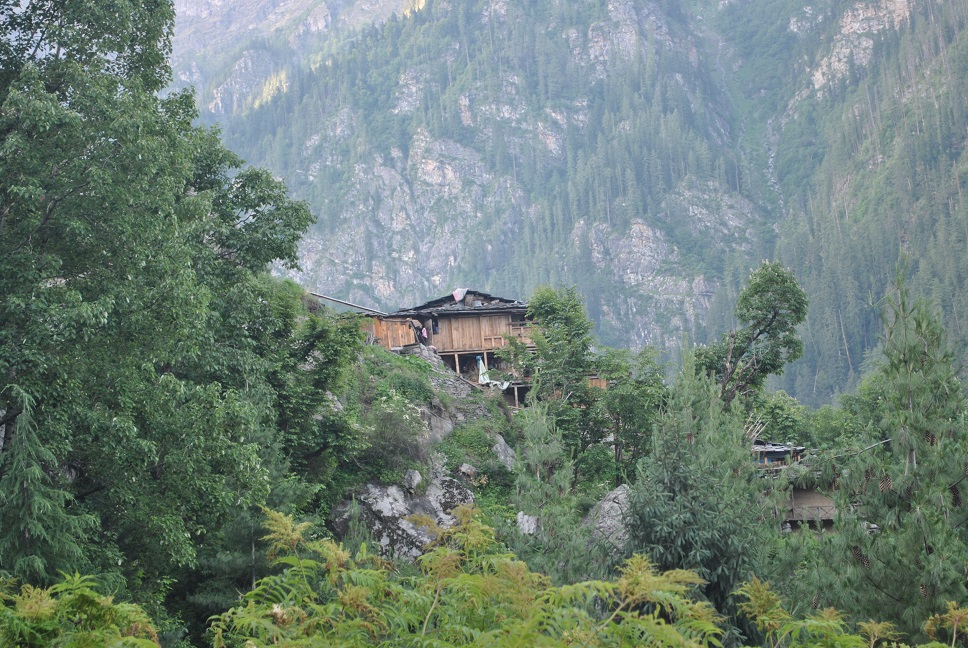
Jhaka, the village of Satsangis, people here are vegetarian and don’t consume liquor in any form. Jhaka is the last village on Rupin Pass trek and is also known as the hanging village, as the entire village is on the steep mountain face. I restricted myself to a few joints in the warmth of the lovely house while others went out for the drinks, the owner didn’t allow them to drink in the house. Soon after the dinner, we slid ourselves in sleeping tents for one of the best sleep I’ve ever had!
Day 2 - (Jhaka - ~2620m to Upper Waterfall Camp - ~3870m)
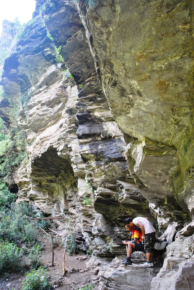
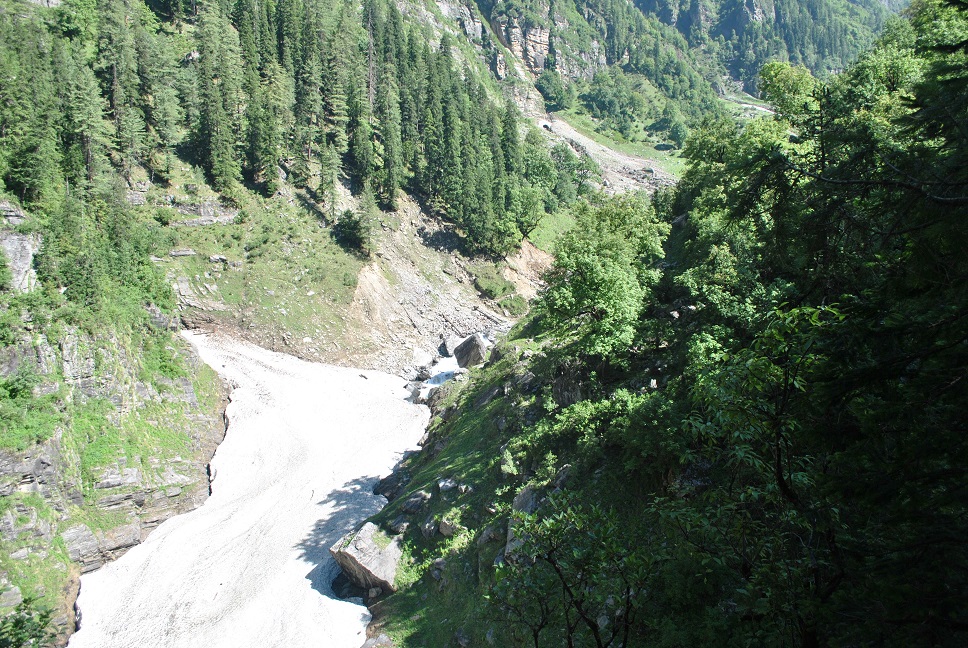
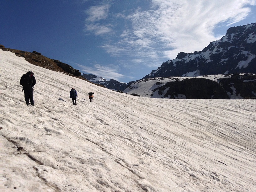
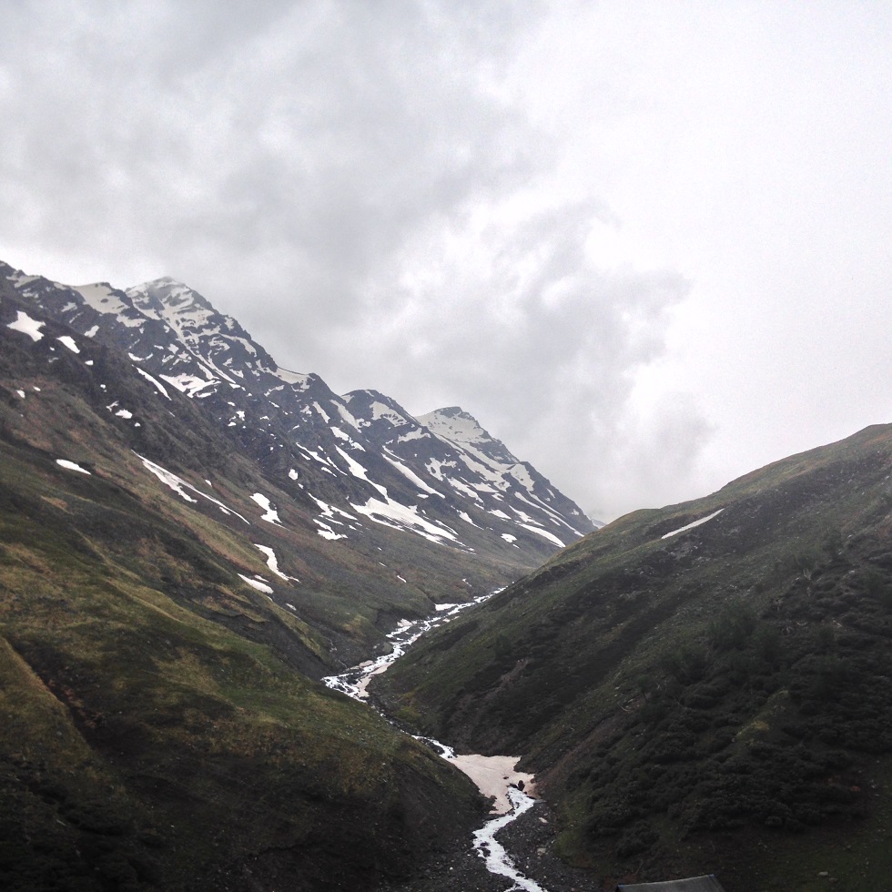
Day 2 had a lazy kick-off, we started from Jhaka at 8 in the morning very well aware of the treacherous climb ahead of us. Climbing the staircase trail of the village, passing the small playground, with fields on our left and Rupin on our right we did really well during the first hour. Around 3.5 kms of uphill walk in an hour, trail took us through one of the dense forest I’ve ever come across with towering Pine and Deodar trees, and a few more which I failed to recognize. From there it’s an easy & somewhat steep downhill walk for nearly 15 minutes, and we were out of the forest. Drastic change in the surroundings, a moment ago we were among the towering trees and now on the side of rad river bed with no shade above us. No trees to protect from the sun, huge snow bridge(the first one on the trail) on the Rupin, Rupin entering ferociously into a deep gorge, steep climbs ahead and rocks as far as you can see. I asked the guide if this is end of tree line on this lane, he mentioned we will re-enter the forest for a short while in sometime.
Crossing a few other snow bridges and carefully hopping on the small rocks for another kilometer or two, we entered the forest again. This time a wide range of trees were there. Maple trees were the surprise, didn’t know one can find maple trees in the Himalayas. Within 2.5 hours we were at Udaknal, 7kms from Jhaka at an altitude of 2900m.
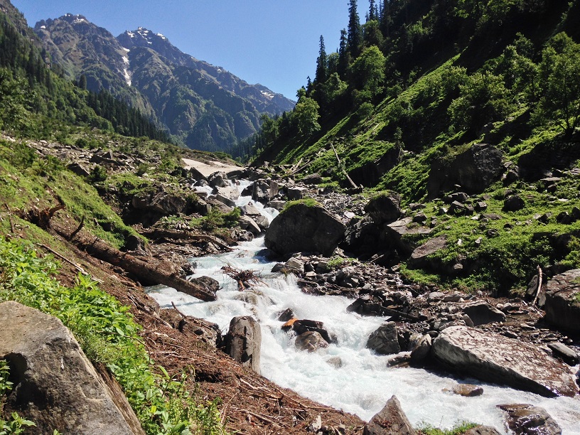
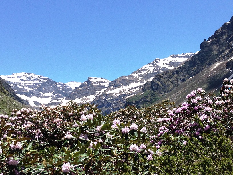
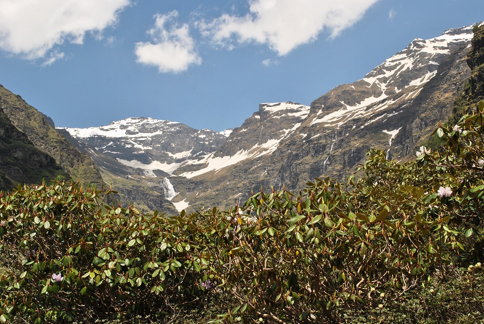
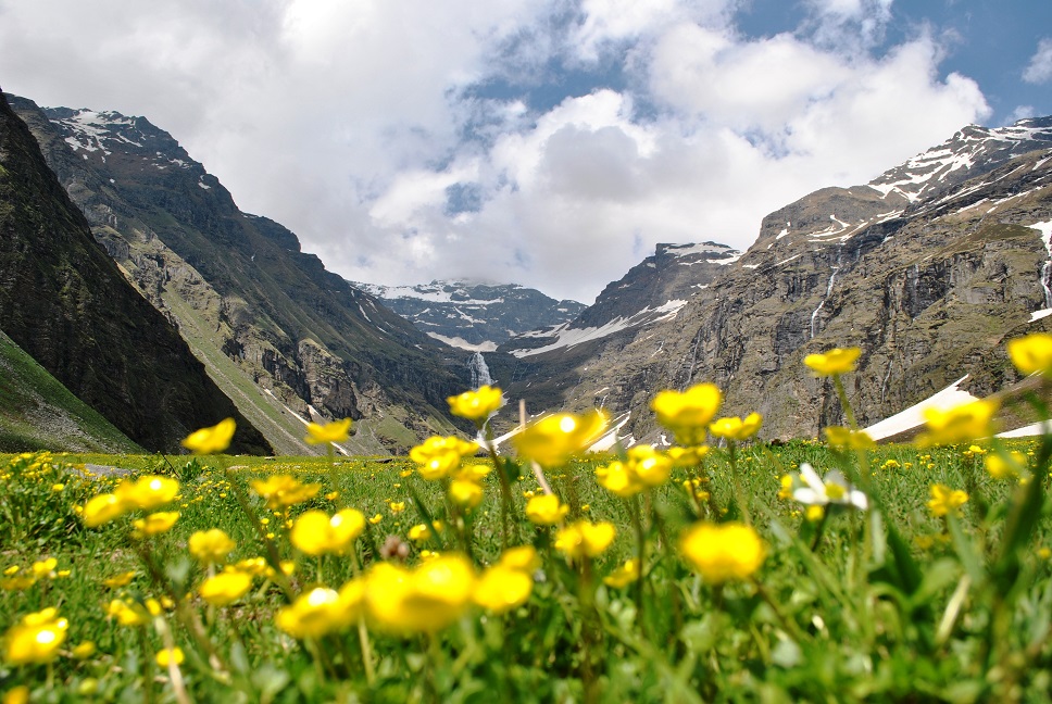
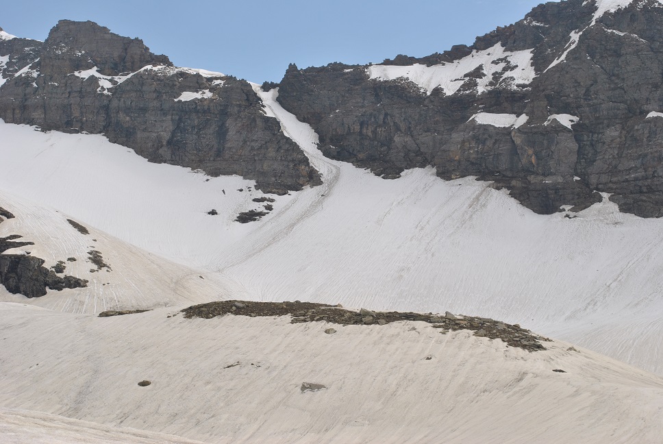
Chaen Singh and Vinod grabbed a quick bite, while three of us were relaxing our muscles. Looking at the climb ahead, we knew this was going to be one mammoth of a day. We started walking again after an hour, immediately crossing the biggest snow bridge so far over Rupin and started the steep uphill walk on the other side. Maneuvering over way through steep rocky trail, followed by a short downhill and flat walk on the river bed, we reached a place known as ‘Buransh(Rhododendron) Kandi’. Mammoth rock faces on both sides, golden eagles hovering on the top, river was very wide all of a sudden, and white rhododendrons, it was a gorgeous sight. Buransh Kandi is a beautiful camping site in case you want to pitch the tents here. Intact, further 20 minutes of flat walk on the river bed takes you to an equally beautiful camping site. Don’t try to eat those white rhododendrons, Chaen Singh mentioned that flowers are poisonous.
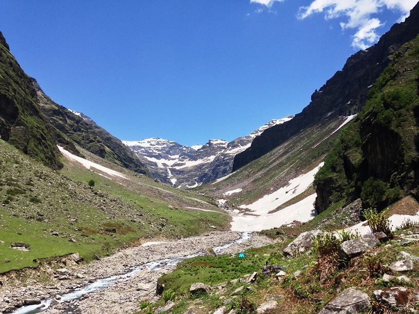
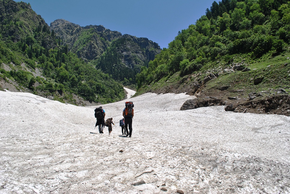
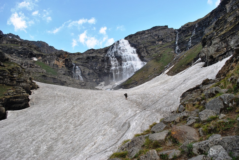
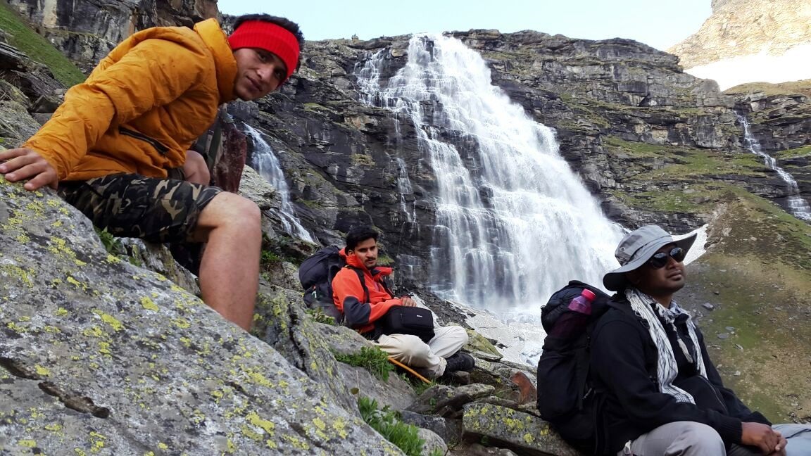
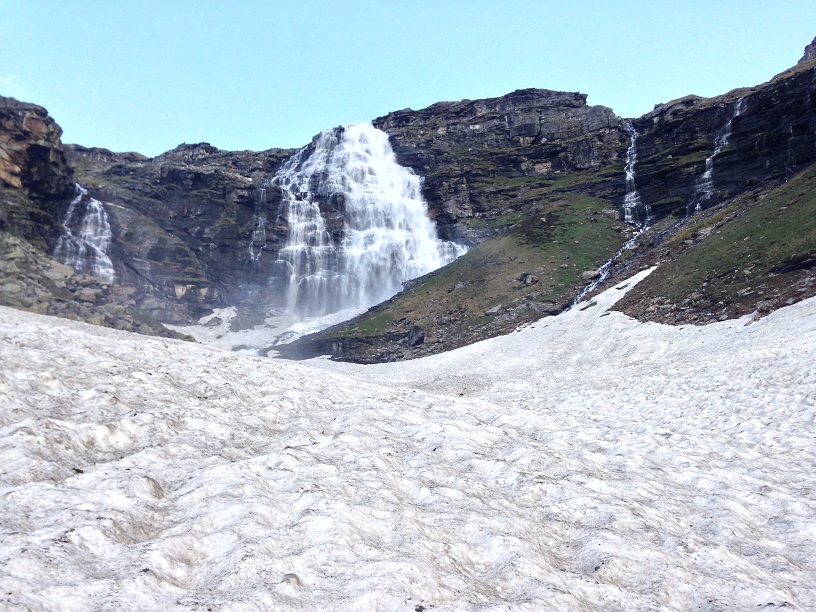
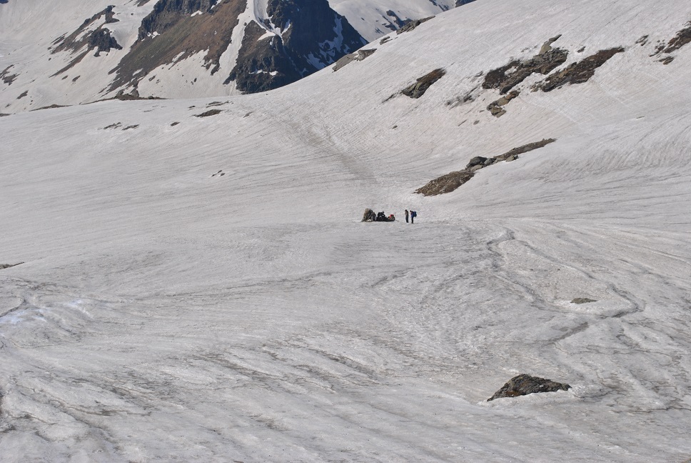
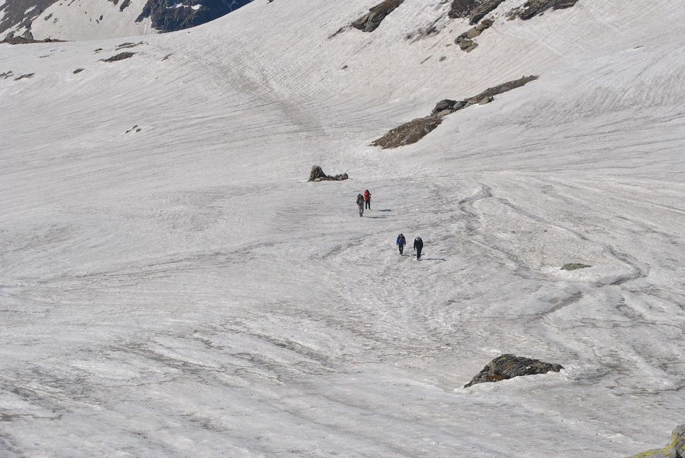
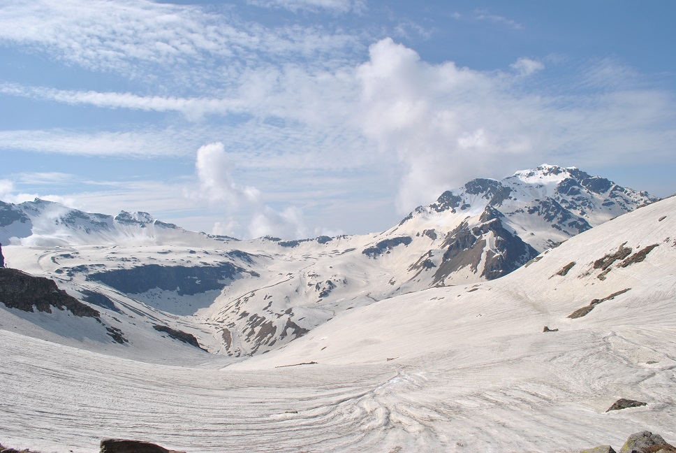
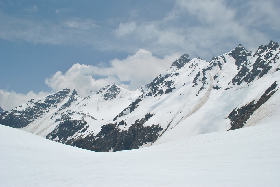
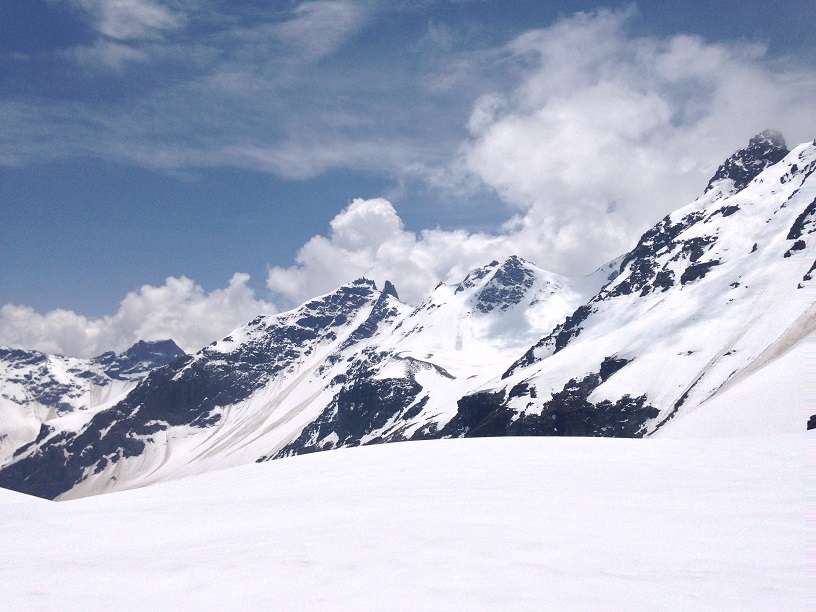
Oh! The first sight of those cascading Lower and Upper waterfalls on Rupin, it was a sight I’ll never forget. I felt weak in my legs all of a sudden, it was so far and high up in the sky that reaching there seemed impossible. It was already 1 in the noon, we had almost covered ~9 km and 9kms more to go, with numerous glacial & snow walks, climb so steep that you would be bound to crawl on 4 limbs, especially if you wish to do that on the second day from Dhaula. We kept moving, greeted by the longest glacial walk of nearly 200 meters, damn slippery with no scope of error. Chances are you’ll end up in the river if you fall, so walk carefully, not too slow nor too fast. Cut the steps with ice ax if you’re too scared. Yes! Ice ax is good to have if you’re an amateur, let your guide use that for you, it’s not a child’s play, you can hurt yourself if you don’t know how to use an ice ax. Immediately followed the longer glacial walk, but this was more or less flat, much easier. Trail just doesn’t stop straining your muscles, as soon as you finish the glacier, a very steep uphill walk is waiting for you. At Bikat Adventures, we call it “one Bikat of a climb”. Sun was shining bright, at 2 in the noon my wristwatch was recording 30 degrees and 3310m. Upper waterfall camp didn’t appear to come any closer to us, I tried not to look at it but couldn’t stop myself. Walking a few meters on the flatlands, we had another glacier waiting for us, bigger and steeper. It took us 30 minutes to cross this one and another half an hour for the extremely steep climb after the glacier. I looked back for Agasty and Ashish, man! the view at our back, I don’t have the skills to pen it down, pictures will do the justice I hope.
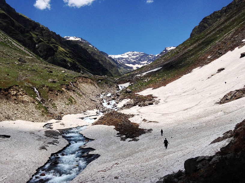
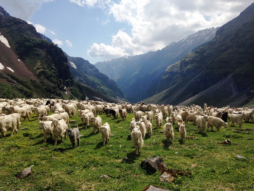
We were greeted by the ever smiling mountain goats grazing over the beautiful pastures with cascaded waterfalls in front of us and beautiful shiny Rupin cutting through the valley behind us. An easy walk to the river bed, and we could clearly see where we were headed, towering climb right in front of us, 400m of altitude and just 2 kms of distance. With sun ready to go behind the mountains, we started feeling the extreme winds and droplets from lower & upper waterfalls. Those last two kilometers took us 2 more hours and we were finally at day’s stop at 7pm, it was an extreme day. Climb from lower waterfall to the camp was extreme, tackling the scary glacier of lower water fall camp and climbing the steep unclear trail right in front of second waterfall, we hardly had any strength left. Be careful on the waterfall glacier specially the lower one, its slippery with a deadly gradient and you need to go uphill on it. Upper waterfall glacier is relatively easy as it is on the river, more or less plain, unlike lower water fall glacier which is steep and on the side of the river, and you go uphill on this one. It surely is an adrenaline pumping experience!
The 360-degree view from above the upper waterfall simply left me in awe. I don’t remember how many times my finger pressed the capture button on the camera, there was no stopping, I was walking with no strength left in the legs. It's surprising how things you love doing give you immense energy to move forward. Shinning colorful Rupin at one end surrounded by the towering rocky mountains wearing a crown of orange blue clouds. At other end, river Rupin coming out of the glaciers surrounded by never-ending white peaks. In between were a bunch of us, wrapped in layers, feeling so tiny and lucky to witness such an amazing sight.
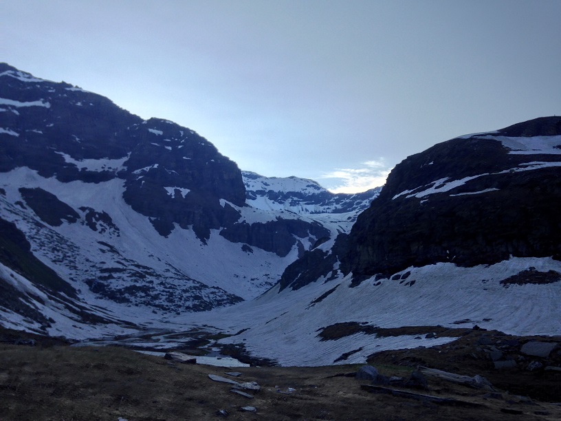
Day 3 (UWC - ~3870m to Rupin Pass - ~4550m to Sangla - ~2550m)
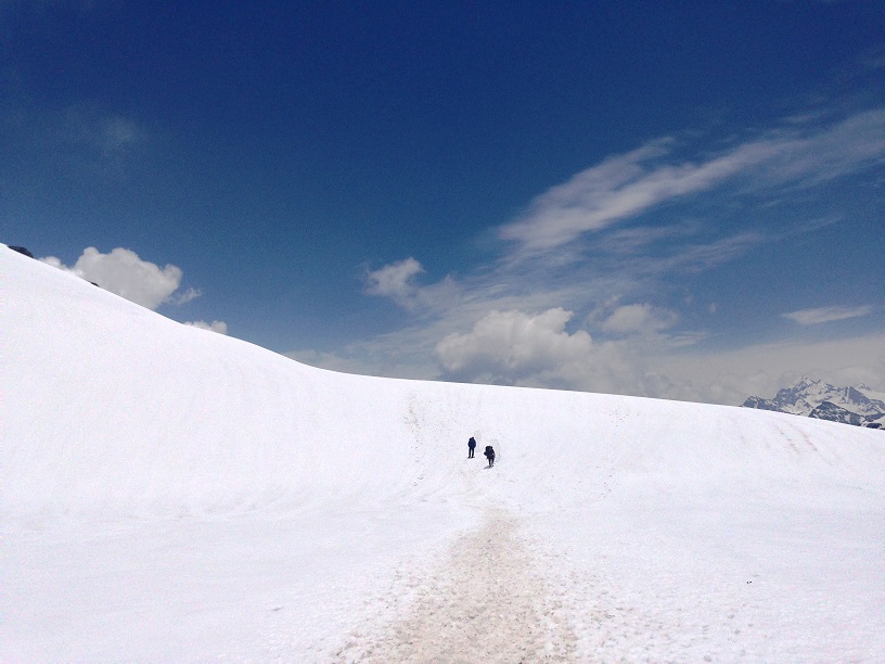
We woke up around 5, the time we were supposed to leave. None of us enjoyed the sleep, blame the altitude and cold weather, must have been close to 0 in the night. Entire trail from campsite to Rupin pass and few kilometers beyond is either snow or glacial walk, that’s why we wanted to start early. It’s easier to tackle snow in the morning.
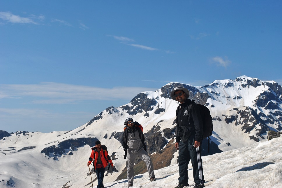
After climbing the steep face for nearly 2 hours and 2.5 Kms, terrain gave us some respite. Upper waterfall camp was still visible but not for long. From here, trail curves towards the right towards the never-ending snow and glacial sheets. Our guide managed to get an ice ax today, which made crossing the tricky snow sections a lot easier. It also slowed us down I think, we had to wait till Chaen Singh made steps for us. Its better late than never! Ice ax was especially very helpful in crossing the two small glaciers on the way up from camp and the long & slippery, nearly 200m, snow section later on. The best use was yet to come! Half and hour of long and easy walk on snow took us to another campsite, Ratapheri. Sadly, we were not supposed to camp here, we were supposed to cover another 25 Kms to reach Sangla. One can camp here as well during the months of September and October as there won’t be much snow during that time of the year.
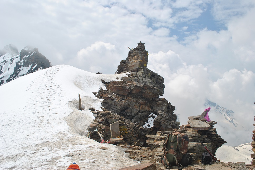
The pass was clearly visible now and so was the painfully steep climb to cross it. It was the clear trail in the snow, local shepherds frequently use this trail, goats & sheep’ footmarks clearly define the trail when snow is around. With so much scope of getting lost, there’s no way one can get lost here unless the person wants to. At an altitude of ~4200m, sun started to play hide and seek while we were grasping our breath, the clock was recording 10:00 am, the temperature at 20 degrees with extremely chilled winds. The sight in front of us was extremely awe-inspiring, it took us a while to devour what we had in front of us. I’ll let the pictures do the justice to my inability to express this in words. We relaxed a bit to regain our strength for the last strenuous climb, the sight of it was killing us. I cannot describe the steepness in words, probably it looked steeper because we were there on the 3rd day from Sewa. This very thought gave me the strength for that last few steps we had in front of us.
I motivated Ashish and Agasty to start walking, and we moved at 10:30 for those few steps. Hardly 500m in distance, I wanted to run those few steps, but you don’t always get or do what you want. Had I attempted that wish, I would have surely died. I made a plan, counting 20 steps at a time. Chaen Singh was cutting steps for us while we were walking like snail. Thanks to the ice axe, last thing I wanted was to slip on this climb. If you slip, chances of stopping in between are rare, you have to start all over again. My plan failed badly, in first attempt I had to stop at 8th step to catch the breath. Agasty was having the toughest time of his life I guess, all three of us were having a tough time in fact, he was falling behind and was hardly moving. It took us almost an hour to cover that last 500m of climb, all the hard work was completely worth it. Vast snow plains on both sides, towering peaks on your right and beyond Sangla, with lush green Sangla valley in between, we were awestruck. For a moment, I remembered all those people who ask me why do I go to mountains all the time. May their soul rest in peace. It was Bliss!
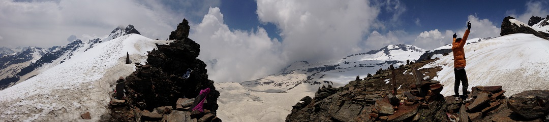
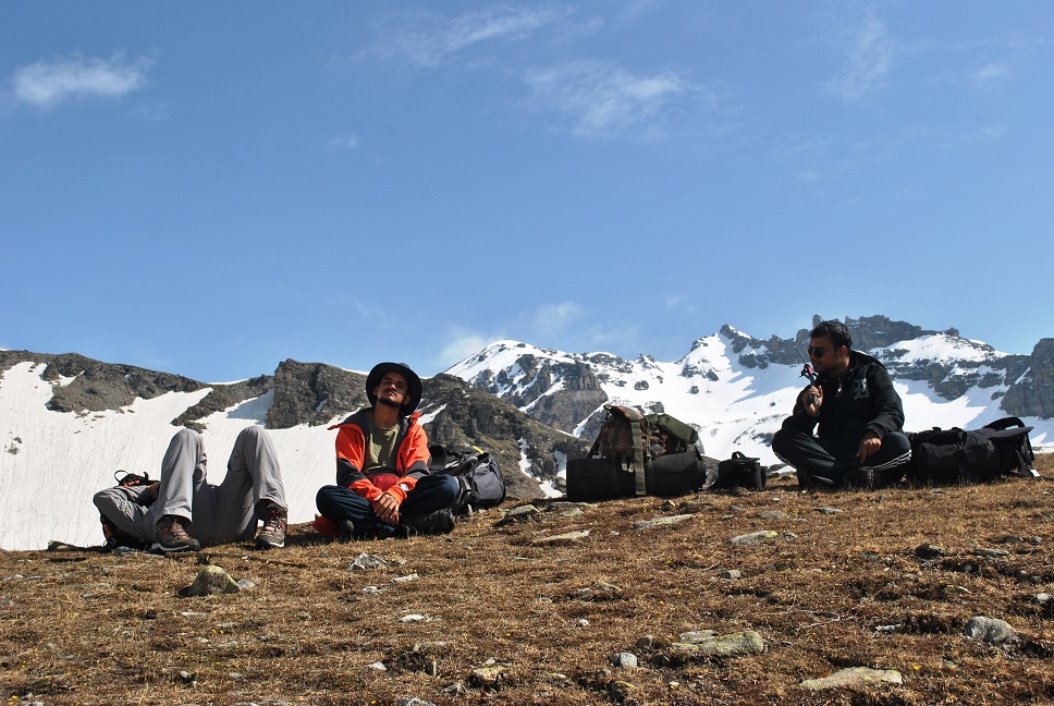
I and Agasty were having a mild headache, both of us decided to sacrifice that ‘pass waali beedi’ while Chaen Singh was enjoying his. We still had over 20 kms to cover for the day, but were relaxed, it was the long and easy downhill walk ahead. We wanted to overwhelm ourselves with what we had in front of our eyes, we were lost in the wild and we wanted to stay lost for as long as we can!
Next 3-4 km were the easy downhill walk on the snow with few long and short sliding sections. We were losing altitude quickly, devouring the beautiful landscape. Within the next hour and a half, we were below the snow line, next to a river stream, we came from its very origin. My headache was not getting better, so we decided to halt and eat something. We took a long break, all of us were too tired, even the guide and porter, and I decided to have a disprin for my headache. Sun was no longer bothering us, the sky was full of clouds instead. We didn’t care about the rain, we were ready to take on everything after that last climb. After a short, nap we started walking again and it started raining.
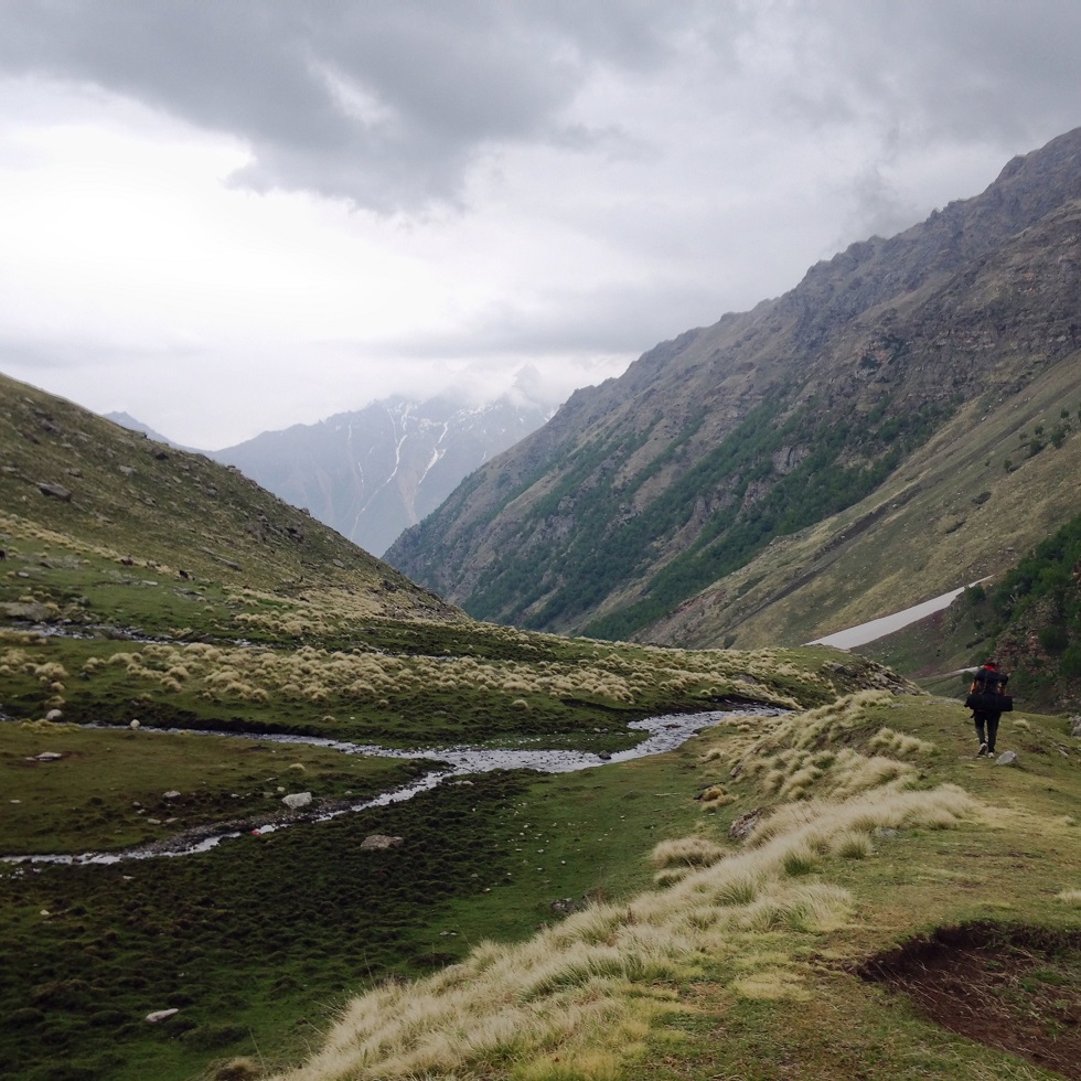
We were walking, we were walking very fast in fact. Chaen Singh, Vinod and I, our steps were in complete sync, I was having a walk of my life. Agasty always have hard time on downhill sections, he was not slow but slow than us, Ashish was walking with him. Within an hour we were in the meadows of Ronti Gad, beautiful camping site. Few people were camping there and we decided to wait there for a while. Guys over there offered us tea, and we accepted the offer without second thought. Chai, sutta, pahaad aur baarish!
We had already covered 14 kms for the day and we still had 12kms more to cover. I wanted to reach Sangla asap, eat good food and get a good sleep. We knew that bus to Shimla leave early in the morning. Agasty knee problem was troubling him, he was getting slower. After a short stop, we walked again! Trail is quite clear from here, at few places you’ll come across diversions, take any one of them. All of them leads to Sangla Kanda, just don’t take the one going down to the river. Rain was kind to us, it was there but not as a trouble! :)
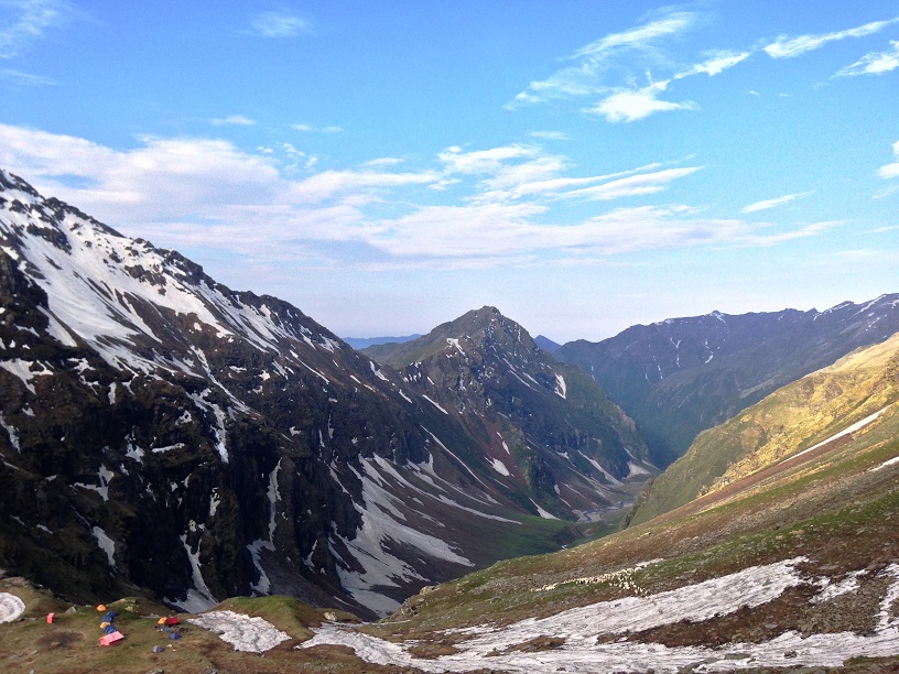
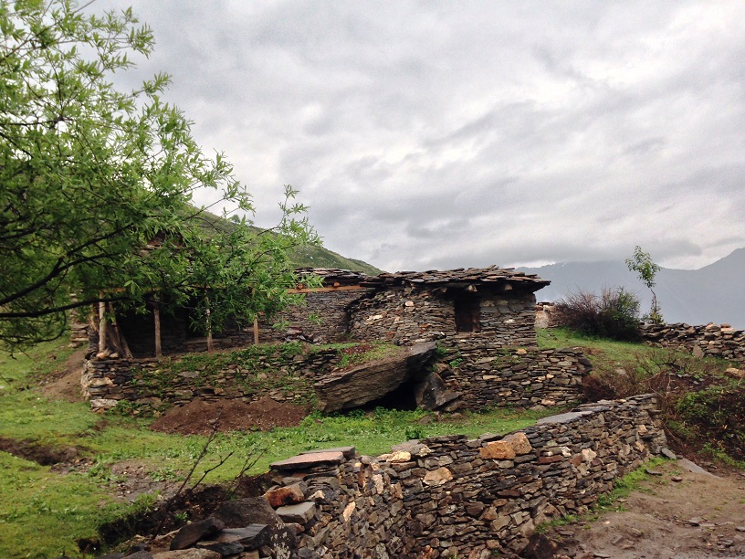
I was awestruck by the Sangla valley, natural green was never so green in front of me. While walking in breathtakingly beautiful meadows, Kinner Kailash range appear all of a sudden in front of you, the view made me weak in knees. I wanted to stay there forever! Village Sangla Kanda was a complete surprise, cute little homes made by piling rocks, villagers are warm and friendly. Sadly, we didn’t have time for a cup of tea there. The village also has a tiny lake, not exactly in the village but nearby.
Finally, crossing through the Sangla Kanda meadows we were below the tree line, Sangla was visible now. The trail grows wider after a short while and you realize its actually the unfinished road you’re walking on. This road/trail is a delight to walk on, you walk amidst the blue pines forest, crossing quaint wooden Sangla houses, and apple orchards. There was the road from Ghusangu to Jispun and then there was this road, a road one surely want to take.
Finally, at 08:30 in the night we were back in the civilization, Sangla. With variety in dinner, a bottle of VAT69 and cushioned bed under the back, we slept late in the night for the best sleep we’ve had in past few days.


")


Hi This blog shows three days, but on your site it shows 8 days trek. Can you confirm exact number of days, price and when is the next trek planned for this place.Regards,Madhusudan
HI Madhusudan. This was done for exploration purpose by one of our very experienced hiker. In our fixed departure batches, we organize this trek in 8 days only. This helps everyone acclimatize better, and complete successfully.