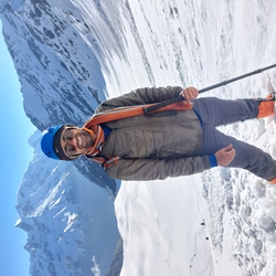
Mountains have the ability to move you, challenge you and change you. For most people, this feeling is unknown, scaling more heights and peaks to find peace and purpose within.
With the same feeling, I had decided to climb my first 6000m+ peak in August 2023. There was not much preparation on my end but I had been keeping fit by playing tennis regularly and running. I had also summited Bali pass a couple of months ago in June 2023 so I was confident that I would be able to climb a non-technical 6000m peak without much focused preparation.
It was already 7th august and I was still going through the options: KY2, Dzo Jongo or Both. And that is when I reached out to Bikat and on 9th August I booked my first 6000m+ expedition with Bikat, Dzo Jongo(East) peak for 12th August , leaving me just 3 days to pack up and prepare mentally.
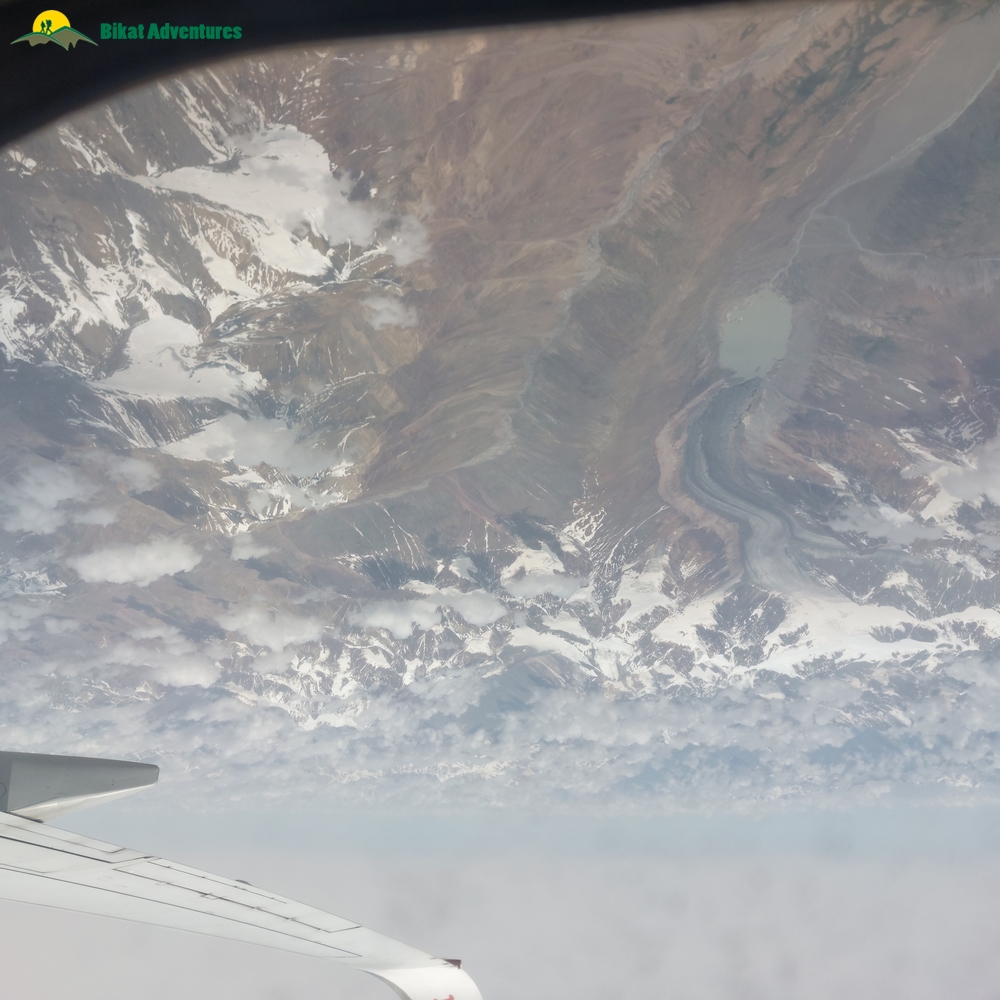
And so, just like that I was on my morning flight to Leh from Delhi. I made sure I got the window seat because it was completely worth it. You could see distant himalayan ranges. I could also spot Chandratal Lake and also what I think was Tso Kar lake from the flight.
View of Samudra tapu (centre left), chandratal cirque and Chandratal lake (bottom) from the flight
After a visually stunning 1.5 hour flight from Delhi, I went straight to the hotel booked for us in Leh by Bikat, which again was a very pleasant hotel with great views of the Stok Range and within a very close proximity to Mall Road and Leh Palace. I was to stay with Anirudh Ji, one of my fellow participant, a 54 year passionate trekker with likes of EBC, Stok Kangri already in his resume.
I freshened up, rested for half hour and went out to explore Leh market and palace.
Leh, very rightly said, is the Lhasa of India with its Buddhist history fused with the Balti culture from Baltistan and Islamic culture from middle east all of which was possible due to its presence on the Ladakh (Indian) branch of the Silk Route.
Our trek leader asked all the participants to be present for the briefing in the hotel at 5pm.
We all gathered for the briefing where the whole group was intorduced with each other for the first time. We were a group of 6: me, Anirudh Ji, Abhishek Ji (another passionate traveller and trekker) along with three young but experienced Japanese participants who were all around the same age as mine (24).
Our trek leader was Sachin Lama who I believe is one of the best trek leaders at Bikat and right before leading our group, he had just returned from a successful summit to Mt. Nun.
As informed in the briefing and according to the itinerary we were to rest and acclimatize in Leh itself for the next day (13th) and on 14th we were to start our trek from the standard route which starts from Lato village on the Leh Manali highway.
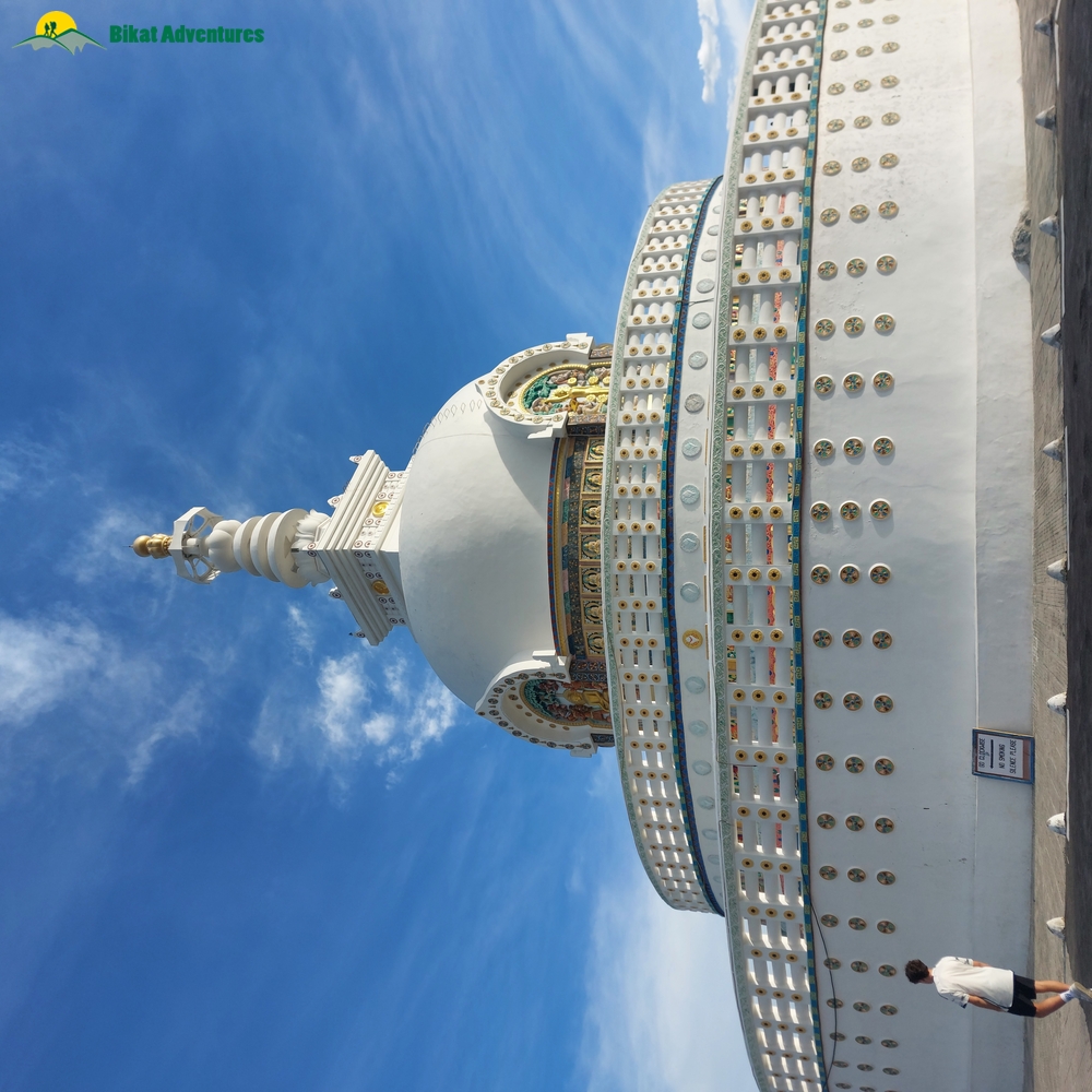
And so we rested in Leh on 13th, explored the Palace again, went to the Central Asian Museum and took a walk to Shanti stupa.
Shanti Stupa
After a day of rest and explorng just as we were packing and gearing up for the trek which was to start the next day, we got a text from our trek leader informing us that going from the standard route from Lato will not be possible and we will have to instead go from Markha.
He mentioned that due to flash floods on the route from Lato, mules cannot cross the flooded streams and hence we will have to go from the other side of the Hemis National Park which is through Markha, Hankar, Nimaling (the route followed for the KY2,KY1 and Markha Valley treks) starting from 15th. Which meant that we'd have to stay in Leh for another day which would make 3 days and nights in Leh (too much acclimatization if you ask me ).
The new route and Itinerary that we were to follow was: Drive almost till Markha, stay in Umlung followed by stay at Thuchutse after crossing Hankar and then from there a long day march straight to Dzo Jongo Base camp after crossing Nimaling.
I was a bit rattled with this sudden change in plan but then there are forces of nature at work that we have no control on.
So we stayed another day in Leh, but me, Anirudh Ji and Abhishek Ji made a full use of this day by going on an adventurous bike ride to Lamayuru and back via Magnetic Hill and Indus-Zanskar sangam (the same route which we would be following the next day too).
Day One:
Finally, the next day, after a long wait, we were starting our trek towards Markha. Although vehicles are allowed only till Skiu which is at the entry of Hemis National park on the Markha side but our trek leader and Bikat had to take a special permission to take us in the vehicle beyond Skiu till 2-3 kms short of Markha to make up for the lost day due to route change.
It was a bumpy ride but the views made up for it and we also got the privilege to meet a special sherpa who was travelling with us in our vehicle. He was going to open the routes for KY1 and he had climbed multiple 8000ers with climbing Everest 4 times.
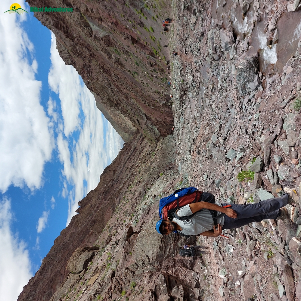
After getting down from our vehicle, we took some refreshments and started our trek towards Umlung. The days's trek was around 9kms, 3kms till Markha and then 6km from there till Umlung.
I knew that the Ladakh landscape was dry and desolate and being born and raised in Rajasthan dryness was not something new to me but I did not expect Markha valley to be this dry and arid. It seemed as dry as the Thar desert, probably even more. The Sun was shining bright overhead with high intensity and the skies were crystal clear. Leave your head uncovered and you'd probably end up with a headache.
Though its dry, but Markha valley gets its name from the Markha river that flows through here and is the lifeline for the few people that live in this remote and desolate valley.
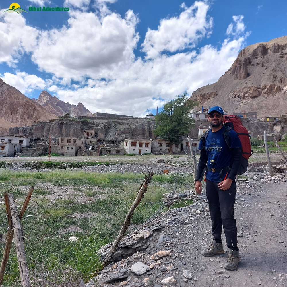
After trekking for about an hour and half we reached the village of Markha, made of some old ladakhi style mud-brick houses on the hillside with prayer flags all around and some green fields.
Markha Village
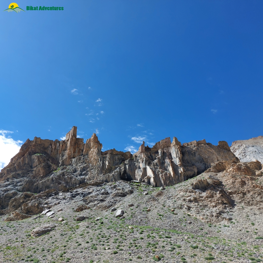
Post that we had our first water crossing, it was gentle but big. After that we passed the famous Techa Monastery, the most important monastery of the valley, upon a narrow hilltop and entered a deep gorge with out of the world landforms, result of thousands of years of wind and water erosion, something that is common in the barren lands of Ladakh and Spiti.
All in all it was a fairly easy 6km from Markha till Umlung, our stop for the day. We stayed in a local homestay with a cozy living area and satellite wifi. Our hosts were a very sweet family consisting of a couple, their kid and their mother.
We had amazing tea, followed by a fulfilling dinner. Post that we stepped outside to get glimpses of the clear nightsky. That was probably the most times I have seen shooting stars in such a short span of time (a record that would be broken in the next few days). We got in our rooms shortly since it got too chilly to be outside and called it a day.
Day Two:
We had a more or less straighforward march ahead of us the following day, around 10 kms till Thuchutse which is at an alitude of 4100m and we were already at an altitude of around 3700m so it was pretty much a flat trail with a couple of steep ascents. We started at around 8am and after walking for a few minutes we got the first glimpse of the might Kang Yatse (The Icy Peak), the most dominant,famous and one of the highest peaks of Hemis National Park. Just looking at the mountain you'd know that its a huge and a pretty high mountain. It made us a bit nervous because we had to climb almost at a similar height after a few days.
In around 1.5 hours we reached lower Hankar where we stopped for some refreshments. After that we had our first steep ascent of the day which brought us right at the foot of Hankar Fort. It was once a big fort built in 17th or 18th Century but was now just ruins with a narrow path leading upto it.
Hankar Fort
After a straight walk of about a couple hundred metres from the foot of the fort, we reached Upper Hankar which is comparatively more greener than Lower Hankar with quite a few agriculture fields.
We stopped for breakfast after crossing Upper Hankar, post that we started our second and final steep ascent of the day and after that we reached the beautiful campground of Thuchutse. It took us a total of 4 hours to reach Thuchutse from Umlung.
We got in our tents, freshened up, had our lunch and were done by around 2pm. So, we had a lot of time to sit around and soak in the beauty of the place. By this time, the three Japanese participants started having some fatigue since all of them were suffering from diarrhoea right from the starting of the trek. As all of them were carrying their own equipment, their bags were also quite heavy (around 25 kgs) which added to their trouble.
Trek leader asked them to offload some of their stuff and after some rest and medication all three of them were fine.
We went for our acclimatization walk at around 5:30pm on a nearby hill overlooking the campsite and caught a beautiful sunset.
We came back had our dinner and went to bed at around 9pm since we had a long day ahead of us.
Day Three:
We started our trek early at 7am and we had a long day ahead of us, 16kms from Thuchutse to right till Dzo Jongo Basecamp. But what was more concerning was the altitude gain we had to do. Along with this long distance we were gaining 1000m+ alttude as Dzo Jongo basecamp was at an altitude 5140m, 1040m higher than Thuchutse.
Right after Thuchutse we had a long steep ascent and for the first time on this trek I felt the affects of fatigue and altitude. We were no longer in river valleys or gorges like the past two days, we were on hilltops now with gentle meadows and a beautiful view of the whole surrounding area.
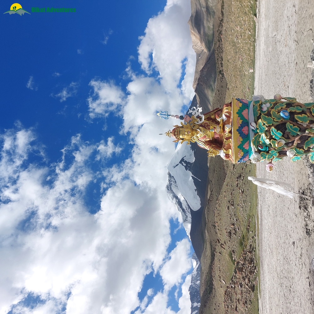
After a gradual ascent of around 1 hour more, we reached the Twin Lakes, one of the most scenic places of the whole trek. Twin lakes are a set of two small lakes at an altitude of around 4800m with a fantastic view of Kang Yatse in the background and a statue of Lord Padmasambhava right in the middle.
We had a bit of a bad luck because the lakes were undergoing kind of a renovation at the time and the streams that fill up the lake were diverted, so the lakes were empty. But it was still a sight to behold.
After having breakfast at Twin Lakes we moved on towards Nimaling. It was a fairly straight walk with a slight descent. After sometime our trek leader informed us that we are entering a Marmot hotspot.
Although I have been to Ladakh a couple of times before but I was not able to see Marmots and I got very excited knowing that I'd finally get to see them. For those who don't know Himalayan Marmots are a rodent species found in high altitude alpine grasslands and live in holes they dig in the ground.
After spotting a few Marmots and Pikas we spotted some more wildlife, Yaks and Dzos. Dzos are a mix of Yak and Cow and the peak Dzo Jongo is named after it. Just as we were enjoying the wildlife of Hemis National Park we found ourselves in front of a sight that was straight out of a picture book.
Beautiful alpine grassland, surrounded by huge but gentle mountains, river streams flowing along the grassland, Yaks and Dzos grazing, Marmots stepping out of their holes to soak in the sun, maroon-brown mountains, clear blue sky and white clouds.(The picture in the heading of this blog)
This was Nimaling.
We soaked in the beauty of this place for sometime, clicked some pictures and then moved ahead towards Nimaling campsite.
We stopped in Nimaling campsite for a while, had maggi and met some cheerful people who were bound for KY2. After stopping for around half an hour we started moving towards Dzo Jongo Basecamp which was another 1.5 hour walk along the river with gradual ascent.
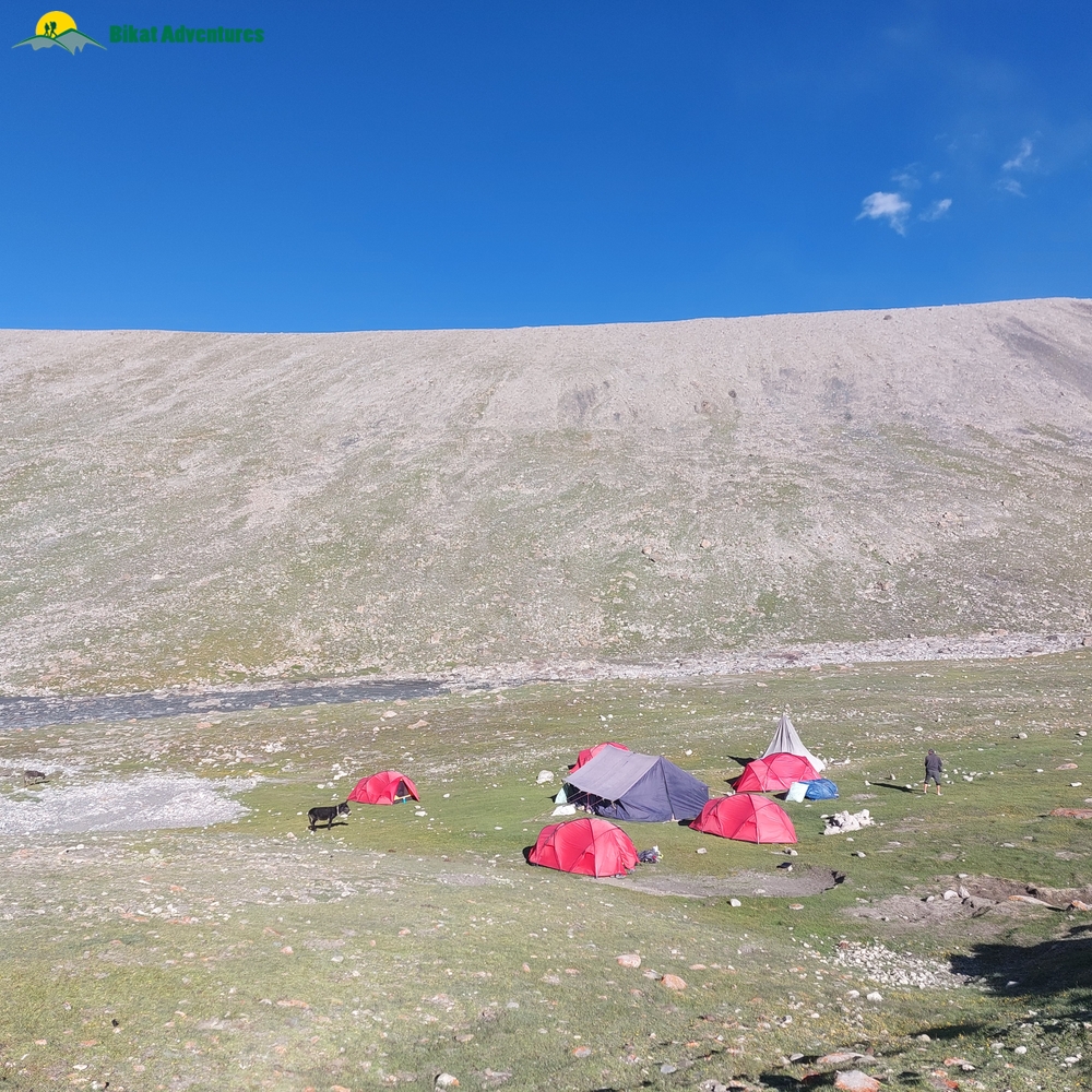
Finally, after a long day of trekking with some out of the world scenery we reached our destination at around 3:30pm.
At an altitude of 5140m, Dzo Jongo Basecamp is higher than Kang Yatse Basecamp. As most of the people come to climb the famous KY2, there is comparatively very less crowd on Dzo Jongo. We were the only group there with another group camped a few hundred metres ahead of us.
The weather was overcast with a little bit of rain. We encountered a group in the basecamp at around 4pm, they were just returning from their summit attempt. They had started at 10pm the previous night and made it back to basecamp almost 18 hours later. They mentioned that the ascent is very challenging.
We got a bit nervous hearing this but our trek leader assured us that we'd do good and reach the summit comfortably.
We had tea followed by a sumptous dinner along with Gulab Jamuns at 5140 metres. Post that we retired to our tents but at around 9pm me and Abhishek Ji came out of our tent to capture some fantastic glimpses of Milkyway and shooting stars. We stargazed for around half an hour and then called it a day.
Day Four - Rest and Preparation Day:
We woke up pretty late at around 11am, I was not able to sleep properly the previous with a constant light headache in the back of my head, affects of spending a night at such a high altitude for the first time. We had our lunch and then I just spent some time outside around the campsite, walking around soaking in the sun and the peaceful sight around.
Dzo Jongo Basecamp
We had an early dinner at 6pm, where our trek leader Sachin briefed us about the summit attempt. We were to start the summit attempt at 10:30pm. We were distributed the gears needed, microspikes and helmet. Although Sachin told us that its mid august and we won't encounter much snow up there and we might not even require microspikes on the way up.
We were to carry two waterbottles each because there was no water source on the way.
We were done with dinner and briefing by 7pm and went in our tents to get much needed rest before the summit attempt.
Summit Attempt:
I got up at around 10pm, barely slept half an hour due to nervous excitement of attempting my first ever 6000 metre plus summit. I put on my layers: compression t shirt, t-shirt, fleece and down jacket and stepped out. It was a clear night with bone chilling cold and strong winds. I filled both of my bottles (one flask and one plastic) with warm water.
We started from our campsite at 10:45pm with a target to reach the summit by 6am, a whole night of climbing on rugged terrain, ice and rocks at an altitude of more than 6000 metres with only about half of oxygen compared to sea level. But again, these are the kind of challenges we live for.
It was a straight walk along the river for the first half hour and then we turned right towards the mountain.
The most mysterious thing about this whole trek was that even till now after trekking for four days and on the summit attempt, none of us had seen Dzo Jongo Peak. I mean it was a 6200 metre giant but still we had not seen it at all during the whole trek.
This is the mystery of Dzo Jongo, its a silent giant standing beside KY1 and KY2 which get all the attention and you won't even know that Dzo Jongo exists till you climb it. And the ironical thing is that Dzo Jongo (East) is a few metres higher than KY2.
We were making good progress but it was getting pretty cold. I was sweating while walking and whenever we stopped I was feeling cold due to the strong chilly winds. But whenever I looked up I saw a shooting star and my record of watching most shooting stars at Umlung was broken in just two hours into our summit attempt. And I don't remember how many times I wished to just reach the summit as soon as possible.
After about 3 hours into the summit push, we reached the first ridge towards the summit and were greeted with snow for the first time on the whole trek, at an altitude of aroung 5600m.
The water in my plastic bottle was almost over and as I was taking last sips from it I realized that it was not water that I was drinking but ice. The water inside my bottle had frozen while we were trekking.
Strong bone-chilling winds were making me feel very cold in my hands and head and I was also starting to feel fatigued.
I realized that my first 6000er will not be a cakewalk and I'll really have to push myselves for this last patch till the summit.
The ice was not too soft nor too hard and it was also not too deep, we were able to grip on it just with our shoes so we decided not to wear microspikes on the way up. But due to my weight and body size I was having trouble to get a firm grip on the ice and my legs were slipping after every few steps.
I knew if I stopped now to put on the microspikes my body will get cooled down and then walking again would be very difficult, so I just kept going as is.
After the first ridge, there is a second ridge that leads straight to the summit but it is ladden with huge cornices so one has to turn left after the first ridge towards the left face and then traverse it right till the summit. This face is full of loose rocks, shales and ice.
These were the toughest 3 hours of my trekking life yet.
But after scrapping, climbing with all my strength and focus left, we were right below the summit by 4:45am. We made pretty good time.
Five of us were there along with Sachin and one of our guides. One of the Japs was around half an hour behind with the other guide, still battling the summit and an upset stomach.
We knew that it would be a long wait so we continued towards the summit and decided to wait there.
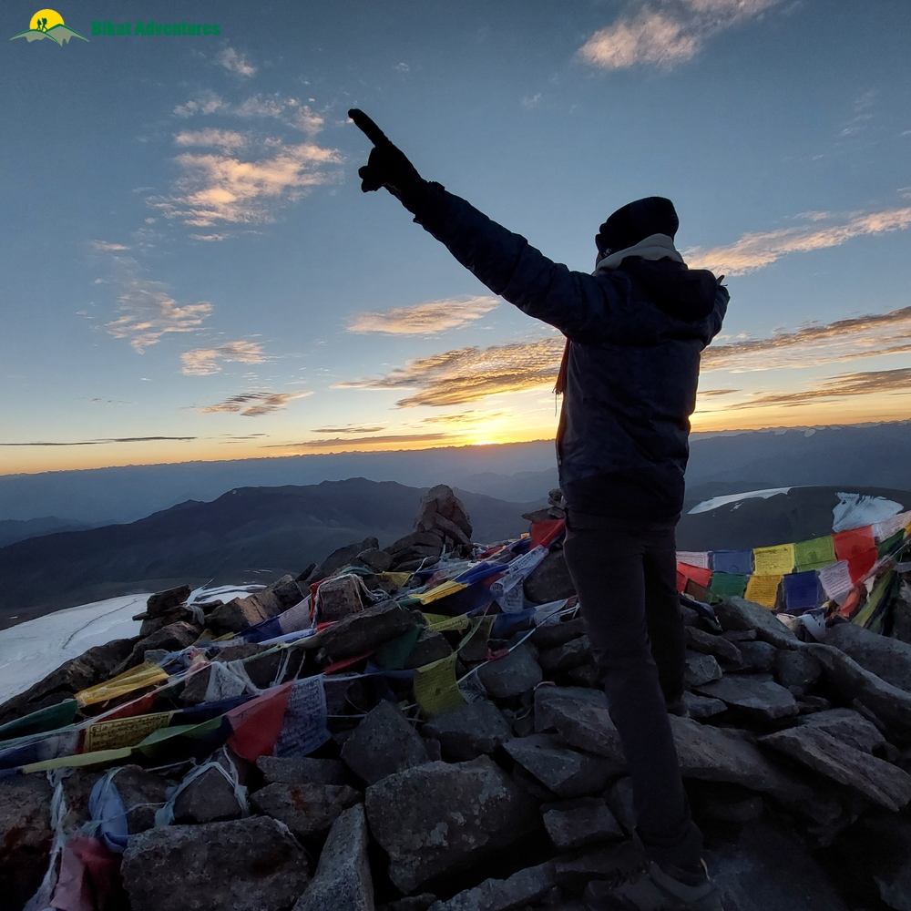
5:15am was the time when I made it to the summit, first in our team to reach along with Sachin. 6.5 hours of summit push at an altitude where I've never been before. For the first couple of minutes I couldn't believe that I've made it.
As a teenager I had only dreamed of climbing a 6000er and years later I was standng on top of one.
The summit of Dzo Jongo East is quite small and can hardly accomodate 15 people at a time. Right in front was a ridge leading to Dzo Jongo West around 50m higher than Dzo Jongo East, on the right was the mighty Kang Yatse 1 and behind was a spectacular sunrise overlooking the amazing landscape of Ladakh.
Dzo Jongo (East) Summit
To my amazement, we were getting mobile and internet signal at the summit. I called my parents, showed them the summit. By this time, the sun was up and with it so were my energy levels, even after a grueling summit attempt, I felt suddenly charged up with energy. I even told Sachin about the prospect of traversing the ridge in front and going to Dzo Jongo West to which he respectfully declined.
We stayed at the summit for around 40 mins and then started on our way down. On the way down we wore helmet and microspikes.
It was a bit tricky to negotiate the face right below the summit, ladden with loose shales with snow in between but we crossed it safely and reached the first ridge.
Going down the ridge was as easy as difficult it felt while going up, I practically ran down it.
The first ridge leading to the summit. Summit on the top right of the photo. Notice how the ridge leading to the summit is filled with cornices.

All of us were in a hurry to reach the comfort of our camps after a successful summit so we rushed down.
We reached back at basecamp at around 9:30 am, so it took us only 3.5 hours to reach the basecamp from the summit.
We just lazed around for the remaining day, resting, eating and basking in the sun. The summit was done but the trek was not over yet.
We still had the longest day of the trek ahead of us.
Day Six - The way Back.
Even though we wanted to rest but we had to start the day early as we had a pretty long and tiring day ahead of us.
This was the longest day of the trek, 17kms of trek, first a gradual ascent of around 300m till the famous Kongmaru La pass at ~5400m, the gateway out of the Markha Valley. After that a steep descent through the narrow gorges of Shang valley till Chogdo, the roadhead of the other side of Hemis National Park.
We woke up at 7, packed our bags, sleeping bags and tents and started at 8am from the Basecamp, crossed the river and started the ascent towards Kongmaru La. The landscape was a sight to behold. A broad valley with alpine meadows, barren maroon brown mountains and a clear blue sky with white clouds.
The Silent giant Dzo Jongo was in our view now all along with Kang Yatse. Now we got the perfect idea of how big and high Dzo Jongo really is.
Taken a few hundred metres before Kongmaru La. All credits to Abhishek Ji for this picture.

We reached Kongmaru La at around 10:15 am. All the trekking traffic from Markha valley, KY1,KY2, Dzo Jongo exits through Kongmaru La only and so we found a pretty good crowd on the pass.
We stayed on the pass for around half hour and then started the never ending descent towards Chogdo. Wthin minutes of starting our descent, we were in the narrow gorges cut by the Shang river. I don't remember how many times we had cross the river to change the banks from left to right and vice versa repeatedly.
The narrow gorges with people walking along with mules carrying the load really made it feel like we have travelled back in time and our travelling on the Silk route.
Finally after a long never ending descent, we made it to Chogdo at around 2:30pm. We rested there for a while, had some refreshments while we were waiting for mules to arrive with the supplies and tents. The luggage and supplies were loaded in the bus and we started our way back towards civilization. We were greeted with rare Blue Sheeps on the way back.
And by 5:30 pm were back in Leh, with feelings of elation, gratefulness and companionship. We had our summit party and I caught the morning flight to Delhi the next day.
The trek to my first 6000er was not just a challenge but an awakening journey to the beautiful land of Ladakh, to refurbish the purpose within me of why I climb and trek.
Julley!


")


